Virginia
1 - 5 days
3 day
itinerary in
Shenandoah
Appalachian Trail - Tanners Ridge Road Trailhead
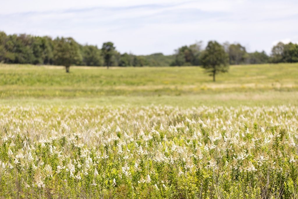
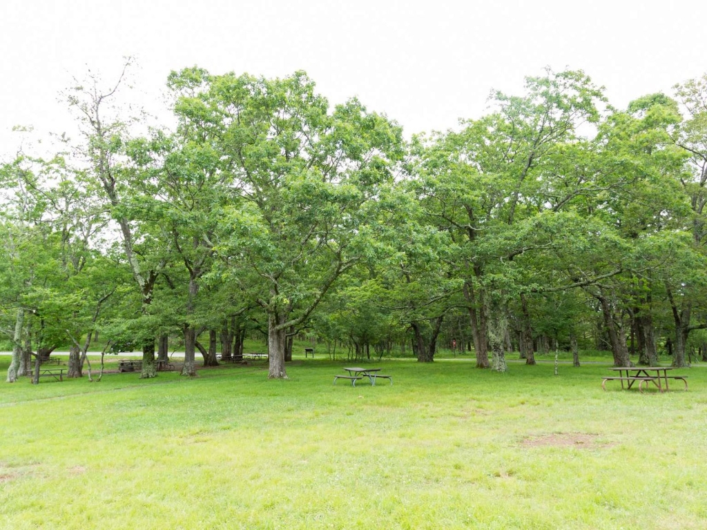
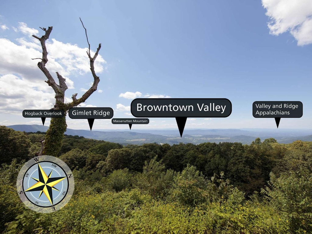
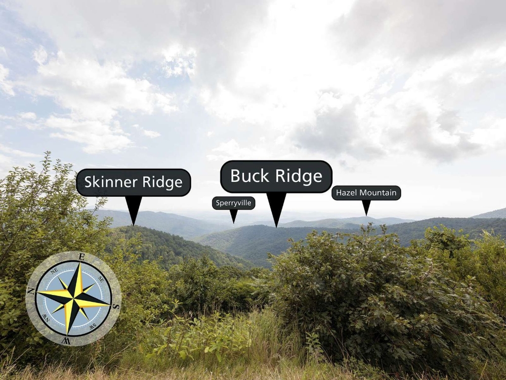
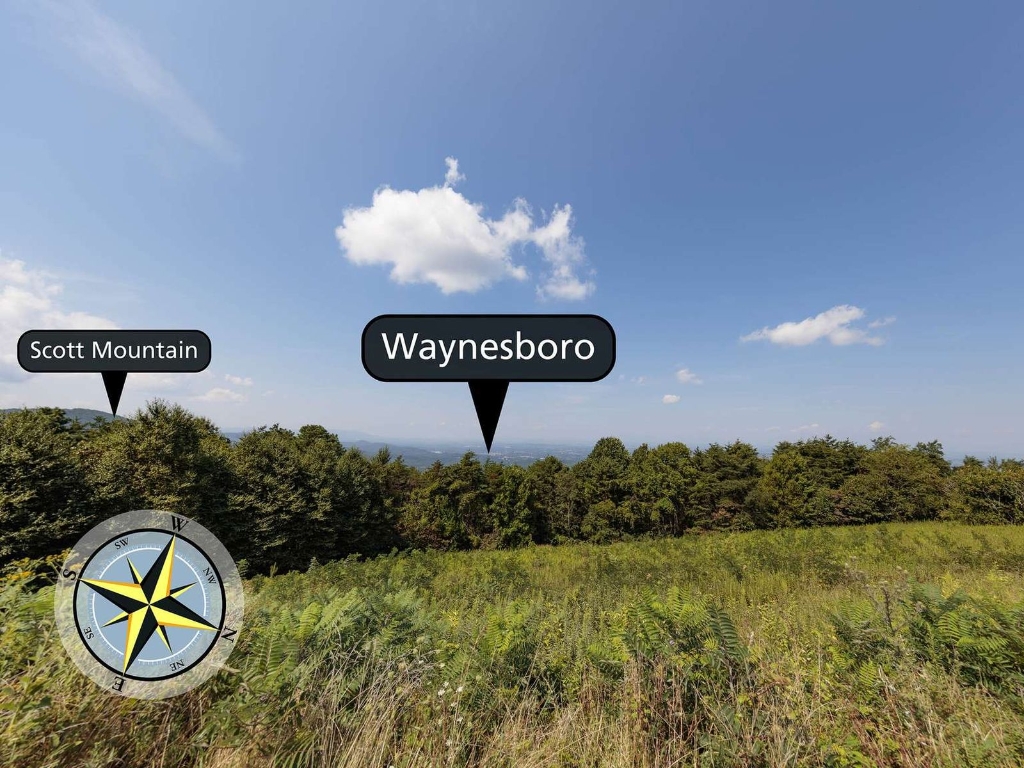
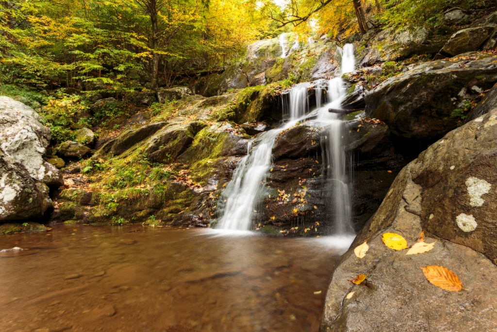
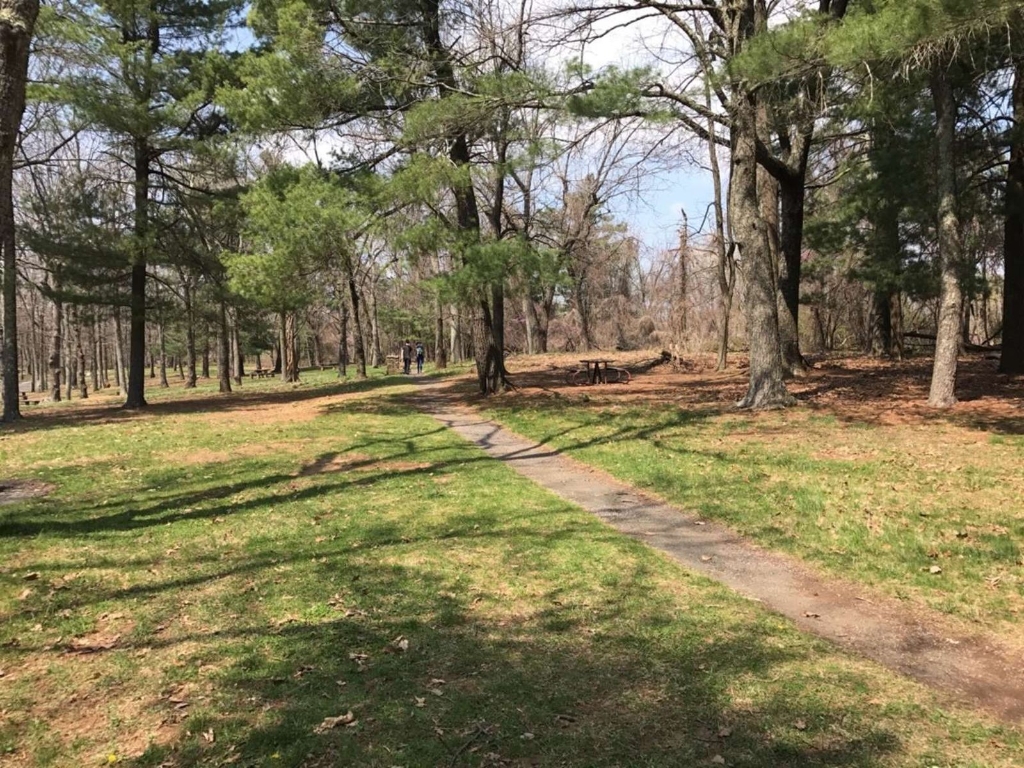
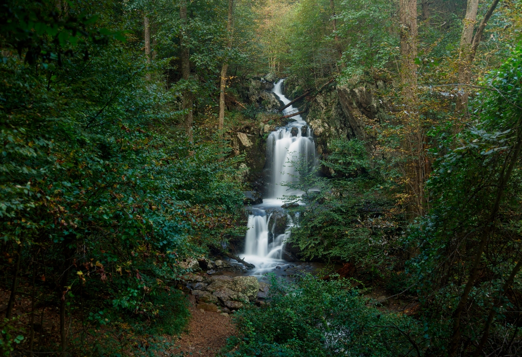
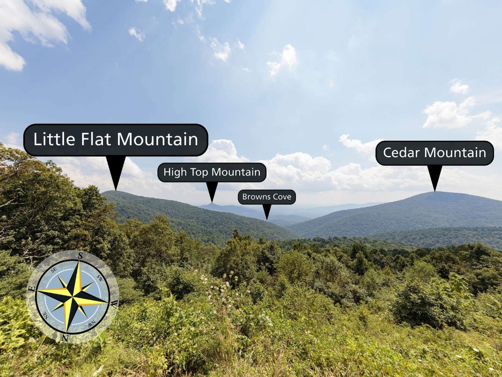
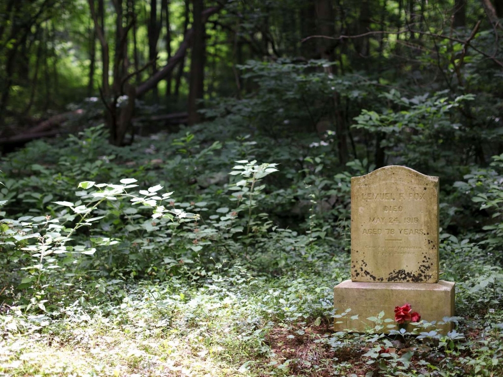
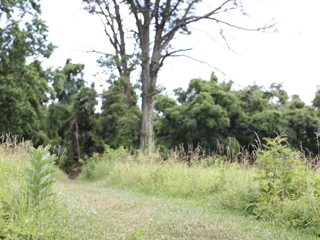
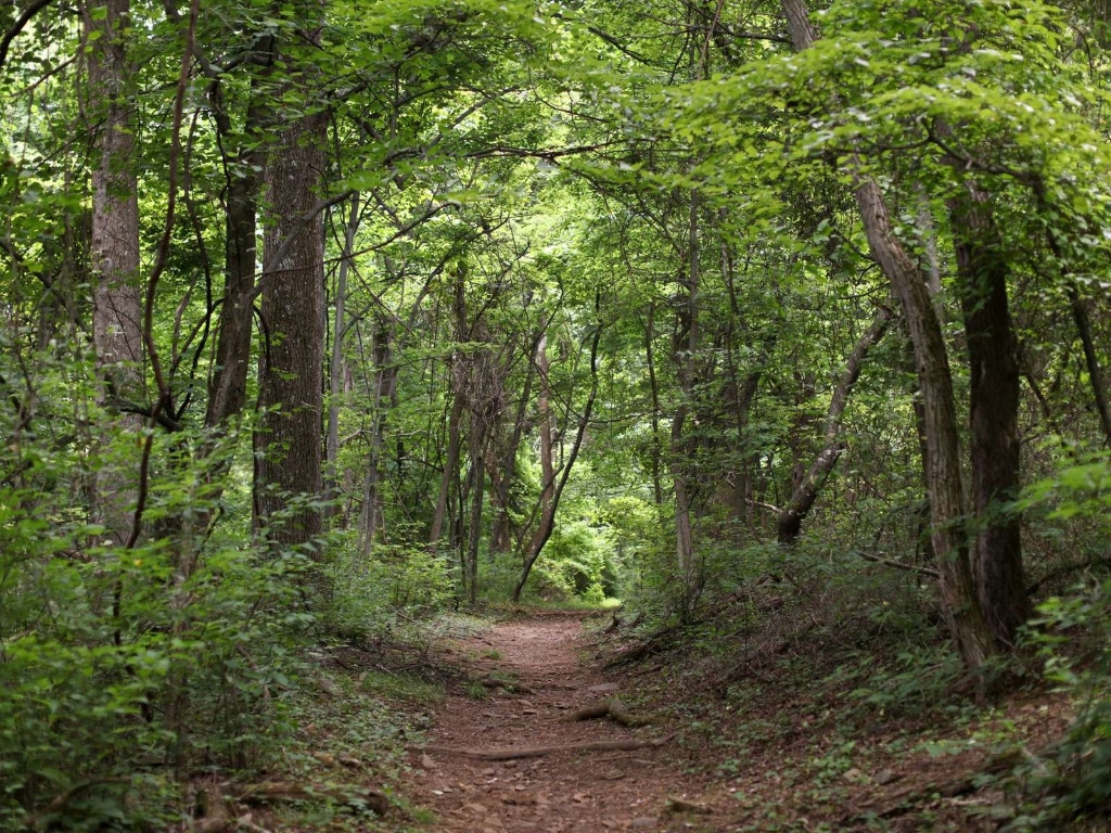
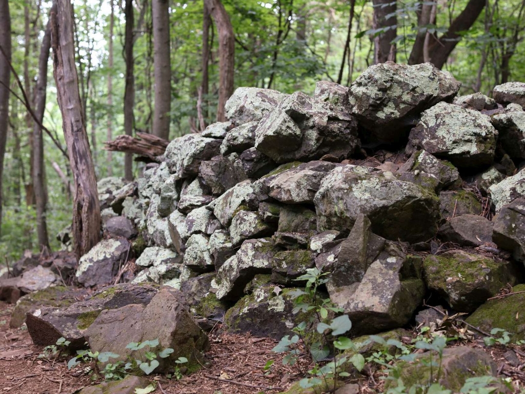
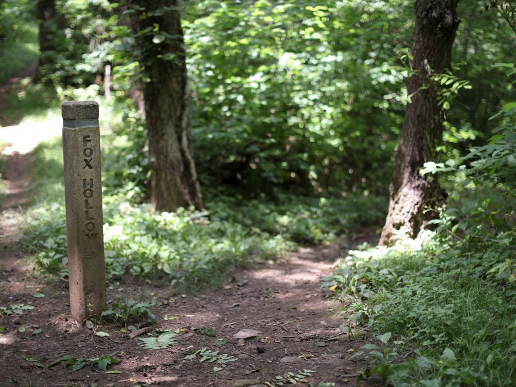
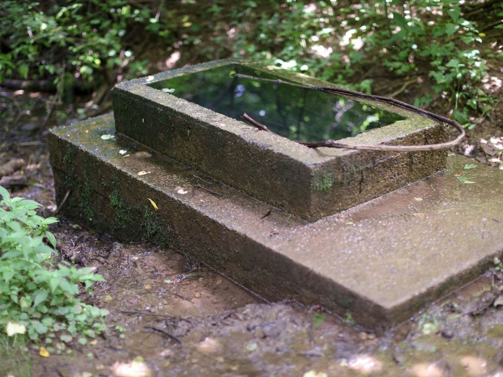
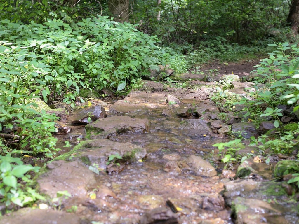
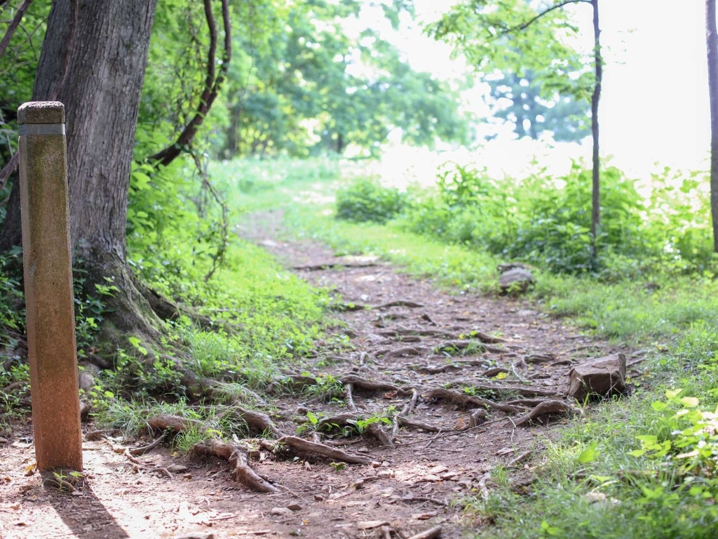
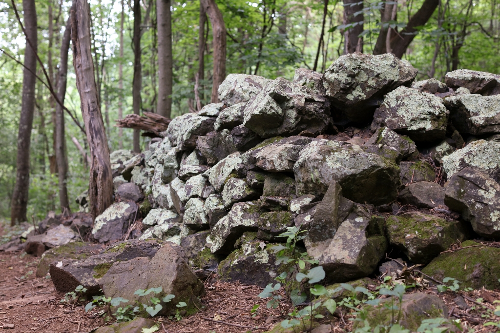
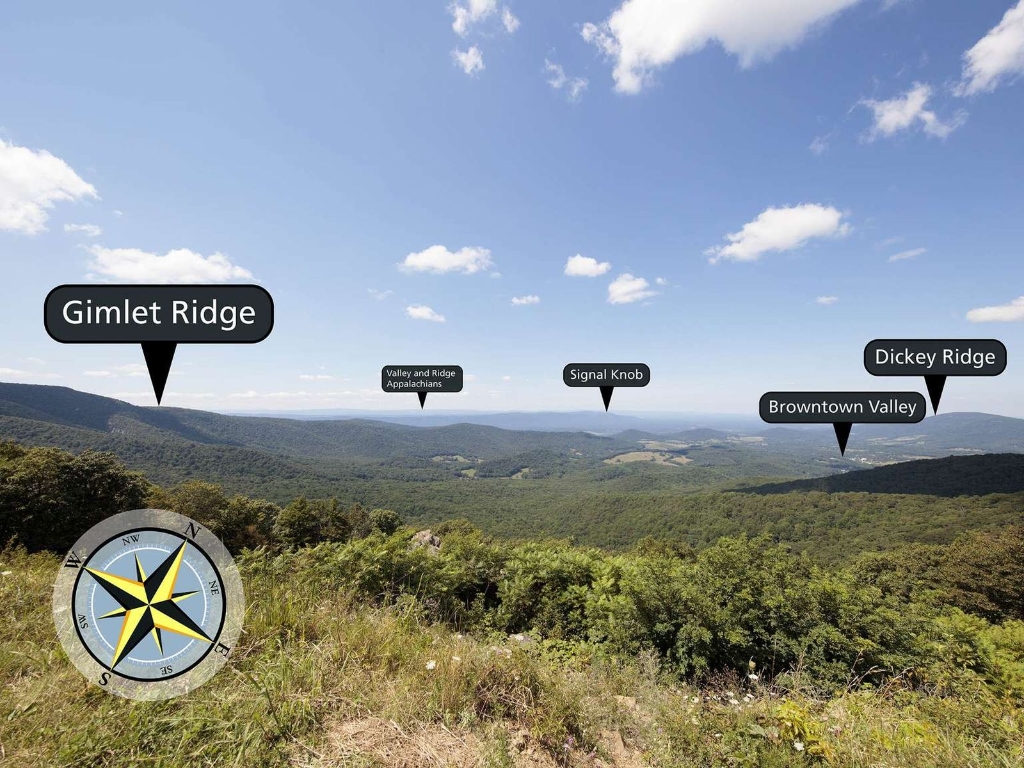
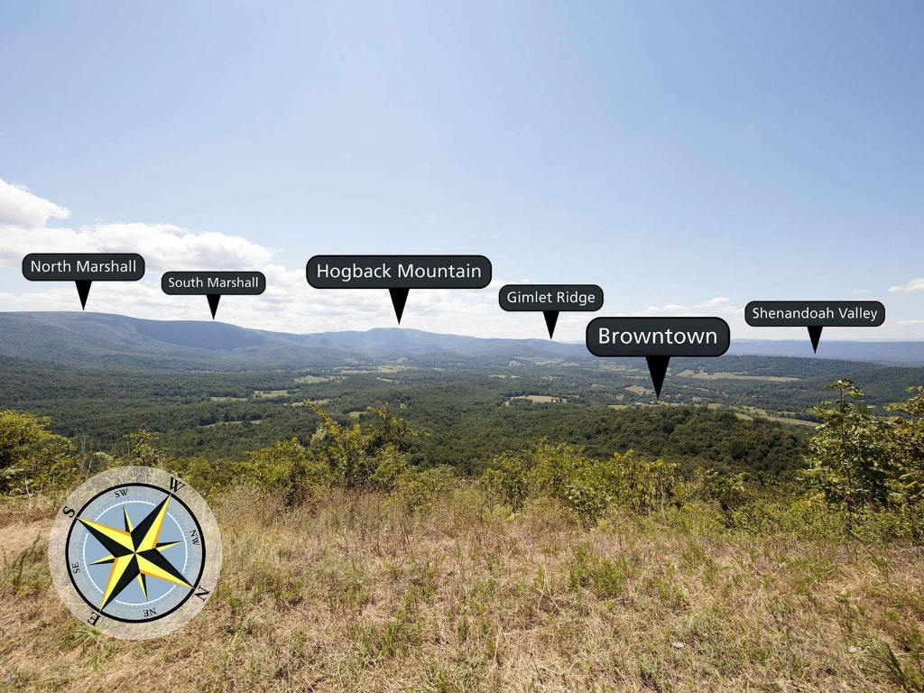
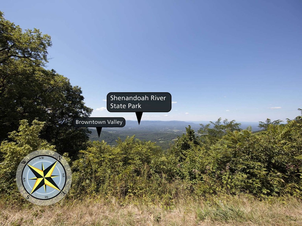
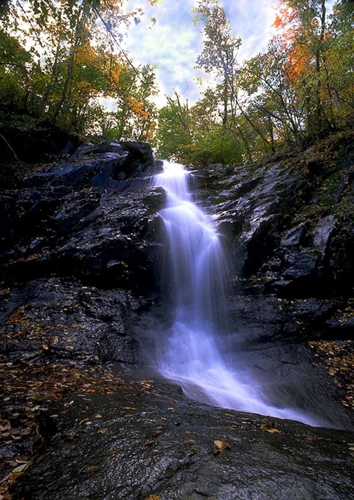
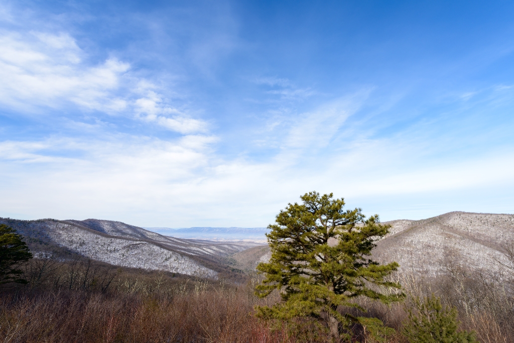
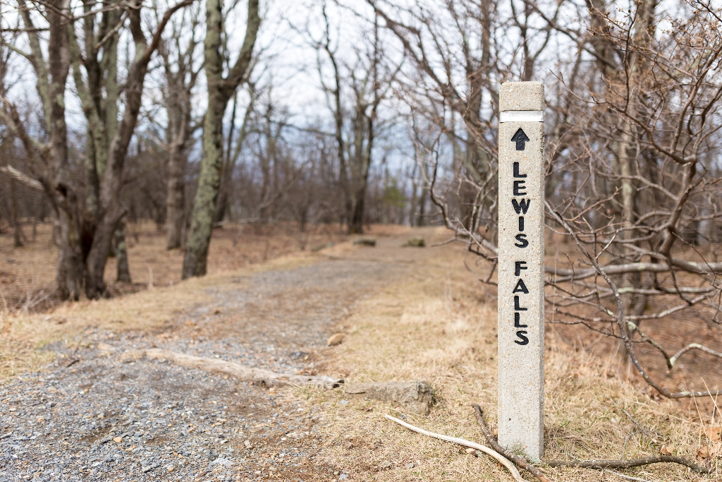
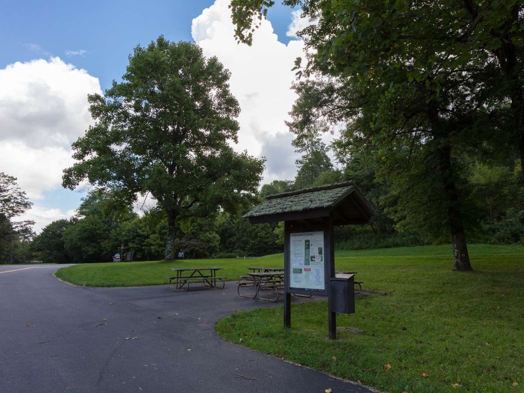
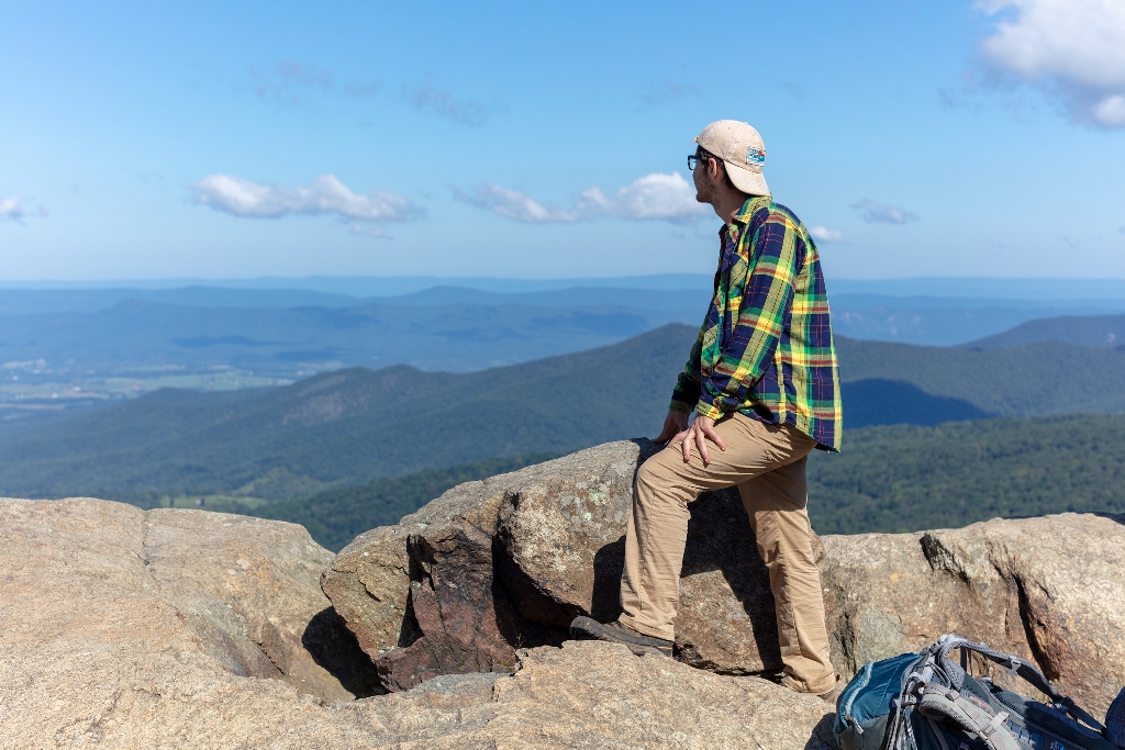
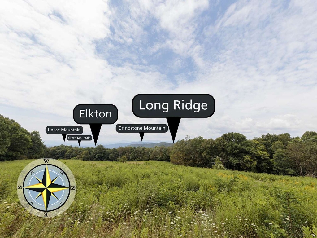
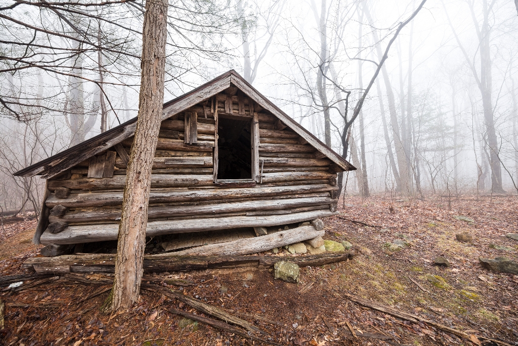
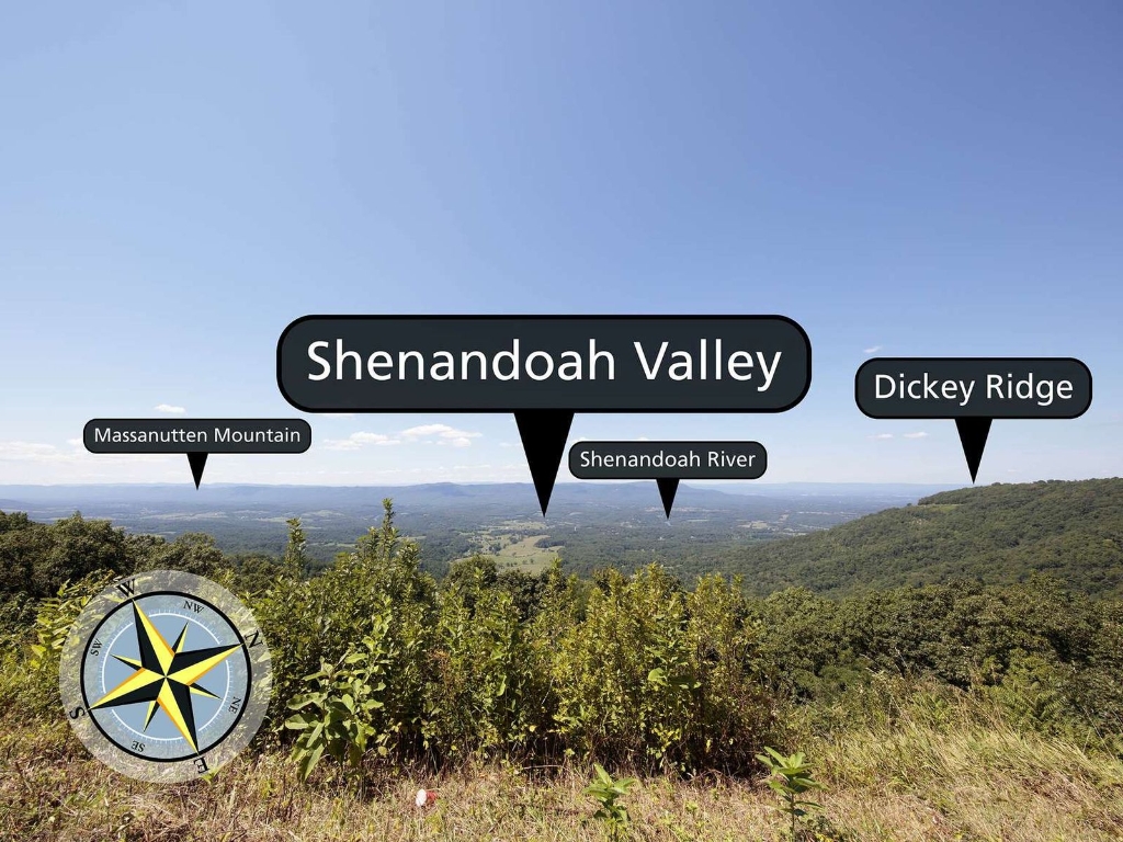
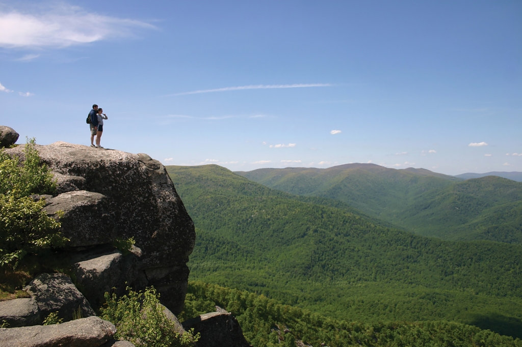
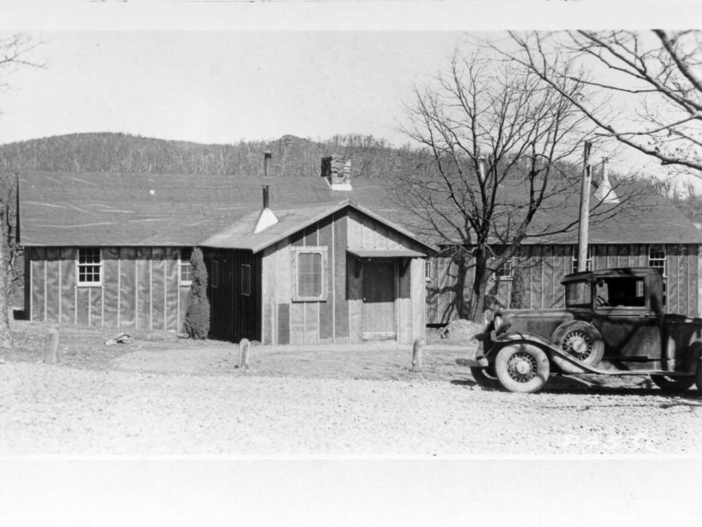
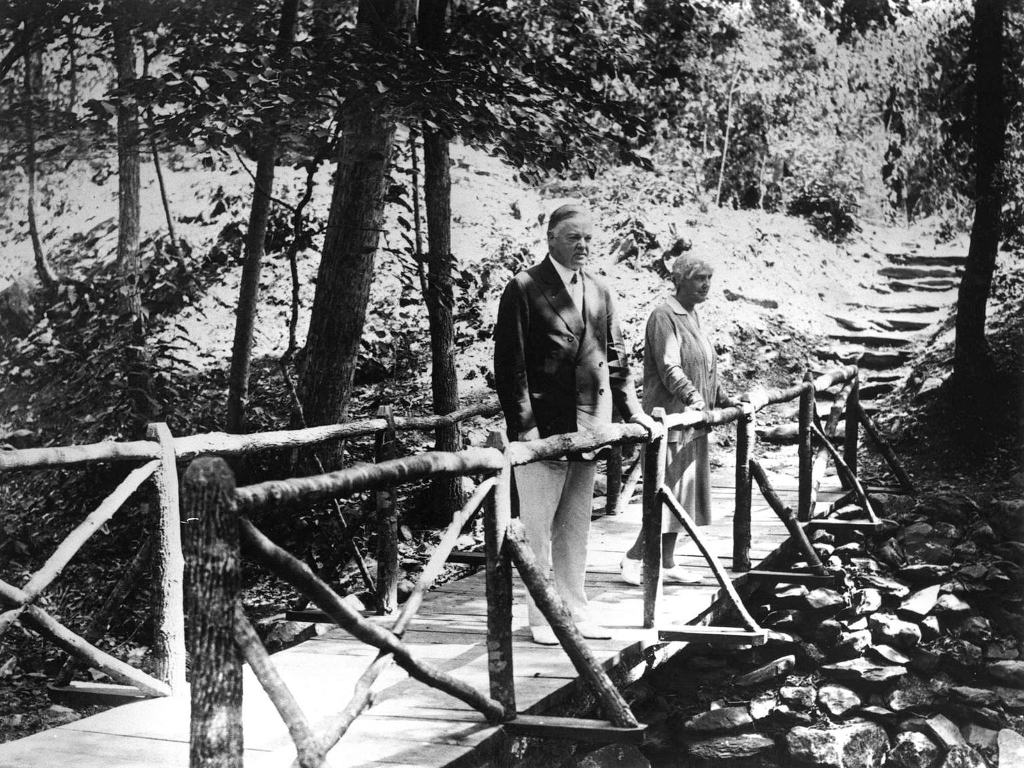
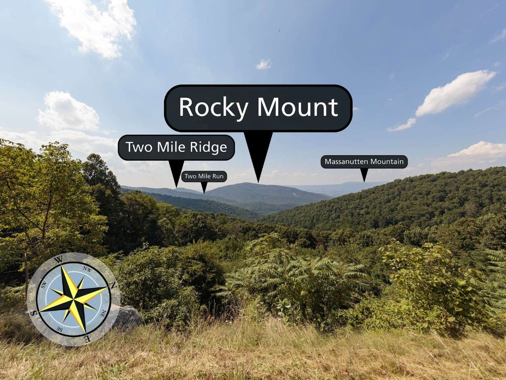
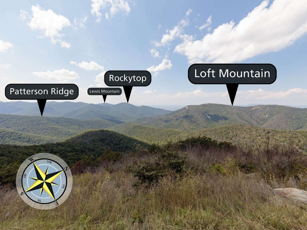
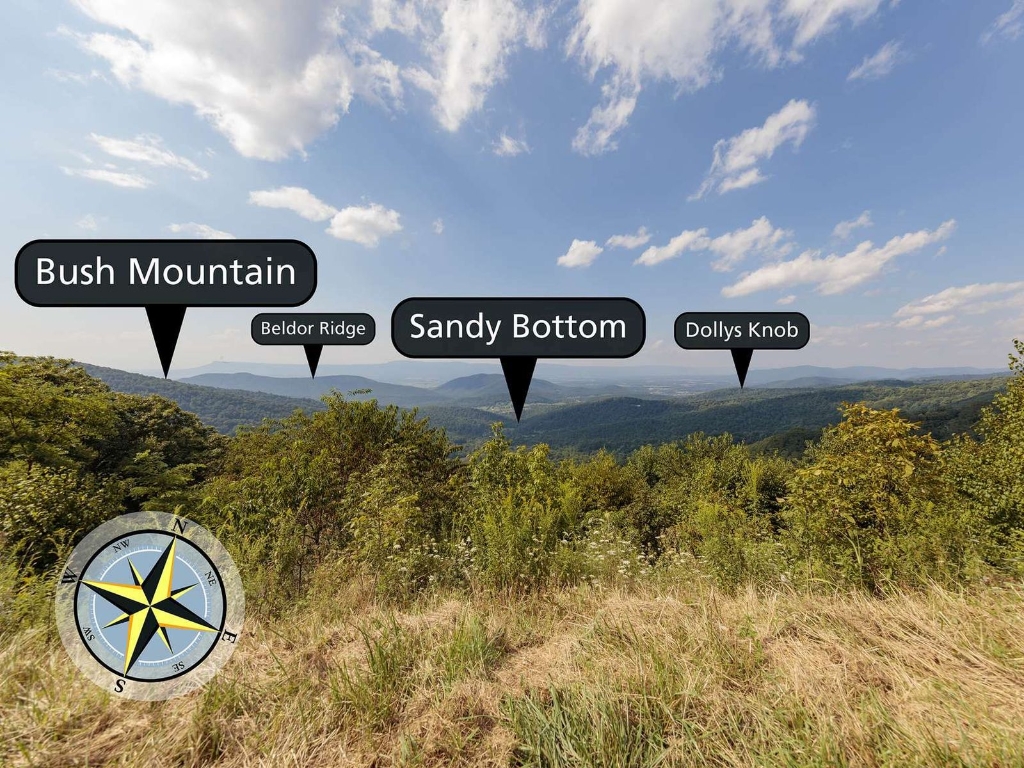
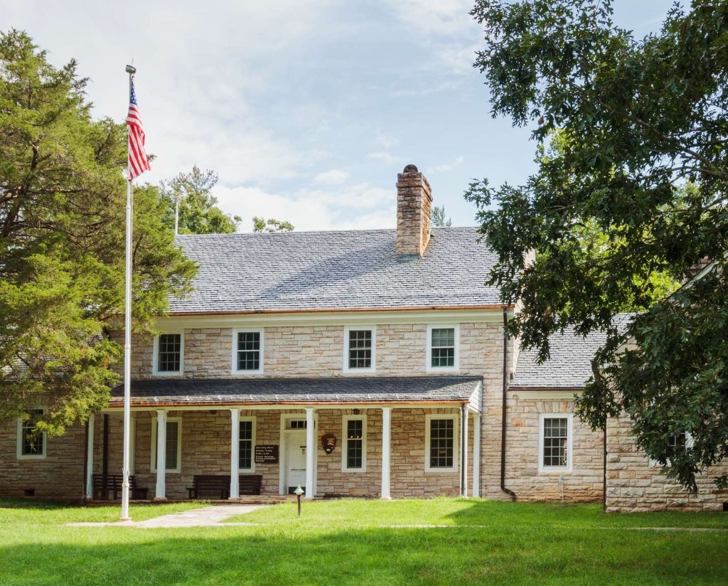
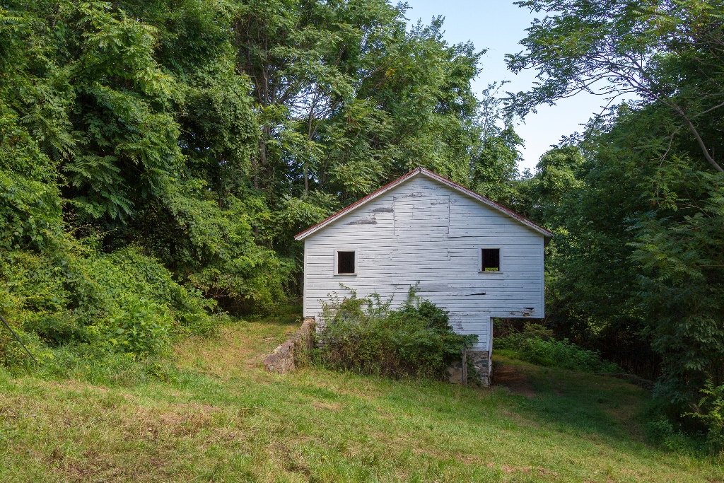
Level hike through former homestead on Appalachian Trail, walking time.
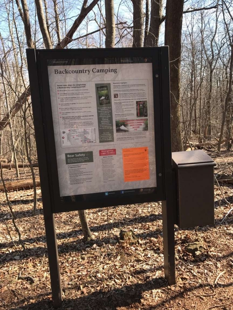
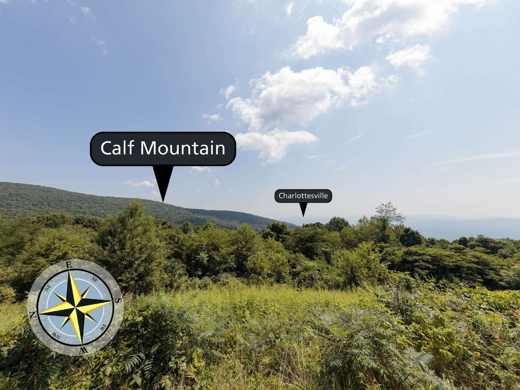
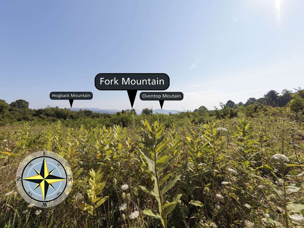
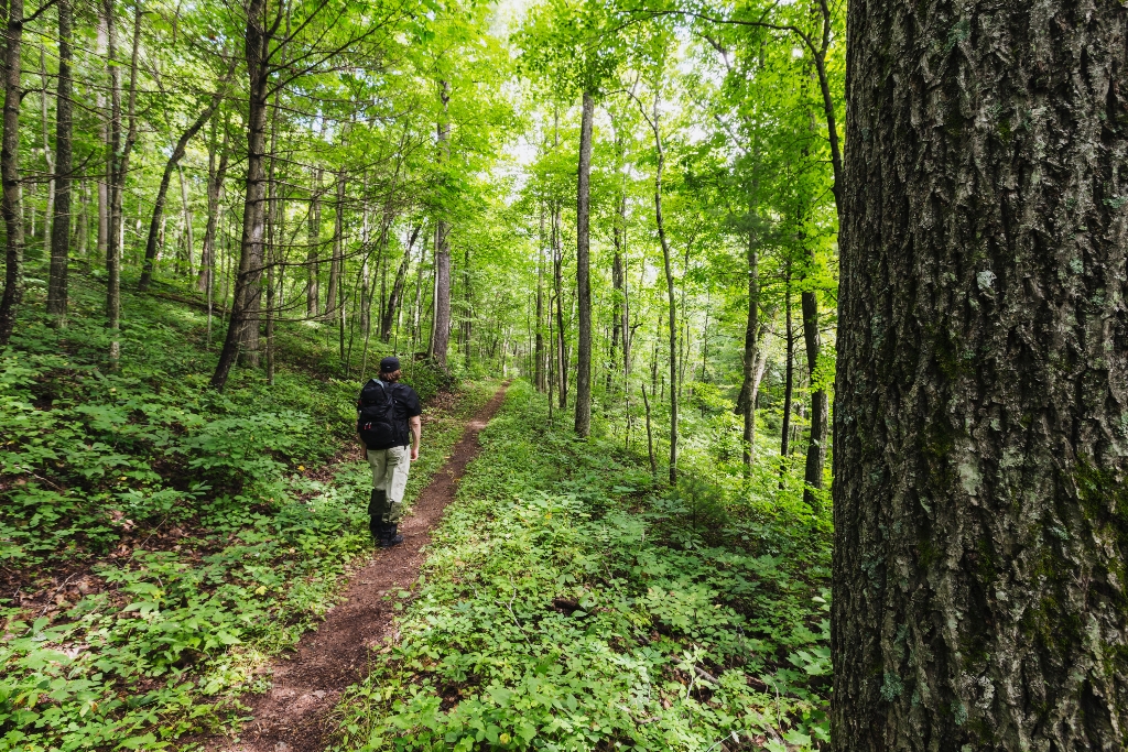
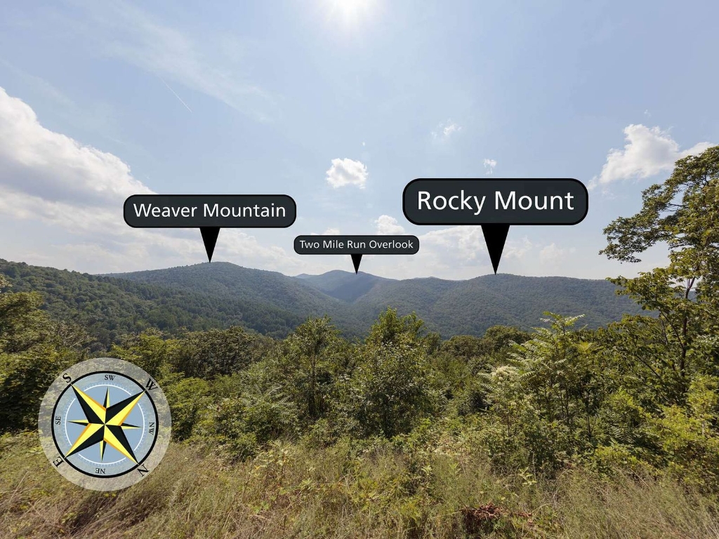
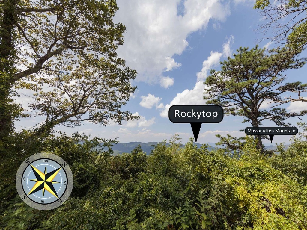
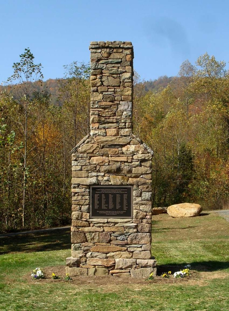
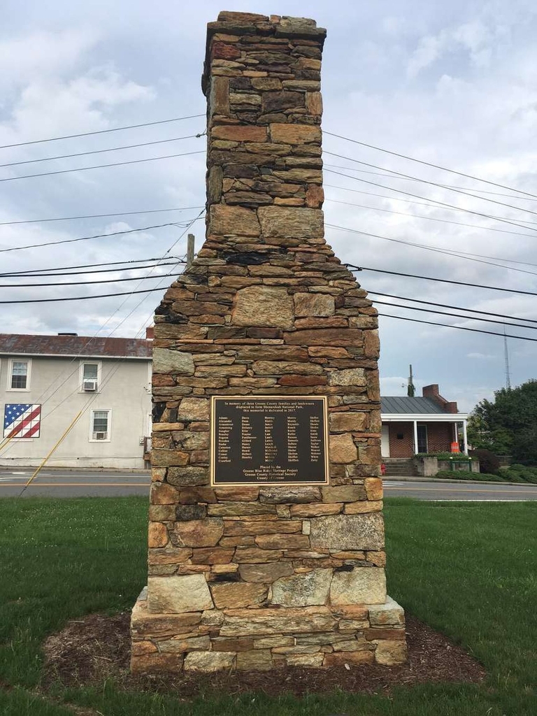
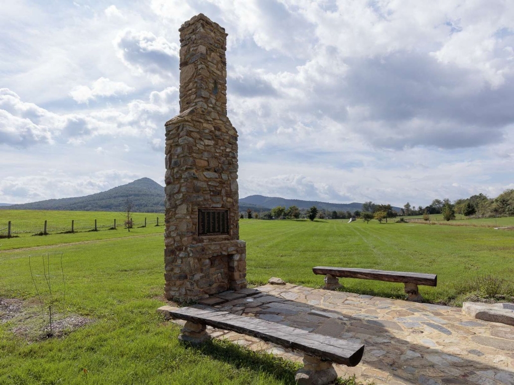
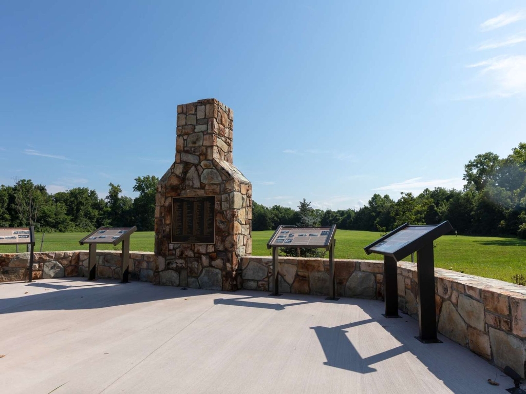
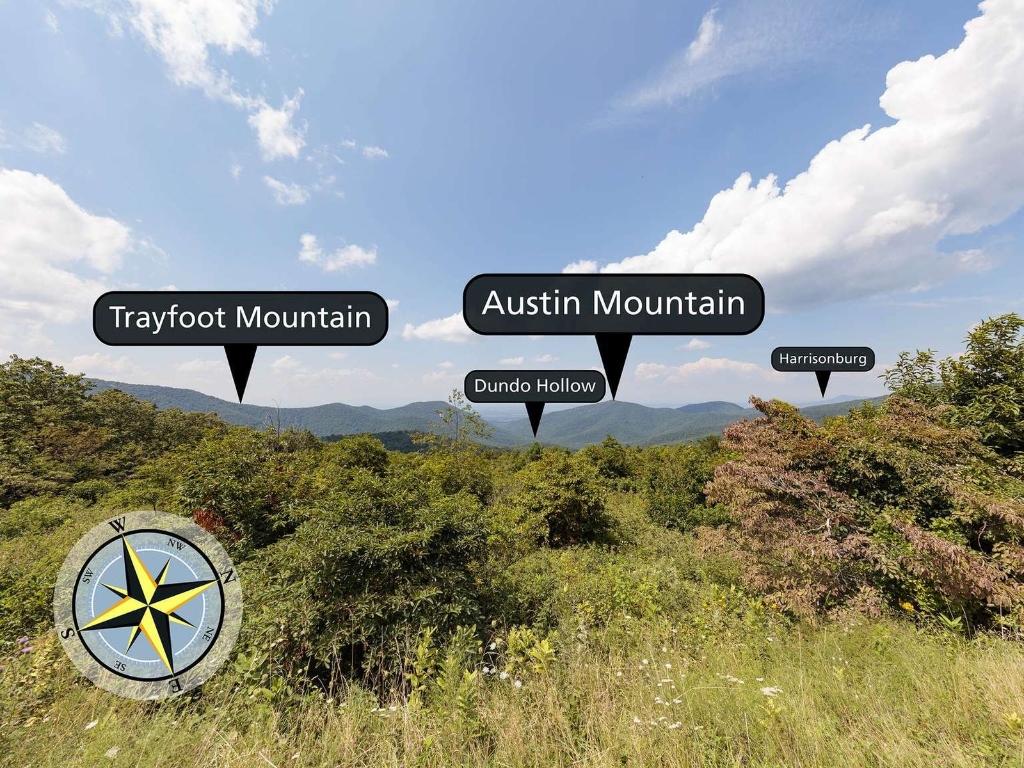
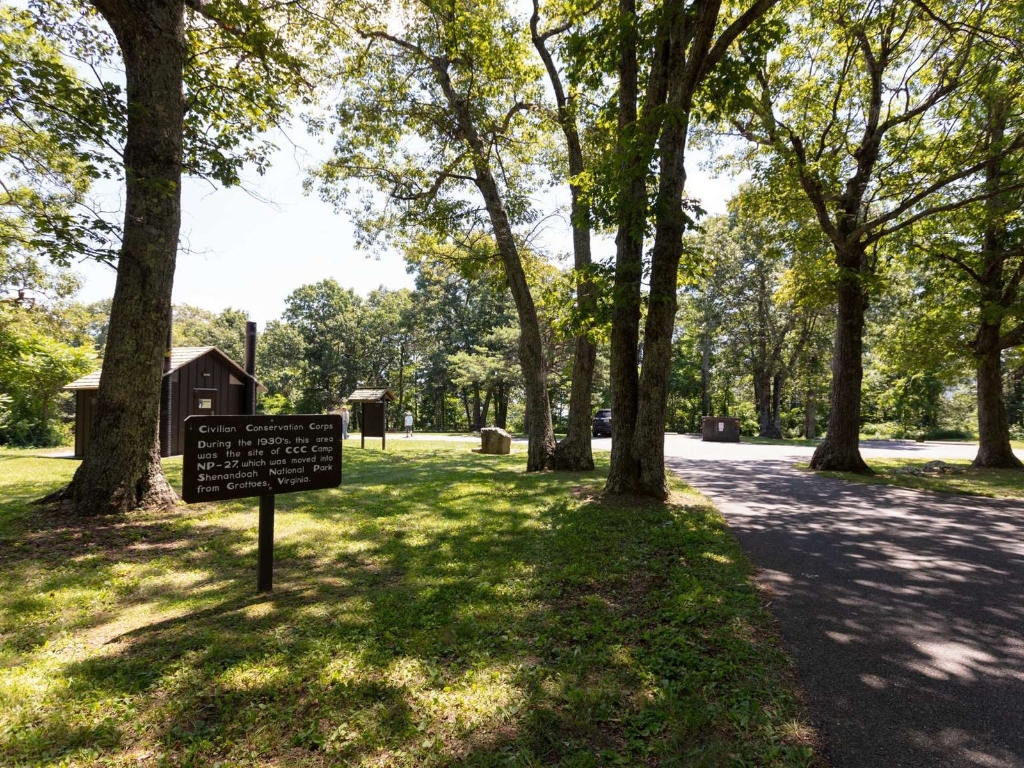
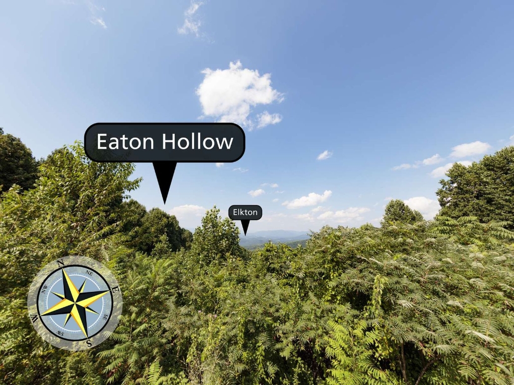
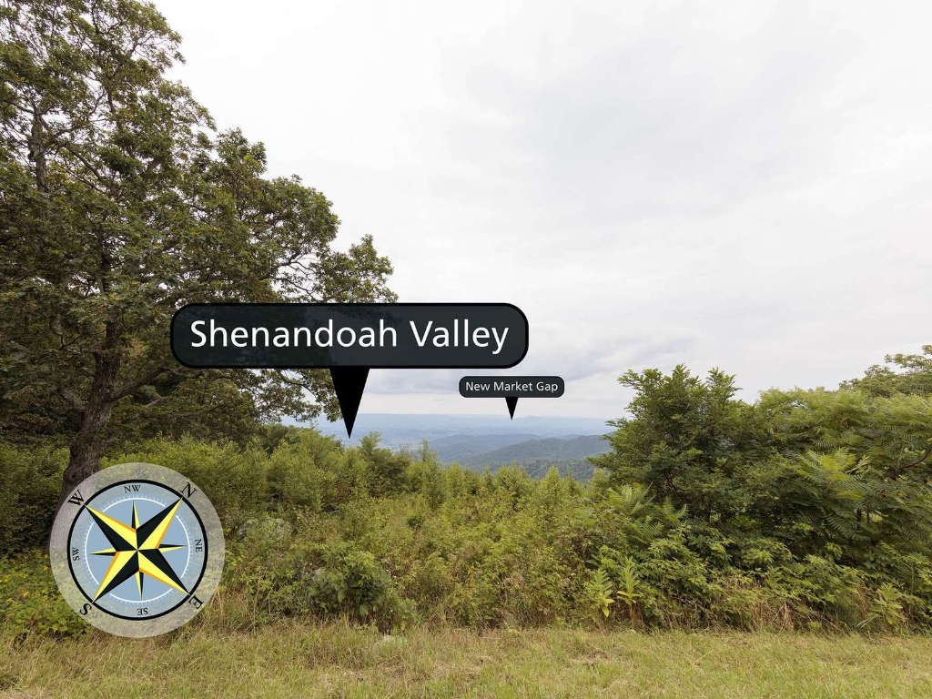
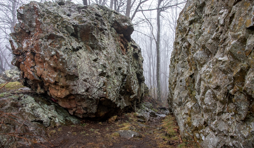
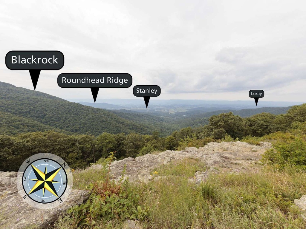
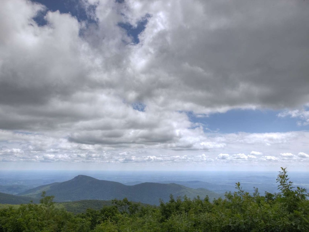
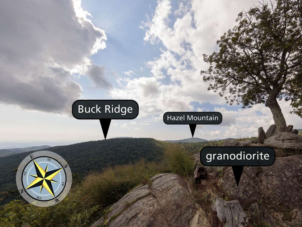
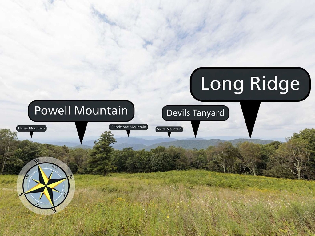
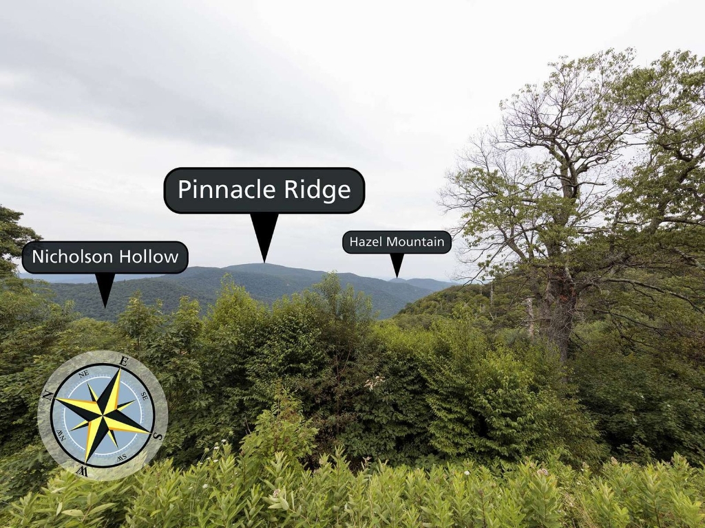
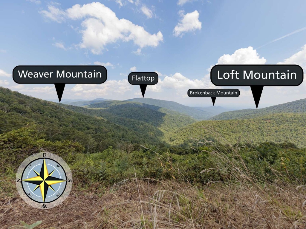
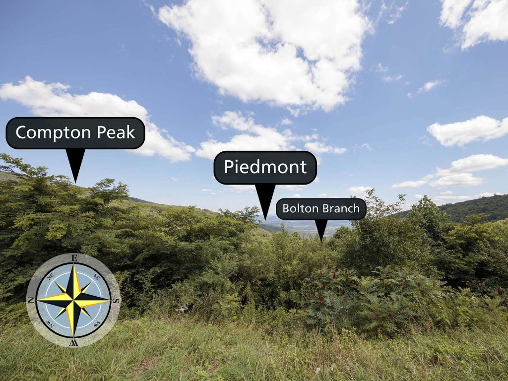
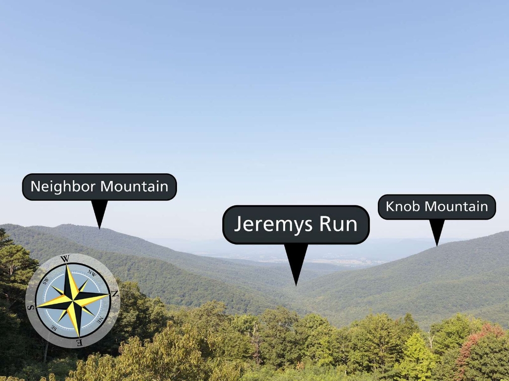
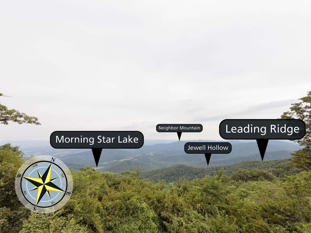
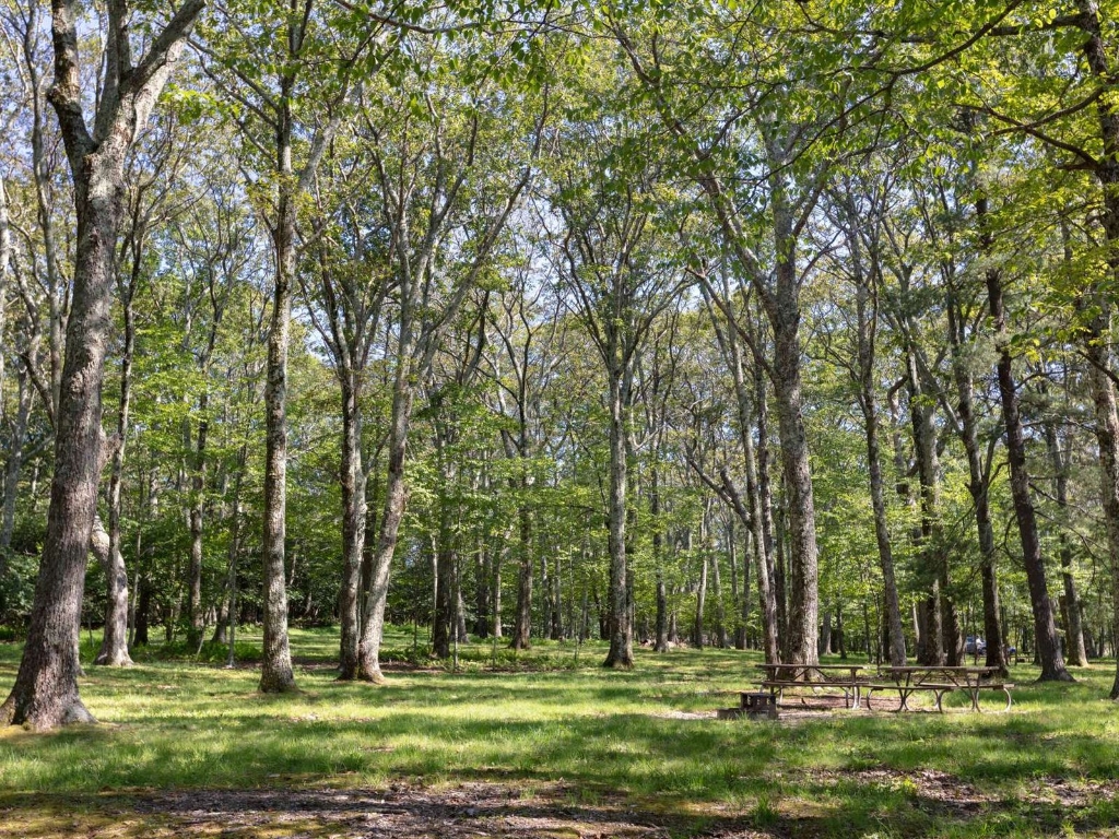
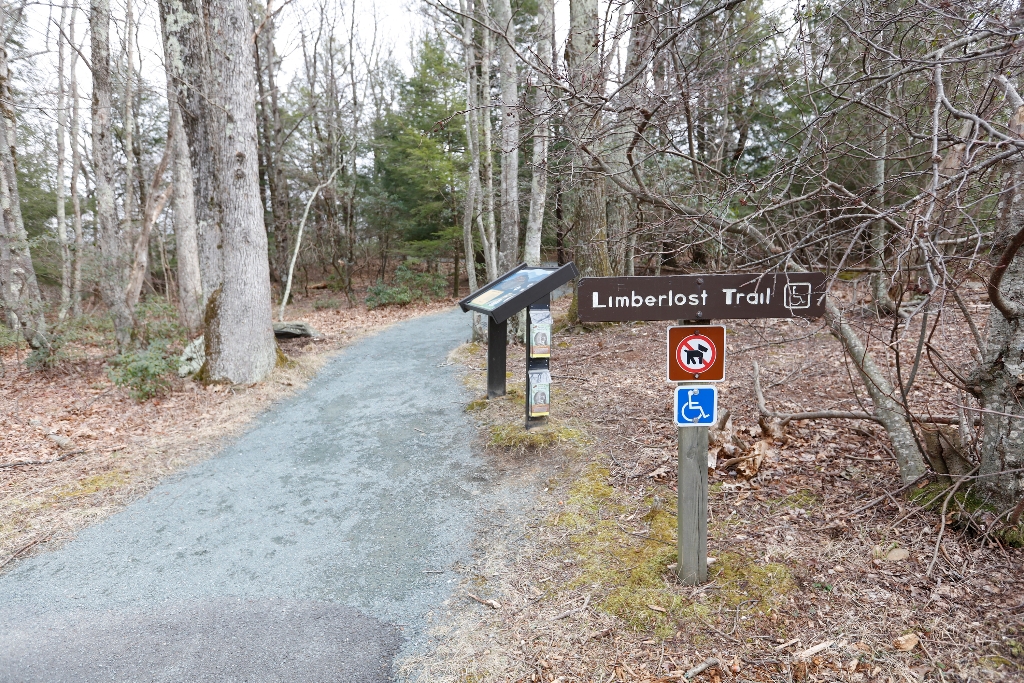
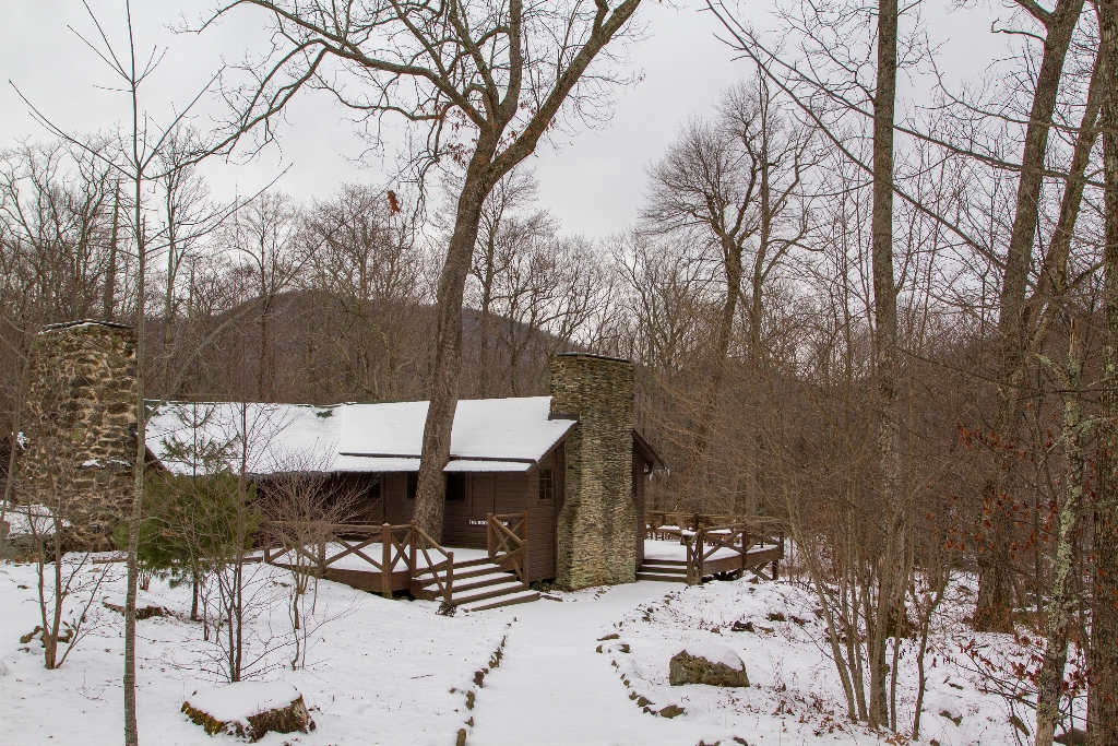
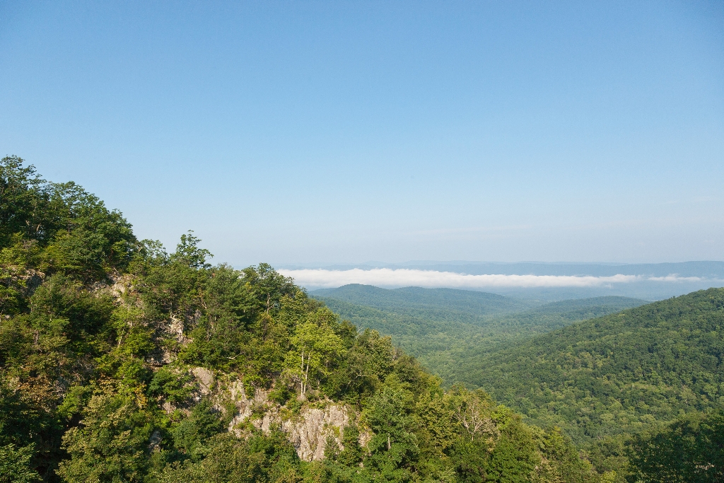
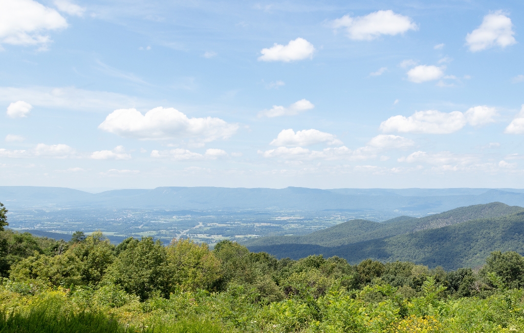
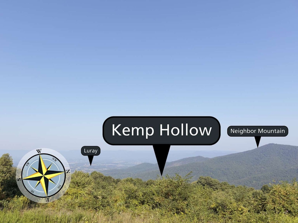
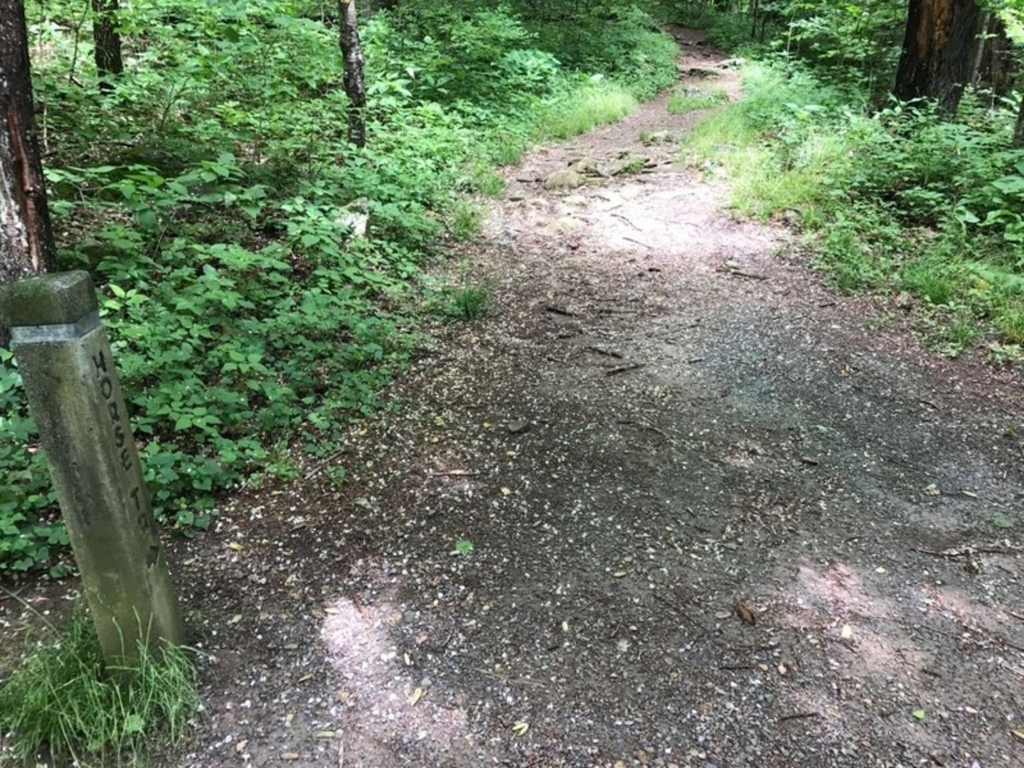
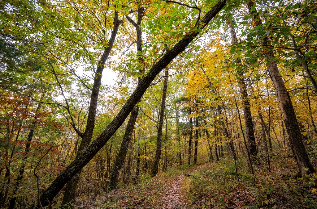
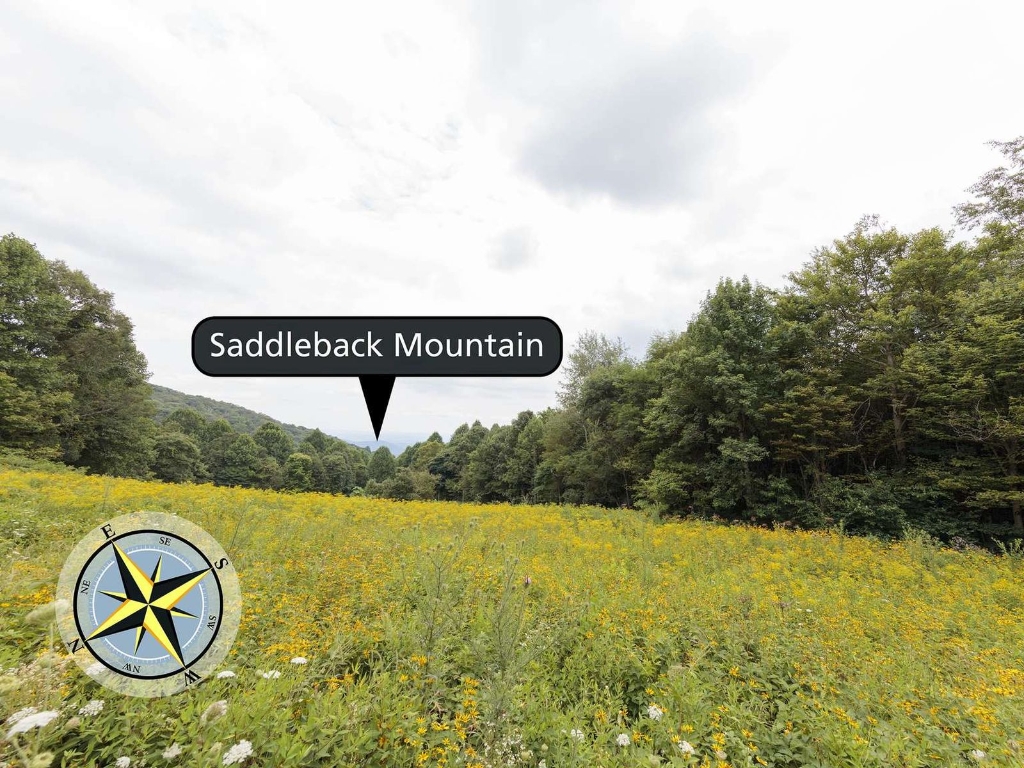
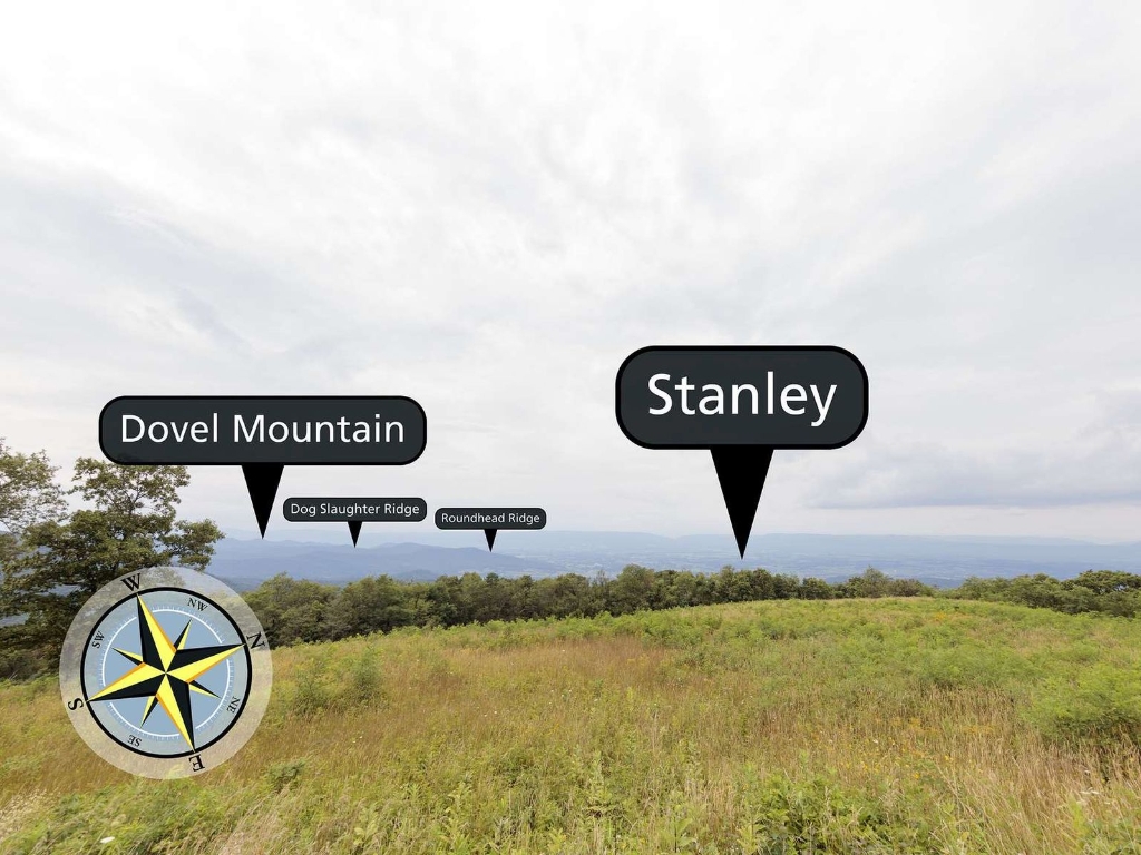
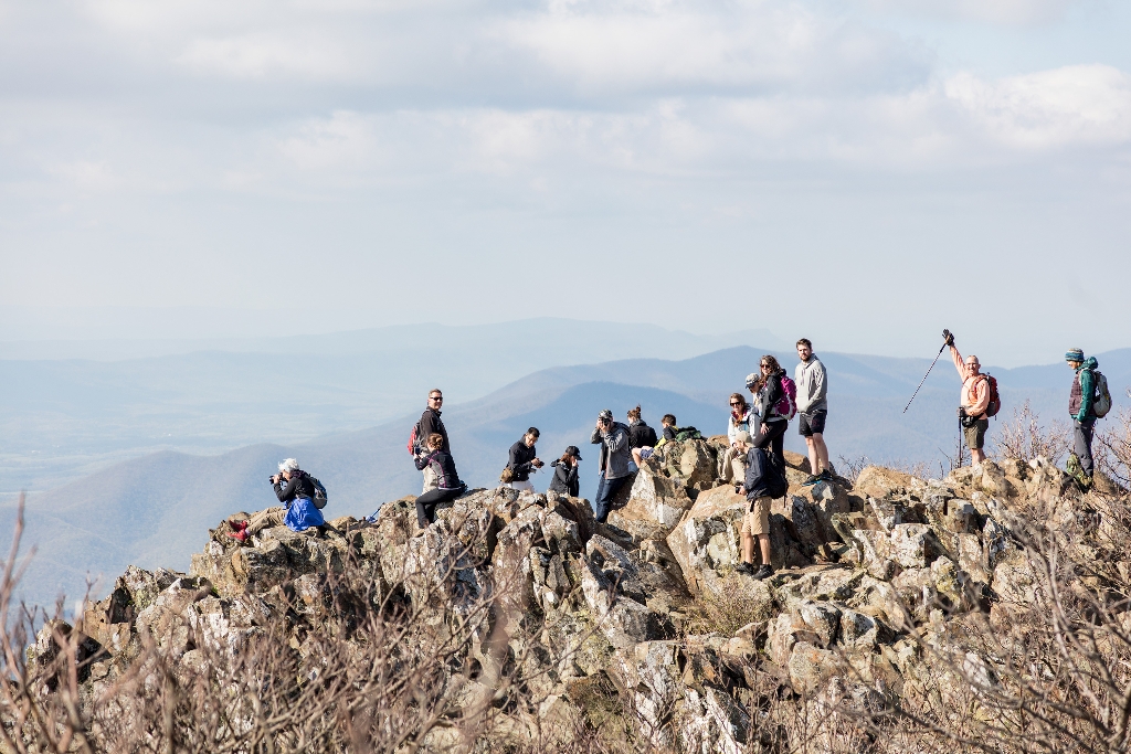
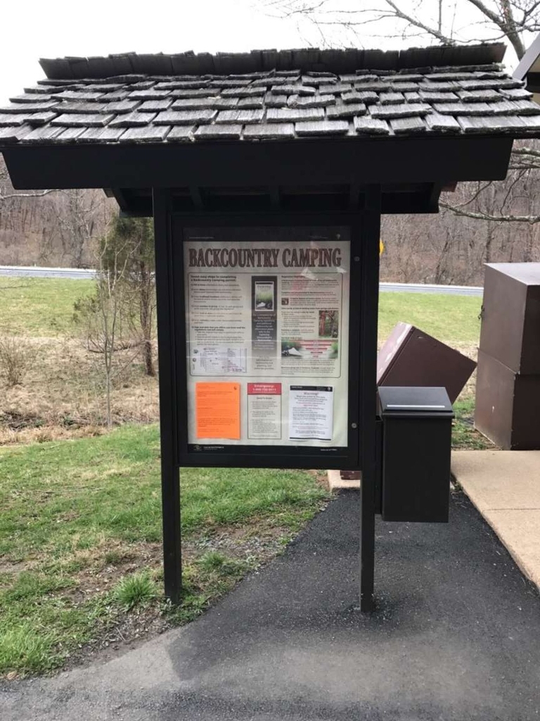
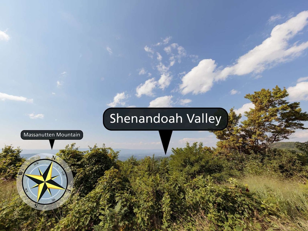
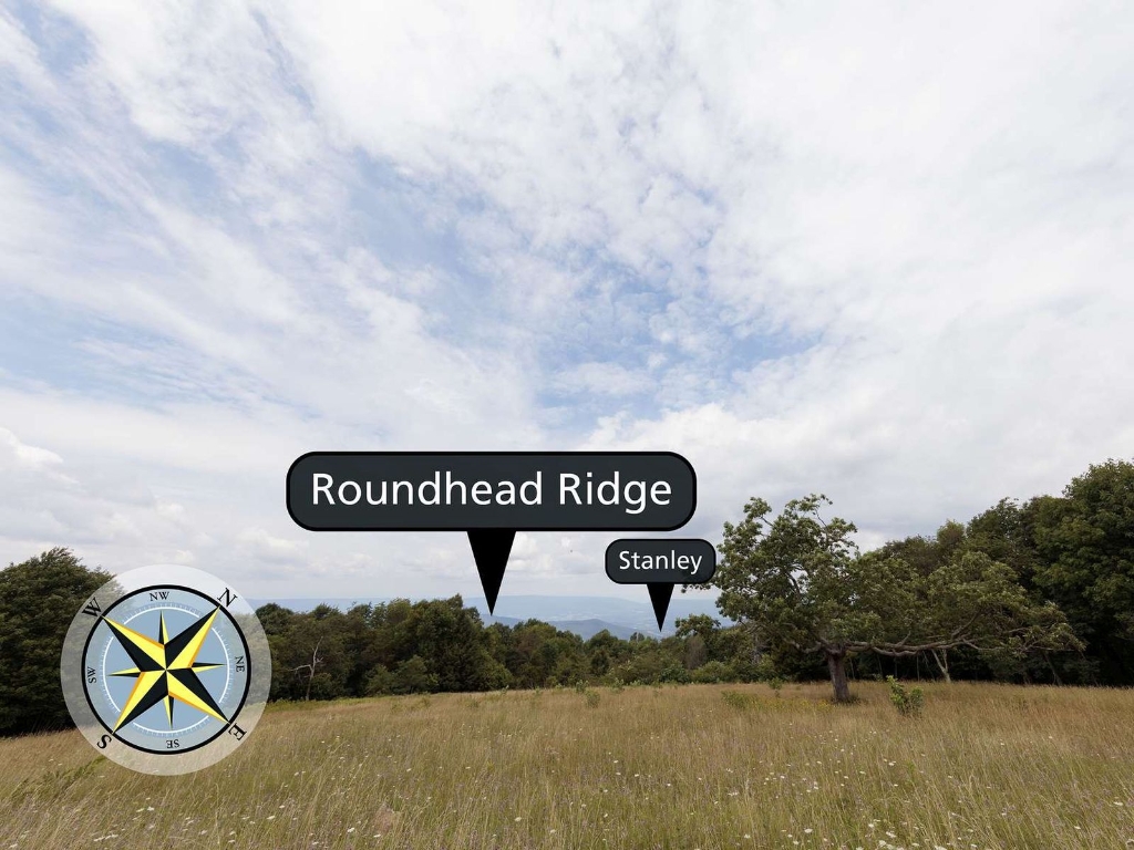
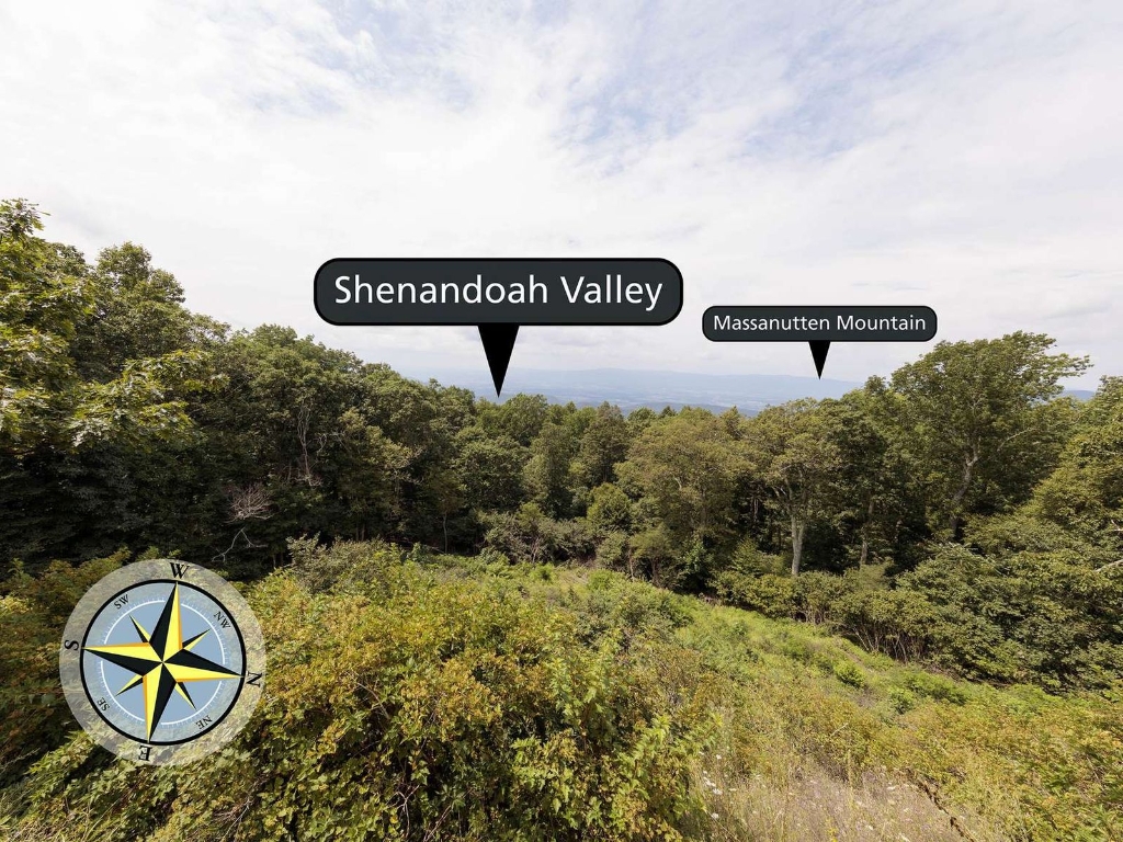
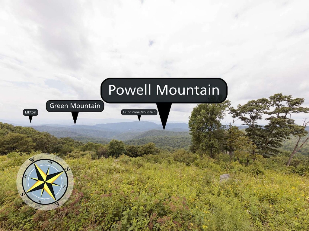
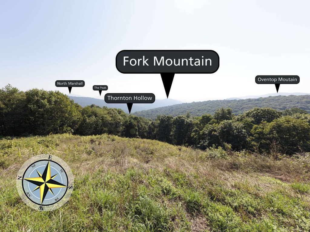
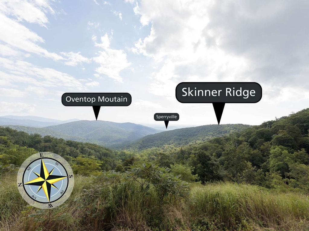
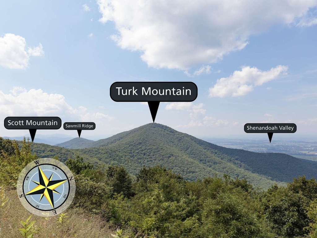
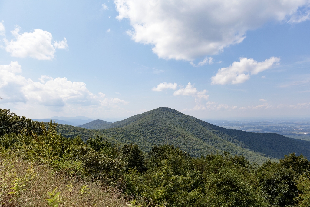
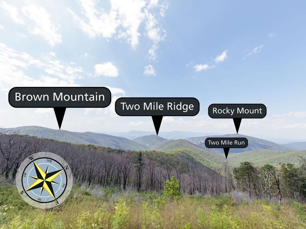
Milam Gap Parking Area (Mile 52.8) | A fairly level hike that takes you through a former homestead on the famous Appalachian Trail.
Backcountry Registration: Appalachian Trail (North)
Free permit needed for backcountry camping. Self-register along Appalachian Trail.
A free backcountry camping permit is required to camp in Shenandoah's backcountry. A permit can be filled out at this self-registration kiosk, located along the Appalachian Trail at the northern end of Shenandoah National Park. Note that this kiosk is not accessible by vehicle.
Bacon Hollow Overlook
View from Bacon Hollow Overlook faces south, overlooking Piedmont region.
Facing south from an elevation of 2,455 ft (748 m), the view from Bacon Hollow Overlook stretches out over a broad hollow that descends to the Piedmont in the distance. The Piedmont is the central region of Virginia between the Blue Ridge Mountains and the Coastal Plains. Literally meaning foothills, the Piedmont region is known for its rolling hills and rural character.
Baldface Mountain Overlook
View slopes from Baldface Mtn overlook, Shenandoah Valley glimpsed below.
Facing northwest from an elevation of 3,345 ft (1,019 m), the view from Baldface Mountain Overlook glimpses into the Shenandoah Valley below. You are atop a slope of Baldface Mountain. The peak is on the opposite side of the Skyline Drive to the northeast.
Beagle Gap
Beagle Gap: parking lot, toilets, Appalachian Trail access. Walking time.
Beagle Gap contains a small parking lot with portable toilets and access to the Appalachian Trail.
Beagle Gap Overlook
View from Beagle Gap Overlook extends to Virginia Piedmont region.
Facing east from an elevation of 2,495 ft (760 m), the view from Beagle Gap Overlook stretches outside of Shenandoah National Park to the Piedmont region of Virginia. Calf Mountain is the long ridge from the left descending down to the center of the view. If you travelled in a south-eastern direction the first urban center you would hit is the town of Charlottesville, Virginia.
Beahms Gap Overlook
Elevation 2,485 ft at Beahms Gap, limited visibility from parking lot, scenery nearby.
Beahms Gap sits at an elevation of 2,485 ft (757 m). During the early years of Shenandoah National Park, there was a 360 degree view from this location, created by clearing the land around Skyline Drive. Over time, trees have grown back and there is no view of the Shenandoah Valley from the Beahms Gap parking lot. If you cross the Skyline Drive on a clear day, you can see Hogback Mountain, Fork Mountain, and Oventop Mountain.
Bearfence Rock Scramble Trailhead
Bearfence Parking: No pets allowed. Rock scramble with panoramic view.
Bearfence Parking Area (mile 56.4) | Pets are not allowed on this hike. An exhilarating rock scramble leads to a magnificent 360-degree view of the Virginia Piedmont and Shenandoah Valley.
Bearfence Viewpoint Trailhead
Bearfence Parking Area, no pets, panoramic valley view, no scrambling.
Bearfence Parking Area (mile 56.4) | Pets are not allowed on this hike. This route takes you to a 180-degree view of the Shenandoah Valley without a rock scramble.
Beldor Hollow Overlook
View southwest from 2,345 ft, Blue Ridge Mountains, Skyline Drive.
Facing southwest from an elevation of 2,345 ft (714 m), the view from Beldor Hollow Overlook expands out to the Blue Ridge Mountains with Skyline Drive in the distance.
Big Meadows
High-elevation meadow surprise at Skyline Drive, mile 51.
Skyline Drive (mile 51) | Perched on top of a mountain, this high-elevation meadow can come as a bit of a surprise after the miles of lush, green forests that make up most of Shenandoah National Park. A must-see for every visitor, stop by Big Meadows to explore the trails, grab a bite to eat, or talk to a Ranger at Byrd Visitor Center.
Big Meadows Amphitheater
Join ranger program at Big Meadows for insightful nature connection.
Nothing adds to the National Park experience quite like enjoying an evening ranger program at Big Meadows amphitheater! Come listen to a Park Ranger present a variety of topics that will help you to connect to Shenandoah on a deeper level.
Big Meadows Gas Station
Gas station next to Big Meadows Wayside within Shenandoah Park.
This refueling station is located next to the Big Meadows Wayside. It is the only gas station located within Shenandoah National Park, so be sure to plan accordingly!
Big Meadows Lodge
Accommodations range with walking distance to dining areas.
Big Meadows Lodge has accommodations ranging from main lodge rooms to detached small cabins, preferred and traditional rooms, suites, and pet friendly rooms - all located within walking distance of the main lodge building in the popular Big Meadows area. The Spottswood Dining Room, New Market Taproom, and Craft Shop are aso located in the main lodge building.
Big Meadows Picnic Grounds
Next to campground, Big Meadows Picnic Grounds with tables, grills.
Located next to the Big Meadows Campground, Big Meadows Picnic Grounds provides an open space to relax, complete with picnic tables and grills.
Big Meadows Wayside
Varied regional menu, grab 'n go options, groceries, gifts available.
Big Meadows Wayside offers a varied menu of regional favorites available for carry-out or sit down dining. The Grab 'n Go kiosk inside offers sandwiches, salads, pastries, snacks and drinks to go. Groceries, gifts, and camping supplies are also available. 
Big Run Overlook
NW view from 2,860 ft, obstructed by overgrowth, Shenandoah Valley.
Facing northwest from an elevation of 2,860 ft (871 m), at Big Run Overlook you will look out toward the Shenandoah Valley below. Unfortunately, the view at this overlook is obstructed by overgrowth most of the year, making it difficult to see the mountains and valley beyond.
Blackrock Summit Trailhead
Blackrock Parking Area | Short hike to scenic viewpoint, kid-friendly TRACK Trail.
Blackrock Parking Area (mile 84.4) | A short hike to a viewpoint on top of a rocky talus slope with incredible views of the Shenandoah Valley, Massanutten Mountain, and beyond. This hike is also a designated TRACK Trail, featuring a self-guided brochure designed for kids.
Blue Ridge Heritage Project Monument - Albemarle
Blue Ridge Heritage Project honors displaced mountain residents through monuments.
The Blue Ridge Heritage Project is a non-profit organization whose mission is to build monuments to honor the people who were displaced by the creation of Shenandoah National Park. Currently, six of the eight counties from which mountain residents were relocated have monuments: Madison, Page, Rockingham, Greene, Rappahannock, and Albemarle. Warren has a site selected and Augusta is in the planning stages. Most of the monument sites include exhibits about the families. We invi
Blue Ridge Heritage Project Monument - Greene County
Blue Ridge Heritage Project honors displaced people with monuments, exhibits.
The Blue Ridge Heritage Project is a non-profit organization whose mission is to build monuments to honor the people who were displaced by the creation of Shenandoah National Park. Currently, six of the eight counties from which mountain residents were relocated have monuments: Madison, Page, Rockingham, Greene, Rappahannock, and Albemarle. Warren has a site selected and Augusta is in the planning stages. Most of the monument sites include exhibits about the families. We invi
Blue Ridge Heritage Project Monument - Madison County
Non-profit honors those displaced by Shenandoah Park; 8 counties involved.
The Blue Ridge Heritage Project is a non-profit organization whose mission is to build monuments to honor the people who were displaced by the creation of Shenandoah National Park. Currently, six of the eight counties from which mountain residents were relocated have monuments: Madison, Page, Rockingham, Greene, Rappahannock, and Albemarle. Warren has a site selected and Augusta is in the planning stages. Most of the monument sites include exhibits about the families. We invi
Blue Ridge Heritage Project Monument - Page County
Non-profit honors displaced mountain residents with monuments in counties.
The Blue Ridge Heritage Project is a non-profit organization whose mission is to build monuments to honor the people who were displaced by the creation of Shenandoah National Park. Currently, six of the eight counties from which mountain residents were relocated have monuments: Madison, Page, Rockingham, Greene, Rappahannock, and Albemarle. Warren has a site selected and Augusta is in the planning stages. Most of the monument sites include exhibits about the families. We invi
Blue Ridge Heritage Project Monument - Rappahannock County
Non-profit honors displaced mountain residents with monuments and exhibits.
The Blue Ridge Heritage Project is a non-profit organization whose mission is to build monuments to honor the people who were displaced by the creation of Shenandoah National Park. Currently, six of the eight counties from which mountain residents were relocated have monuments: Madison, Page, Rockingham, Greene, Rappahannock, and Albemarle. Warren has a site selected and Augusta is in the planning stages. Most of the monument sites include exhibits about the families. We invi
Blue Ridge Heritage Project Monument - Rockingham County
Honoring displaced mountain residents with monuments in six counties.
The Blue Ridge Heritage Project is a non-profit organization whose mission is to build monuments to honor the people who were displaced by the creation of Shenandoah National Park. Currently, six of the eight counties from which mountain residents were relocated have monuments: Madison, Page, Rockingham, Greene, Rappahannock, and Albemarle. Warren has a site selected and Augusta is in the planning stages. Most of the monument sites include exhibits about the families. We invi
Brown Mountain Overlook
Brown Mountain Overlook at 2,844 ft elevation, with expansive views.
Brown Mountain Overlook sits at an elevation of 2,844 ft (866 m). This overlook is long, with views from north to south of Two Mile Ridge, Rocky Mount, Rockytop, Trayfoot Mountain, and the Shenandoah Valley.
Browns Gap Trailhead
Hike to Upper and Lower Doyles River Falls, Jones Run.
Browns Gap Parking Area (mile 83) | This circuit hike leads you through designated Wilderness to Upper and Lower Doyles River Falls, as well as Jones Run Falls.
Browntown Valley Overlook
View historic community and hills from 2,890 ft elevation.
Looking west-northwest from an elevation of 2,890 ft (880 m), you will see the view of an historic community and surrounding hills from the Browntown Valley Overlook
Buck Hollow Overlook
Stop at Buck Hollow Overlook, view mountains from 2,710 ft.
Stop at Buck Hollow Overlook, facing east-northeast from an elevation of 2,710 ft (826 m), and look out over the mountains! Skinner Ridge is visible towards the left, while Buck Ridge makes its way from the right toward the center of the view.
Calf Mountain Overlook
West-facing view from 2,480 ft overlooking Waynesboro, walking time.
Facing west from an elevation of 2,480 ft (755 m), the view from Calf Mountain Overlook is straight out over the town of Waynesboro.
CCC Barracks: Daily Schedule
Enrollment in CCC: 6 months, re-enlist for 2 years. Oath required. Some struggled.
The enrollment period for the CCC was initially for six months, but an enrollee could re-enlist for up to a maximum of two years. Enrollees were required to take an oath, swearing to obey those in authority and follow all rules and regulations. Some of the boys adjusted more easily to a regimented life than others. Those who had come from rural backgrounds tended to have an easier time with the labor than those from more urban backgrounds. Others suffered from homesickness a
CCC Barracks: Home Away From Home
CCC started quickly, first enrollees in surplus tents, built camps.
Given the speed with which the CCC was started, the first enrollees didn't arrive to finished camps in May of 1933 but rather, in the early months, they lived in surplus WWI tents. As the organization of the CCC evolved, more standardization was introduced into the building of the camps but almost all camps were built around a common open space or "Company Street."Shenandoah National Park had 10 different camps at various times throughout the nine years of the Civilian Conser
CCC Barracks: Living Was Sparse
CCC requirements: man 18-25, unmarried, need assistance; older veterans eligible. Earned $30, $25 sent home; economic benefit spread.
In the beginning, the official requirements for being a CCC enrollee were to be a man between the ages of 18-25, unmarried, and in need of assistance. (Although some older WWI veterans were also allowed to enroll.) Unofficially, some of the CCC boys lied about their ages to enter the Corps. CCC enrollees earned 30 dollars a month, a dollar a day, but $25 were automatically deducted and sent back home to their families, thus spreading the economic benefits of the program to th
CCC Barracks: Near Bathhouse
Mountain cold, firewood abundant. CCC boys find ravaged landscape, chestnut blight.
Winters would have been cold here on the mountain but there was no shortage of firewood to heat the stoves. When the CCC boys arrived at Shenandoah, they found a landscape that had been ravaged by the chestnut blight, a fungus that had been unintentionally imported from Asia and which had destroyed the American Chestnut. In the space of 30 years, the majestic trees which made up 25% of the forest ecosystem had died and left a "ghost forest" behind. It was a huge economic and
CCC Barracks: Sports
Close living, conflicts arose, boxing helped, exposure to diverse backgrounds.
Living in close quarters, with little privacy, conflicts inevitably arose. As well as being fun, participating in competitive sports, including boxing, was one way of dealing with tensions as they arose.The boys came from varied backgrounds, rural and urban, and for many it was their first journey away from home. Being in the CCC exposed these young men to people completely different from themselves and gave them an opportunity to learn how to get along. Many an enrollee left
CCC Camp
1933: Nation in Great Depression, ecological issues, high unemployment.
The year was 1933. The nation had been struggling for years with the effects of the Great Depression. Unemployment reached as high as 12 million people, equivalent to 25% of the eligible working population. People had lost their savings and livelihoods, bread lines were long and morale was low. Adding to the economic woes, the United States was also facing severe ecological issues. Drought conditions, poor farming practices and indiscriminate timber harvesting were contributi
CCC Education
CCC legacy: education, skills, travel opportunities for young men.
The legacy of the CCC is vast and varied. The program affected change on both the personal and national levels. For the young men who came in with minimal or poor education, they learned how to properly read and write. Others learned the technical and construction skills that would serve them well in their later careers. Many saw parts of the country they had never seen before.
CCC Mess Hall
Mess hall built first for CCC boys to fuel their work.
When setting up a camp, the mess hall was the typically the first building built. The idea behind the CCC was to put men to work, not machines, so they needed proper nutrition to fuel their various labors. <br />The food was basic, but plentiful, and having regular meals three times a day was a welcome change for most of the CCC boys who had been living off more meager rations during the Depression.
CCC Office
Multiple agencies recruited CCC men for work projects effectively and quickly.
There were many agencies involved in getting the CCC men here: the Department of Labor recruited and enrolled the men, the Department of Interior (under which the National Park Service is administered) and Department of Agriculture provided the work projects and the War Department/Army ran the camps. Despite the many agencies involved, the CCC was up and running with incredible speed. From Roosevelt's initial meeting with his Cabinet regarding the CCC on March 9, 1933 to the
CCC Recreation
Employees relax at building after work, attend movies and dances.
After a long, hard day of work, this building must have the place to come for a little relaxation. But the boys wouldn't just stay up on the mountain, even if their dances did sometimes attract hundreds of attendees. Needing a change of scene, they might go on Friday and Saturday nights down into the nearby towns to attend movies and the local dances.
CCC Technical Building
Skyline Drive construction by CCC involved building overlooks and erosion control.
The building of Skyline Drive was a labor-intensive endeavor. Though the CCC did not engineer and build the road itself (that was done by the Bureau of Public Roads) they designed and created the overlooks as well as worked to control the erosion on the hillsides created from it's construction. Additionally, they planted hundreds of thousands of trees and plants, including mountain laurel, creating the beautiful "natural" landscaping we enjoy today as we take a drive along th
CCC: Flower Garden
CCC managed vegetation, reforestation, landscaping, and facility placements at Park.
The CCC worked on every aspect of vegetation and reforestation management in the Park. They grew and planted new seedlings, cleared the understory of dead brush and trees, and moved shrubs and trees around from one area to another, particularly by picnic grounds, overlooks and other facilities. What might seem natural to us now is actually the product of extensive landscape manipulation.
Cedar Run - Whiteoak Circuit Trailhead
Challenging hike, rewarding views of cascades and waterfalls.
Hawksbill Gap Parking Area (mile 45.6) | This hike is very challenging, although those who do it are rewarded with exceptional cascades and waterfalls.
Chimney Rock Trailhead
Hike to Chimney Rock for excellent viewpoint of geological features.
Riprap Parking Area (mile 90) | An out-and-back hike to Chimney Rock, an excellent viewpoint with some very interesting geological features.
Compton Peak Trailhead
Hike from Compton Gap to western view, columnar jointing feature.
Compton Gap Parking Area (mile 10.4) | A hike through the forest along the Appalachian Trail to a western view and a great look at columnar jointing, an exciting geologic feature.
Crescent Rock Overlook
Crescent Rock Overlook west-facing, elevation 3,550 ft, informative sign.
Facing west, with an elevation of 3,550 ft (1,082 m), Crescent Rock Overlook has some of the best views of Hawksbill Peak, the highest peak in Shenandoah, at 4,050 ft (1,234 m). An informational sign located at the overlook shares information about the establishment of Shenandoah National Park and the resettlement of former residents of the land.
Crimora Lake Overlook
View northwest 2,985 ft elevation, contemplate valley's industrial history.
Facing northwest from an elevation of 2,985 ft (909 m), Crimora Lake Overlook is a good place to contemplate the industrial history of the Shenandoah Valley.
Dark Hollow Falls Trailhead
No pets allowed on hike. Steep, rocky, challenging return walk.
Dark Hollow Falls Parking Area (mile 50.7) | Pets are not allowed on this hike. This hike follows a stream to a beautiful waterfall, and is one of the Park’s most traveled trails. The trail is short, but very steep and rocky and the return hike is challenging!
Dickey Ridge Picnic Grounds
Picnic spot with amenities, closed in winter. 540-999-3500 for details.
A beautiful spot to stop for a picnic in the northernmost area of the park. Equipped with tables, fire grates, water, restrooms, and plenty of room to relax! Closed in winter. Call 540-999-3500 for exact dates.
Doyles River Falls Trailhead
Hike from Doyles River Parking Area to two waterfalls.
Doyles River Parking Area (mile 81.1) | This beautiful trek through Wilderness takes you along cool, clear mountain streams to two unique waterfalls.
Doyles River Overlook
View south from Doyles River Overlook. Elevation 2,875 ft.
Take in a view to the south from Doyles River Overlook. Sitting atop an elevation of 2,875 ft (876 m), the view here looks out to Browns Cove, nested beyond Little Flat Mountain and Cedar Mountain.
Dundo Overlook
View west-northwest from 2,769 ft, see distant mountains.
Facing west-northwest from an elevation of 2,769 ft (843 m), the view from Dundo Overlook expands to the mountains in the distance.
Dundo Picnic Grounds
Year-round picnic grounds with amenities and historical significance. Located at loop drive end.
Welcome to Dundo Picnic Grounds! This picnic grounds is open year round. You will find drinking water, vault toilets, picnic tables, and fire rings for making your picnic the best ever. This location was once the site of a Civilian Conservation Corps camp. Dundo Group Campground is located at the end of the one-way loop drive around the picnic ground.
Eaton Hollow Overlook
Eaton Hollow Overlook: obstructed view, possible glimpse north-northeast, 2,500 ft.
The view from Eaton Hollow Overlook is obstructed by vegetation for much of the year. Facing north-northeast from an elevation of 2,500 ft (762 m), you may be able to see a small window between the growth to look out upon the Shenandoah Valley below.
Elkwallow Picnic Grounds
Year-round picnic grounds with tables, grates, water, restrooms.
Elkwallow Picnic Grounds is open year-round and fitted with picnic tables, fire grates, water, and restrooms.
Elkwallow Wayside
Elkwallow Wayside closes early November, reopens in April, offers supplies.
Elkwallow Wayside offers groceries, camping supplies, gifts, and grab 'n go food. Elkwallow usually closes around the beginning of November and reopens in April.
Fishers Gap Overlook
Facing northwest from 3,070 ft, view Shenandoah Valley.
Facing northwest from an elevation of 3,070 ft (935 m), Fishers Gap Overlook provides a narrow window to view the Shenandoah Valley.
Fort Windham Rocks Trailhead
Short hike at Compton Gap to geologic feature, 10.4 miles.
Compton Gap Parking Area (mile 10.4) | A short hike along the Appalachian Trail that leads to an interesting geologic feature.
Fox Hollow Cemetery: Stories Laid to Rest
Families with private cemeteries; observe and imagine historical significance. Flowers.
Many families who lived in the mountains had private family cemeteries. Although only a few gravestones are left, generations of the Foxes are buried here. Observe your surroundings. Can you imagine what this spot would have been like when the Fox family still held funerals here? What did this space mean to the family?If you are visiting in spring, you may discover flowers that the Fox family planted years ago - frilly old fashioned daffodils and narcissuses, deep purple bear
Fox Hollow First Trail Post: Tour Introduction
Past inhabitants left remnants, stories in this hidden hollow.
People once called this place home. Remnants of their lives and the impact they had on this land are still evident if you know where and how to look. In this hollow are the stories of people and a history obscured by the wild, rapid pace of natural flux.
Fox Hollow Right Turn: A Barn was Here
Near Merchant barn rock foundation. Walking on old county road.
As the trail turns a sharp right, you are very near the location of a barn that belonged to a neighbor of the Foxes, Edgar Merchant. A short section of the trail here is on the Merchant property. Today, the rock foundation of Merchant's barn lies under thick spicebush and multiflora rose.After the turn, you will be walking along an old county road which once connected the Fox family to the town of Front Royal. To your left (and possibly not even visible through the dense fore
Fox Hollow Rock Piles: Things Left Behind
Remnants of Fox's farm, mystery rock piles from plowed fields.
There is not much left of the Foxes and their lives here. These rock piles are one of the few large, visible artifacts of the Fox's farm. What could these rocks be? A wall, a fence, part of a barn, a house? <br />Lemuel Fox Jr. said that he would add rocks to the piles as he found them while plowing the cornfields. The original purpose of these rock piles is unknown.
Fox Hollow Second Trail Post: The Fox Family
Fox family history in Shenandoah National Park, spanning generations. Time:1h.
The family that chose this hollow as their home were named Fox. Thomas and Martha Fox started farming here - on this ground - in 1856. Their son Lemuel Franklin Fox and his wife, Lucy, planted bluegrass pastures, corn, and wheat after Lemuel returned from the Civil War. Lemuel's grandson Lemuel Fox Jr. courted his future wife, Maude Vaught on the family property. By the time of the establishment of Shenandoah National Park, the Foxes and extended family lived in several frame
Fox Hollow Springbox: Getting Water
Springbox at Dickey Ridge Visitor Center built after Fox family.
Are you thinking like an archaeologist? When do you think people made this? Who made this?If you guessed that the Fox family did not build this you would be correct. This is a springbox built after the Fox family left. At one time this springbox helped provide a water supply to the dining room at Dickey Ridge Lodge, currently Dickey Ridge Visitor Center. Though the Fox family did not build this springbox, they did use the water here for their farming and other daily needs. Op
Fox Hollow Stream: Life Abounds
Water source essential for farming, plant and animal life, lush vegetation.
A stable water source would have been one of the most important factors in finding a place to live for Thomas and Martha Fox when they began farming here in the 1850s. This water not only provides for farming and human life, but also for a wide variety of plant and animal life as well. One of the reasons Shenandoah is so lush, and how much of the vegetation here seems to grow faster than other places, is the prevalence of water sources like this one here.
Fox Hollow Sycamore Tree: Wilderness to Farm and Back Again
Lemuel Fox Jr. recalls attaching windmill to sycamore, forest history. Walking.
When Lemuel Fox Jr. walked here with Park Rangers in 1976 he told them that when he was a young man in the 1920s he once attached a windmill to this tree. "[The sycamore] was the only tree on this hill then," Lemuel said, "All the rest of it was cleared from here." Most of the older growth forest was cut down long ago to make way for farmland in the 1800s and early 1900s. Certain trees, maybe a tall red oak here, a white pine over there, or this sycamore before you were spare
Fox Hollow Third Trail Post: Out in the Clearing
Approach third trail post, imagine cleared hollow or mountain view.
As you approach the third trail post, take a second to look out at the clearing. As the forest opens up, imagine what the whole hollow would have looked like if it were cleared like this. When you think about living in the mountains, do you think of a hollow - low, narrow, enclosed on either side - or do you think of a home with a sweeping view? The cleared pastures and farmland certainly would have created some views for the Fox family, but the view was a secondary considera
Fox Hollow Trailhead
No pets. Explore cultural history. TRACK Trail with kids brochure.
Dickey Ridge Visitor Center (Mile 4.6) | Pets are not allowed on this hike. Discover the cultural history of Shenandoah National Park as you pass by historic rock walls, a cemetery, and periwinkles planted by former residents. This hike is also a designated TRACK Trail, featuring a self-guided brochure designed for kids.
Franklin Cliffs Overlook
Views Franklin Cliffs Overlook, views narrow hollow to town.
Looking northwest from 3,140 ft (957 m), Franklin Cliffs Overlook views a narrow hollow leading to the town of Stanley in the Shenandoah Valley.
Frazier Discovery Trailhead
Pets not allowed | Several overlooks | Walk through varying woodlands.
Loft Mountain Wayside (mile 79.5) | Pets are not allowed on this hike. This hike features several picturesque overlooks as it passes through woodlands of varying ages on Loft Mountain.
Front Royal Entrance
Explore Shenandoah National Park from northern entrance to Dickey Ridge.
Entering the park here at its northern entrance gives you an opportunity to travel south along Skyline Drive's entire length and experience the beauty of Shenandoah National Park. You'll notice mile posts on your right as you travel. Use these as references to find everything from dining and lodging to trails and visitor centers. Be sure to stop at beautiful, historic Dickey Ridge Visitor Center at mile 4.6 for information, an orientation movie, guides and books, and more! Yo
Front Royal Entrance Station Backcountry Registration
Wild camping, requires permit, register 1 hour before sunset walking.
Backcountry Camping is a wilder, more primitive experience than staying in a campground and requires important planning and appropriate equipment. Backcountry campers are required to have a permit. Register for a backcountry camping permit here. You must register 1 hour before sunset. For more information visit <a href="https://www.nps.gov/shen/planyourvisit/campbc.htm">nps.gov/shen/planyourvisit/campbc.htm</a>
Gimlet Ridge Overlook
View Gimlet Ridge from 2,675 ft, walking time included.
Looking north from an elevation of 2,675 ft (815 m), Gimlet Ridge Overlook views the gently descending slope of Gimlet Ridge into the valleys below.
Gooney Manor Overlook
View southwest from 1,930 ft elevation at Gooney Manor.
From Gooney Manor Overlook you are looking southwest from an elevation of 1,930 ft (588 m) into Browntown Valley and the hills beyond.
Gooney Run Overlook
NW view at 2,085 ft. Walking time: not specified.
Facing northwest at an elevation of 2,085 ft (635 m), Gooney Run Overlook looks down upon Browntown Valley.
Hawksbill Loop Trailhead
Hike to Hawksbill Peak for panoramic views. Walking distance included.
Hawksbill Gap Parking Area (mile 45.5) | A circuit hike to Shenandoah’s highest peak. The viewing platform on top of Hawksbill offers a magnificent 360-degree view of the Shenandoah Valley, the Blue Ridge Mountains, and the Virginia Piedmont.
Hawksbill Summit Trailhead
Hawksbill Gap Parking Area | 360-degree panoramic view from peak.
Hawksbill Gap Parking Area (mile 45.5) | A shorter, yet steeper route to Shenandoah’s highest peak. The viewing platform on top of Hawksbill offers a magnificent 360-degree panoramic view of the Shenandoah Valley, the Blue Ridge Mountains, and the Virginia Piedmont.
Hawksbill Summit via Upper Hawksbill Trailhead
Hiking trail to highest peak, panoramic views. Walking time: unspecified.
Upper Hawksbill Parking Area (mile 46.5) | A hike to the top of Shenandoah’s highest peak, offering 360-degree views of the Shenandoah Valley, the Blue Ridge Mountains, and the Virginia Piedmont.
Hazel Mountain Overlook
View from 2,770 ft overlook includes granodiorite rock formation.
Looking southeast from an elevation of 2,770 ft (844 m), the view from Hazel Mountain Overlook includes the granodiorite rock formation and Hazel Mountain in the distance
Hazel River Falls Trailhead
Trail from Meadow Spring Parking Area to waterfall, 33.5 miles.
Meadow Spring Parking Area (mile 33.5) | A trail that leads you through a rugged section of the Park to an exceptional waterfall.
Hazeltop Ridge Overlook
View Blue Ridge Mountains from Hazeltop Ridge Overlook, walking time.
Gaze upon the Blue Ridge Mountains from Hazeltop Ridge Overlook. The view from this overlook stretches from the northwest to the southwest.
Hemlock Springs Overlook
Hemlock Springs Overlook - elevation 3,380 ft, view eastward forest.
Facing east from an elevation of 3,380 ft (1030 m), Hemlock Springs Overlook is a great place to contemplate the dynamic nature of the forest.
Hensley Hollow Overlook
View Shenandoah Valley from Hensley Hollow Overlook, north of Elkton.
Look north from an elevation of 2,560 ft (780 m) at Hensley Hollow Overlook and view the Shenandoah Valley below. Beyond Hensley Ridge is the town of Elkton, Virginia.
Highest Point on Skyline Drive
Skyland entrance at Mile 41.7, highest point is Hawksbill Mountain. Initialize hike under 2 miles.
Mile 41.7, just at the northern entrance to Skyland is the highest point on Skyline Drive at 3,680 feet. The highest point in Shenandoah is the summit of Hawksbill Mountain at 4,050 feet. Getting to the summit entails a relatively short hike of less than 2 miles.
Hightop Summit Trailhead
Hike to rocky viewpoint at 3,296 feet, 66.7 miles.
Hightop Mountain Parking Area (mile 66.7) | Wind your way up a ridge on this hike to a rocky viewpoint that stands at 3,296 feet.
Hogback Overlook
Hogback Overlook, 0.2 miles along Skyline Drive, highest park.
Looking north from an elevation of 3,385 ft (1031 m), Hogback Overlook extends 0.2 miles along Skyline Drive, making it the longest overlook in the park.
Hogwallow Flats Overlook
Hogwallow Falts Overlook faces SE from elevation of 2,665 ft.
Hogwallow Falts Overlook faces southeast from an elevation of 2,665 ft (812 m). You are looking down to Rappahannock County and the town of Flint Hill.
Horsehead Overlook
Northwest views from 2,580 ft at Horsehead Overlook, Augusta County.
Look northwest to the Shenandoah Valley from an elevation of 2,580 ft (786 m) at Horsehead Overlook. You are looking into Augusta County in the southern Shenandoah Valley.
Indian Run Overlook
Indian Run Overlook elevation: 2,400 ft; overlook faces east.
Indian Run Overlook faces east and sits at an elevation of 2,400 ft (731 m). Indian Run is a stream that has formed the hill in front of you through the slow process of erosion.
Iron Mike Statue
"Statue outside Byrd Visitor Center honoring Civilian Conservation Corps."
Iron Mike stands outside Byrd Visitor Center. This statue was donated to the Park to honor the young men in the Civilian Conservation Corps who, together, built much of the infrastructure of Shenandoah National Park still in use today.
Ivy Creek Overlook
Elevation of 2,890 ft, view Shenandoah National Park, Appalachian Trail.
Facing east from an elevation of 2,890 ft (880 m), you will look out to the rolling ridges of Shenandoah National Park from Ivy Creek Overlook. The Appalachian Trail intersects with this overlook, as well.
Jenkins Gap Overlook
Jenkins Gap Overlook: view to Piedmont from 2,355 ft elevation.
Jenkins Gap Overlook peers onto the Piedmont from a small window above the v-shaped intersection of two hills. Looking east, and at an elevation of 2,355 ft (717 m), you are peering into a hollow formed by the Bolton Branch of the Burgess River.
Jeremys Run Overlook
View from Jeremys Run Overlook, elevation 2,410 ft, showing hollow.
Looking west from Jeremys Run Overlook, at an elevation of 2,410 ft (734 m), you will see the hollow formed by Jeremys Run cutting between Neighbor Mountain on the left and Knob Mountain on the right.
Jewell Hollow Overlook
View Blue Ridge Mountains from overlook; elevation 3,320 ft.
Facing north-northwest at an elevation of 3,320 ft (1,011 m), you can see the Blue Ridge Mountains descend into the valley from atop the Jewell Hollow Overlook.
Jones Run Falls Trailhead
Hike from parking area, over stream, by 42’ waterfall.
Jones Run Parking Area (mile 84.1) | This hike takes you over a mountain stream, through the forest, and beside a 42’ waterfall.
Knob Mountain - Jeremys Run Trailhead
Hike at Elkwallow Wayside, mile 24, for picturesque stream walking.
Elkwallow Wayside (mile 24) | This hike goes around a beautiful area of the Park featuring one of the most picturesque streams in Shenandoah.
Lake Arrowhead
Lake Arrowhead: west overlook, picnic shelters, beach, activities, 1-mile trail.
From many west-facing overlooks you can see a large lake in the valley. It is Lake Arrowhead and serves as a reservoir and a recreation area for the neighboring town of Luray. Lake Arrowhead features 6 picnic shelters for rent (Call 540-743-5511 for availability), fishing, white sand beach and swimming during the summer, ball field, volleyball nets, horseshoe pits, playground, 1 mile trail that circles the lake, and the Edwin Smith scout camping area. The physical address is
Lands Run Falls Trailhead
Lands Run Parking Area | Cascades trail, 80 feet drop.
Lands Run Parking Area (mile 9.2) | A short hike down a fire road to a series of cascades that descend about 80 feet into a gorge. Note that it may not have water in dry seasons.
Lewis Falls Trailhead
Hike to amphitheater, overlooks 81' waterfall, walking time not specified.
Big Meadows Amphitheater (mile 51.2) | This hike leads to an observation point over a beautiful 81’ waterfall.
Lewis Mountain
Lewis Mountain is popular for return visitors. Closes in November.
The Lewis Mountain developed area is a favorite among return visitors. Its small, intimate atmosphere is both beautiful and relaxing. Lewis Mountain usually closes in November and reopens the end of March. Call 877-847-1919 for exact dates. For cabin rental, visit GoShenandoah.com . The campground is first-come, first-served. For more information: nps.gov/shen/planyourvisit/campgrounds.htm Other services in Lewis Mountain include a campstore, showers, a picnic ground, and a
Lewis Mountain Amphitheater
Weekly evening programs in amphitheater during late spring, summer, fall.
Evening programs are held in the amphitheater once a week at night during late spring, summer, and early fall.
Lewis Mountain Cabins
Comfortable cabins in Shenandoah Park for families, couples. Authentic experience.
The historic Lewis Mountain Cabins offer comfortable accommodations to families, couples, or anyone seeking an authentic Shenandoah National Park experience.
Lewis Mountain Campstore
Register for cabin at Lewis Mountain campground; amenities available seasonally.
Register for a cabin at Lewis Mountain here. Campground registration is at the campground. You'll also find a campstore with groceries and supplies, as well as a few souvenirs, showers, and laundry in this building. Lewis Mountain's coin-operated showers and laundry are open seasonally when the campground and cabins are open.
Lewis Mountain Picnic Grounds
Lewis Mountain Picnic Ground open April-October. Quiet, relaxing atmosphere.
Lewis Mountain Picnic Ground is open April through October. A pleasant, quiet wooded atmosphere makes it a great place to relax and have a picnic.
Limberlost Trailhead
Accessible path with mountain laurel, columnar jointing, TRACK Trail brochure.
Limberlost Parking Area (mile 43) | An ADA accessible path through the forest with mountain laurel in the springtime and an example of a columnar jointing geological feature. This hike is also a designated TRACK Trail, featuring a self-guided brochure designed for kids.
Little Devils Stairs Loop Trailhead
Rocky gorge at mile 19.4, steep sections, rewarding walk along stream.
Keyser Run Parking Area (mile 19.4) | A journey into a rocky gorge with some very rewarding, yet steep, sections along a stream.
Little Devils Stairs Overlook
Pause at Overlook for view into rocky gorge, elevation 3,120 ft.
Stop at Little Devils Stairs Overlook for a sweeping view to the south. Looking down from an elevation of 3,120 ft (950 m), you are peering into Little Devils Stairs, a rocky gorge with some very steep sections.
Little Hogback Overlook
Little Hogback Overlook: 3,035 ft elevation, views Browntown Valley, Appalachian Trail.
Looking north-northeast from an elevation of 3,035 ft (925 m), Little Hogback Overlook gives you a narrow window from which to view Browntown Valley. A section of the Appalachian Trail runs directly below this overlook.
Loft Mountain
Loft Mountain area amenities: campground, campstore, amphitheater, Loft Mountain Wayside.
Welcome to the Loft Mountain area. Here you'll find a campground, amphitheater, campstore and Loft Mountain Wayside! Loft Mountain Campground facilities usually close at the end of October and reopen the beginning of May.
Loft Mountain Amphitheater
Evening programs in amphitheater on select nights during warm seasons.
Evening programs are held in the amphitheater on some nights during late spring, summer, and early fall. The schedule is posted in the bulletin board at the amphitheater entrance and our calendar.
Loft Mountain Campstore, Showers, and Laundry
Get camping supplies, shower, laundry at Loft Mountain Campstore. Contact for exact closing and reopening dates.
Get camping supplies, take a shower, and do laundry here at Loft Mountain Campstore. Loft Mountain Campground facilities usually close at the end of October and reopen the beginning of May. Call 540-999-3500 for exact dates. https://www.goshenandoah.com/dining/food-groceries
Loft Mountain Overlook
Overlooking Blue Ridge Mountains descending into Piedmont region.
Looking southeast from an elevation of 2,455 ft (748 m), Loft Mountain Overlook presents you with a view of the Blue Ridge Mountains descending into the foothills that merge with the Piedmont region of Virginia.
Loft Mountain Wayside
Stop for meal and souvenirs, closes November, reopens April. Walking time.
The Loft Mountain Wayside is a great stop for a quick meal and souvenirs. Loft Mountain Wayside usually closes around the beginning of November and reopens in April. Call 877-847-1919 for exact dates. There is an orientation shelter in front of the wayside, along with a backcountry registration board, a bike repair station, and picnic tables. https://www.goshenandoah.com/dining/food-groceries
Loft Mountain Wayside Backcountry Registration
Primitive camping harder than campground, requires planning, permit, appropriate gear.
Backcountry Camping is a wilder, more primitive experience than staying in a campground and requires important planning and appropriate equipment. Backcountry campers are required to have a permit. Register for a backcountry camping permit here.
Luray
Luray town seen from central Park, west, gateway community.
When you are in the central part of the Park, the town you see to the west is Luray, one of Shenandoah National Park's gateway communities.
Marys Rock Summit Trailhead
Views of Shenandoah Valley from Panorama Parking Area at mile 31.5.
Panorama Parking Area (mile 31.5) | Many legends surround the name of this hike, but there is no denying the beautiful westward views that it provides of the Shenandoah Valley and Massanutten Mountain.
Marys Rock Tunnel
Skyline Drive tunnel at mile 32.2, 12'8" clearance height.
This iconic feature of Skyline Drive is located at mile 32.2. Turn on those headlights and make sure your vehicle has enough clearance before travelling through. The height of this tunnel is 12'8".
Massanutten Lodge
Historic Massanutten Lodge: exhibit "The Women of Skyland," open seasonally.
Massanutten Lodge is a historic building from the early days of Skyland. Built in 1911, it was the home of Addie Nairn Pollock, co-owner of Skyland Resort and wife of Skyland founder George Freeman Pollock. The lodge houses an exhibit, "The Women of Skyland," which documents the lives of several women who frequented the resort during the roaring 20s. The exhibit is typically open late-spring through fall.
Mathews Arm Amphitheater
Amphitheater hosts Ranger programs in spring to fall, closed in winter.
The amphitheater at Matthews Arm hosts Ranger programs during the day and in the evening from spring to fall. Check the calendar of events to see if there are any programs during your visit! Closed in winter.
McCormick Gap Overlook
View Shenandoah Valley, bordered by Blue Ridge Mountains and Appalachians.
View the southern end of the Shenandoah Valley from McCormick Gap Overlook. The Shenandoah Valley is bordered by the Blue Ridge Mountains to the east and the Valley and Ridge Appalachians to the west.
Mill Prong - Laurel Prong Loop Trailhead
Hike to Camp Rapidan, historical site, exhibits on First Couple.
Milam Gap Parking Area (mile 52.8) | A circuit hike to Camp Rapidan, the rustic getaway of President Herbert Hoover and First Lady Lou Henry Hoover. Today, this restful spot features exhibits on the First Couple and their perspectives.
Millers Head Trailhead
Hike to Skyland Amphitheater viewpoint, former fire tower site, mile 42.5.
Skyland Amphitheater (mile 42.5) | Take this hike to a spectacular viewpoint at the site of a former fire tower.
Moormans River Overlook
View east-southeast from 2,975 ft. to Charlottesville Reservoir.
Facing east-southeast from an elevation of 2,975 ft (906 m), Moormans River Overlook looks straight out to the Charlottesville Reservoir, fed by Moorman's River.
Mount Marshall Overlook
Mountain overlooks at elevation 2,850 ft with southeast view.
Mount Marshall Overlooks sits at an elevation of 2,850 ft (868 m) and looks southeast onto the Piedmont region of Virginia.
Naked Creek Overlook
View west from 3,250 ft, see hills, Elkton below foothills.
Looking west from an elevation of 3,250 ft (990 m), the view from Naked Creek Overlook stretches out beyond the tree line and out to the hills beyond. Nestled in the foothills below is the small town of Elkton.
Nicholson Hollow via Park Boundary Trailhead
Alternate pet-friendly hike to Corbin Cabin from Old Rag parking.
Old Rag Parking Area (Park Boundary) | An alternate option for visitors with pets who still wish to hike from the Old Rag parking area. This hike takes you to Corbin Cabin, an old homesite built by a former resident, and features several stream crossings along the way.
No Name Overlook
No Name Overlook: elevation 1,985 ft, views of Shenandoah Valley.
This unassuming overlook really is named No Name Overlook, but that doesn't mean there is nothing to see! Facing west-northwest and at an elevation of 1,985 ft (605 m), No Name Overlook looks down upon the Shenandoah Valley.
Old Rag Circuit Trailhead
Obtain day-use ticket, no pets, strenuous hike, sweeping views.
Old Rag Parking Area (Park Boundary) | Visitors must obtain an Old Rag day-use ticket in advance of this hike. Pets are not allowed. Old Rag is a popular, very strenuous hike with sweeping views and several scrambles across large rocks. This route starts from the Old Rag parking area on the boundary of the Park.
Old Rag Mountain
Old Rag Mountain popular destination with adventurous rock scrambles.
PARK BOUNDARY | Featuring hikes with adventurous rock scrambles and 360-degree views that make you feel like you're on top of the world, there's no wonder why Old Rag Mountain is the most popular destination in Shenandoah National Park. Old Rag is usually accessed from the Park boundary, as accessing it from Skyline Drive makes for an incredibly long hike.
Old Rag Parking and Fee Station
Pay entrance fee for Shenandoah National Park hike at boundary.
Park and pay the entrance fee here for entering Shenandoah National Park to hike Old Rag. Parking is limited, and will often fill up completely on busy days. Be prepared to pay the entrance fee at the boundary. Paying a private individual to park does not cover the entrance fee.
Old Rag Summit via Berry Hollow Trailhead
No pets allowed. Obtain ticket. Popular, strenuous route. Start at Berry Hollow parking.
Berry Hollow Parking Area (Park Boundary) | Visitors must obtain an Old Rag day-use ticket in advance of this hike. Pets are not allowed. Old Rag is a popular, strenuous hike with sweeping views. This route starts from the Berry Hollow parking area and allows you to get to the summit without having to navigate the rock scramble.
Old Rag View Overlook
Old Rag View Overlook: 3,585 ft elevation, 3-mile distance.
Looking east-northeast from an elevation of 3,585 ft (1,092 m), Old Rag View Overlook will give you a glimpse of Old Rag, located about 3 miles away.
Overall Run Falls Trailhead
Mathews Arm Campground (mile 22.1) | Hike through wilderness to 93ft waterfall view.
Mathews Arm Campground (mile 22.1) | A hike through federally designated Wilderness to a view of the highest waterfall in the Park at 93 feet. Unless rain is plentiful, Overall Run Falls may have minimal to no water flow.
Panorama
Panorama parking lot near Thornton Gap Entrance Station, with amenities.
Just south of Thornton Gap Entrance Station is Panorama. Panorama is a large parking lot where there are restrooms with running water, water fountains, and park information on an orientation shelter and bulletin boards. Open year-round.
Pass Mountain Loop Trailhead
Appalachian Trail hike to shelter, watch for wildflowers, birds.
Panorama Parking Area (mile 31.6) | A hike along the Appalachian Trail to a shelter. Be on the lookout for wildflowers and birds through the fairly open woods along the trail!
Pass Mountain Overlook
View over Kemp Hollow, Neighbor Mountain, and Luray town below.
Looking west from an elevation of 2,460 ft (749 m), Pass Mountain Overlook gives you the chance to glance over Kemp Hollow and Neighbor Mountain, into the town of Luray below.
Piney River CCC Building
CCC camp building restoration with historical exhibits, supported by fundraising effort.
A Civilian Conservation Corps (CCC) Camp was once situated in this area. This building was the camp's technical building and is one of a very few remaining CCC structures. Shenandoah National Park with the help of the National Park Foundation is attempting to raise money to restore this building to its original appearance and install exhibits designed to acquaint visitors with the stories of the CCC in Shenandoah.
Pinnacles Overlook
Hannah Run and Old Rag Mountain visible from Pinnacles Overlook.
Looking south from an elevation of 3,320 ft (1011 m), Hannah Run and Old Rag Mountain can be seen from Pinnacles Overlook.
Pinnacles Picnic Grounds
Pinnacles picnic grounds open year-round with pavilion available.
The picnic grounds are open; the shelter is not. Pinnacles Picnic Grounds is open year round. There are picnic tables, fire grates for cooking, and water. There is also an open pavilion with picnic tables and fireplaces available on a first-come, first-served basis.
Range View Overlook
Visit Range View Overlook for breathtaking mountain scenery.
Come to Range View Overlook for an expansive view of the mountains of Shenandoah. Looking south from an elevation of 2,810 ft (856 m), you are glimpsing into the center of Shenandoah National Park, from Keyser Mountain in front of you all the way to Old Rag and Stony Man Mountain in the distance.
Rapidan Camp
Rapidan Camp was Hoover's rustic White House getaway during Great Depression, accessible by shuttle bus or walking.
Rapidan Camp was the beautiful, rustic getaway of President Herbert Hoover and First Lady Lou Henry Hoover during their time in the White House. Exhibits and tours to the area reveal what it was like to lead a nation during the Great Depression, and how this land provided respite and rejuvenation. **This area is only accessible via a shuttle bus tour, or by foot or horseback. The road is closed to all private vehicles.
Rapidan Camp - Five Tents
Trail leads to Hoovers' first night. "Five Tents" wooden platforms.
From here, you can take the trail to the site of the Hoovers' first night's stay at their new camp. Originally, "Five Tents" was just that: five army tents on wooden platforms. From this vantage point, the Hoovers planned their retreat. Despite eventually becoming a wood-sided much more permanent structure, the building retained its original name. "Five Tents" was one of the ten structures removed during the 1960s renovations. The fireplace remains mark the location of the fo
Rapidan Camp - Five Tents Chimney
"Five Tents" fireplace remains, Marines built it, popular gathering spot.
All that is left of "Five Tents" is this huge fireplace and chimney built by the Marines. Still, it's not difficult to imagine the rustic building that surrounded it and housed the many guests who came to Rapidan Camp. Many a cool evening was spent by this fireplace most likely accompanied by lively discussions.
Rapidan Camp - Fountain
Fountain built for relaxing sound of water, flows to Hemlock Run.
In keeping with the theme of the relaxing sound of water, this fountain was built. Water came up through the fountain, emptied into pools below, then ran underground before emerging again and then back underground on its way to Hemlock Run.
Rapidan Camp - Hemlock Run
Water was crucial. Camp near murmuring streams, Hemlock Run, Laurel Prong.
Water played an important role in the camp. Early on, when the Hoovers were reviewing sites, Mrs. Hoover said, "My husband's idea was to have a camp down on one of the tree-covered flats beside a stream or at the junction between two streams. He likes to be near enough to hear the water murmuring." As plans developed, the Hoovers endeavored to extend that courtesy to all their guests instructing the Marines to build Hemlock Run. The Laurel Prong was diverted by an upstream sl
Rapidan Camp - Hemlock Run Sluice
Hoover engineer; Mrs. Happy in mining camps, recreated relaxation. Marines diverted.
President Hoover was an engineer before he entered public service. Mrs. Hoover accompanied him all over the world and spent many happy years in mining camps. Both loved the simplicity of camp life and wanted to recreate it at Rapidan. They achieved the relaxing sound of the mountain streams even where none originally existed by asking the Marines to construct Hemlock Run. This sluice diverted water from the Laurel Prong sending it through the camp.
Rapidan Camp - Hitching Post
Horseback riders hitch horses here, not on walkways, explore camp.
Horseback riders are asked to hitch their horses here while exploring the camp. Horses are not allowed beyond this point on the camp's walkways.
Rapidan Camp - Mess Hall
Informal meals at Hoover's "Mess Hall" with outdoor dining option.
The Hoovers and their guests usually ate their morning and evening meals together in the "Mess Hall" unless the weather was particularly fine, then the evening meal might be served outside or on one of the porches. Meals were informal and served on one or two long wooden tables. One guest described the decor: "The table decorations are a far cry from the massive silver service used for state functions at the White House. There are gay colored dishes. Spritely fall asters or
Rapidan Camp - Mill Prong Bridge
Rustic bridge near streams, premiere trout fishing spot, former presidential camp.
This rustic bridge across the Mill Prong was the site of many photo opportunities. The picturesque mountain stream travels just a few feet further before meeting up with the Laurel Prong to form the headwaters of the Rapidan River. The Rapidan has long been known as a premier trout stream and was, perhaps, the biggest consideration of the Hoovers when choosing the area for their camp. President Hoover once claimed that he believed that "God does not subtract from your life th
Rapidan Camp - National Historic Landmark Plaque
NHLs signify exceptional US heritage, Camp Hoover. Earned 1988 designation.
"National Historic Landmarks (NHLs) are nationally significant historic places designated by the Secretary of the Interior because they possess exceptional value or quality in illustrating or interpreting the heritage of the United States. Today, just over 2,500 historic places bear this national distinction." So, it is worth noting that Rapidan Camp earned this distinction in 1988 as "Camp Hoover," the name the camp came to be known as during the years it operated as a gover
Rapidan Camp - Outdoor Fireplace
Outdoor fireplace unused by Hoovers, mostly for photo opportunities. Built by Marines.
Although this seems a cozy spot, especially when outfitted with hewn logs for sitting and a crackling blaze, the Hoovers and their guests rarely used this outdoor fireplace. It was primarily used for photo opportunities on the rare occasions the Press was allowed in camp. Like the other fireplaces in the camp's buildings, this massive stone chimney was built by the Marines who were stationed here. Initially, President Hoover refused to have the soldiers stationed here, but wa
Rapidan Camp - President's Walk
Hoovers improved nature, created Hemlock Run, walking time not specified.
Though both Hoovers valued the restorative powers of nature, they were not averse to improving upon it. After choosing the Rapidan site, they carefully manipulated and enhanced its natural elements - terrain, boulders, water, and plantings. Their greatest natural artifice, Hemlock Run was created by diverting part of Laurel Prong so that its waters flowed through the heart of the camp in cascading layers, forming waterfalls and feeding the stocked trout pond. Their goal was t
Rapidan Camp - Prime Minister's Cabin
Area closed. Tour virtually. Outdoor panels year-round. Indoor open peak.
CLOSED AT THIS TIME. VIST VIA OUR VIRTUAL TOUR: https://www.nps.gov/shen/learn/photosmultimedia/virtual-tours.htmAn interpretive sign indicating the area of the Prime Minister's Cabin which houses an exhibit. The outdoor panels van be viewed year-round. The indoor exhibits are open Memorial Day through October when caretakers are on the grounds. For more information call Byrd Visitor Center. 540-999-3500 ext. 3283
Rapidan Camp - Prime Minister's Porch Exhibit
Visit porch exhibit at Prime Minister's cabin, explore camp history.
The porch of the Prime Minister's cabin is a great place to continue your exploration of Rapidan Camp. If the camp overseers are in residence, the cabin will be open and you can enter to experience an exhibit about the Hoovers, their lives, their presidency, and their time here at Rapidan Camp. Regardless of the season, you can learn more about the camp from the panel on the porch which has an historic water color map that shows the locations of most features at the camp and
Rapidan Camp - Recreational Pursuits
Adjacent to "Town Hall" building, site of horseshoe tournaments.
This area was adjacent to the building the Hoovers called "Town Hall" where guest met to converse, play cards, read, etc. This area was the site of many famous horseshoe pitching tournaments.
Rapidan Camp - The Brown House
President and Mrs. Hoover's retreat by Rapidan River features fishing.
The Brown House was President and Mrs. Hoover's restful and beautiful answer to their hectic city dwelling, the White House. Tucked between the Mill Prong and the Laurel Prong exactly where they meet to form the headwaters of the Rapidan River, The Brown House features a broad porch from which the President could cast into one of the best waterways on the east coast for trout! Although President Hoover was never known to take the easy way out and spent his time in waders amon
Rapidan Camp - The Brown House Back Entrance
Accessible entrance to President's Cabin. Van tour available for visitors.
The back porch of the President's Cabin, also known as the Brown House provides an accessible entrance. During the summer and fall seasons, visitors can join a van tour with a Ranger to explore the camp. The van is equipped for wheelchairs and this entrance is provided for those who cannot negotiate the steps. The interior of the Brown House has been historically refurnished to the Hoover era. Note the curved notch in the roof overhang. It was the Hoovers' goal to disturb the
Rapidan Camp - The Creel Cabin
Creel Cabin at Rapidan Camp housed president's physician and secretary.
During the Hoover era at Rapidan Camp, Creel Cabin housed the White House physician, Joel T. Boone. Dr. Boone was at Rapidan every time the president was there. He said of Rapidan, "It was one of the most relaxing places that I have ever known." Today, the Creel houses volunteer caretakers during the season. The President's secretary stayed here when he was in the Camp.
Rapidan Camp - Then and Now: Finding your way around the Camp
Plan exploration of Rapidan Camp with specific building markers, interpretive panels.
From this spot, you can plan your exploration of Rapidan Camp. Each building (existing and obliterated) is marked with a sign and most of them are on the main path. Be sure to explore the Prime Minister's cabin. When the caretakers are here you can view the exhibit inside, and year-round you can peruse the interpretive panels on the porch. The Brown House, which is historically refurnished to the Hoover era is also a must-do during the summer and fall when the camp is staffed
Rapidan Camp - Town Hall
Camp center, diverse activities, lively conversations, after-dinner relaxation.
Town Hall was the social center of the camp. Used for recreation as well as meetings, the large L-shaped building was outfitted with a variety of chairs, couches, gliders, rockers, bookcases, tables, desks, and a ping-pong table. Guests retired to Town Hall after dinner to smoke and sit by the fires knitting, working jigsaw puzzles, and conversing. By many accounts, conversations were lively, interesting, and enjoyed by all who participated. The large grassy area nearby was a
Rapidan Camp - Town Hall - Famous Town Visitors
Metal signs mark Town Hall, Lindbergh attended themed gatherings, air mail discussed.
This is one of several metal photo signs on posts marking the site of "Town Hall." Colonel Charles A. Lindbergh was a frequent guest to Rapidan. Hoover would hold themed weekends during which he would assemble groups of people with like-interests. He was particularly keen on developing air mail so on one weekend he invited Lindbergh and the Postmaster General to discuss the possibility. Hoover's mail was dropped from an airplane on Big Meadow each day he was in camp.
Rapidan Camp - Trout Pond
Fishing as escape, for solitude, humility, equality. President should fish occasionally.
"Fishing seems to be the sole avenue left to Presidents through which they may escape to their own thoughts and my live in their own imaginings and find relief from the pneumatic hammer of constant personal contacts, and refreshment of mind in the babble of rippling brooks. Moreover, it is a constant reminder of the democracy of life, of humility and of human frailty - for men are equal before fishes. And it is desirable that the President of the United States should be perio
Rapidan Camp - Vault Toilet
Vault toilet maintained at camp for visitor comfort.
A vault toilet is maintained at the camp for the comfort of visitors.
Rapidan Camp Road and Mill Prong Trail Intersection
Access Rapidan Camp via trail or road. Follow directions accordingly.
Depending upon how you traveled to Rapidan Camp, you will be coming off the trail or arriving via the road. If you used Mill Prong Trail to hike in, go right and follow the road to the signs where the Camp tour begins. If you came via the road, continue straight.
Rapidan Camp Trailhead
Hike to President Hoover's rustic getaway, exhibits on First Couple.
Milam Gap Parking Area (mile 52.8) | A hike, featuring three stream crossings, to the rustic getaway of President Herbert Hoover and First Lady Lou Henry Hoover. Today, this restful spot features exhibits on the First Couple and their perspectives.
Rapidan Road
Road part of Skyline Drive, closed for security reasons, hike options available.
This road was once part of Skyline Drive - the first part of the Drive ready for traffic! However, it was closed for security reasons when President and Mrs. Hoover were spending their weekends at Rapidan Camp, their "summer white house" and never reopened to the public. Today, Rapidan Road is used to take visitors on a tour of the President's Camp. Check at Byrd Visitor Center for details. If you'd like to hike to the Camp, there are several options. We recommend the beautif
Rattlesnake Point Overlook
View from Rattlesnake Point Overlook at 3,105 ft elevation - peak visibility including Marys Rock, Stony Man, Old Rag.
Looking south from an elevation of 3,105 ft (946 m), the view from Rattlesnake Point Overlook extends across a small meadow and out to the distant mountains beyond. Many peaks are visible from here including popular destinations like Marys Rock, Stony Man, and even Old Rag in the far distance if the day is clear enough.
Riprap - Wildcat Ridge Trailhead
Loop hike from Riprap or Wildcat Ridge Parking. Scenic views.
MILE 90 or 92.1 | This loop can be hiked from Riprap Parking or Wildcat Ridge Parking Areas. It takes you through pristine forest, over several stream crossings, and offers beautiful views of the hollows and valley to the west and north.
Riprap Overlook
View west from 2,920 ft elevation, Waynesboro visible. Fire towers built.
Facing west from an elevation of 2,920 ft (890 m), you will look out to Waynesboro and, on a clear day, out to the Alleghenies from Riprap Overlook. In the 1930s, one of the many duties of young men in the Civilian Conservation Corps was to build fire towers and keep them manned around the clock. One of the locations for a fire tower was Wildcat Ridge, straight ahead of this overlook.
Robertson Mountain Trailhead
Pets prohibited on Ridge/Saddle Trails, alternative route available. No summit.
Old Rag Parking Area (Park Boundary) | Pets are not allowed on the Ridge or Saddle Trails, although an alternate route is available for pet owners who still wish to do this hike. This hike does not ascend to the summit of Old Rag, but does provide a great view of the mountain.
Rockfish Backcountry Registration
Backcountry camping requires permit, plan ahead, register at least 1 hour before sunset. Visit provided link for details.
Backcountry Camping is a wilder, more primitive experience than staying in a campground and requires important planning and appropriate equipment. Backcountry campers are required to have a permit. Register for a backcountry camping permit here. You must register 1 hour before sunset. For more information visit <a href="https://www.nps.gov/shen/planyourvisit/campbc.htm">nps.gov/shen/planyourvisit/campbc.htm</a>
Rockfish Entrance Station - Historic
Original Shenandoah entrance, new building built in 2010, CCC construction.
This site was the original entrance to Shenandoah from the south. The building was constructed by the Civilian Conservation Corps and served as the welcoming point until the current building just south of here was built in 2010.
Rockfish Gap Entrance
Start at Rockfish, walk north. Mile markers guide to amenities. Quiet, scenic.
Rockfish is the southern entrance to Shenandoah National Park. From here you can travel north through Shenandoah National Park. Be sure to notice the mile markers. Use those to find dining, lodging, visitor centers, trailheads, and more. You are starting at mile 105; numbers will descend as you travel north. The first 20 miles or so will be through the quietest part of the Park with beautiful vistas overlooking federally designated wilderness. The Loft Mountain area at mile 7
Rocky Mount Overlook
Rocky Mount Overlook faces west-northwest on 2,445 ft elevation.
Facing west-northwest from an elevation of 2,445 ft (745 m), the view from Rocky Mount Overlook looks straight out to Rocky Mount. The second largest forest fire in the history of Shenandoah National Park occurred in the Rocky Mount area. The fire began on April 16, 2016. Dry conditions and wind soon caused the fire to spread rapidly. The fire was contained by April 29, leaving a total of 10,326 acres burned.
Rockytop Overlook
View pinnacle at Rockytop Overlook, 2,860 ft elevation, Lewis Mountain.
Looking west-northwest at Rockytop Overlook from an elevation of 2,860 ft (871 m), you will see the more rugged south district of Shenandoah National Park. Lewis Mountain is far in the distance, while Loft Mountain is on the right. Loft Mountain is not the location of the Loft Mountain Campground. Rather, the campground is located on Big Flat Mountain. Due to the unappealing nature of the name Big Flat Mountain Campground, park officials decided to use Loft Mountain as the c
Rose River Falls Trailhead
Fishers Gap Parking Area to 67' waterfall, scenic trail hike.
Fishers Gap Parking Area (mile 49.4) | A hike to a dazzling 67' waterfall. For most of this hike, you’ll be on a beautiful trail in one of the Park’s federally designated Wilderness areas.
Sandy Bottom Overlook
Scenic view of Blue Ridge Mountains from Sandy Bottom Overlook.
From Sandy Bottom Overlook you will see the foothills of the Blue Ridge Mountains descending to the Shenandoah Valley below. Sandy Bottom is the small community in the valley. The southern section of the Shenandoah Valley is historically more sparsely populated and remote than the northern section. In the 1790s when turnpikes arose as a means of connecting towns and villages to larger trade routes further east, smaller enclaves in the southern end of the valley were often byp
Sawmill Ridge Overlook
Sawmill Ridge Overlook: view of Shenandoah's south district mountains. Walking time not provided.
See a sweeping view of Shenandoah's south district from Sawmill Ridge Overlook. Facing southwest from an elevation of 2,215 ft (675 m), the mountains visible from here are, from the left, Calf Mountain, further back is Scott Mountain, closer and straight ahead is Ramsey Mountain, and closer still and moving off to the right is Sawmill Ridge. Sawmill Ridge leads up to Turk Mountain.
Sawmill Run Overlook
Overlook faces southwest at 2,200 ft, with 10 min walk.
Facing southwest from an elevation of 2,200 ft (670 m), Sawmill Run Overlook gives you a small window to view the distant mountains. To your right is Sawmill Ridge, heading up to Turk Mountain. Straight ahead at the descent of Sawmill Ridge is Sawmill Run. This overlook is obscured by vegetation for much of the year.
Shenandoah National Park Headquarters
Park office open weekdays; has map and resources information.
This building houses the Park's administrative offices and is open 8:00 a.m. to 4:30 p.m., Monday through Friday. (Closed federal holidays.) The signage out front has a map, and information about some of the natural and cultural resources that make Shenandoah National Park a special place for everyone.
Shenandoah River State Park
Shenandoah River state park; 5.2 miles of shoreline. Visit website.
On the south fork of the Shenandoah River, this state park contains over 1,600 acres along 5.2 miles of shoreline. Learn more about visiting at <a href="http://www.dcr.virginia.gov/state-parks/shenandoah-river#general_information">their website</a> .
Shenandoah Valley Battlefields National Historic District
Scenic place for generations to understand and commemorate heritage.
A place of unmatched scenic beauty where generations can gather to understand, commemorate, and draw meaning from our nation's heritage.
Shenandoah Valley Overlook
Facing north at 1,390 ft, view Shenandoah Valley and Signal Knob.
Facing north from an elevation of 1,390 ft (423 m) you are looking at the northern end of the Shenandoah Valley. Looking to the right you can see Signal Knob. Signal Knob is the northern tip of the Massanutten Mountain, a range that divides the Shenandoah Valley and forks the Shenandoah River. The town of Front Royal is to the right of the view. Front Royal was incorporated in 1788. It is believed that the name Front Royal derived from the French "le front royal," referring t
Shenandoah-Blue Ridge Parkway
Spot where Skyline Drive meets Blue Ridge Parkway, orientation panels.
This spot is where Skyline Drive, the scenic byway through Shenandoah National Park joins the Blue Ridge Parkway, another national park unit. The orientation panels in the kiosk here describe the differences between the two. Both are wonderful! If you are traveling north into Shenandoah, welcome! You will encounter a ranger station in less than a mile where you can pay your entrance fee and get a map and other information. Have a great visit in Shenandoah National Park!
Signal Knob Overlook
2,090 ft elevation, west-northwest view of Shenandoah Valley. Signal Knob.
Facing west-northwest from an elevation of 2,090 ft (637 m), you are looking across the Shenandoah Valley to the Massanutten Mountain Range. Signal Knob is the northern most point of the Massanutten before the ridge descends back into the valley. During the Civil War, Confederate soldiers held signal knob as a lookout, most notably for the Battle of Cedar Creek. Union soldiers later took control of Signal Knob in 1864. Today, Signal Knob is a part of George Washington Nationa
Skyland
Skyland offers dining, lodging, and Ranger programs in historic setting.
Whether you want to sit down to a nice dinner, unwind in one of the many available lodging accommodations, or attend an evening Ranger program, Skyland has you covered. This historic resort predates Shenandoah National Park, marketed as an escape from city life beginning in the 1890s by businessman and promoter George Freeman Pollock. Today, the facilities here are managed by the Park concessioner and still offer that same sense of escape.
Skyland Amphitheater
Enjoy ranger program at Skyland amphitheater, connect to Shenandoah.
Nothing adds to the National Park experience quite like enjoying an evening ranger program at Skyland amphitheater! Come listen to a Park Ranger present a variety of topics that will help you to connect to Shenandoah on a deeper level.
Skyland Conference Hall
Rent Skyland Conference Hall on lower level for private events.
The Skyland Conference Hall is located on the lower level of Skyland (mile 41.7). The venue can be rented out for private functions.
Skyland Dining Room
Dining with scenic view at historic Skyland resort, various options.
This beautiful building on the site of historic Skyland resort gives diners a beautiful view of the Shenandoah Valley below, while offering the chance to relax and unwind after a busy day exploring the Park. There are several different dining options.
Skyland Lodging
Check in at Skyland Registration Office before your stay, 28 buildings.
If you're staying at Skyland, the Skyland Registration Office will be your first stop to check in. Lodging accommodations range from premium rooms to detached small cabins, preferred and traditional rooms, suites, and pet friendly rooms - located in 28 separate buildings along the ridge and in the wooded areas on over 27 acres of Shenandoah National Park.
Skyland Stables
Experience Shenandoah National Park on horseback through guided rides.
There is no more genuine way to experience Shenandoah National Park than on horseback. Leaving from Skyland Stables, guided horse and pony rides are typically available throughout the day, May through October, weather permitting. Rides depart from the stables, cross over Skyline Drive, and travel past the Limberlost area through an old apple orchard.
Snead Farm Loop Trailhead
Hike to historic barn at Dickey Ridge Visitor Center.
Dickey Ridge Visitor Center (Mile 5.1) | Hike through old apple orchards and farmlands to an historic barn on the former Snead homesite.
South River Falls Observation Point Trailhead
Hike from picnic grounds through forest to waterfall overlook (mile 62.7).
South River Picnic Grounds (mile 62.7) | From the South River Picnic Grounds, this hike leads you through a verdant forest alive with a wide variety of plant and animal life to a stone-walled observation point overlooking an 83’ waterfall.
South River Falls Trailhead
Hike circuit from South River Picnic Grounds to waterfall overlook.
South River Picnic Grounds Comfort Station (mile 62.7) | From the South River Picnic Grounds, this route is a circuit hike that takes you to an observation point overlooking an 83’ waterfall. A great hike for wildflower and bird enthusiasts, alike!
South River Overlook
View SE from 2,950 ft, see Saddleback Mountain, wildflowers late summer.
Facing southeast from an elevation of 2,950 ft (899 m), the view from South River Overlook spans across a field and provides a small window to see Saddleback Mountain in the distance. During late summer the field surrounding this overlook can burst with colorful wildflowers.
South River Picnic Grounds
Picnic grounds open year-round with amenities; winter water shutdown.
The South River Picnic Grounds is open year round. There are picnic tables, grates for cooking, restrooms, and water from spring to fall. During winter the water in the picnic grounds is shut off, but the vault toilets will remain open.
Spitler Knoll Overlook
Imagine watching over livestock on Spitler Knoll Overlook. Elevation 3,285 ft.
Stand atop Spitler Knoll Overlook and imagine what it would be like to watch over livestock on the mountain. Looking west-northwest and sitting at an elevation of 3,285 ft (1,001 m) Spitler Knoll Overlook was once the location of Spitler Ranch. Prior to the establishment of Shenandoah National Park, some mountain areas were used to graze cattle and other livestock, while the valley below produced more crops.
Stony Man Trailhead
No pets allowed. Scenic hike with great valley view.
Stony Man Parking Area (Mile 41.7) | Pets are not allowed on this hike. This enjoyable hike brings you to an outstanding view of the Shenandoah Valley, Massanutten Mountain, and beyond.
Story of the Forest Trailhead
Byrd Visitor Center mile 51, no pets. Easier walk through woods passing Big Meadows Air Quality Station.
Byrd Visitor Center (mile 51) | Pets are not allowed on this hike. An easier stroll through the woods that passes next to the Big Meadows Air Quality Station, an important place for scientists and researchers to learn about air quality in Shenandoah.
Sugarloaf Loop Trailhead
Park at mile 22, hike to viewpoint. Mountain laurel flowers in summer.
Piney River Parking Area (mile 22) | Follow the trail to a viewpoint. In the early summer, the showy white flowers of mountain laurel bloom in abundance here.
Swift Run Entrance
Explore Shenandoah National Park from Swift Run Entrance. Use mileposts for reference.
Entering the park here at Swift Run entrance gives you an opportunity to travel north or south along Skyline Drive and experience Shenandoah National Park. You'll notice mile posts as you travel. Use these as references to find everything from dining and lodging to trails and visitor centers. Travel north and you will reach the Big Meadows area with a scenic meadow, Byrd Visitor Center, and plenty of options for hiking, lodging, and dining. Travel south and you will ride thro
Swift Run Entrance Backcountry Registration
Backcountry camping closed; permit required; register one hour before sunset.
THE BACKCOUNTRY IS CLOSED TO OVERNIGHT USE AT THIS TIME. Backcountry Camping is a wilder, more primitive experience than staying in a campground and requires important planning and appropriate equipment. Backcountry campers are required to have a permit. Register for a backcountry camping permit here. You must register 1 hour before sunset. For more information visit <a href="https://www.nps.gov/shen/planyourvisit/campbc.htm">nps.gov/shen/planyourvisit/campbc.htm</a>
Swift Run Overlook
North view at 2,715 ft with orientation shelter, overgrown year-round.
Facing north from an elevation of 2,715 ft (827 m) the view from Swift Run looks out to the Shenandoah Valley and Massanutten Mountain on the horizon. The view here is overgrown for most of the year. There is an orientation shelter at this overlook with information to help you during your visit.
Tanners Ridge Overlook
View from Tanners Ridge Overlook; town of Stanley in distance.
Looking northwest from an elevation of 3,465 ft (1,056 m) the view from Tanners Ridge Overlook moves across a field and out to the Shenandoah Valley below. The town of Stanley below, is located in the center of Page County. Stanley began when the railroad was built in the 1880s. The new town grew at an intersection of two railroad lines. In 1900 the town was officially incorporated as Stanley.
The Oaks Overlook
Shenandoah Valley overlook, 3,125 ft elevation, man-made landscape.
Facing west from an elevation of 3,125 ft (952 m), The Oaks Overlook view is a narrow window into the Shenandoah Valley below. The man-made landscape of the Shenandoah Valley provides a stark contrast from the wilderness in Shenandoah National Park. For hundreds of years American Indians cultivated the land and grew corn, squash, and beans. Later European settlers established permanent farms. While agriculture expanded in the valley, the mountains provided land for smaller ho
The Point Overlook
The Point Overlook views Blue Ridge Mountains; includes walking time.
Looking west-northwest from an elevation of 3,235 ft (986 m), at The Point Overlook you can view the Blue Ridge Mountains, and on a clear day, out to the Shenandoah Valley. Straight ahead lies Powell Mountain. Further back to the left is Grindstone Mountain. To the left of Grindstone Mountain is Green Mountain. The town of Elkton in the Shenandoah Valley is to the left of Green Mountain, but may or may not be visible depending on the air quality in the valley below. There is
Thornton Gap
Thornton Gap mountain pass used by both sides in Civil War.
Thornton Gap was one many mountain passes used to access the Shenandoah Valley by both Confederate and Union troops during the American Civil War. Neither side controlled it for very long and its scattered inhabitants were left largely undisturbed by the conflict raging in the valleys below.
Thornton Gap Entrance
Travel opportunities in Shenandoah National Park, Big Meadows scenic area.
Entering the park here at Thornton Gap entrance gives you an opportunity to travel north or south along Skyline Drive and experience Shenandoah National Park. You'll notice mile posts on the west side of the road as you travel. Use these as references to find everything from dining and lodging to trails and visitor centers. Travel south and you will reach the Big Meadows area with a scenic meadow, Byrd Visitor Center, and plenty of options for hiking, lodging, and dining. Tra
Thornton Gap Entrance Backcountry Registration
Backcountry camping permit required, register 1 hour before sunset.
Backcountry Camping is a wilder, more primitive experience and requires important pre-planning and appropriate equipment. Backcountry campers are required to have a permit. Register for a backcountry camping permit here. You must register 1 hour before sunset. For more information: <a href="https://www.nps.gov/shen/planyourvisit/campbc.htm">https://www.nps.gov/shen/planyourvisit/campbc.htm</a>
Thornton Hollow Overlook
View overlooks Thornton Hollow; Mount Marshall and Oventop Mountain visible.
Looking east from an elevation of 2,460 ft (749 m) the view from Thornton Hollow Overlook provides a window into Thornton Hollow and an expansive view of mountains in the distance. Mount Marshall is visible from the left, while Oventop Mountain is visible from the right.
Thorofare Mountain Overlook
Highest overlook in park, views of mountains, walking time unspecified.
Looking east from 3,595 ft (1,095 m) Thorofare Mountain Overlook is the highest overlook in the park. Straight ahead is Thorofare Mountain. To the left of Thorofare Mountain in the distance is Hazel Mountain, with Pinnacle Ridge further left and a little closer. The slope in the distance to the right is Old Rag Mountain.
Timber Hollow Overlook
Timber Hollow Overlook faces west. Elevation: 3,360 ft (1,024 m).
Facing west at an elevation of 3,360 ft (1,024 m), Timber Hollow Overlooks sits atop Timber Hollow. On either side of Timber Hollow are ridges that descend to the valley. The town of Ida is situated right beyond where the ridge of Nakedtop Mountain descends into the valley. Ida was one of the relocation settlements for families who lived within the park boundary during the establishment of Shenandoah in the 1930s.
Traces Trailhead
Hike around Mathews Arm Campground, see historical traces. Walk time: unspecified.
Mathews Arm Campground (mile 22.2) | A hike that follows a trail around Mathews Arm Campground. Along the way, you’ll see traces left behind by former residents of the area.
Trayfoot Mountain Overlook
Trayfoot Mountain Overlook offers view of Cedar and Pasture Fence Mountains.
Looking south and at an elevation of 2530 ft (771 m), from Trayfoot Mountain Overlook you will see Cedar and Pasture Fence Mountains in the distance. Trayfoot Mountain is far to the right and across Skyline Drive.
Tunnel Parking Overlook
View towards east, 2,510 ft elevation, two large mountains, walking time.
Looking east at an elevation of 2,510 ft (756 m), from Tunnel Parking Overlook you will view two larger mountains. Skinner Ridge is towards the right. Oventop Mountain is towards the left and a little farther away. Beyond where these two mountains meet is the town of Sperryville. Civilian Conservation Corps workers blasted through the hills of Marys Rock for three months before completing the tunnel that gave this overlook its name in 1932. <br /><br />
Turk Mountain Overlook
Turk Mountain Overlook at 2,720 ft with quartzite covered peak.
At the Turk Mountain Overlook you will look straight to the quartzite covered peak of Turk Mountain. Facing northwest from an elevation of 2,720 ft (829 m) you will also look out to the Shenandoah Valley to the right of Turk Mountain and the Blue Ridge Mountains on the left. Turk Mountain takes its name from a family that lived in the area before the establishment of Shenandoah National Park.
Turk Mountain Trailhead
Hike to Turk Mountain summit for westward view, Mile 94.1.
Turk Mountain Parking Area (Mile 94.1) | A hike to the 2,981’ summit of Turk Mountain that provides a wonderful view to the west.
Two Mile Run Overlook
Viewpoint at 2,770 ft elevation, face Rocky Mount fire's results.
Facing west-northwest from an elevation of 2,770 ft (844 m), at Two Mile Run Overlook you are face-to-face with the effects of fire on the ecosystem of Shenandoah National Park. The Rocky Mount fire spread through this area in April of 2016. High winds and dry conditions caused the fire to spread quickly. While it is believed that humans caused this fire, fire is a natural part of the ecosystem. Fires can clear out the forests fast-growing undergrowth and helps many native sp
Washington Monument - RENAME
See Washington Monument from Thorofare Mountain Overlook (74 miles).
On really clear days and nights, you can actually see the Washington Monument from Thorofare Mountain Overlook, 74 miles in the distance!
Whiteoak Canyon Falls Lower Trailhead
Easier hike to lower falls, park entrance fee required.
Whiteoak Canyon Parking Area (Park Boundary) | An easier hike to the base of the lower falls in Whiteoak Canyon. Note that a Park entrance fee is still required.
Whiteoak Canyon Falls Upper Trailhead
Challenging hike to cascades; upper falls, 2.5 miles round-trip.
Whiteoak Canyon Parking Area (mile 42.6) | This challenging hike to cascades and waterfalls has been popular since the early days of Skyland Resort. This particular hike goes to the upper falls before returning.

Is there something we missed for this itinerary?

Let us know!

Itineraries across USA