Washington
1 - 5 days
3 day
itinerary in
Mount Rainier
10th Mountain Division Memorial
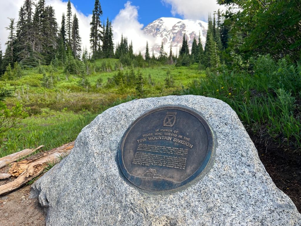
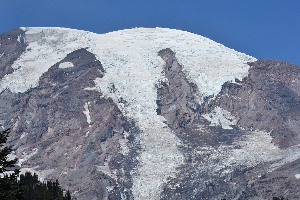
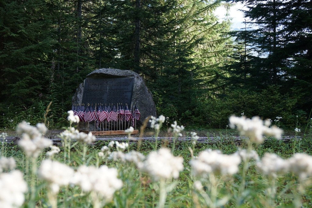
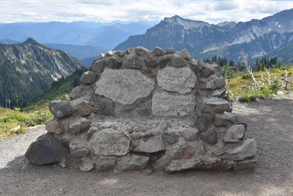
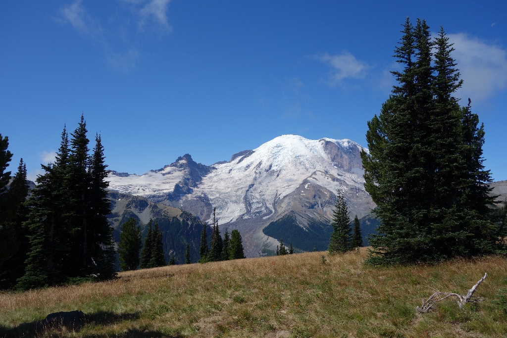
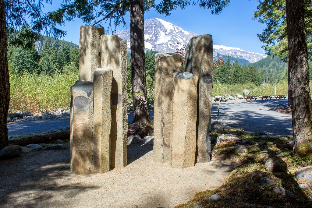
Bronze plaque honors 10th Mountain Division at Paradise in WWII.
A bronze plaque honors the U.S. Army’s 10th Mountain Division which trained at Paradise during World War II.
Backbone Ridge
Pause at Backbone Ridge for Mount Rainier views on Stevens Canyon Road, closed for construction on weekdays.
Pause at Backbone Ridge along Stevens Canyon Road for views of Mount Rainier and the Tatoosh Wilderness along the southern border of the park. Stevens Canyon Road is closed for construction on weekdays.
Backbone Ridge Exhibit Panel
Backbone Ridge Wayside on Stevens Canyon Road, views Mount Rainier.
Backbone Ridge Wayside is located along Stevens Canyon Road with views of Mount Rainier.
Bench and Snow Lake Trailhead
Bench and Snow Lake Trail: Ideal for beginners and families.
The Bench and Snow Lake Trail is a great hike for beginners, families with children, or those just looking for beautiful scenery.
Box Canyon
Impressive slot canyon along Stevens Canyon Road; walking time undisclosed.
Box Canyon is an impressive slot canyon along Stevens Canyon Road carved by the Muddy Fork of the Cowlitz River. A popular stop when touring the park by vehicle, Box Canyon includes a comfort station and picnic area.
Box Canyon: Canyon Exhibit Panel
Panel discusses formation of Box Canyon, walking time not specified.
One of three exhibit panels at Box Canyon, this panel dives deep into the formation of this canyon.
Box Canyon: Forest Exhibit Panel
Box Canyon exhibit panel, plants grow on glacier-carved bedrock.
One of three Box Canyon exhibit panels, this panel examines how plants can eventually grow on glacier-carved bedrock.
Box Canyon: Glacier Exhibit Panel
Glacial impact on landscape revealed at Box Canyon exhibit.
One of three exhibit panels at Box Canyon, this panel reveals how glaciers have left a lasting mark on the landscape.
Carbon Glacier
Carbon Glacier on north side of Mount Rainier, lowest terminus.
Located on the north side of Mount Rainier, the Carbon Glacier has the lowest terminus of any glacier in the contiguous United States.
Carbon River
Remote Carbon River: rainforest, glacier, river; hiking, biking, camping available.
Located in the remote northwest corner of the park, Carbon River is home to temperate rainforest, Mount Rainier's lowest elevation glacier, and a dynamic river system. Hiking, bicycling, and camping opportunities abound.
Carbon River Rainforest Trail: A Different Rainforest Exhibit Panel
Temperate rainforest trees: western red cedar, Douglas-fir.
Common trees found in temperate rainforests include western red cedar and Douglas-fir.
Carbon River Rainforest Trail: Above It All Exhibit Panel
Exhibit panel highlights Carbon River rainforest canopy.
Look up! This exhibit panel highlights the complex canopy of the Carbon River temperate rainforest.
Carbon River Rainforest Trail: Beneath It All Exhibit Panel
Dense plant understory in temperate rainforests.
Temperate rainforests have a dense understory of plants.
Carbon River Rainforest Trail: Crowding Out Competition Exhibit Panel
Exhibit panel shows temperate rainforest middle canopy.
This exhibit panel highlights a temperate rainforest's middle canopy.
Carbon River Rainforest Trail: Rainforests Reuse Exhibit Panel
Explore Carbon River temperate rainforest through exhibit panels. Walk time included.
Learn about the lush temperate rainforest of the Carbon River area through a set of exhibit panels.
Carbon River Rainforest Trail: Usual Forecast Exhibit Panel
Hike Carbon River Rainforest Trail in Mount Rainier National Park.
Explore Mount Rainier's temperate rainforest along the Carbon River Rainforest Trail.
Carbon River Rainforest Trail: Water Lovers Exhibit Panel
Temperate rainforests house frogs, salamanders.
Temperate rainforests are also home to amphibians like frogs and salamanders.
Carbon River Rainforest Trail: Welcome Exhibit Panel
Begin hike at Carbon River Entrance for Carbon River Trail.
Start the Carbon River Rainforest Trail at the Carbon River Entrance.
Carter Falls
Waterfall named after trail builder Harry Carter near Longmire, Paradise.
This popular waterfall is named in honor of Harry Carter, builder of much of the trail between Longmire and Paradise.
Carter Falls Trailhead
Trailhead offers access to Wonderland Trail, rivers, moderate waterfall hike.
Carter Fall Trailhead provides access to the Wonderland Trail, the Nisqually River, and a moderate hike to view waterfalls.
Carter Falls Trailhead Exhibit Panel
Access Nisqually River exhibit panel, Carter Falls Trailhead.
Carter Falls Trailhead provides access to the Nisqually River, a dynamic force of nature described in this exhibit panel.
Chenuis Falls
Chenuis Falls: cascades over smooth bedrock into pool.
Chenuis Falls is a series of cascades over smooth bedrock ending in a beautiful pool.
Chenuis Falls Trailhead
Hike to cascading waterfall.
Hike to a beautiful cascading waterfall in a less visited area of the park.
Chenuis Falls Trailhead Exhibit Panel
Chenuis Falls Trail, walk from Carbon River, river system exhibit.
Chenuis Falls Trail starts from the banks of the dynamic Carbon River. Learn more about this river system through this exhibit panel.
Chinook Entrance Arch
Chinook Entrance Arch spans Mather Memorial Parkway near Tipsoo Lake.
The historic Chinook Entrance Arch spans the width of the Mather Memorial Parkway (SR 410). The impressive log and stone bridge supports the Pacific Crest Trail, near Tipsoo Lake on the eastern boundary of the park.
Christine Falls
Christine Falls: scenic waterfall near historic bridge on road to Paradise.
Christine Falls is a scenic waterfall framed by a historic bridge. It is located between Longmire and Paradise, along the road to Paradise. 
Climbers' Guide House Exhibit Panel
Climbers' Guide House used by generations at Mount Rainier.
The Climbers' Guide House has been in use since the 1920s by generations of climbers at Mount Rainier.
Columbia Crest Glacier
Glacier at Mount Rainier summit crater.
The Columbia Crest Glacier occupies the summit crater on Mount Rainier.
Comet Falls
Park waterfall, over 300 feet drop, walking time not specified.
This tall waterfall is one of the park’s most spectacular, with the highest drop falling over 300 feet.
Comet Falls & Van Trump Park Trailhead
320-foot Comet Falls, popular hike to Van Trump Park meadows.
Plunging 320 feet, Comet Falls is one of the highest waterfalls in the park and a popular destination for many hikers. Continue past Comet Falls to climb into the subalpine meadows of Van Trump Park.
Cougar Rock Picnic Area
Quiet picnic area in Mount Rainier forest for relaxing meal.
The Cougar Rock Picnic Area offers a quiet place to take a break and enjoy a meal in the forests of Mount Rainier National Park.
Cowlitz & Ingraham Glaciers
Two glaciers share terminus at Mt. Rainier's southeast slope.
Cowlitz and Ingraham are two glaciers that share a common terminus on the southeast slope of Mount Rainier.
Deer Creek Falls
Deer Creek cascades 60 feet into scenic gorge.
Deer Creek cascades over 60 feet into a scenic gorge.
Deer Creek Trailhead
Connect to trails from SR 123 south of Cayuse Pass.
Connect to the Eastside Trail and Owyhigh Lakes Trail from SR 123 south of Cayuse Pass.
Denman Falls
Hike or bike Westside Road to 140 ft waterfall.
Hike or bike the Westside Road to this 140 foot waterfall along St. Andrews Creek.
Eagle Peak Trailhead
Hike to Tatoosh Range saddle with panoramic Mount Rainier views.
Climb through forest to a saddle in the Tatoosh Range with panoramic views of Mount Rainier and the surrounding landscape. Trailhead begins in Longmire.
Edith Gorge Falls
Waterfall in Edith Gorge visible from Paradise Valley Road.
Visible from Paradise Valley Road, this waterfall cascades through the narrow Edith Gorge in several cascades.
Emmons Glacier
Emmons Glacier largest in contiguous US.
The Emmons Glacier has the largest area of any glacier in the contiguous United States. 
Emmons Vista Overlook 1
First Emmons Vista Overlook. View northeast side Mt. Rainier summit.
The first of two Emmons Vista Overlooks. View the whole northeast side of Mount Rainier, from the summit to the bottom of the White River Valley.
Emmons Vista Overlook 1 Exhibit Panel
Exhibit panel, Emmons Glacier landscape exploration.
This exhibit panel explores the landscape of the Emmons Glacier.
Emmons Vista Overlook 2
Additional views of Mount Rainier and Emmons Glacier available.
The second of two Emmons Vista Overlooks, providing additional views of Mount Rainier, the Emmons Glacier, and the White River Valley.
Emmons Vista Overlook 2 Exhibit Panel
Osceola Mudflow reshaped mountain and surrounding region. Second exhibit panel.
The second exhibit panel along the Emmons Vista Trail examines how the Osceola Mudflow dramatically reshaped the mountain and the surrounding region.
Emmons Vista Trailhead
Emmons Vista Trailhead at Sunrise access trails, walking time varies.
The Emmons Vista Trailhead at Sunrise provides access to several trails, including the Emmons Vista Overlooks, Silver Forest Trail, and the Sunrise Rim Trail.
Fairy Falls
3-tiered cascade drops nearly 600 feet in Stevens Canyon.
This 3-tiered cascade drops nearly 600 feet over a headwall of Stevens Canyon.
Falls Creek Falls
Small waterfall with cascades, tallest drops 30 feet over bedrock.
This small waterfall has a series of cascades, with the tallest dropping 30 feet over mossy bedrock.
Glacier Basin Trailhead
Hike White River Valley, views of Mount Rainier, Emmons Glacier.
Hike along the White River Valley with views of Mount Rainier and the Emmons Glacier along the Glacier Basin Trail. Trailhead begins in the White River Campground.
Gobblers Knob Fire Lookout
Historic fire lookout on rocky outcrop near Lake George.
Gobblers Knob Fire Lookout, one of four historic fire lookouts in the park, sits on a rocky outcrop above Lake George near the Westside Road.
Green Lake Trailhead
Hike tranquil trail, find waterfall, lake, trees.
Hike a less traveled trail and discover a cascading waterfall and a beautiful lake surrounded by tall trees.
Grove of the Patriarchs Trailhead
Explore Grove of the Patriarchs, walking through trails, bridges, boardwalks.
Explore the Grove of the Patriarchs and wander through trails boardwalks, bridges, and dirt paths while winding through centuries old trees.
Historic Paradise Camp Lodge Exhibit Panel
Paradise Camp Lodge no longer exists, left historic mark.
The Paradise Camp Lodge no longer exists, but has left its mark on the historic landscape of Paradise.
Historic Sunrise Road Exhibit Panel
Exhibit panel at Sunrise Point explores history of Sunrise Road.
Discover the history of the Sunrise Road through this exhibit panel, located at Sunrise Point.
Huckleberry Creek Patrol Cabin
Patrol cabin: north of Sunrise near park's northern boundary.
This patrol cabin is located north of Sunrise near the park’s northern boundary.
Indian Bar Trail Shelter
Stone masonry trail shelter built by Civilian Conservation Corps.
This trail shelter is one of two stone masonry shelters in the park built by the Civilian Conservation Corps.
Indian Henry's Patrol Cabin
Historic cabin, oldest ranger station, built 1915-16.
Built in 1915-16, this historic cabin is the oldest backcountry ranger station in the park.
Inspiration Point
Inspiration Point pullout, west end Stevens Canyon Road, Mount Rainier.
Inspiration Point is a large pullout and viewpoint on the west end of Stevens Canyon Road. From the very beginning of the park, Inspiration Point has been a popular spot for visitors to pause and take in spectacular views of Mount Rainier.
Inspiration Point Exhibit Panel
Exhibit panel at Inspiration Point, Stevens Canyon Road, overlooks Paradise River valley.
Inspiration Point exhibit panel is located along Stevens Canyon Road and overlooks the Paradise River valley with views of Mount Rainier.
Ipsut Creek Patrol Cabin
Cabin built in 1933 for backcountry rangers.
This historic cabin was built in 1933 to house backcountry rangers.
Ipsut Falls
Ipsut Falls near Ipsut Creek Campground.
Ipsut Falls is a two-tiered waterfall located near Ipsut Creek Campground.
Kautz Creek
Pause at Kautz Creek for views of Mount Rainier, short walk.
Pause at Kautz Creek for the first glimpse of Mount Rainier once you enter the park via the Nisqually Entrance. A short walk with wayside exhibits leads to a viewpoint, along with access to longer hiking trails.
Kautz Creek Nature Trail: A Changing Landscape Exhibit Panel
Exhibit panel on Kautz Creek Nature Trail.
This exhibit panel is a part of the Kautz Creek Nature Trail.
Kautz Creek Nature Trail: A Recovering Forest Exhibit Panel
Exhibit panel on Kautz Creek Nature Trail.
This exhibit panel is a part of the Kautz Creek Nature Trail.
Kautz Creek Nature Trail: Changing Course Exhibit Panel
Exhibit panel at Kautz Creek Nature Trail.
This exhibit panel is a part of the Kautz Creek Nature Trail.
Kautz Creek Nature Trail: Quote Exhibit Panel
Kautz Creek Nature Trail exhibit panel.
This exhibit panel is a part of the Kautz Creek Nature Trail.
Kautz Creek Nature Trail: Welcome Exhibit Panel
Introducing Kautz Creek Nature Trail.
This exhibit panel introduces the Kautz Creek Nature Trail.
Kautz Glacier
Kautz Glacier on Mount Rainier is significant in geology and climbing.
Located on the southwest side of Mount Rainier, the Kautz Glacier is a significant player in the recent geologic and climbing history of the mountain.
Klapatche Point
Klapatche Point, Westside Road terminus, North Puyallup Trailhead, rolling hills.
Klapatche Point is the terminus of Westside Road, with views of the rolling hills on the western border of the park. It is also the location of the North Puyallup Trailhead.
Lake George & Gobblers Knob Trailhead
Hike/bike Westside Road to Round Pass, trail to Lake George.
Hike or bike Westside Road to Round Pass. From Round Pass, hike the trail to reach Lake George and Gobbler’s Knob Fire Lookout.
Lake George Patrol Cabin
Lake George Patrol Cabin above Round Pass off Westside Road.
The Lake George Patrol Cabin is located above Round Pass off the Westside Road.
Lake James Patrol Cabin
Backcountry patrol cabin north park along Northern Loop Trail.
This backcountry patrol cabin is located in the northern part of the park along the Northern Loop Trail.
Laughingwater Creek Trailhead
Hike to Three Lakes Camp following Laughingwater Creek, connecting to PCT.
Hike to Three Lakes Camp or connect to the Pacific Crest Trail along this trail that follows Laughingwater Creek through the forest.
Longmire
Year-round gateway to Mount Rainier with historic buildings, hiking trails.
Open year-round, Longmire is a gateway to Mount Rainier. Longmire is the first developed area in the park, with many buildings showcasing NPS rustic architecture, and is a National Historic District. Learn about the history of the area and view volcanic mineral springs along the Trail of Shadows, stay overnight and enjoy a meal at the National Park Inn, or explore one the area's hiking trails.
Longmire Community Building Viewpoint
Longmire community view: see Nisqually River valley, Mount Rainier. Parking/picnic table.
The Longmire community building viewpoint provides a clear view of the Nisqually River valley and Mount Rainier. Parking and picnic table provided.
Longmire Historic Tour: Administration Building Exhibit Panel
Longmire Administration Building stop on Historic Longmire Walking Tour.
The Longmire Administration Building is one of the stops along the Historic Longmire Walking Tour, which explores the rustic architecture of the Longmire area.
Longmire Historic Tour: Community Building Exhibit Panel
Longmire Community Building stop on Historic Longmire Walking Tour, exploring rustic architecture.
The Longmire Community Building is one of the stops along the Historic Longmire Walking Tour, which explores the rustic architecture of the Longmire area.
Longmire Historic Tour: General Store Exhibit Panel
Longmire General Store on Historic Longmire Walking Tour. Explore architecture.
The Longmire General Store is one of the stops along the Historic Longmire Walking Tour, which explores the rustic architecture of the Longmire area.
Longmire Historic Tour: Introduction Exhibit Panel
Exhibit panel starts Longmire Walking Tour, exploring rustic architecture.
This exhibit panel kicks off the Historic Longmire Walking Tour, which explores the rustic architecture of the Longmire area.
Longmire Historic Tour: Library Exhibit Panel
Longmire Library stop on Historic Longmire Walking Tour, exploring architecture.
The Longmire Library is one of the stops along the Historic Longmire Walking Tour, which explores the rustic architecture of the Longmire area.
Longmire Historic Tour: Museum Exhibit Panel
Longmire Museum stop on Historic Walking Tour explores rustic architecture.
The Longmire Museum is one of the stops along the Historic Longmire Walking Tour, which explores the rustic architecture of the Longmire area.
Longmire Historic Tour: Nisqually Suspension Bridge Exhibit Panel
Nisqually Suspension Bridge on Historic Longmire Walking Tour, rustic architecture.
The Nisqually Suspension Bridge is one of the stops along the Historic Longmire Walking Tour, which explores the rustic architecture of the Longmire area.
Longmire Historic Tour: Service Station Exhibit Panel
Longmire Service Station on Historic Longmire Walking Tour with rustic architecture.
The Longmire Service Station is one of the stops along the Historic Longmire Walking Tour, which explores the rustic architecture of the Longmire area.
Longmire Service Station
Longmire Service Station: historic gas station, well preserved.
The Longmire Service Station is one of the best preserved examples of a historic gas station found in the National Park Service.
Longmire Transportation Exhibit: Panel 1
Transportation exhibit at Longmire Service Station explores park travel.
The first panel of the Transportation Exhibit located inside the historic Longmire Service Station. The exhibit explores the long history of travel in Mount Rainier National Park.
Longmire Transportation Exhibit: Panel 2
Transportation Exhibit in Longmire Service Station, explores Mount Rainier travel.
The second panel of the Transportation Exhibit located inside the historic Longmire Service Station. The exhibit explores the long history of travel in Mount Rainier National Park.
Longmire Transportation Exhibit: Panel 3
Transportation exhibit at Longmire Service Station explores Mount Rainier travel.
The third panel of the Transportation Exhibit located inside the historic Longmire Service Station. The exhibit explores the long history of travel in Mount Rainier National Park.
Longmire Transportation Exhibit: Panel 4
Exhibition on travel history at Longmire Service Station, Mount Rainier.
The fourth panel of the Transportation Exhibit located inside the historic Longmire Service Station. The exhibit explores the long history of travel in Mount Rainier National Park.
Longmire Transportation Exhibit: Panel 5
Transportation Exhibit at Longmire Station explores Mount Rainier Park travel.
The fifth panel of the Transportation Exhibit located inside the historic Longmire Service Station. The exhibit explores the long history of travel in Mount Rainier National Park.
Longmire Transportation Exhibit: Timeline
Transportation exhibit at Longmire Service Station depicts park travel history.
The timeline panel of the Transportation Exhibit located inside the historic Longmire Service Station. The exhibit explores the long history of travel in Mount Rainier National Park.
Madcap Falls
Short waterfall near Carter Falls, 34 feet high. Upstream location.
Located upstream of Carter Falls, this short waterfall cascades down about 34 feet.
Marine Memorial
Marine Memorial on Westside Road for 32 Marines, plane crashed.
The Marine Memorial, located along Westside Road, remembers 32 U.S. Marines that died when their plane crashed into the South Tahoma Glacier on December 10, 1946.
Martha Falls
Falls named after Martha Longmire by son on Wonderland Trail.
These falls were named for Martha Longmire by one of her sons while he was working on the Wonderland Trail in Stevens Canyon.
Martha Falls Exhibit Panel
Exhibit panel overlooks falls along road.
Martha Falls exhibit panel overlooks Martha Falls along Stevens Canyon Road.
Mount Fremont Fire Lookout
Highest fire lookout along ridgeline with Mount Rainier views.
This historic fire lookout is the highest in the park and sits along a rocky ridgeline with views of Mount Rainier.
Mowich Lake
Mowich Lake: largest, deepest in Mount Rainier. Summer destination for hiking, fishing, boating.
Set in a glacial basin surrounded by fragile wildflower meadows, Mowich Lake is the largest and deepest lake in Mount Rainier National Park. Accessible during the summer, the lake is a popular destination for hiking, fishing, non-motorized boating, and wilderness camping.
Mowich Lake Entrance & Paul Peak Trailhead
Mowich Lake Road entrance to remote location in Mount Rainier.
The Mowich Lake Road provides an entrance to one of the more remote locations accessible by vehicle in Mount Rainier National Park.
Mowich Lake Patrol Cabin
Oldest backcountry ranger station in park near Mowich Lake.
Mowich Lake Patrol Cabin is one of the oldest backcountry ranger stations in the park.
Myrtle Falls
60-foot waterfall with braided cascade, Mount Rainier in background.
This popular 60-foot waterfall has a braided cascade with Mount Rainier towering in the background.
Mystic Lake Patrol Cabin
Cabin for backcountry patrols on Wonderland Trail in park.
This cabin has served as a base for backcountry patrols in the north side of the park along the Wonderland Trail. 
Narada Falls
Visit Narada Falls, walk to lower view point, have picnic.
Narada Falls is an impressive waterfall along the road to Paradise. Take the short walk down to the lower view point or stop for a picnic.
Narada Falls Exhibit Panel
Exhibit panel story about Narada Falls on road to Paradise.
This exhibit panel tells the story of Narada Falls, an impressive waterfall along the road to Paradise.
Narada Falls Overlook Exhibit Panel
Panel introduction to Narada Falls from Paradise River overlook.
This exhibit panel provides an introduction to Narada Falls from the overlook above the Paradise River.
National Park Inn in Longmire
Year-round lodging, dining, general store, and gift shop available.
The National Park Inn in Longmire provides year-round food and lodging for visitors exploring Mount Rainier National Park. The inn also has a general store and gift shop.
Nisqually Entrance
Nisqually Entrance to Paradise open year-round, six miles east.
The Nisqually Entrance to Paradise stays open year-round and is located six miles east of Ashford, Washington on SR 706. 
Nisqually Glacier
Nisqually Glacier: closest to Paradise, most visited on Mount Rainier.
Due to its proximity to Paradise, the Nisqually Glacier is the most visited and best surveyed glacier on Mount Rainier.
Nisqually Historic Suspension Bridge
Nisqually Suspension Bridge: historic, rustic aesthetic using native wood materials.
The Nisqually Suspension Bridge is one of the oldest suspension bridges in the National Park Service. Originally constructed in 1924 and improved in 1952, this historic bridge continues to reflect the special "NPS rustic" aesthetic by using native wood materials that harmonize with the rugged park landscape.
Nisqually Vista Trailhead
Easy loop trail through Paradise Meadows with views of Mount Rainier.
Nisqually Vista Trail is an easy, paved, loop trail through the Paradise Meadows with views of Mount Rainier and the Nisqually Glacier.
Nisqually Vista Walking Tour: A Changing Mountain
Reflect on Mount Rainier while walking the trail.
Take in one final view of the mountain on this trail and ponder the past and future of Mount Rainier.
Nisqually Vista Walking Tour: Deadhorse Creek
Creek shapes Mount Rainier, year-round.
This year-round creek is the first indicator of some of the forces that shape Mount Rainier.
Nisqually Vista Walking Tour: Fairy Pool
Tiny pond is Paradise landmark, showcasing subalpine zone ecosystem.
This tiny pond is a Paradise landmark, demonstrating the unique ecosystem of the subalpine zone.
Nisqually Vista Walking Tour: Meadow Life
Explore Mount Rainier meadows, a true paradise.
Take a closer look at the meadows that make Mount Rainier a true “Paradise”.
Nisqually Vista Walking Tour: Mountain Passages
Series begins with views of dynamic history on Mount Rainier.
The first of a series of fantastic views exposes evidence of the dynamic history of Mount Rainier.
Nisqually Vista Walking Tour: Mountains Upon Mountains
Ancient rocks in Tatoosh Range reveal pre-Mount Rainier history.
The ancient rocks of the Tatoosh Range tell the story of a time before Mount Rainier.
Nisqually Vista Walking Tour: Nisqually Vista
View Mount Rainier and famous glacier.
Take in the full vista of Mount Rainier and one of its most prominent and famous glaciers.
Nisqually Vista Walking Tour: Sculpting the Mountain
Glaciers carve mountain surface, forming unique features.
The surface of the mountain is constantly being carved by glaciers, creating unique features and formations.
Nisqually Vista Walking Tour: The Hollow Rock
Boulder reveals Mount Rainier formation clues.
A boulder and its distinct features provide clues to the formation of Mount Rainier.
Nisqually Vista Walking Tour: Tree Clusters
Trees adapt for extreme winters and short summers.
A stand of trees signals the adaptations plants use to survive through extreme winters and short summers.
Nisqually Vista Walking Tour: Valley of Water and Ice
Volcanic eruptions and other events alter Mount Rainier's surface.
Eruptions aren’t the only major events to change the surface of Mount Rainier.
Nisqually Vista Walking Tour: Well-traveled Rocks
Boulders show forces in Paradise valley, mudflows aftermath.
The locations of boulders throughout the Paradise valley illustrate the massive forces of mudflows.
North Mowich Glacier
Large glacier on Mount Rainier's northeast side; visible from Seattle-Tacoma.
This large glacier on the northeast side of Mount Rainier is one of the most visible glaciers from the Seattle-Tacoma area.
Ohanapecosh
Visit Ohanapecosh area for trails, trees, river, and campground.
Explore the Ohanapecosh area and walk amongst the old-growth trees, take in the Ohanapecosh River, and discover new trails. The area also hosts a popular campground.
Ohanapecosh Falls
Ohanapecosh River waterfall, two tiers, double plunge pools, 70 feet.
The Ohanapecosh River drops nearly 70 feet in this 2-tiered waterfall with double plunge pools.
Ohanapecosh Picnic Area
Picnic area in Mount Rainier with old growth forests.
The Ohanapecosh Picnic Area offers a quiet place to enjoy a meal in the old growth forests of Mount Rainier National Park.
Ohanapecosh Walking Tour: River
Ohanapecosh river holds significance in the area.
The Ohanapecosh river is important to this area.
Old Mine Tour: Douglas-fir
Find distinctive Douglas-fir along Carbon River Trail.
Along the Carbon River Trail, look for a massive old growth Douglas-fir that stands out among other large trees of the temperate rainforest.
Old Mine Tour: History of the Carbon River Road
Learn about history at Old Mine Tour stop 2.
At the second stop of the Old Mine Tour, learn about the history of the Carbon River Road that is now a trail.
Old Mine Tour: Nurse Logs
Dead tree becomes nurse log for new trees. Visit Old Mine Trail.
Once a tree dies, it can become a nurse log, supporting the next generation of trees. Several excellent examples of nurse logs can be found near the start of the Old Mine Trail.
Old Mine Tour: Rainforest Understory
Understory vegetation thrives in temperate rainforest.
Smaller trees and shrubs, like Devil's Club, thrive in the understory of the temperate rainforest.
Old Mine Tour: Rainforest Wildlife
Observe rainforest levels, look for wildlife. Walking time not specified.
At this stop, all levels of a rainforest can be glimpsed, from the dense understory to the towering canopy. Take a moment to look and listen for wildlife.
Old Mine Tour: The Old Mine
Explore old mine entrance at end of Old Mine Trail.
At the end of the Old Mine Trail, take a moment to explore the entrance to old mine! It is a remnant of early 1900s mining work that once took place in this area.
Old Mine Tour: Western Hemlock
Fallen trees create gaps in forest canopy allowing fast tree growth.
At this stop, fallen trees created a gap in the dense forest canopy. Gaps, which let extra light through, are opportunities for trees like Western hemlocks to grow quickly.
Old Mine Tour: Western Red Cedar
Common fallen old-growth trees. Stop and examine fallen red cedar.
Fallen old-growth trees are common in the temperate rainforests of Carbon River. At this stop, take a closer look at a fallen Western red cedar.
Old Mine Trailhead
Hike or bike Carbon River Trail to discover old mine.
Hike or bike along the Carbon River Trail (former road) and discover an old mine. The area is rich in mining history and this is just one piece of that story.
Owyhigh Lakes Trailhead
Hike to secluded lakes and meadows without Mount Rainier views.
Although this hike offers no views of Mount Rainier, Owyhigh Lakes Trail climbs to secluded mountain lakes and subalpine meadows.
Paradise
Year-round paradise views of Mount Rainier, varying visitor center hours.
Open year-round, Paradise offers some of the best views of Mount Rainier. Aptly named paradise, this area features extraordinary views of wildflower meadows, wildlife sitings, and historic structures like the Paradise Inn. The park's main visitor center, the Henry M. Jackson Memorial Visitor Center, is located in the upper parking area and is open in the summer and with limited days and hours in the winter.
Paradise Extreme Snow Exhibit Panel
Extreme paradise landscape with wildflower meadows and deep winter snow.
Paradise is a landscape of extremes. Idyllic wildflower meadows in summer become buried under deep snowpack in winter.
Paradise Historic District Exhibit Panel
Exhibit panel explores Paradise Area's historical layers.
This exhibit panel reveals the layers of history that makeup the Paradise Area.
Paradise Historic Tour: 10th Mountain Division Memorial
Bronze plaque commemorates U.S. Army's 10th Mountain Division at Paradise.
A bronze plaque honors the U.S. Army’s 10th Mountain Division which trained at Paradise during World War II.
Paradise Historic Tour: Climbers' Guide House
Climbers' Guide House used by generations since 1920s.
The Climbers' Guide House has been in use since the 1920s by generations of climbers at Mount Rainier.
Paradise Historic Tour: Paradise Camp Lodge
Historic building ruins buried beneath site, remnants of Paradise Camp Lodge.
Remnants of the historic Paradise Camp Lodge building lie buried beneath this site.
Paradise Historic Tour: Paradise Historic District
Mount Rainier district includes trail, cabins, park road, developed areas.
The Mount Rainier National Historic Landmark District includes the park road system, the Wonderland Trail, most of the major developed areas, and some backcountry ranger cabins. The district was designated to preserve this outstanding example of early park planning and National Park Service rustic architecture of the 1920s and 1930s.
Paradise Historic Tour: Paradise Inn
Paradise Inn built 1917, National Historic Landmark.
The Paradise Inn was built in 1917 and is a National Historic Landmark.
Paradise Historic Tour: Paradise Ranger Station
Historic structure showcases alpine rustic architecture at Paradise.
This historic structure, while not open to the public, is a classic example of alpine rustic architecture at Paradise.
Paradise Historic Tour: Paradise Ski-Tow Powerhouse
Rope tow at Paradise ran from 1937 to 1972.
The rope tow at Paradise operated from the 1937 to 1972, transporting skiers from the Guide House up to Alta Vista.
Paradise Historic Tour: Ski Tow-Powerhouse
Paradise rope tow operated from 1937 to 1972 for skiers.
The rope tow at Paradise operated from the 1937 to 1972, transporting skiers from the Guide House up to Alta Vista.
Paradise Historic Tour: Tent Camps
Tent camps gone, meadows part of historic district for 100 years.
While the tent camps no longer exist, the meadows themselves are included within the historic district because they have been an inextricable part of the patterns of human activity in the area over the last 100 years.
Paradise Inn
Historic inn open May-September, dining room, gift shop, walking time.
If you enjoy historic architecture, a good meal or place to relax than the Paradise Inn is the place for you! Built in 1917, the Paradise Inn is open generally from May through September and features a large dining room and gift shop.
Paradise Inn Exhibit Panel
Introduction to Paradise Inn history.
The Paradise Inn exhibit panel provides an introduction to the history of the Paradise Inn.
Paradise Meadows & Skyline Trailhead
Explore Skyline Trail to Paradise Meadows. Trails suit all abilities.
Experience the famous subalpine Paradise Meadows via the Skyline Trail. A network of trails in the area provides options for all abilities.
Paradise Meadows: Glacier Vista Exhibit Panel
Hike Skyline/Glacier Vista Trail to view Nisqually Glacier exhibit.
Hike up the Skyline Trail to Glacier Vista Trail for an impressive view of the Nisqually Glacier. Learn more about the glacier's features through this exhibit panel.
Paradise Meadows: Nisqually Vista Exhibit Panel
Exhibit panel on Nisqually Vista Trail in Paradise Meadows. Easy.
This exhibit panel is along the Nisqually Vista Trail, an easy family-friendly trail in the Paradise Meadows.
Paradise Meadows: Panorama Point Exhibit Panel
Peaks visible from Panorama Point identified on exhibit panel.
This exhibit panel identifies some of the peaks visible from Panorama Point along the Skyline Trail.
Paradise Meadows: Skyline Exhibit Panel
Hike Skyline Trail through subalpine meadows, plant adaptations to survive.
Hike up the Skyline Trail through subalpine meadows, where plants have adapted to survive harsh winters and short summers.
Paradise Picnic Area
Picnic area with tables, grills, mountain view on clear day.
The Paradise Picnic Area offers picnic tables and grills with a view of the mountain on a clear day.
Paradise Ranger Station Exhibit Panel
Historic ranger station used for coordinating rescues and protecting park.
The historic Paradise Ranger Station is still use by park rangers as a base for coordinating rescues and protecting park resources.
Paradise Road: Canyon View Exhibit Panel
Learn about mid-elevation forest on the road to Paradise.
Pause along the road to Paradise to learn about mid-elevation forest, distinct from the dense old-growth of low elevations and the hardy trees of the subalpine.
Paradise Road: Glacier View Exhibit Panel
Stop to study Nisqually Glacier on way to Paradise.
Pause along the road to Paradise to learn about the Nisqually Glacier.
Paradise Ski-Tow Powerhouse
Rope tow operated from 1937 to 1972 at Paradise.
The rope tow at Paradise operated from the 1937 to 1972, transporting skiers from the Guide House up to Alta Vista.
Paradise Trails Orientation: 4th Crossing Trailhead
Trailhead at Paradise Valley Road connects to Skyline Trail.
The 4th Crossing Trailhead starts from the Paradise Valley Road and connects to the Skyline Trail.
Paradise Trails Orientation: Alta Vista & East Alta Vista Trail Junction
Lower junction of 2 trails at Alta Vista.
This location is the lower junction of the Alta Vista and East Alta Vista Trails.
Paradise Trails Orientation: Alta Vista & JVC Connector Trail Junction
Trail junction near Jackson Visitor Center. No walking time mentioned.
This location is the junction of Alta Vista Trail and the Jackson Visitor Center (JVC) Connector Trail.
Paradise Trails Orientation: Avalanche Lily & Alta Vista Trail Junction
Main junction of Avalanche Lily Trail and Alta Vista Trail.
This location is the main junction of Avalanche Lily Trail and Alta Vista Trail.
Paradise Trails Orientation: Deadhorse Creek & Avalanche Lily Trail Junction
Junction of two trails.
This location is the junction of Deadhorse Creek Trail and Avalanche Lily Trail.
Paradise Trails Orientation: Deadhorse Creek & Moraine Trail Junction
Junction of two trails with no walking time specified.
This location is the junction of Deadhorse Creek Trail and Moraine Trail.
Paradise Trails Orientation: Deadhorse Creek & Skyline Connector Trail Junction
Trail junction - Deadhorse Creek and Skyline connector.
This location is the junction of Deadhorse Creek Trail and a Skyline connector trail.
Paradise Trails Orientation: Deadhorse Creek & Waterfall Trail Junction
Junction of two trails.
This location is the junction of Deadhorse Creek Trail and Waterfall Trail
Paradise Trails Orientation: East Skyline & 4th Crossing Trail Junction
Trails junction.
This location is the junction of the East Skyline Trail and 4th Crossing Trail.
Paradise Trails Orientation: East Skyline & Guide House Connector Trail Junction
Junction of two trails.
This location is the junction of East Skyline Trail and the Guide House Connector Trail.
Paradise Trails Orientation: East Skyline & Lower Goldengate Trail Junction
Location: junction of two trails - East Skyline, Goldengate.
This location is the junction of East Skyline Trail and the lower Goldengate Trail.
Paradise Trails Orientation: East Skyline & Mazama Ridge Trail Junction
Junction of trails: East Skyline <> Mazama Ridge.
This location is the junction of the East Skyline Trail and Mazama Ridge Trail.
Paradise Trails Orientation: East Skyline & Paradise Glacier Trail Junction
Trail junction at location.
This location is the junction of the East Skyline Trail and Mazama Ridge Trail.
Paradise Trails Orientation: East Skyline & Paradise Inn Trail Junction
Junction of two trails - East Skyline and Paradise Inn.
This location is the junction of East Skyline Trail and the Paradise Inn Trail.
Paradise Trails Orientation: East Skyline & Upper Golden Gate Trail Junction
Trail junction, East Skyline Trail, Upper Golden Gate Trail.
This location is the junction of East Skyline Trail and Upper Golden Gate Trail.
Paradise Trails Orientation: East Skyline & Waterfall Trail Junction
Trail junction - East Skyline and Waterfall Trail.
This location is the junction of East Skyline Trail and the Waterfall Trail.
Paradise Trails Orientation: Paradise Picnic Area Trailhead
Trailhead location for Paradise Picnic Area Connector Trail.
This location is the trailhead of Paradise Picnic Area Connector Trail.
Paradise Trails Orientation: Pebble Creek & Pebble Creek Spur Trail Junction
Junction of Pebble Creek Trail and Pebble Creek Spur Trail.
This location is the junction of Pebble Creek Trail and Pebble Creek Spur Trail.
Paradise Trails Orientation: Pebble Creek Spur & Skyline Trail Junction
Trail junction at Pebble Creek Spur and Skyline Trail.
This location is the junction of Pebble Creek Spur Trail and Skyline Trail.
Paradise Trails Orientation: Skyline & Alta Vista Trail Junction
Junction of Skyline Trail and Alta Vista Trail.
This location is the lower junction of Skyline Trail and Alta Vista Trail.
Paradise Trails Orientation: Skyline & Lower Glacier Vista Trail Junction
Location: Skyline Trail and Lower Glacier Vista Trail junction.
This location is the junction of Skyline Trail and Lower Glacier Vista Trail.
Paradise Trails Orientation: Skyline & Lower Pebble Creek Trail Junction
Junction of Skyline Trail and Lower Pebble Creek Trail.
This location is the junction of Skyline Trail and Lower Pebble Creek Trail.
Paradise Trails Orientation: Skyline & Upper Deadhorse Creek Trail Junction
Junction of two trails on Skyline Trail. No walking time.
This location is the junction of Skyline Trail and Upper Deadhorse Creek Trail.
Paradise Trails Orientation: Skyline & Upper Glacier Vista Trail Junction
Intersection of two trails, Skyline and Upper Glacier Vista.
This location is the junction of Skyline Trail and Upper Glacier Vista Trail.
Paradise Trails Orientation: Skyline Trail & Deadhorse Creek Connector Trail Junction
Location: junction of Skyline Trail & Deadhorse Creek trail.
This location is the junction of Skyline Trail and Deadhorse Creek connector trail.
Paradise Trails Orientation: Skyline-Alta Vista-Dancefloor Trail Junction
Trail junction at "Dancefloor" flat area on Skyline and Alta Vista.
This location is the upper junction of Skyline and Alta Vista Trails at a rare flat area called the “Dancefloor”.
Paradise Trails Orientation: Skyline-Waterfall-Guide House Trail Junction
Trails junction: Skyline, Waterfall, and Guide House Connector.
This location is the junction of Skyline Trail, Waterfall Trail, and Guide House Connector Trail.
Paradise Trails Orientation: Waterfall & Alta Vista Trail Junction
Trail junction with memorial plaque for 10th Memorial Division near.
This location is the junction of Waterfall Trail and Alta Vista Trail. A memorial plaque for the 10th Memorial Division is located nearby.
Paradise-Stevens Glacier
Ice caves attraction vanished due to glacier retreat a century ago.
Nearly a century ago, the ice caves of the Paradise-Stevens Glacier were one of the main attractions of the park. Today, the glacier has rapidly retreated, leaving a barren rocky valley.
Puyallup Glacier
Glacier starts mountain top, ends valley.
Puyallup Glacier begins high on the mountain in Sunset Amphitheater and ends in a hanging valley.
Ranger Falls
Ranger Falls: 3-part waterfall in Carbon River area.
Ranger Falls is a dramatic 3-segmented waterfall in the Carbon River area.
Reflection Lakes
Reflection Lakes scenic views, wildflower viewing, hiking opportunity.
Reflection Lakes are a popular destination along Stevens Canyon Road for scenic reflections of Mount Rainier, wildflower viewing, and hiking.
Reflection Lakes Exhibit Panel
Park restored beautiful lakes damaged by overuse.
Once damaged by overuse, the park has worked to restore these beautiful lakes.
Ricksecker Point
Scenic loop drive with Mount Rainier views near Longmire - Paradise.
Ricksecker Point is a one-way scenic loop drive featuring views of Mount Rainier, the Nisqually and Paradise river valleys, and the Tatoosh Range. It is located between Longmire and Paradise.
Ricksecker Point First Exhibit Panel
Nisqually Glacier movement and landscape formation explained.
The first of two exhibit panels along Ricksecker Point Road describes the movement of the Nisqually Glacier and how it has shaped the landscape.
Ricksecker Point Second Exhibit Panel
Views of Mount Rainier, Nisqually and Paradise Valleys, walking time.
Featuring spectacular views of Mount Rainier, the second of two exhibit panels along Ricksecker Point Road also overlooks the Nisqually and Paradise River Valleys.
Shriner Peak Fire Lookout
Shriner Peak Fire Lookout offers stunning views of Mount Rainier.
Shriner Peak Fire Lookout, one of four historic fire lookouts in the park, offers commanding views of Mount Rainier and the surrounding valley.
Shriner Peak Trailhead
SR 123 park eastside. Strenuous hike to Shriner Peak. Views rewards.
Located on SR 123 in the eastside of the park, the strenuous hike to Shriner Peak rewards visitors with views of Mount Rainier.
Silver Falls
Ohanapecosh River creates park's impressive waterfall.
The powerful force of the Ohanapecosh River makes this one of the park’s most impressive waterfalls.
Silver Falls Trailhead
Silver Falls day hike in Ohanepocosh area, suitable for all.
Silver Falls is located in the Ohanepocosh area and is an excellent day hike for many levels of hikers.
Sluiskin Falls
Cascade named after Sluiskin, visible from Skyline Trail.
Visible from the Skyline Trail, this veil-like cascade was named for Sluiskin, the Yakama Indian who guided Mount Rainier’s first summit climbers.
Sourdough Ridge Trailhead at Sunrise
Hike Sourdough Ridge Trail for scenic views in Sunrise Area.
Enjoy spectacular views along Sourdough Ridge Trail and along a network of connecting trails in the Sunrise Area.
South Puyallup Trailhead
Hike or bike Westside Road, walking time.
Hike or bike Westside Road to reach the South Puyallup Trailhead.
South Tahoma & Tahoma Glaciers
South Tahoma and Tahoma Glaciers, once connected on Mount Rainier.
Located on the southwest side of Mount Rainier, South Tahoma and Tahoma Glaciers are separate glaciers that were connected in the recent historical past.
Spray Falls 
354-foot waterfall over lava cliff, magnificent and veil-like.
Spray Creek drops 354 feet over a lava cliff in a magnificent, veil-like waterfall.
SR123 South Entrance Arch
Welcome to southeast Mt. Rainier Park entrance arch on SR123.
The entrance arch on SR123 welcomes you to the southeast corner of Mount Rainier National Park.
SR410 North Entrance Arch
Arch marks park & forest boundary. No walking time mentioned.
The SR410 northern entrance arch marks the boundary between Mount Rainier National Park and Mt. Baker-Snoqualmie National Forest.
St. Andrews Creek Trailhead
Hike or bike to St. Andrews Creek Trailhead, then hike trail.
Hike or bike to St. Andrews Creek Trailhead along Westside Road. Then hike the trail to reach the subalpine meadows of Klapatche Park.
St. Andrews Patrol Cabin
Oldest backcountry ranger station on Westside Road, 2 miles away.
St. Andrew’s Patrol Cabin is one of the oldest backcountry ranger stations in the park, located on Westside Road, two miles from the Wonderland Trail.
Stafford Falls
Waterfall named after William Stafford, drops 30 feet into pool.
Named for an early park ranger, William Stafford, this waterfall drops about 30 feet into a clear plunge pool.
Stevens Canyon Entrance
Southeast corner of national park near Ohanapecosh.
Stevens Canyon Entrance is located in the southeast corner of Mount Rainier National Park near Ohanapecosh.
Stevens-Van Trump Monument
Stone bench monument on Skyline Trail marking first Rainier ascent.
This stone bench monument along the Skyline Trail commemorates the first documented ascent of Mount Rainier. 
Summerland Trail Shelter
Trail shelter near subalpine meadows in Summerland, park has two.
Located near the subalpine meadows of Summerland, this trail shelter is one of two stone masonry shelters in the park.
Summerland Trailhead
Popular summer hike with wildflowers, views, wildlife, and mountain goats.
With subalpine wildflowers, panoramic views of Mount Rainier and Little Tahoma, and frequent sightings of mountain goats and other wildlife, Summerland is an extremely popular hike during the summer.
Sunrise
Sunrise at 6,400 ft elevation, colorful meadows, July–mid-October, visitor center, avoid crowds.
Sitting at 6,400 ft elevation in colorful subalpine meadows that turn bright reds and oranges in fall, Sunrise offers spectacular views of the mountain and glaciers. Sunrise is typically accessible July–mid-October and closed the remainder of the year. The area offers a visitor center with exhibits and a bookstore, ranger-led activities, a day lodge with a gift shop and restaurant, restrooms, and trails. Arrive mid-week or early or late in the day to avoid the crowds.
Sunrise Camp Exhibit Panel
Subalpine meadows damaged; staff and volunteers working on restoration.
Subalpine meadows at Sunrise have been damaged by decades of use, but park staff and volunteers have been working to restore this delicate ecosystem.
Sunrise Columnar Lava Exhibit Panel
Sunrise Road exhibit panel explains columnar lava formation.
Located along the Sunrise Road, this exhibit panel explains the formation of columnar lava rocks, evidence of ice age volcanic eruptions.
Sunrise Day Lodge
Visit Sunrise Day Lodge for food, gifts, and hiking supplies.
The historic Sunrise Day Lodge serves visitors from early July to late September. Stop in for a meal or ice cream after a hike. Pick up supplies and gifts in the building’s gift shop.
Sunrise Nature Trail Stop 1
Sunrise Nature Trail Tour, first stop.
First stop of the Sunrise Nature Trail Tour.
Sunrise Nature Trail Stop 10
Yellow cedar patches grow on Sunrise Nature Trail.
Patches of Alaska yellow cedar continue to grow along the Sunrise Nature Trail.
Sunrise Nature Trail Stop 11
Ridge trees display winter effects.
Along the ridge, trees show evidence of the extreme winter environment.
Sunrise Nature Trail Stop 12
See krummholz trees on Sunrise Nature Trail, walking time included.
View twisted trees known as “krummholz,” along the Sunrise Nature Trail.
Sunrise Nature Trail Stop 13
Explore Sunrise Nature Trail, view Mount Rainier. Enjoy scenic views.
View Mount Rainier and continue your exploration of Sunrise after this last stop along the Sunrise Nature Trail.
Sunrise Nature Trail Stop 2
Pumice visible on Sunrise Nature Trail from volcanic eruptions.
Pumice from volcanic eruptions is visible on the surface along the Sunrise Nature Trail.
Sunrise Nature Trail Stop 3
Sunrise Nature Tour stop examines meadow foliage, walking time included.
This stop on the Sunrise Nature Tour looks closer at some of the meadow foliage.
Sunrise Nature Trail Stop 4
Iconic tree species along Sunrise Nature Trail.
Whitebark pine is one of the iconic tree species along the Sunrise Nature Trail.
Sunrise Nature Trail Stop 5
Subalpine firs create tree islands in meadows on Sunrise Nature Trail.
Subalpine firs form "tree islands" that dot the meadows along the Sunrise Nature Trail.
Sunrise Nature Trail Stop 6
Nature Trail stop with historic building views.
This stop along the Sunrise Nature Trail provides an excellent view of the historic buildings in the Sunrise area.
Sunrise Nature Trail Stop 7
Protect fragile subalpine meadows. Stay on trail to minimize damage.
Subalpine meadows are easily damaged. Please stay on trail.
Sunrise Nature Trail Stop 8
Sunrise Nature Trail, subalpine meadows, blooming wildflowers. Walk: unspecified.
Subalpine meadows along the Sunrise Nature Trail are full of wildflowers!
Sunrise Nature Trail Stop 9
Observe slope differences at sunrise trail ridge.
Once the Sunrise Nature Trail reaches the ridge, look at the different between the north and south slopes.
Sunrise Picnic Area
Picnic with nature views at Sunrise; walking time not specified.
Enjoy a packed lunch with meadow and mountain views at Sunrise.
Sunrise Point North Exhibit Panel
Exhibit panel at Sunrise Point with view of meadows and ridges.
One of three exhibit panels at Sunrise Point, this panel is on the north side overlooking a view of subalpine meadows and ridges.
Sunrise Point Overlook
Sunrise Point: views of mountains, accessible in summer. Walking time.
Sunrise Point offers unparalleled views of Mount Rainier and the surrounding Cascade Range. Sunrise Point is accessible during the summer season along the road to Sunrise.
Sunrise Point South Exhibit Panel
Exhibit panel at Sunrise Point explores Mount Rainier's formation.
With a spectacular view from Sunrise Point, this exhibit panel explores how Mount Rainier and the Cascade Range formed.
Sunrise Road Columnar Rock Formation
Rock formation depicts Mount Rainier's geological history. Embrace the view.
The columnar rock formation viewed from this pullout along the Sunrise Road tells the story of Mount Rainier: one of fire and ice.
Sunrise Road Pullout
Study Mount Rainier geologic history through road to Sunrise.
Explore the geologic history of Mount Rainier along the road to Sunrise. Hillside road cuts reveal many layers of lava, volcanic debris, ash, and pumice created during thousands of years of volcanism and glaciation.
Sunrise Road White River View
Pullouts along drive with views of valley, Mount Rainier, Mount Adams.
Several pullouts between Sunrise Point and Sunrise offer views of the White River Valley, as well as Mount Rainier and Mount Adams.
Sunrise Visitor Center Exhibit Panel
Visit exhibit panel near Sunrise Visitor Center, learn about climbing.
You don't have to climb the mountain to learn more about climbing Mount Rainier! Instead visit this exhibit panel next to the Sunrise Visitor Center.
Sunset Park Patrol Cabin
Historic cabin from 1922, old backcountry ranger station, in park.
Built in 1922, this historic cabin is one of the oldest backcountry ranger stations in the park.
Sunset Park Trail Shelter
Shelter on west side of Sunset Park Trail by Golden Lakes.
The Sunset Park Trail Shelter is located on the west side of the park along the Wonderland Trail at Golden Lakes.  
Sylvia Falls
Sylvia Falls at Stevens Creek, 43 feet single drop waterfall.
Located where Stevens Creek takes a sharp bend, Sylvia Falls is a single drop, fan-shaped falls with a height of 43 feet.
Three Lakes Patrol Cabin
Historic cabin along eastern boundary used for backcountry patrols.
Located on the park’s eastern boundary, this historic cabin was used for backcountry patrols. 
Timed Entry Reservations at Mount Rainier
Entrance reservations required, May 24-Sept 2, 7 am-3 pm.
Timed entrance reservations are required from May 24-Sept 2, 2024, to enter the Paradise and Sunrise Corridors between 7:00 am-3:00 pm.
Tipsoo Lake
Popular summer destination for wildflowers and hiking; congested with limited parking.
Tipsoo Lake is a popular summer destination for wildflower viewing and hiking, but can also be very congested with limited parking. It is located on the east side of the park at Chinook Pass.
Tipsoo Lake Exhibit Panel
Exhibit panel showcases Tipsoo Lake wildflower meadows in short-season.
Tipsoo Lake exhibit panel highlights the short-season wildflower meadows of Tipsoo Lake.
Tolmie Peak Fire Lookout
Park historic lookout offers views of mountain and lake.
One of four historic fire lookouts in the park, Tolmie Peak Fire Lookout offers panoramic views of Mount Rainier and Eunice Lake.
Trail of the Shadows & Rampart Ridge Loop Trailhead
Forest and meadow history merge on easy Trail of Shadows.
Human and natural history come together in the forest and meadows of Longmire along the easy Trail of the Shadows. For a longer hike, climb up Rampart Ridge for views overlooking Longmire, the Nisqually River Valley, and Mount Rainier.
Trail of the Shadows: Border Town Exhibit Panel
Trail of Shadows weaves border forest and meadow.
The Trail of the Shadows weaves along the border between forest and meadow.
Trail of the Shadows: Cast in Ice Exhibit Panel
Exhibit panel in Longmire Meadow shows glacier history.
This exhibit panel in the Longmire Meadow is part of the Trail of the Shadows in Longmire. The panel reveals how a glacier once covered this area.
Trail of the Shadows: Cryptic Creatures Exhibit Panel
Cryptic creek creatures thrive on Trail of Shadows, walking time.
What cryptic creatures thrive in the creek along the Trail of the Shadows?
Trail of the Shadows: Hiding in the Shadows Exhibit Panel
Explore Mount Rainier's forests for hidden lichen, enriching environment.
Look for a rich environment of lichens hiding in plain site in Mount Rainier's forests.
Trail of the Shadows: Life on the Edge Exhibit Panel
Exhibit panel on Longmire Meadow changes over time. Walk time.
The final exhibit panel along the Trail of the Shadows explores how the use of the Longmire Meadow has changed over time.
Trail of the Shadows: Local Homesteaders Exhibit Panel
Other animals make homes here; part of Trail of Shadows.
Humans are not the only ones to construct homes in this area. This exhibit panel is part of the Trail of the Shadows in Longmire.
Trail of the Shadows: Nature's Own Laboratory Exhibit Panel
Historic mineral springs in Longmire Meadow for health benefits.
Volcanic mineral springs in the Longmire Meadow were historically promoted for their health benefits.
Trail of the Shadows: Nature's Spa Exhibit Panel
Exhibit panel highlights historic spring along Trail of the Shadows.
This exhibit panel preserves the history of one of two developed springs remaining along the Trail of the Shadows.
Trail of the Shadows: On the Shoulders of Giants Exhibit Panel
Nurse logs support forest growth, walking time included.
Nurse logs provide shelter and nutrients for the next generation of the forest.
Trail of the Shadows: Rooted in Time Exhibit Panel
Prehistoric plants thrive along stream on Trail of Shadows.
Three prehistoric-looking plants thrive along a stream in this area of the Trail of the Shadows.
Trail of the Shadows: Rusty Springs Exhibit Panel
Spring exhibit panel explains red spring on Trail of the Shadows.
Why is this spring red? Find out by reading this exhibit panel along the Trail of the Shadows in Longmire.
Trail of the Shadows: Settling Into History Exhibit Panel
Longmire Trail of Shadows - rich historical significance.
The Trail of the Shadows in Longmire is rich in history.
Trail of the Shadows: Shadow of the Past Exhibit Panel
Imagine living in cabin at woods, explore settler life.
What would have been like to live in this cabin at the edge of the woods? Explore early settler life via this exhibit panel.
Trail of the Shadows: Structural Support Exhibit Panel
Explore forest near meadow on Shadow Trail with walking time.
Dip into the old growth forest bordering the Longmire Meadow along the Trail of the Shadows.
Trail of the Shadows: Welcome to the Neighborhood Exhibit Panel
Diverse plants and animals in Longmire Meadow.
The Longmire Meadow is home to a wide variety of animals and plants.
Twin Firs Exhibit Panel
Stop to explore old-growth forest along drive to Longmire.
Stop along the drive to Longmire to explore some of Mount Rainier's old-growth forest.
Twin Firs Trailhead
Twin Firs Loop Trail explores old-growth forest. Trailhead 2 miles west.
Twin Firs Loop Trail is a 0.4 mi/0.6 km trail that explores old-growth forest. The trailhead is located 2 miles west of Longmire along the road between the Nisqually Entrance and Longmire.
Valor Memorial
Memorial in Mount Rainier National Park honors ultimate sacrifices made.
The Mount Rainier National Park Valor Memorial ensures that the individuals who made the ultimate sacrifice while saving the lives of others will never be forgotten.
Van Trump Falls
Van Trump Falls, also known as Bloucher Falls, near Comet Falls.
Also known as Bloucher Falls, Van Trump Falls is located just before Comet Falls along the Comet Falls Trail.
Westside Road: Dry Creek Trailhead
Westside Road closed, park at Dry Creek for hiking/biking trails.
The majority of Westside Road is closed to vehicles. Park at Dry Creek to hike or bike the road and access other trails on the western side of Mount Rainier National Park.
Westside Road: Winter Trailhead
Westside Road closed in winter, suitable for hiking, snow activities.
Closed to vehicles during the winter, Westside Road is suitable for hiking, snowshoeing, and cross-country skiing depending on snow levels.
White River
White River northeast park corner. Entrance station, wilderness info, restrooms. Continue west.
White River is in the northeast corner of the park. Here you will find an entrance station, wilderness information station, and restroom facilities. Continue west on the White River Road to trailheads, the White River Campground, and Sunrise.
White River Patrol Cabin
Oldest structure in White River area.
The White River Patrol Cabin is the oldest structure in the White River area.
White River Picnic Area
White River Picnic Area: Comfortable stop in Mount Rainier National Park.
The White River Picnic Area provides a comfortable stopping point for travelers in the northeast corner of Mount Rainier National Park.
Wilson Glacier Falls
Waterfall from Wilson Glacier, 300-foot drop into Nisqually Glacier.
This impressive waterfall emerges from the Wilson Glacier before falling over 300 feet into the lower portion of the Nisqually Glacier.
Winthrop Glacier
Winthrop Glacier on northeast side of Mount Rainier, second largest.
Located on the northeast side of Mount Rainier, the Winthrop Glacier is the second largest glacier on the mountain.
Wonderland Trail: Longmire Trailhead
Popular trailhead, start of Wonderland Trail, through old growth forest.
This trailhead is the most popular starting point of the 93-mile Wonderland Trail. Meander through old growth forest to explore the Nisqually River corridor or travel to higher elevations for meadows and mountain views.

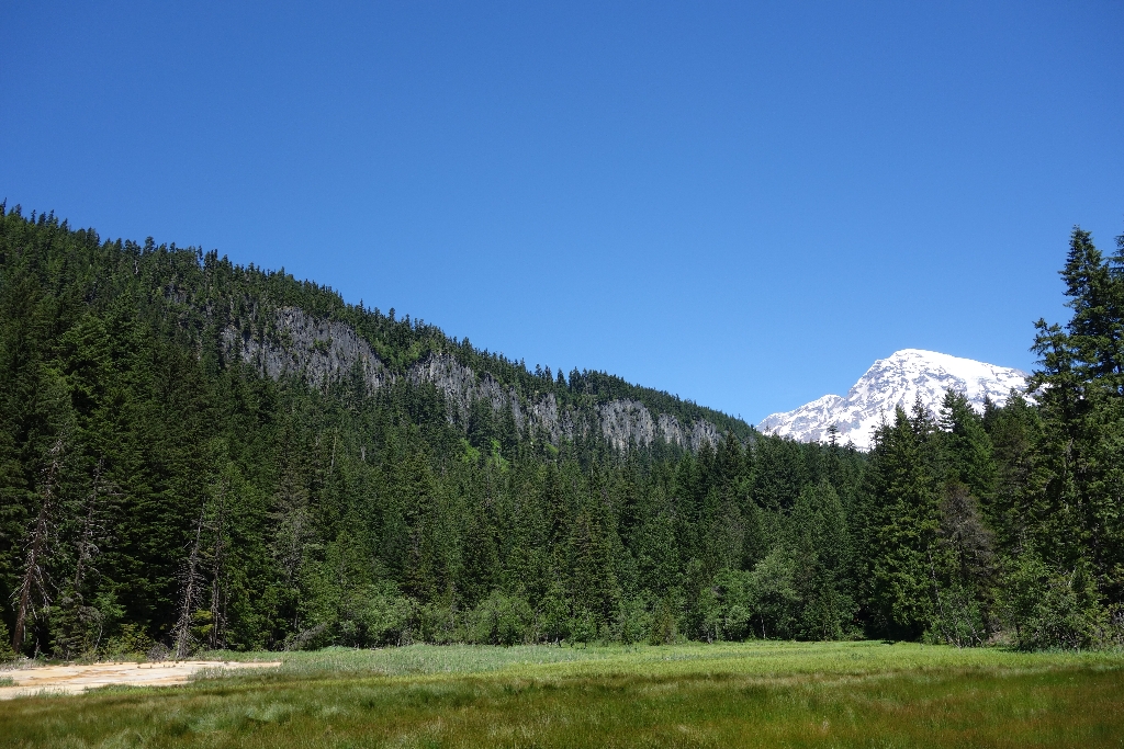
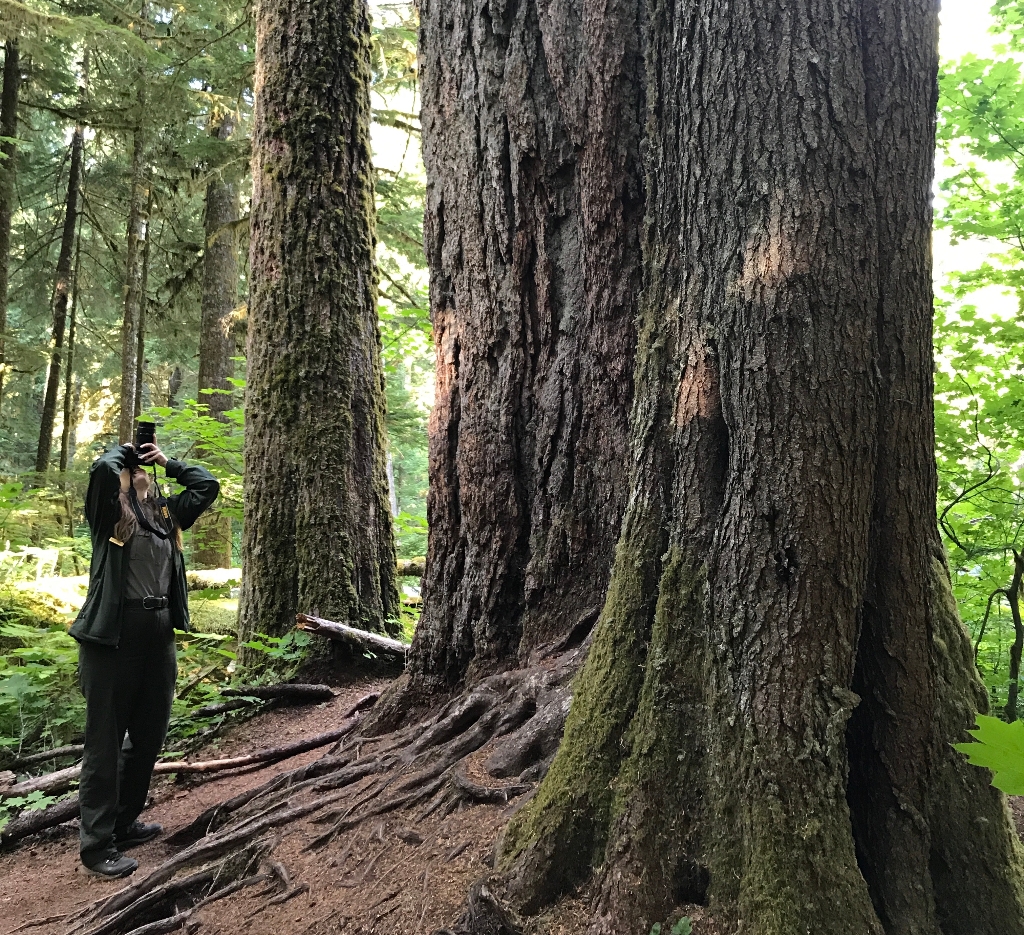
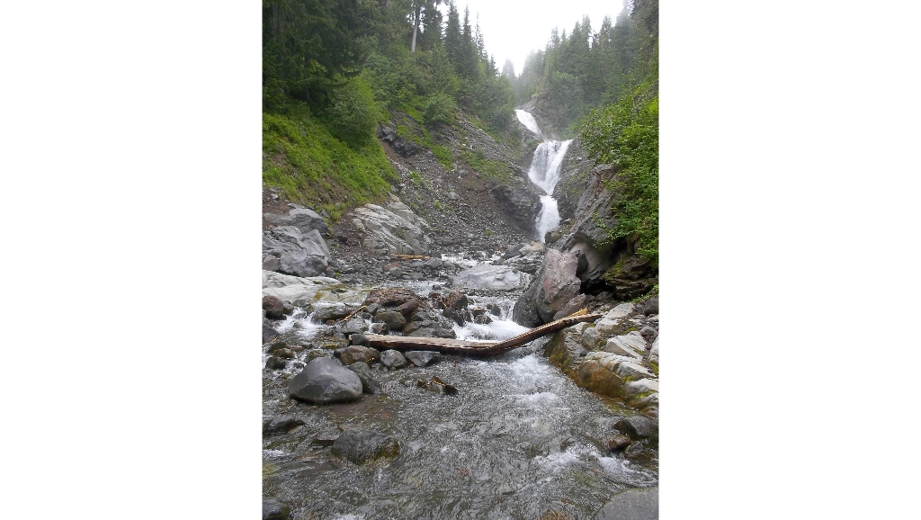
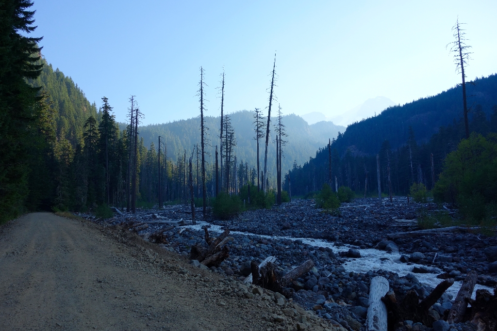
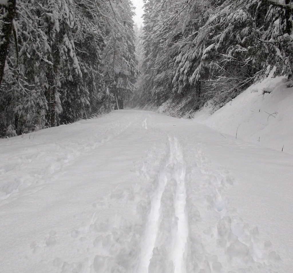
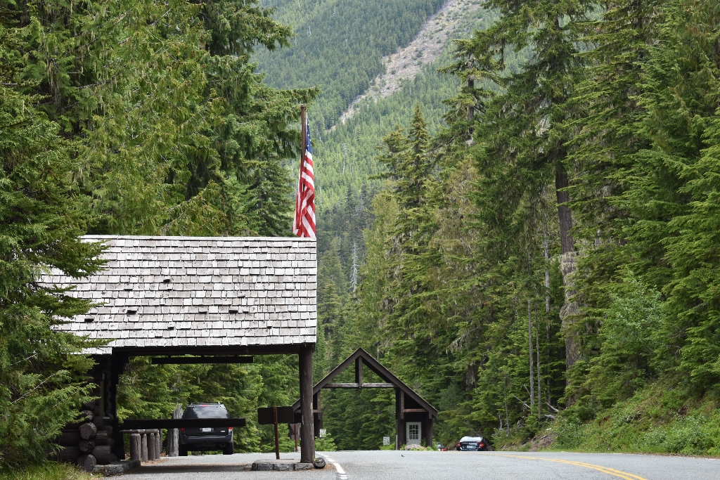
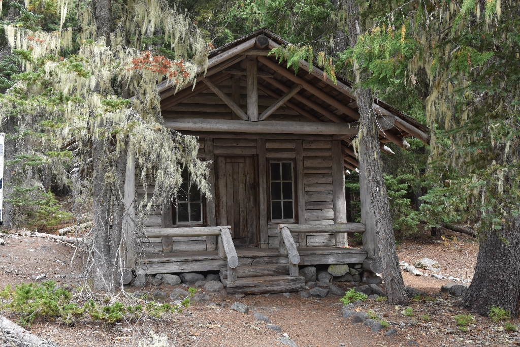
Is there something we missed for this itinerary?

Let us know!

Itineraries across USA