Utah
1 - 5 days
3 day
itinerary in
Canyonlands
Alcove Spring Trail
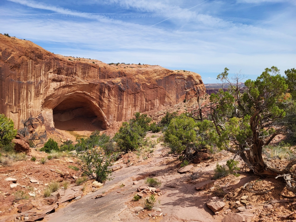
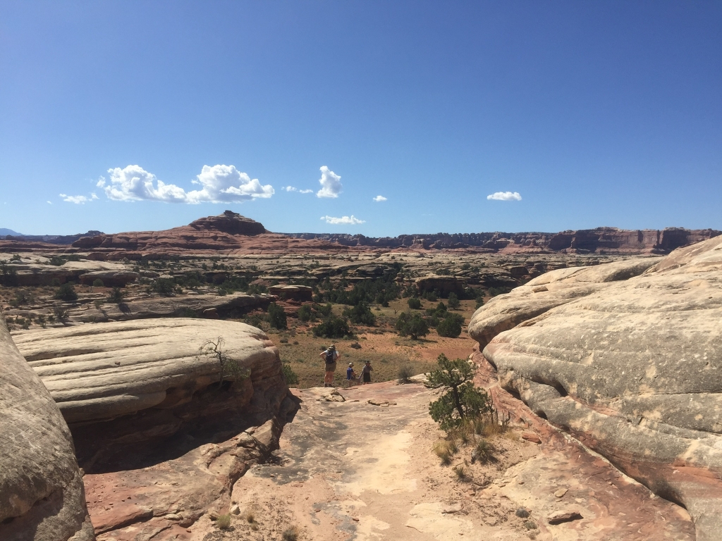
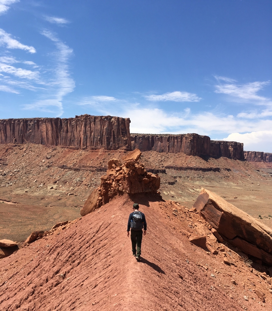
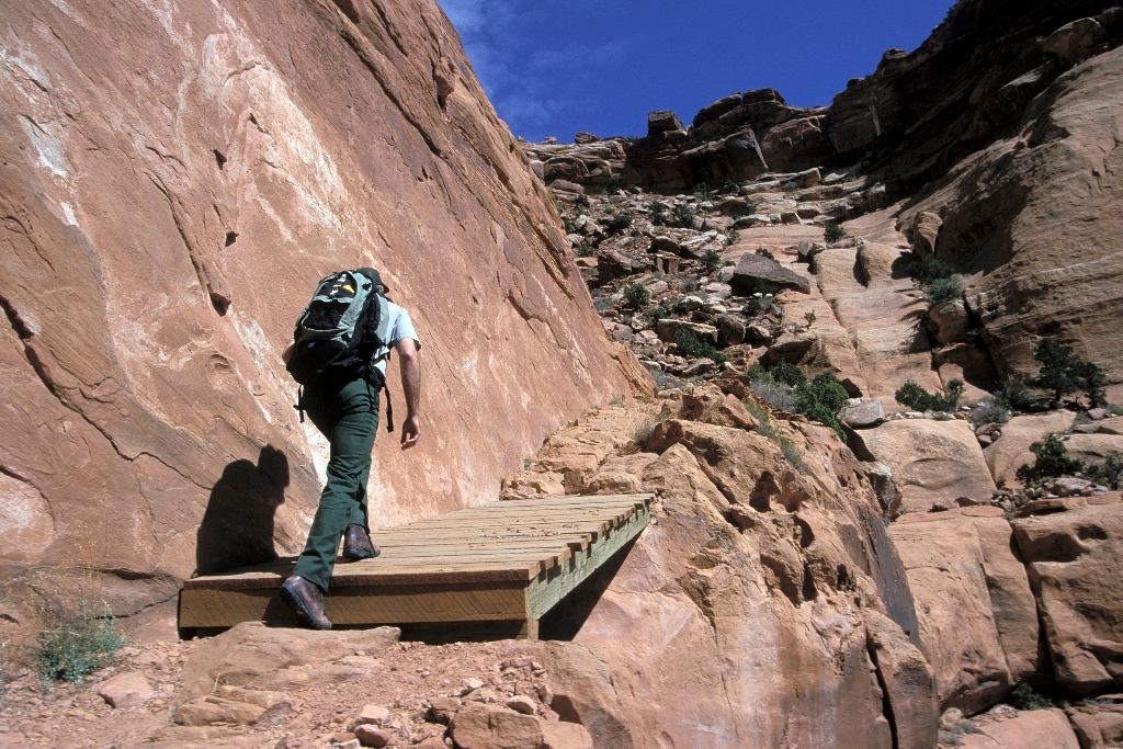
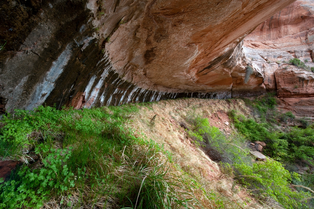
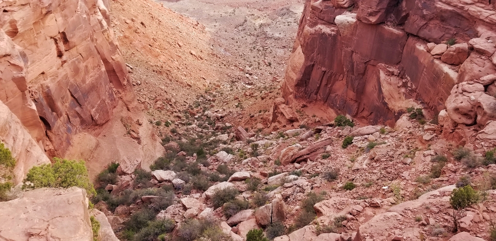
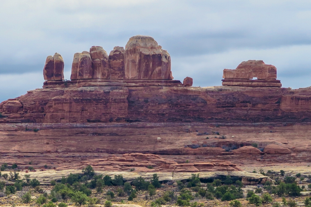
Trail descends 1,400 ft to Moses and Zeus towers.
After descending 1,400 ft (4276 m) past a large alcove, the trail meanders in a wide canyon to the base of the notable Moses and Zeus towers.  
Aztec Butte Trail
Trail climbs sandstone buttes to views, stone granaries built ago.
This trail climbs two sandstone buttes to outstanding views and stone granaries built by Indigenous people centuries ago.
Big Spring Canyon Overlook and Trailhead
Big Spring at end of Needles Park road, lush vegetation.
Big Spring rests at the end of the Needles Park Road. From the overlook, unique rock spires and multi-colored sandstone benches line the bend in the canyon. The presence of the spring allows trees and plants to flourish in the spring and summer months.
Big Spring Canyon to Elephant Canyon Loop Trail
Loop hike, slickrock benches, mesa tops, sheer cliffs, climb ladders.
This loop features extended hiking on slickrock benches and mesa tops overlooking canyons. Excellent views of sheer cliff walls and other rock formations. Must climb two ladders.
Big Spring Canyon to Wooden Shoe Canyon Loop Trail
"The Needles landscape loop hike connects two canyons."
A great introduction to the landscape of The Needles, this route connects two canyons for a loop across varied terrain.
Buck Canyon Overlook
Paved overlook at 6,240 feet, sweeping vistas across Colorado River.
From a paved overlook at 6,240 feet (1,902 m) in elevation, enjoy sweeping vistas to the west and across the Colorado River canyon. 
Candlestick Tower Overlook
Roadside pullout with views of Canyonlands, rock candlesticks.
From this small roadside pullout, you can see sweeping views of Canyonlands and several prominent rock features, once of which, resembles a group of candlesticks.
Canyonlands' Cave Spring Trail
Water scarce in desert. Hike 0.6-mile loop from trailhead.
Water is scarce in this desert. From this trailhead, hike a short, 0.6-mile (1 km) loop leading to a historic cowboy camp and prehistoric rock markings, all made possible by a small but essential natural spring.
Chesler Park Loop and Joint Trail
Trail offers panoramas of Needles formations, Joint Trail is scenic.
This trail provides many great panoramas of the Needles formations. The Joint Trail winds through deep, narrow fractures in the rock.
Chesler Park Viewpoint Trail
Trail to scenic desert pass with sandstone spires, walking time.
This popular trail leads to a pass overlooking a scenic expanse of desert grasses and shrubs surrounded by sandstone spires. 
Colorado River Overlook
Overlook: 7 miles on rough road. High-clearance vehicle or bike. No camping.
This overlook is 7 miles down a rugged, unpaved road. You must have a high-clearance, four-wheel-drive vehicle or mountain bike. No permit required; no camping allowed.
Confluence Overlook Trail
Needles trail offers dry, open country with views of rivers.
Unlike other Needles hikes, this trail traverses dry, open country along the northern edge of the geologic faults that shaped the Needles. The trail ends at a cliff overlooking the junction of the Green and Colorado rivers 1,000 ft (304 m) below.
Druid Arch Trail
Chesler Park trail branch with steep climb, ladder, scrambling required.
This trail offers one of the most spectacular views in The Needles. It follows the first part of the Chesler Park trail, then branches off to travel along the bottom of Elephant Canyon through deep sand and loose rock. The last 1.25 mile at the upper end is steep with one ladder and some scrambling.
Fort Bottom Trail
Ancient stone ruin overlooking Green River accessible by White Rim Road.
Fort Bottom Ruin is an ancient stone structure overlooking the Green River, built by Indigenous inhabitants of the Canyonlands area centuries ago. It is only reachable from the 4WD White Rim Road (permit required).
Gooseberry Trail
Steepest trail, Gooseberry descends scree slopes, switchbacks, sheer cliffs.
The steepest trail in this district of Canyonlands, Gooseberry descends over a thousand feet of scree slopes and switchbacks across sheer cliffs.
Gooseneck Overlook Trail
Short walk from 4WD road ends at overlook of river bend.
This short walk from the 4WD White Rim Road (permit required) ends abruptly at an overlook of a meandering gooseneck bend in the Colorado River.
Grand View Point Overlook and Trail
Grand View Point has breathtaking views of Canyonlands at 6,080 feet.
Grand View Point offers a spectacular view of the Canyonlands area. From this panoramic viewpoint at 6,080 feet elevation, you can see distant mountains, canyons, basins, and the four-wheel-drive White Rim Road far below. A short trail leads to even more views.
Green River Overlook
Top view of Green River, perfect for sunset, walking time.
Best mesa-top view of the Green River far below. Can be lovely for sunset.
Horseshoe Canyon
Great Gallery contains significant North American pictographs, added to park 1971.
Horseshoe Canyon contains some of the most significant pictographs in North America. The Great Gallery, the best-known panel in Horseshoe Canyon, includes well-preserved, life-sized figures with intricate designs. Other impressive sights include spring wildflowers, sheer sandstone walls, and mature cottonwood groves along the intermittent stream in the canyon bottom. Horseshoe Canyon was added to Canyonlands National Park in 1971.
Lathrop Trail
Lathrop Trail: grassland views, canyon descent, moderate hiking option, strenuous return.
The Lathrop Trail crosses a wide grassland on the mesa top, enjoys views of Colorado River, then descends into the canyon below. For a moderate trail option, hikers often turn around at the canyon rim. Continuing down to the White Rim Road means a strenuous hike back out.
Mesa Arch Trail
Short hike to natural stone arch, views of mountains, canyon.
Short hike to a natural stone arch perched at the mesa's edge, framing views of La Sal Mountains and the canyon below.
Mormon Pioneer National Heritage Area
Preserves Mormon settlement heritage through community-led efforts.
The Mormon Pioneer National Heritage Area preserves the natural, historical, and cultural heritage legacies and contributions of Mormon settlement in the West. The heritage area accomplishes this through community-led efforts to connect with the past by telling the Mormon pioneer story.
Moses and Zeus Towers Trail
Trail to towers requires hike or permit for White Rim Road.
Moses and Zeus are two prominent towers overlooking Taylor Canyon. This trail leads to their base. Reaching this trail requires a hike down Alcove Spring Trail (11.2 mi/18.3 km roundtrip) or a permit to drive the 4WD White Rim Road.
Murphy Loop Trail
Full-day hike, 1,400 feet elevation change. Outstanding views.
A great full-day hike with 1,400 feet (440 m) elevation change, the Murphy Loop Trail offers outstanding views from atop the Murphy Hogback and White Rim Road.
Murphy Point Trail
Level hike to historic corral, panoramic views in the end.
This mostly level hike leads past a historic corral on the mesa top. The trail ends with panoramic views of Candlestick Tower, the Green River, and the White Rim Road.
Neck Spring Trail
Historic ranch loop trail with watering springs.
A walk back in time, this loop trail passes historic ranching features and two springs where cowboys watered cattle.
Orange Cliffs Overlook
Panoramic canyon views, Green River, Orange Cliffs, Glen Canyon Recreation.
Enjoy panoramic views across the canyon of the Green River to the dazzling sandstone cliffs of the aptly named Orange Cliffs unit of Glen Canyon Recreation Area.
Peekaboo Trail
Challenging route with steep slopes and two ladders to climb.
Steep slopes and nearby cliff edges make this a challenging route. Two ladders must be climbed.
Pets in Canyonlands
National park not ideal for pets due to preservation priorities.
Pets and owners have a special bond, but a national park is not always the best place for pets. Canyonlands National Park is a designated natural area, and its purpose is to preserve and protect the park's natural environment, cultural resources, wildlife, and scenic beauty.
Pothole Point Trail
Short loop trail, sandstone with potholes, surprising aquatic life.
This short loop trail (0.6 mi/1 km) crosses sandstone dimpled with pockets called potholes, which may be filled with surprising aquatic life.
Shafer Trail Viewpoint
Shafer Trail Viewpoint at Island in the Sky offers stunning view.
The Shafer Trail Viewpoint at Island in the Sky provides an incredible view of this iconic road that descends 1,500 feet (457 m) down colorful sandstone walls to the canyon basin.
Slickrock Trail
Trail offers views of canyons and mountains with geology guide.
This trail features expansive 360-degree views into Big Spring Canyon and Little Spring Canyon, with the La Sal Mountains and Abajo Mountains in the background. Geology guide available at trailhead. 
Stone Storehouse Trail
Visit ancient structure in park, over 1,000 years old.
Visit one of the best preserved ancient structures in the park, built over 1,000 years ago.
Syncline Loop Trail
Challenging trail around Upheaval Dome, steep, requires caution, long walk.
The Syncline Trail follows the canyons around Upheaval Dome and requires navigating steep switchbacks, climbing and scrambling through boulder fields, and a 1,300-foot (396 m) elevation change. Most park rescues occur on this trail.
Upheaval Dome
Circular, tilted geologic formation. Hike one-mile roundtrip, climb 100 feet.
What created this unusually circular and tilted geologic formation? For the best view, hike the one-mile roundtrip (1.5 km) trail to the first overlook (climbing 100 feet/30 meters).
Upheaval Dome Overlooks Trail
Steep hikes to overlook Upheaval Dome, colorful geologic feature.
Two short but steep hikes lead to overlooks of a spectacular and colorful geologic feature; Upheaval Dome.
Whale Rock Trail
Trail up sandstone dome, great for kids, broad views.
This trail leads up the side of a sandstone dome, ending with broad views of the Island in the Sky. Great for kids who like to scramble on rock.
White Rim Overlook Trail
Walk to east-facing overlook for river, mountains view.
Walk to an east-facing overlook for views of the Colorado River, Monument Basin, and La Sal Mountains.
Wilhite Trail
Steep trail descends to wash, no shade. Walk time not provided.
A primitive trail with steep switchbacks drops 1,600 feet (488 m) into a long, sandy wash. Follow the wash to the White Rim Road. No shade.
Wooden Shoe Arch Overlook
Roadside overlook with view of large sandstone arch shaped shoe.
Just like it says, this roadside overlook offers a great view of large sandstone arch shaped like a classic Dutch wooden shoe.
Wooden Shoe Canyon to Lost Canyon Loop Trail
Loop hike, difficult sections climbing between canyons, ladder climb required.
A wonderful loop hike with some difficult sections climbing between two canyons. One ladder must be climbed.

Is there something we missed for this itinerary?

Let us know!

Itineraries across USA