Colorado
1 - 5 days
3 day
itinerary in
Mesa Verde
Balcony House Parking Area
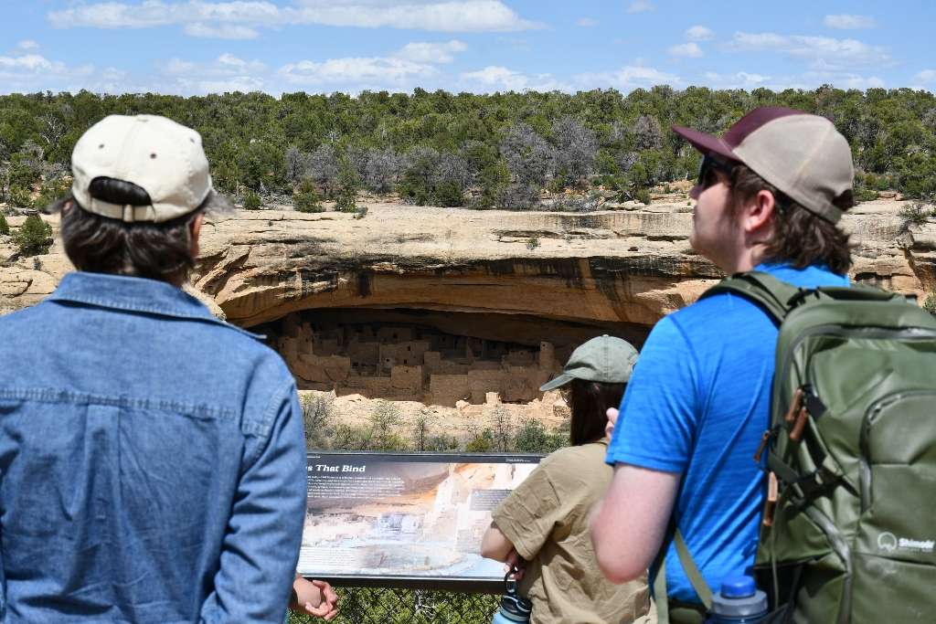
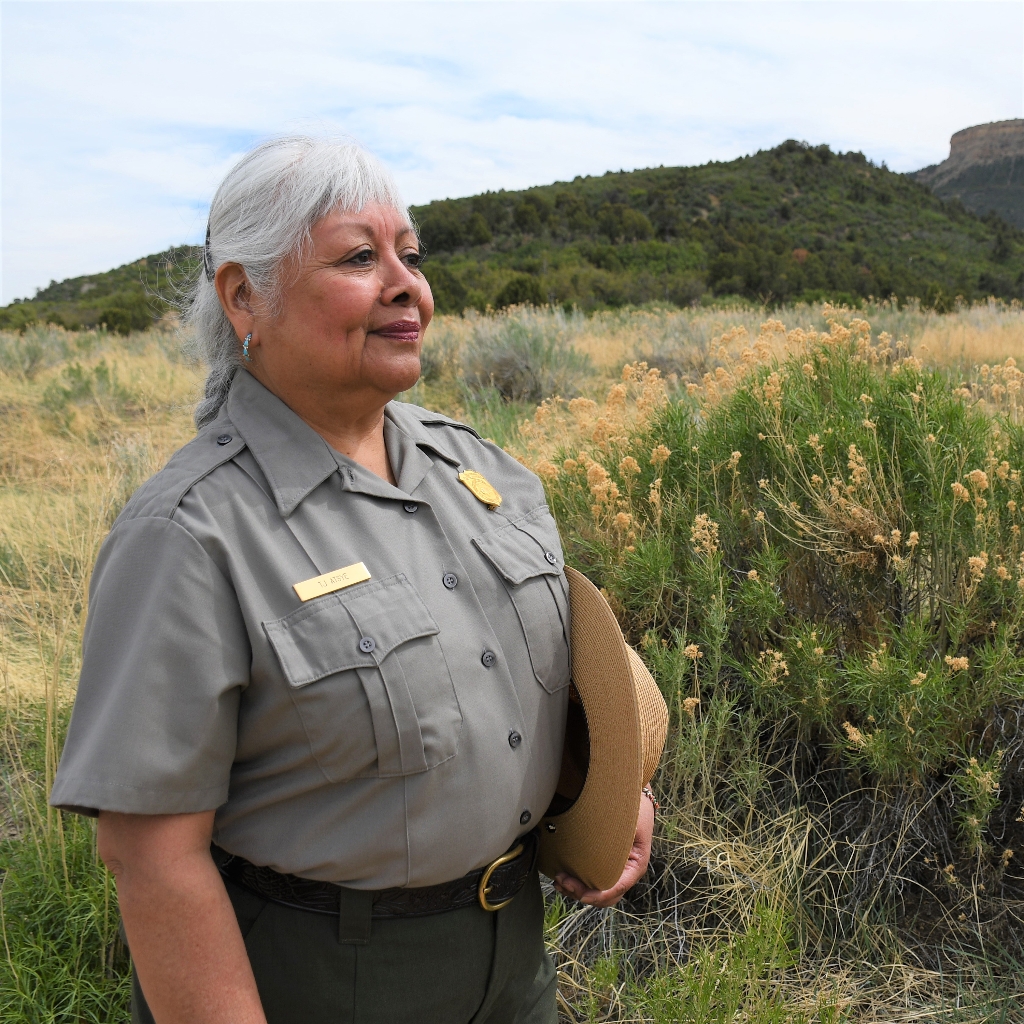
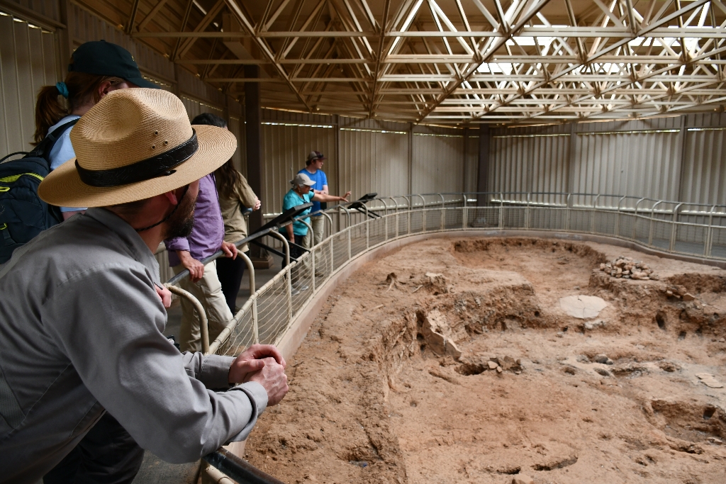
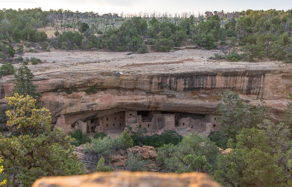
Ranger-guided tours start at Balcony House Parking Area.758-foot walking time.
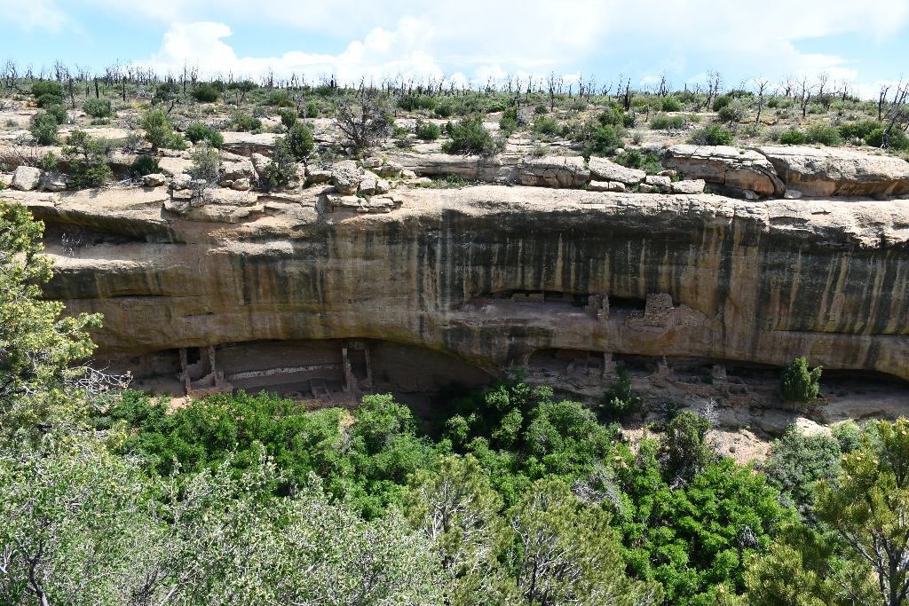
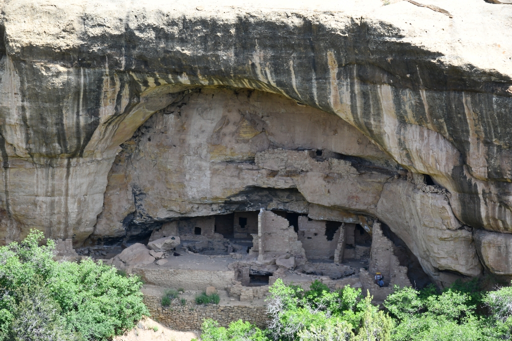
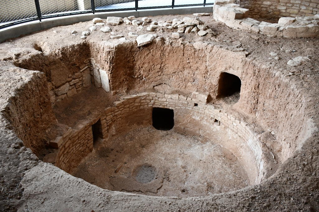
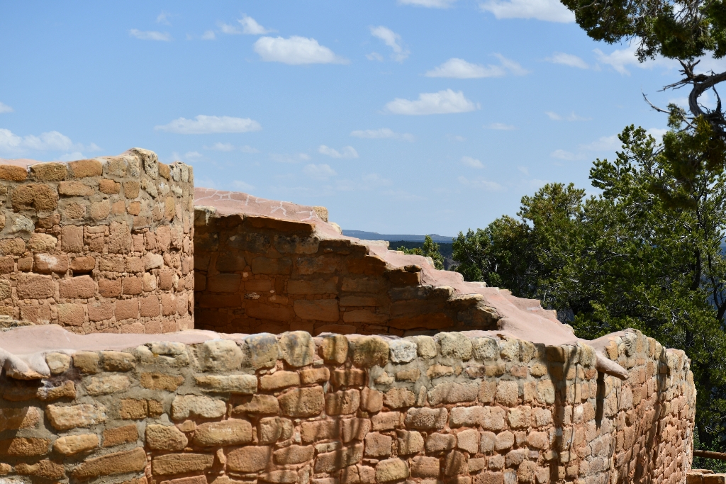
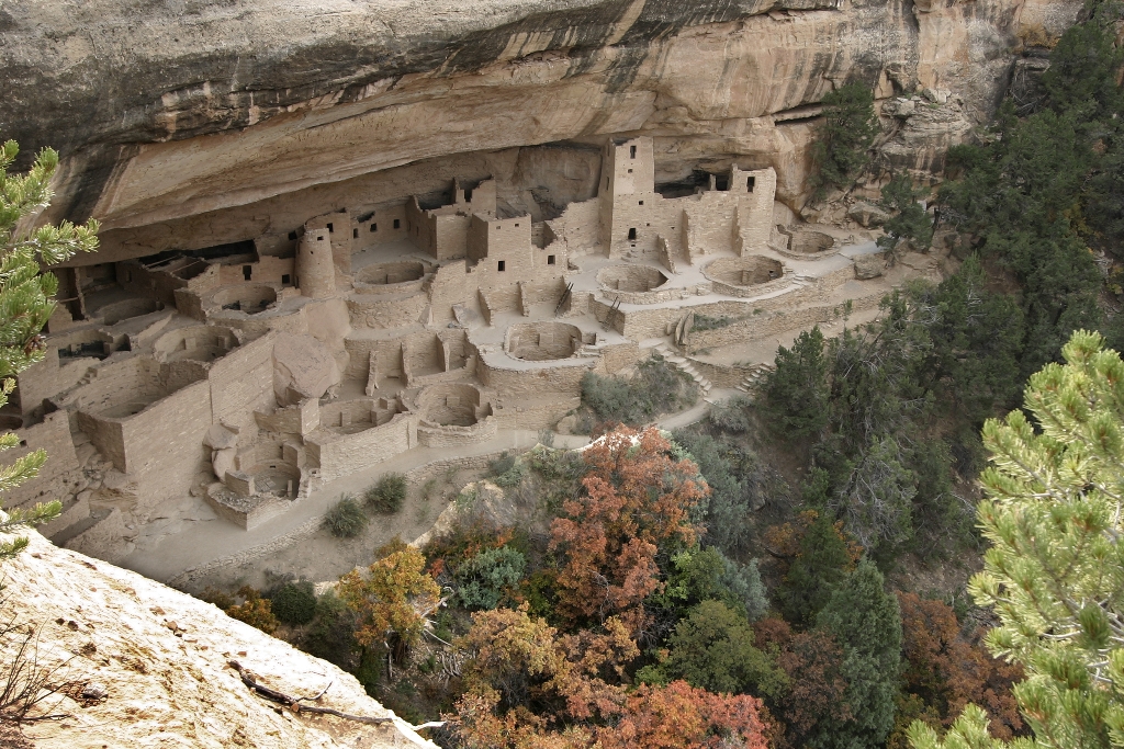
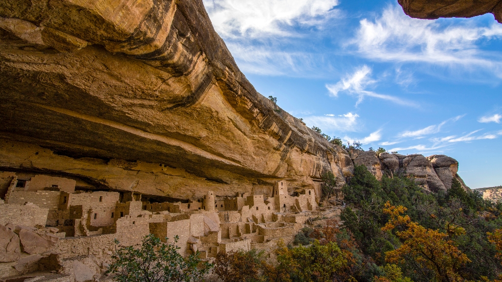
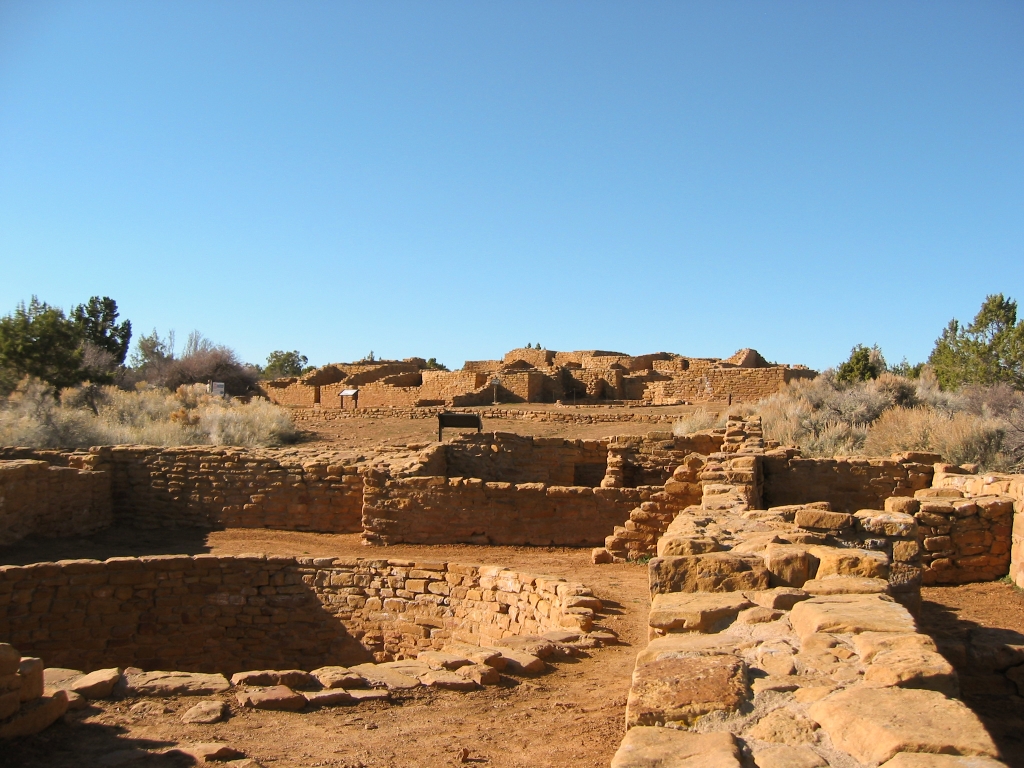
The Balcony House Parking Area is where ranger-guided tours of Balcony House begin. Balcony House is a cliff dwelling with 38 rooms and 2 kivas.
Cliff Canyon Overlook
Cliff Canyon Overlook, view cliff dwellings, keen observer, walking time.
Cliff Canyon Overlook affords a vast view of Cliff Canyon. The keen observer can pick out multiple cliff dwellings tucked into the side of the canyon.
Cliff Palace Loop Road
Cliff Palace Loop Road: 6-mile drive, cliff dwellings, ranger tours.
Cliff Palace Loop Road is a 6-mile (10-km) drive with overlooks of various cliff dwellings and access to ranger-guided tours at Cliff Palace and Balcony House.
Cliff Palace Overlook
Cliff Palace Overlook offers view of largest cliff dwelling.
Cliff Palace Overlook is a magnificent view point for Cliff Palace, the largest cliff dwelling in the park. With at least 150 rooms and 21 kivas, Cliff Palace is an exceptionally large cliff dwelling and possibly an important gathering place as an administrative center with ceremonial use for many nearby Ancestral Pueblo villages.
Far View Community Sites
Unpaved trail, walking ¾-mile, through mesa top community, ancient village.
The level, unpaved ¾-mile trail (1.2 km) leads you through a mesa top community includes Far View House, four other villages, and a dry reservoir. Long before and even after the famous cliff dwellings were built, this area was a well-established Ancestral Puebloan farming community supporting dozens of families. In ancient times, the community was a place of modest homes interspersed with small farm fields. It was a place filled with people, vibrant life, and constant change.
Far View Lodge
Rustic lodge in Mesa Verde with stunning views, open seasonally.
Far View Lodge, the only lodging inside of Mesa Verde National Park, sits on a high shoulder offering panoramic vistas and wildlife watching. The lodge was designed to reflect the true essence of Mesa Verde, with solitude all around you and freedom from the distraction of in-room TVs or cell phone service. Nothing fancy. Absolutely beautiful. Peaceful. A place to linger and appreciate why people lived here for seven centuries. The lodge is open seasonally.
Farming Terrace Trail
Loop trail, 0.5 miles, leads to ancient check dams.
Beginning and ending on the spur road to Cedar Tree Tower, this 0.5-mile (0.8 km) loop trail leads through a series of check dams built by the Ancestral Pueblo people over 800 years ago.
Hemenway House Overlook
Soda Canyon cliff dwelling, Hemenway House built in 1200s.
Perched on a remote cliff in Soda Canyon, Hemenway House looks to fall off the small ledge on which it rests. Built in the 1200s, the cliff dwelling has 26 rooms and one kiva.
House of Many Windows Overlook
House with windows overlooks Cliff Canyon views with cliff dwellings.
House of Many Windows Overlook opens up to wide views of Cliff Canyon, and its many cliff dwellings tucked into the canyon walls.
Introduction & Pithouse
Ancestral Pueblo dwelling, Mesa Verde National Park.
Ancestral Pueblo Pithouse at Mesa Verde National Park
Knife Edge Trail
Trail named after historic road, leads to viewpoint with scenic views.
Named after the historic Knife Edge Road which was known for it's scenic value, this fairly level trail follows the old roadway and leads to a viewpoint that affords excellent views across Montezuma Valley.
Mesa Top Loop Road
6-mile Mesa Top Loop showcases 700 years of Pueblo history.
The 6-mile (10 km) Mesa Top Loop takes you through 700 years of Ancestral Pueblo history. From remains of early pithouses and masonry villages to multi-storied cliff dwellings, archeological sites along this loop show how early Pueblo architecture evolved. Archeology and Pueblo oral histories shed light on what life may have been like for people who lived, worked, and raised families here for generations.
Park Point
Park Point: 8,572 feet, picnic, San Juan Mountains view.
The highest elevation in the park at 8,572 feet (2,612 m) above sea level, Park Point is a breezy and cool place to picnic or take in the view. To the north, the 13,000 and 14,000-foot (4,000+ meters) peaks of the San Juan Mountains are visible. To the south, the high deserts of New Mexico stretch out across rocky canyons. To the West is Sleeping Ute Mountain and to the East lies the La Plata Mountains. 
Petroglyph Point Trail
Moderate 2.4-mile trail, rocky with steep drops, petroglyph panel.
This moderately strenuous, 2.4-mile (3.9 km) Petroglyph Point Trail offers excellent views of Spruce and Navajo Canyons and takes you past a large petroglyph panel located 1.4 miles (2.3 km) south of the trailhead. The trail is narrow and rocky, with several steep drop-offs along the canyon wall on the way to the petroglyph panel. After the panel, you’ll scramble up a large stone staircase using hands and feet to climb to the top, then enjoy an easy return.
Point Lookout Trail
2.2-mile Point Lookout Trail, switchbacks. Magnificent views, San Juan Mountains.
The 2.2-mile (3.5 km) Point Lookout Trail switchbacks up the west side of the iconic Point Lookout, the geological formation that towers above the park entrance. The trail offers magnificent views of the San Juan and La Plata Mountains, as well as the Mancos and Montezuma Valleys.
Prater Ridge Trail
Trail: Prater Ridge, 7.8 miles, loops, views of canyons and mountains.
This trail traverses Prater Ridge which divides Prater and Morefield Canyons. The complete 7.8-mile (12.5 km) Prater Ridge Trail contains two loops. The South loop offers views into Prater Canyon, named for an early pioneer family. The North loop ascends for views into Montezuma Valley and the beautiful San Juan Mountains.
Soda Canyon Overlook Trail
1.2-mile trail through forest to overlooks at Soda Canyon._views_balcony house.
This easy, 1.2-mile (2 km) roundtrip trail meanders through the mesa top pinyon-juniper forest to three overlooks at the edge of Soda Canyon. Hikers are rewarded with views of Balcony House and several other cliff dwellings across the canyon. The canyon was named for the white, calcium carbonate deposits visible below the rim. These are the evaporative remains of seeps springs once used by the Ancestral Pueblo people.
Spruce Canyon Trail
Moderate trail, 2.4 miles, explores canyon with wildlife and plants.
The moderately strenuous, 2.4-mile (3.9 km) Spruce Canyon Trail offers an opportunity to explore the canyon bottoms of Mesa Verde and discover the plants and wildlife that live in this habitat. Starting from the top of Chapin Mesa and following the bottom of Spruce Canyon, this scenic trail winds through excellent wildlife habitat. A steep climb leads out of the canyon and then passes through the picnic area before returning to the museum. 
Spruce Tree House Overlook
View Spruce Tree House from across a narrow canyon.
Enjoy wonderful views of Spruce Tree House, the third largest and best preserved cliff dwelling in the park from across a narrow canyon.
Square Tower House
Ancient dwelling on cliff, Square Tower House.
Square Tower House Cliff Dwelling

Is there something we missed for this itinerary?

Let us know!

Itineraries across USA