Texas
1 - 5 days
3 day
itinerary in
Big Bend
Alvino House
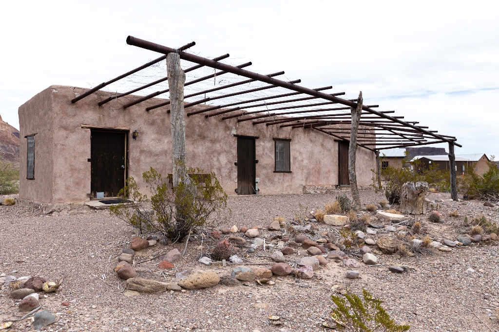
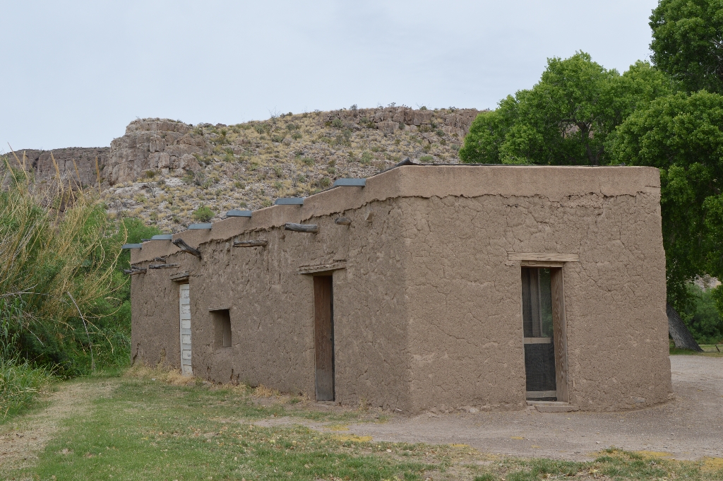
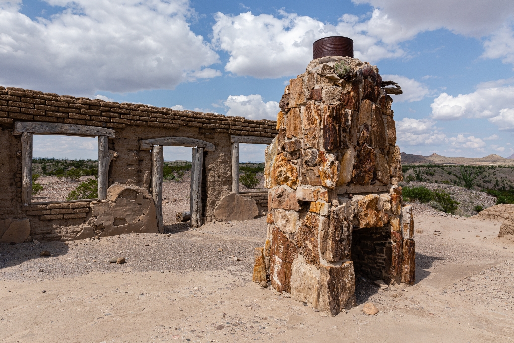
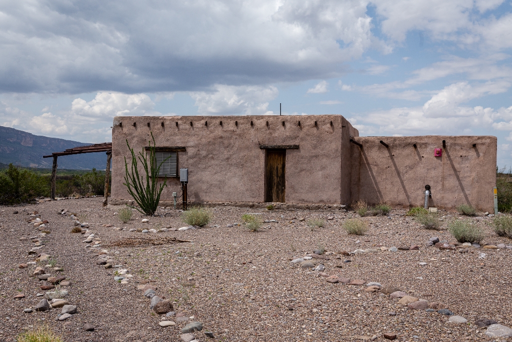
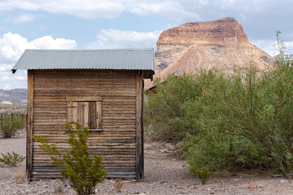
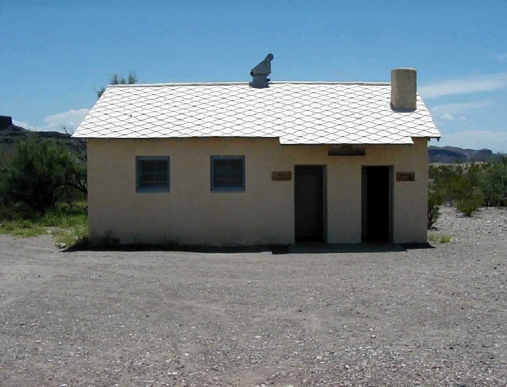
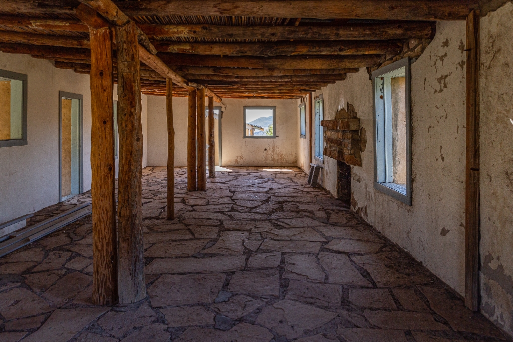
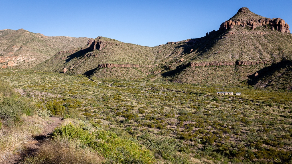
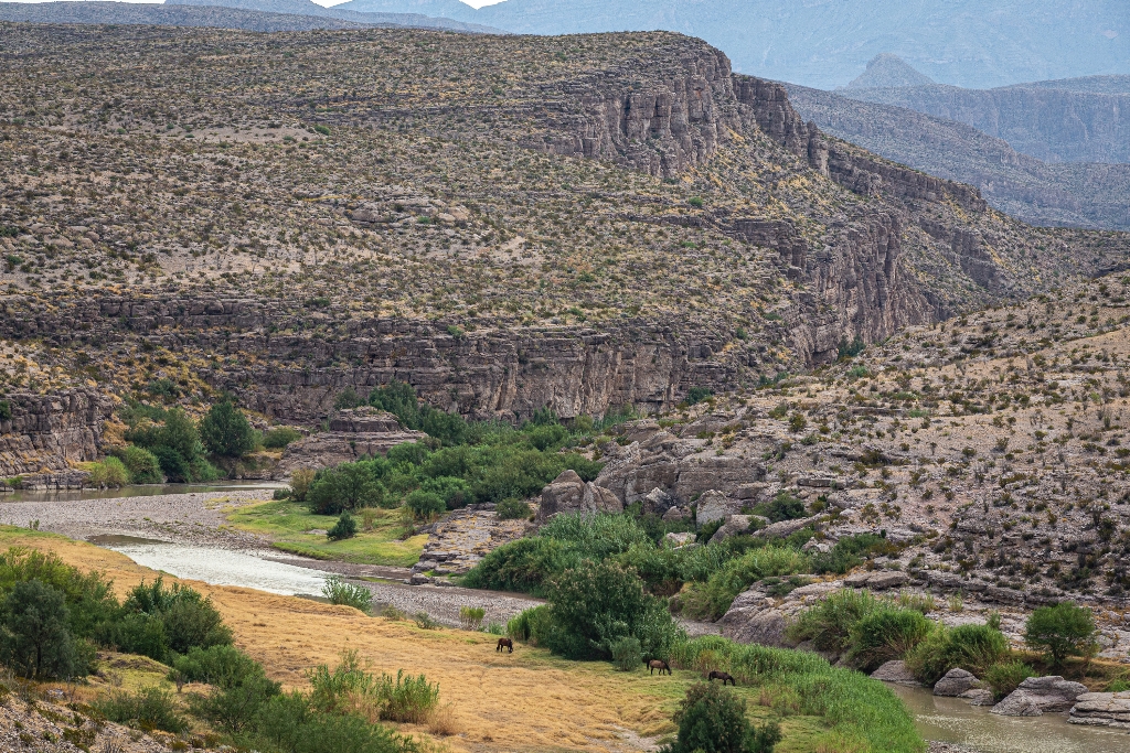
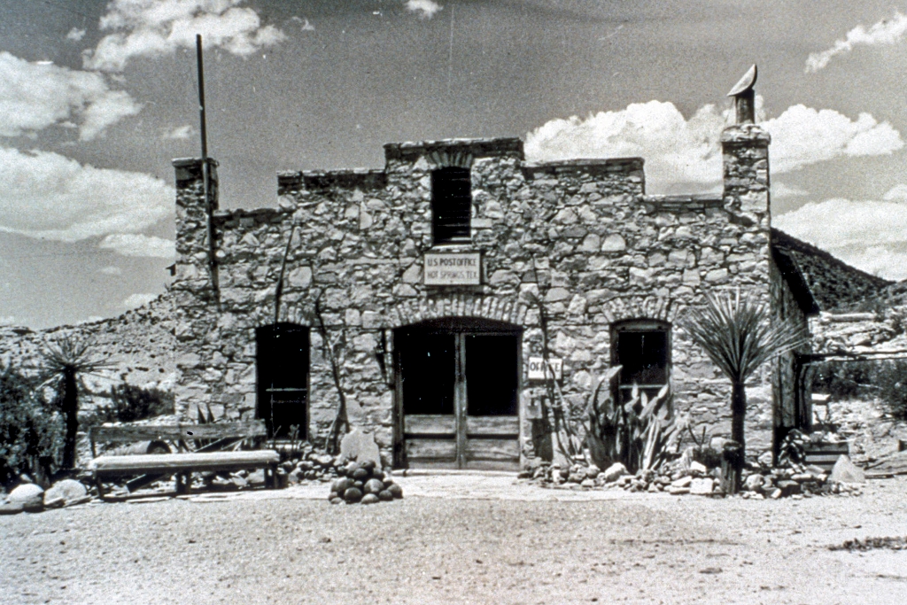
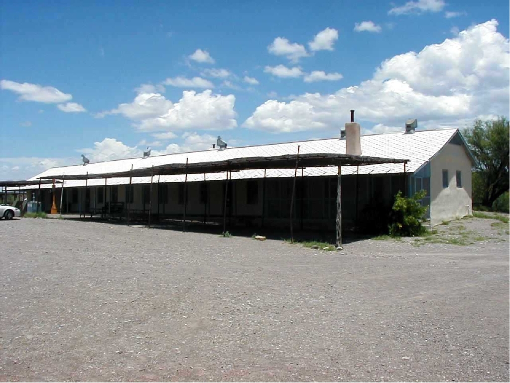
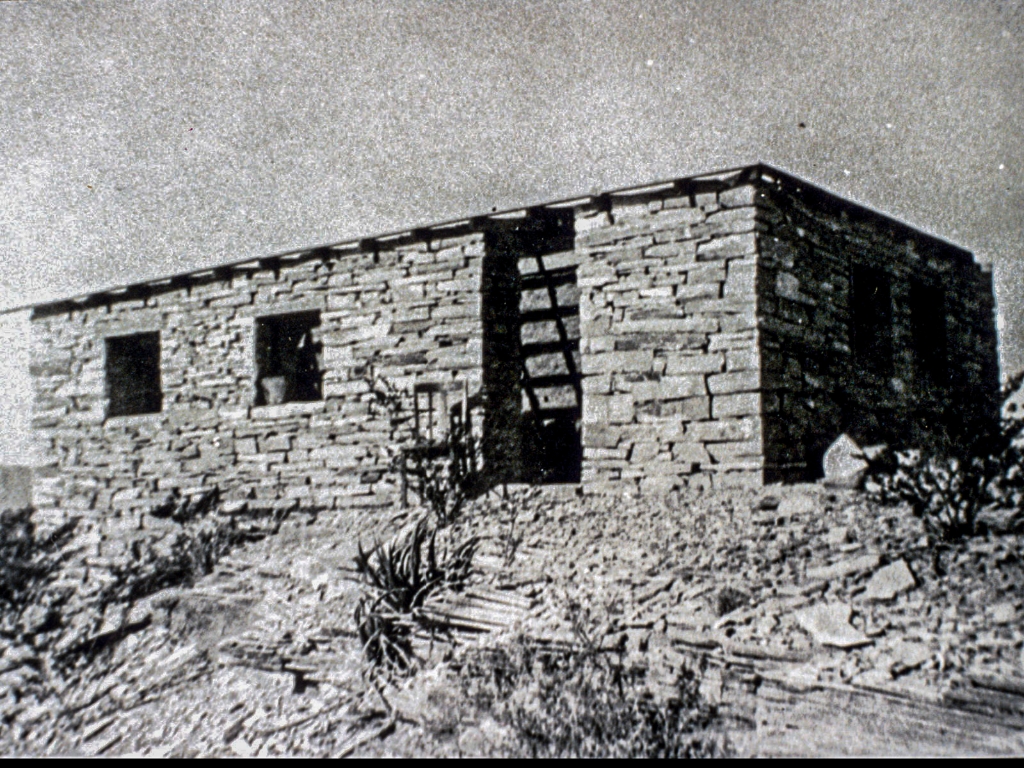
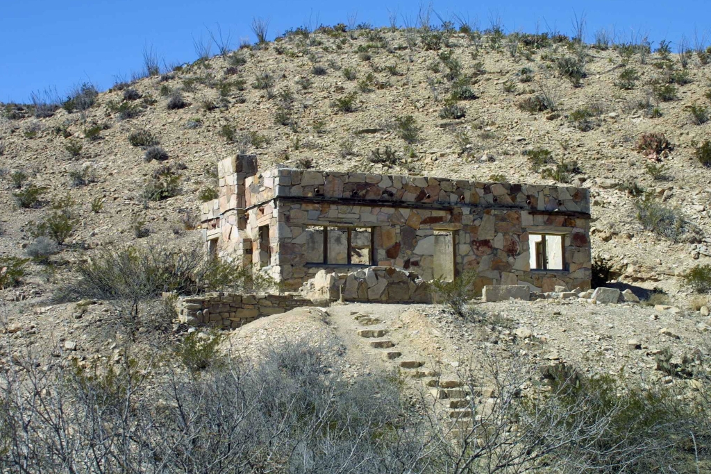
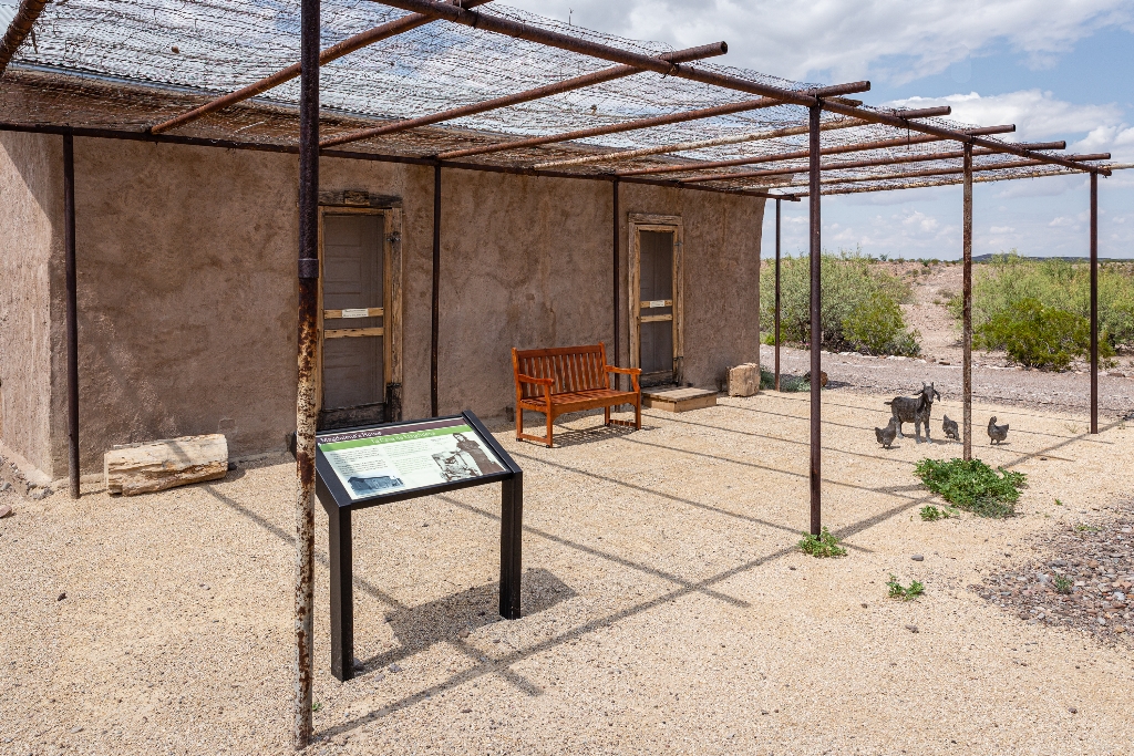
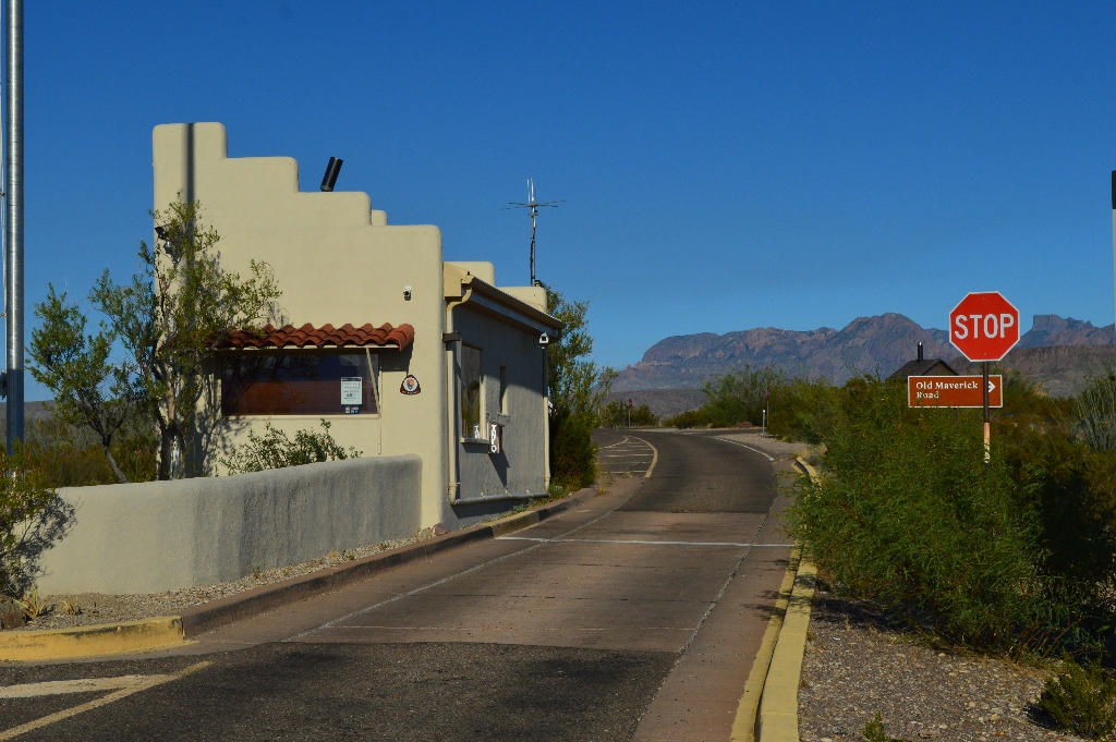
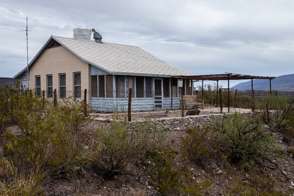
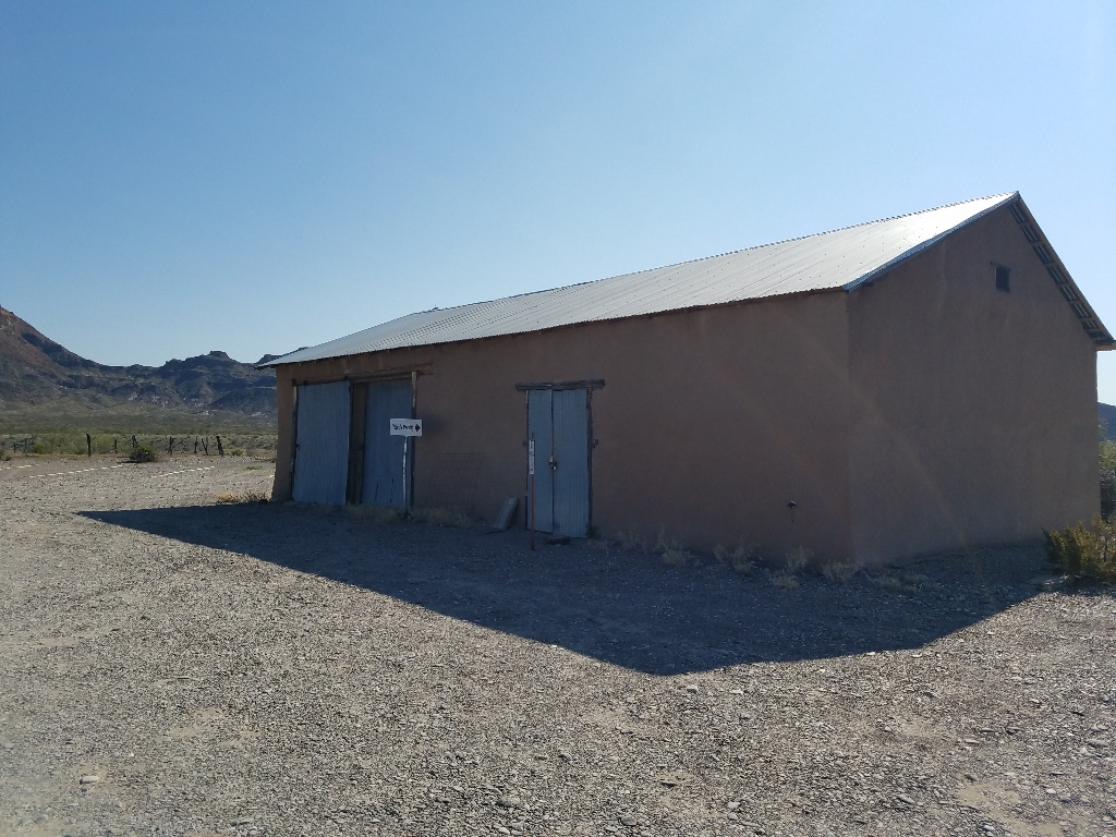
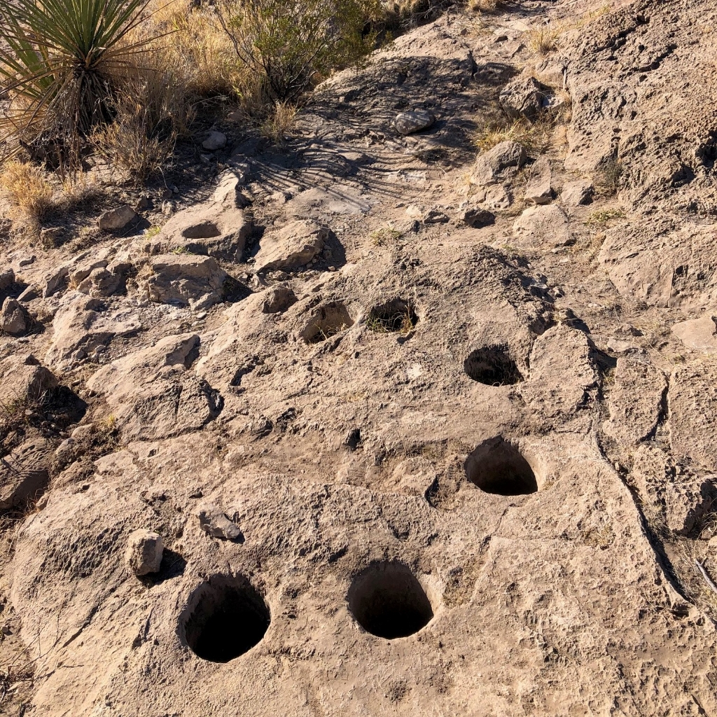
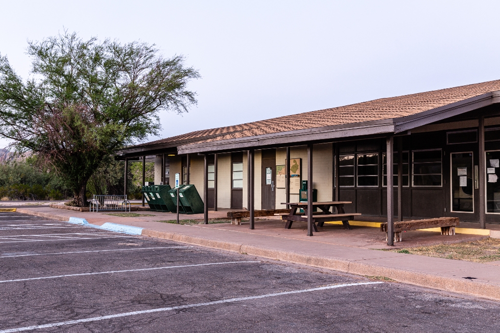
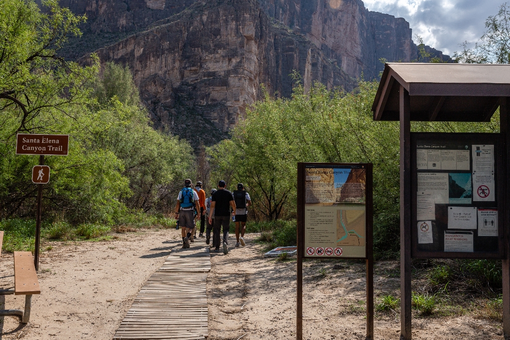
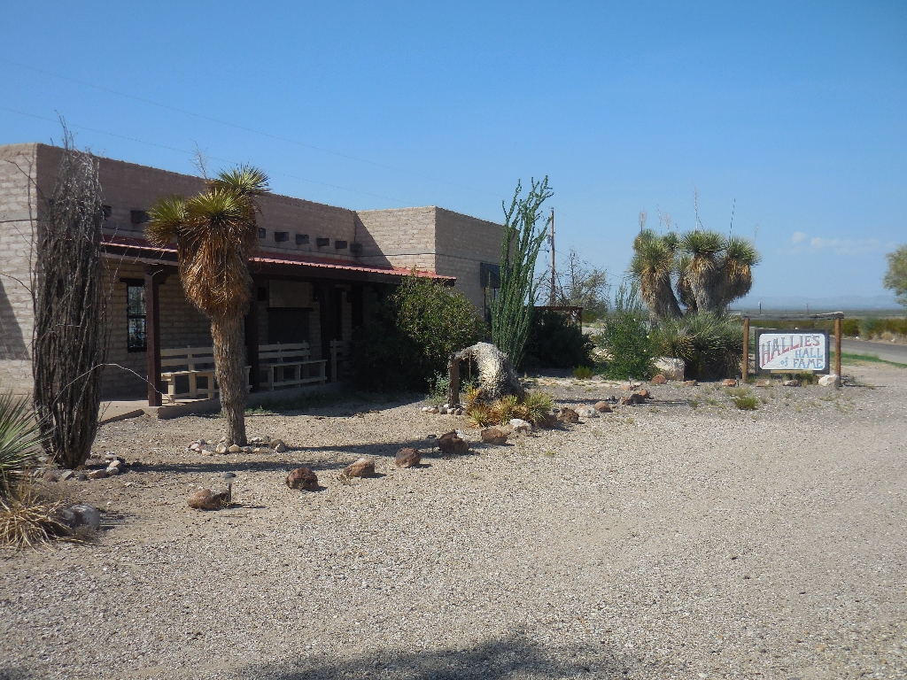
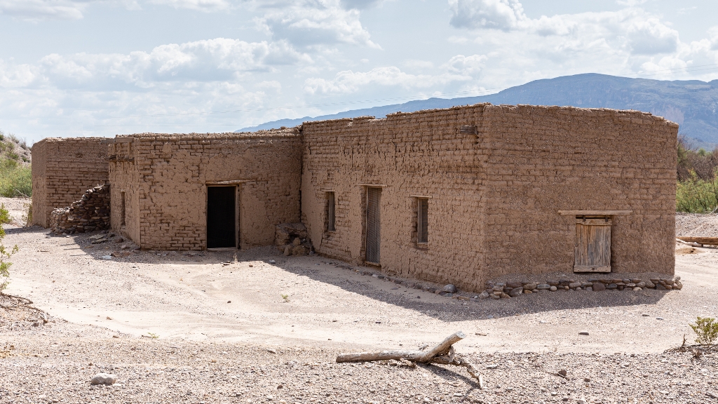
Oldest adobe structure in Big Bend National Park, recently repaired.
The Alvino house is the oldest intact adobe structure in Big Bend National Park, and represents the everyday life of the many families who lived and farmed along the Rio Grande. The Alvino House affords a close look at a recently repaired and stabilized adobe structure.
Anatomy of a Canyon
Walk along Tuff Canyon rim to view platforms, exhibit panel.
A short walk along the rim of Tuff Canyon takes you to three viewing platforms, as well as an exhibit panel that explains how the canyon was formed.
Animal Highways Exhibit
Dry wash silent by day, teeming after sundown with wildlife.
Although the dry wash is still now, after sundown you may hear rustlings, growls, and cries. Arroyos are animal highways between mountain and desert habitats, providing pockets of moisture and dense underbrush for concealment or ambush. Here predator meets prey.
Badlands Exhibit
Exhibit on erosive forces creating colorful clay hills in Big Bend.
This exhibit describes the erosive forces needed to create the colorful clay hills that dominate the landscape on the western end of Big Bend National Park. These sediments were deposited 65-70 million years, at a time when the environment in Big Bend was much different.
Blue Creek Trail
Strenuous 5.5 mile hike through Chisos Mountains, walking time included.
A strenuous, 5.5 mile one-way hike from the Homer Wilson Ranch headquarters up into the Chisos Mountains. The hike takes you along the rocky Blue Creek wash, through an open grassland, and up into the pinyon pine woodland of the Chisos Mountains. The trail ends at the junction with the Laguna Meadow Trail.
Boquillas Canyon Trail
Boquillas Canyon Trail: 1.5-mile round trip along Rio Grande.
The Boquillas Canyon Trail is a great way to enjoy one of the three major canyons located in Big Bend National Park. This trail is 1.5 miles (2.4 km) round trip and parallels the Rio Grande for a short distance where it first enters Boquillas Canyon.
Boquillas Overlook
Boquillas Overlook offers views of Boquillas village and Sierra de Carmen.
The Boquillas Overlook provides a view of the village of Boquillas, Mexico just across the Rio Grande. It is also a great place for photographs of the Sierra del Carmen and Boquillas Canyon.
Boquillas Port of Entry
Visit Boquillas village through Boquillas Crossing Port with a valid passport.
Visiting the Mexican village of Boquillas through the park's Boquillas Crossing Port of Entry is an option for visitors possessing a valid passport.
Boquillas, Mexico
Boquillas, Mexico mining town founded in late 19th century. Visit via Boquillas Crossing Port.
Boquillas, Mexico had its modern beginnings as a mining town in the last decade of the 19th century. You can visit the village through the Boquillas Crossing Port of Entry.
Burro Spring Trail
2.4-mile hike to Burro Spring overlook. Tall cottonwoods, palm tree.
The Burro Spring Trail is a 2.4-mile hike through the desert to an overlook where you can see Burro Spring in the valley below. Tall cottonwoods and a palm tree (a remnant of early 20th-century ranching) mark the place where water flows to the surface.
Camel Experiment Exhibit
Study camel corps experiment expeditions traversing Big Bend 1859, 1860.
Learn about the story of the camel corps experiment and the two expeditions that traversed Big Bend country in 1859 and 1860.
Castolon Historic District
Explore Castolon’s pioneer and military history through historical buildings/exhibits.
The collection of buildings at Castolon is a remnant of Big Bend’s pioneer and military history, where the cultures of Mexico and the United States met. Explore Castolon’s past through the historical buildings and exhibits.
Cerro Castellan
Cerro Castellan created by volcanic events, millions of years ago.
Learn how millions of years of volcanic events created the striking Cerro Castellan.
Chihuahuan Desert Exhibit
Exhibit explores unique aspects of Chihuahuan Desert.
This exhibit introduces the Chihuahuan Desert, exploring what makes it unique from other deserts in North America.
Chihuahuan Desert Nature Trail
0.5 mile trail through Chihuahuan Desert with educational signage.
This short 0.5 mile (0.8 km) trail winds through vegetation typical of the Chihuahuan Desert. Spaced out around the trail are metal signs that discuss the plants and animals found in the park, and point out remnants of the early ranching era of Big Bend .
Chimneys Trail
4.8-mile roundtrip hike to volcanic dike with rock art.
A moderate 4.8-mile roundtrip hike to a volcanic dike featuring prehistoric rock art and remnants of early 20th-century ranching.
Chisos Basin Amphitheater
Ranger-led evening campground program at outdoor amphitheater.
Join a ranger for an evening campground program at this outdoor amphitheater set among the juniper trees and red rock hillsides.
Chisos Basin Trailhead
Trails to Boot Canyon, Emory Peak, South Rim offer good views.
Trails to Boot Canyon, Emory Peak, and the South Rim offer good views of the park and take you into a world far removed from the desert below.
Chisos Mountains Exhibit
Chisos Mountains rise, peaks named, formation explained, walking time included.
The Chisos Mountains rise from the desert floor. Learn the names of the peaks and how these mountains were formed.
Chisos Mountains Lodge
Chisos Mountains Lodge in Chisos Basin has 72 rooms.
The Chisos Mountains Lodge, located in the Chisos Basin, includes 72 rooms, a gift shop, dining room, and camp store.
Chisos Mountains Tree Zone Exhibit
Trees start at elevation, ascend mountain to woodland with junipers.
The world of trees begins at this elevation. As you ascend the lower mountain slopes, you will enter a woodland of junipers, oaks, and Mexican piñons.
Cotton Gin Machinery Exhibit
Historical site at Castolon shows Mexican-American culture. Walk through exhibits.
The collection of buildings at Castolon is a remnant of Big Bend’s pioneer and military history, where the cultures of Mexico and the United States met. Explore Castolon’s past through the historical buildings and exhibits.
Dagger Flat #1
First stop on Dagger Flat Driving Tour, Chihuahuan Desert exploration.
This is the first of nineteen stops along the self-guided Dagger Flat Driving Tour. This location explores the Chihuahuan Desert, which is the second largest desert in North America.
Dagger Flat #10
Stop 10: Dagger Flat Driving Tour, soaptree yucca, 250-300 years old.
The tenth stop on the Dagger Flat Driving Tour, relating information about the soaptree yucca, which can live to be 250-300 years old.
Dagger Flat #11
Eleventh stop on tour, discussing species of prickly pear cactus.
The eleventh stop on the Dagger Flat Driving Tour, discussing the 9 species of prickly pear cactus found in Big Bend.
Dagger Flat #12
Discussing Deadhorse Mountains formation at twelfth stop on Dagger Flat.
The twelfth stop on the Dagger Flat Driving Tour, which talks about the formation of the Deadhorse Mountains.
Dagger Flat #13
Stop 13: dagger flat driving tour, littleleaf leadtree with pods.
The thirteenth stop on the Dagger Flat Driving Tour, talking about the littleleaf leadtree with its distinctive pods.
Dagger Flat #14
Explore candelilla plant at Dagger Flat Stop on tour.
The fourteenth stop on the Dagger Flat Driving Tour, exploring the plant known as candelilla, which has been used to make products including chewing gum, car wax, and shoe polish.
Dagger Flat #15
Stop 15: Del Rio clay, Buda limestone geology, walking time.
The fifteenth stop on the Dagger Flat Driving Tour, discussing the geologic contact between two sedimentary formations - Del Rio clay and Buda limestone.
Dagger Flat #16
Dagger Flat Driving Tour, explore giant dagger yucca, Deadhorse Mountains.
The sixteenth stop on the Dagger Flat Driving Tour, exploring the giant dagger yucca, which resides primarily in the Deadhorse Mountains.
Dagger Flat #17
Explore beaked yucca at 17th stop, Dagger Flat Driving Tour.
The seventeenth stop on the Dagger Flat Driving Tour, exploring the Thompson yucca, also known as the beaked yucca.
Dagger Flat #18
Stop 18 on Dagger Flat Driving Tour, explore honey mesquite.
The eighteenth stop on the Dagger Flat Driving Tour, exploring the honey mesquite, a member of the lequme family.
Dagger Flat #19
Final destination for Dagger Flat Driving Tour, best location for yucca viewing.
The last stop (also the end of the road) on the Dagger Flat Driving Tour. This is the best location from which to view the largest number of giant dagger yucca. They typically bloom sometime in April-June.
Dagger Flat #2
Stop 2: Dagger Flat Driving Tour, lechuguilla - Chihuahuan Desert indicator.
The second stop on the Dagger Flat Driving Tour, describing the lechuguilla, which is the "indicator plant" for the Chihuahuan Desert.
Dagger Flat #3
Dagger Flat Driving Tour stop: creosotebush, successful desert plant.
The third stop on the Dagger Flat Driving Tour, exploring the creosotebush, one of the most successful of desert plants.
Dagger Flat #4
Dagger Flat Driving Tour stop with iconic ocotillo plant.
The fourth stop on the Dagger Flat Driving Tour, highlighting the ocotillo, one of the most recognizable plants in Big Bend.
Dagger Flat #5
Fifth stop on Dagger Flat Driving Tour - strawberry pitaya cactus.
The fifth stop on the Dagger Flat Driving Tour, exploring the beautiful strawberry pitaya cactus.
Dagger Flat #6
Sixth stop on Dagger Flat Tour, describes Texas persimmon tree.
The sixth stop on the Dagger Flat Driving Tour, describing the Texas persimmon tree, found all along the wash in this location.
Dagger Flat #7
Seventh stop: Dagger Flat Driving Tour, description of torrey yucca.
The seventh stop on the Dagger Flat Driving Tour, describing the torrey yucca, the most common yucca in Big Bend.
Dagger Flat #8
Stop 8 on tour explores sotol plant, 400ft elevation gain.
The eighth stop on the Dagger Flat Driving Tour explores the sotol plant, now more prominent as the road has climbed 400 in elevation.
Dagger Flat #9
Discussing volcanic event at ninth stop on Dagger Flat Tour.
The ninth stop on the Dagger Flat Driving Tour, discussing the volcanic event that produced this hill.
Dagger Flat Road
14-mile dirt road drive to see giant dagger yuccas.
A 14-mile round-trip drive down a dirt road - high clearance necessary - to view a unique forest of giant dagger yuccas. Along the way one can view plants, and possibly animals, common to the Chihuahuan desert.
Daniels Ranch
Homesteaders built dwellings, irrigation ditches near Rio Grande early 1900s.
In the early part of the 20th century, hardy homesteaders constructed dwellings and an elaborate network of irrigation ditches for farming near this location beside the Rio Grande.
Desert Mountain Overlook
Visitors overwhelmed by Big Bend landscape, walking time unspecified.
Visitors to Big Bend are often overwhelmed by the scope of the landscape. At this overlook one can spot well-known features of the Chisos mountains such as Emory Peak, the south rim, and Elephant Tusk.
Dodson Trailhead
Strenuous 10 mile desert trail featuring large elevation changes.
A rugged, strenuous 10 mile trail through the desert. The Dodson Trail crosses the southern Chisos Mountains foothills, resulting in large elevation gains and losses throughout the hike.
Dog Canyon Trail
Flat 4-mile round-trip hike to canyon displaying geological forces.
The Dog Canyon trail is a relatively flat 4-mile round-trip hike across open desert to a canyon that splits the Deadhorse Mountains. At the far end of the canyon one can see that the horizontal rock strata have been folded vertically by the geological forces that formed the mountain ridge the canyon traverses.
Dorgan House Exhibit
Alvert Dorgan and wife bought land, built impressive adobe home.
In the 1930s architect Alvert Dorgan and his wife Avis Ann bought land near Sublett’s farm. Later he built an impressive adobe home on top of the mesa using his expertise as an architect to design this atypical hose with a petrified wood fireplace.
Dorgan Sublett Trail
1-mile roundtrip trail to 4 old farm structures, easy walk.
The Dorgan Sublett Trail is an easy one-mile roundtrip walk that leads to the remains of four structures that were part of the “Grand Canyon” farms operation in the early 1900s.
Dugout Wells
Dugout Wells: Cultural oasis, windmill, picnic area, 0.5 mile walk.
Dugout Wells was once known by homesteaders as the "Cultural Center of the Big Bend". A visit today reveals an oasis of trees, a working windmill, picnic tables, and a short 0.5 mile (0.8 km) walk along the Chihuahuan Desert Nature Trail.
Emory Peak Trail
Strenuous 10.5 mile roundtrip hike to park's highest point.
A strenuous 10.5 mile roundtrip hike from the Chisos Basin to the highest point in the park.
Ernst Ridge Trailhead - Daniels Ranch
6-mile trail along Rio Grande to hot springs, Historic District.
The 6-mile roundtrip Hot Springs Canyon trail follows the Rio Grande from Daniels Ranch to the hot spring and the Hot Springs Historic District.
Ernst Tinaja
Hike to year-round water hole in limestone canyon, dangerous for animals.
A one mile round-trip hike to a year-round water hole that has been eroded into a spectacular limestone canyon. Here, brightly colored rock layers have been folded and swirled into fanciful shapes. With steep and slippery sides, the tinaja often becomes a death trap for unsuspecting animals that seek to drink from its waters.
Fins of Fire
Igneous dikes on mountain slopes, formed at Fins of Fire.
Igneous dikes crisscross the mountain slopes. Learn how these volcanic features were formed at the Fins of Fire exhibit.
Flash Flood Exhibit
Exhibit on dry wash, flash flooding effects in desert.
This exhibit highlights a dry wash and discusses the effects of flash flooding in the desert following heavy rainfall.
Fossil Discovery Exhibit
Learn about Big Bend's fossil history through vivid exhibit displays.
At the Fossil Discovery Exhibit visitors can experience the changes to Big Bend's plants and animals, and the world they lived in, through 130 million years of geologic time. Specimens from Big Bend's remarkable fossil record and vivid artwork illustrate the fascinating story of Big Bend's ancient life.
Garlick House
Garlick House addition to Castolon Compound, preserved adobe structure.
The Garlick House is an addition to the Castolon Compound, built after the military left Camp Santa Helena. The building is one of many examples of preserved structures in Big Bend that were made from adobe.
Glenn Springs Road
Explore desert, enjoy vistas of eastern Chisos Mountains. Walking time: n/a
Explore the desert and enjoy amazing vistas of the eastern side of the Chisos Mountains.
Goat Mountain
Big Bend geological history, including calderas, hot pyroclastic flows. Walk 0.25 miles.
Big Bend has a fiery, geologically violent past. Stop at this wayside to learn more about how collapsing calderas, steaming volcanic vents, and super hot pyroclastic flows created Goat Mountain.
Granary & Tack Shed
Camp Santa Helena built granary, tack shed, horse barn, corral.
The granary and tack shed were built as part of Camp Santa Helena for the cavalry horses. A horse barn, large enough for 60 horses, and a corral were also constructed.
Grapevine Hills Road
Drive improved dirt road 6.5 miles. Trailhead leads to balanced rock.
Drive this improved dirt road for about 6.5 miles to reach the Grapevine Hills Trailhead, which leads to the balanced rock (2.2 miles roundtrip). Travel beyond the trailhead is only recommended for high clearance, 4x4 vehicles.
Grapevine Hills Trail
Trail to balanced rocks, 6.5 miles on rough road.
This trail leads to a group of balanced rocks in the heart of Grapevine Hills. The trailhead is reached by driving 6.5 miles down the Grapevine Hills dirt road. Depending on road conditions, vehicles with low clearance may not be able to access this trailhead.
Grassland Restoration Exhibit
Overgrazing effects from 1920s-1950s, Park Service restoring native vegetation.
This exhibit discusses the damage done to vegetation and soils by overgrazing from the 1920s-1950s, and the efforts by the Park Service to restore native vegetation.
Guardhouse
Historic latrine damaged by fire on May 22, 2019.
This historic latrine has provided one of the basic comforts for solders, Castolon residents, and visitors alike. Unfortunately, on May 22 2019, a spread quickly and showered embers on the historic latrine. Although damaged, the buildings remain a rich remnant of Big Bend’s pioneer and military past.
Historic Latrine
Historic latrine damaged by fire remains significant remnant.
This historic latrine has provided one of the basic comforts for solders, Castolon residents, and visitors alike. Unfortunately, on May 22 2019, a spread quickly and showered embers on the historic latrine. Although damaged, the buildings remain a rich remnant of Big Bend’s pioneer and military past.
Homer Wilson Ranch Overlook
Tour historic ranch on Blue Creek, walking time required.
Visit the remains of a historic ranch built on the banks of Blue Creek.
Homer Wilson Ranch Trail
Short hike to well-preserved early 20th-century ranch in Big Bend.
A short hike leads to one of the best-preserved examples of early 20th-century ranching in Big Bend National Park. Explore the stone ranch house, corral, dipping vats, and other ranch features.
Hot Springs
Hot Springs Historic District, rich history, rock art, Hot Springs Post Office, Langford's bathhouse, foundation remains, Rio Grande.
The Hot Springs Historic District preserves a rich history of human occupation from thousands of years ago to the not-so-distant past. Visitors can study rock art left behind on the limestone cliffs, or imagine what it would have been like to meet at the Hot Springs Post Office in the early 1900s to collect your mail. Langford's impressive bathhouse is long gone; today the spring is contained by the foundation remains of the bathhouse, on the north bank of the Rio Grande.
Hot Springs Historic Trail
1 mile walk passing resort, homestead, and pictographs to hot springs.
This 1 mile roundtrip walk passes the remains of a resort, homestead, and pictographs, eventually ending at the hot springs. One can continue hiking above the river to Daniels Ranch, a roundtrip distance of 6 miles.
Hot Springs Motel
Visit old motel built in 1927 near Langford hot springs.
View the remains of the motel that was built in 1927 to serve guests visiting J.O. Langford's hot springs.
Hot Springs Post Office
View historic building serving as store and post office (1927).
View the building that served as the Hot Springs Store and Post Office, built in 1927 by J.O. Langford.
Invisible Wildlife Exhibit
Big Bend animals' adaptations to desert explored, best viewing time.
This exhibit explores the adaptations that Big Bend's animals have developed to thrive in the Chihuahuan Desert, and the best time of day to possibly see them.
La Coyota
Old ruins of La Coyota near Alamo Creek in Big Bend.
Near Alamo Creek, the road cuts through the ruins of a small community known as La Coyota, the oldest documented community in Big Bend National Park. Not much except a few ruined foundations remain as evidence of the community today, although La Coyota was once home to nearly a dozen Mexican and Mexican American families.
La Harmonia Store
Building built 1919-1920 for U.S. Cavalry, purchased by La Harmonia.
The building that historically held the La Harmonia store was built in 1919-1920 to serve as the barracks for U.S. Cavalry troops stationed here during the Mexican Revolution. As the Revolution ended and troops were withdrawn the building was purchased by Wayne Cartledge and Howard Perry, partners in La Harmonia Company and it served as frontier store stocked with a wide variety of merchandise, catering to the diversity of client on both sides of the river.
La Harmonita Store
Temporary store offers drinks, snacks, general supplies, varying operation hours.
The La Harmonita store is a temporary structure that offers ice cold drinks, some snacks, and other general supplies. Store hours and days of operation may vary.
Langford Hot Springs
Langford Hot Springs - used by Native Americans and J.O. Langford.
The Langford Hot Springs have an impressive history of use from Native Americans to J.O. Langford's healing resort.
Langford House
See 1909-1910 Langford house remains overlooking hot springs, walking required.
View the remains of a house built by J.O. Langford in 1909-1910 on a hill overlooking the hot springs.
Livingston House
Visit rock house west of hot springs, built by resident.
View a beautiful rock house to the west of the hot springs built by Alpine resident Charles Livingston.
Lone Mountain Trailhead
3-mile desert trail, moderate difficulty.
A moderate, 3-mile trail in the desert.
Lost Mine Trail
Lost Mine Trail ascends Lost Mine Peak, stunning views offered.
The Lost Mine Trail climbs to the side of Lost Mine Peak, offering spectacular views of Juniper Canyon and the Northeast Rim of the Chisos.
Lost Mine Trail Stop #1
First stop on Lost Mine Trail Self-Guided Tour; examine pinyon pine.
This is the first stop on the Lost Mine Trail Self-Guided Tour. This is a chance to closely examine the Mexican pinyon pine, a tree only found in Texas, New Mexico, and Arizona.
Lost Mine Trail Stop #10
Tenth stop on Lost Mine Trail, with great east view.
This is the tenth stop along the Lost Mine Trail Self-Guided Tour. This low saddle affords a great view to the east into Juniper Canyon and the desert beyond.
Lost Mine Trail Stop #11
Lost Mine Trail Stop 3: view ocotillo and desert adaptations.
This is the third stop on the Lost Mine Trail Self-Guided Tour. At this location one can view an ocotillo and learn about several adaptations they have evolved to survive in the desert.
Lost Mine Trail Stop #12
Twelfth stop, examine lechuguilla up close.
This is the twelfth stop on the Lost Mine Trail Self-guided Tour. Here is an opportunity to examine lechuguilla up close.
Lost Mine Trail Stop #13
Fourth stop on Lost Mine Trail. Learn about common plant.
This is the fourth stop along the Lost Mine Trail Self-Guided Tour. Here you can learn more about the sotol, a common plant found in middle elevations in the park.
Lost Mine Trail Stop #14
Stop 14 on Lost Mine Trail discusses claret cup cactus.
This is the fourteenth stop on the Lost Mine Trail Self-guided Tour. Here we discuss the claret cup cactus..
Lost Mine Trail Stop #15
Stop 15: Close look at blooming prickly pear cactus.
This is the fifteenth stop on the Lost Mine Trail Self-guided Tour. This affords a close look at a group of prickly pear cactus, which sport beautiful blooms in April and May.
Lost Mine Trail Stop #16
Sixteenth stop on Lost Mine Trail; great views southward.
This is the sixteenth stop along the Lost Mine Trail Self-Guided Tour. Here one has a great view to the south of Casa Grande, Toll Mountain, and the East Rim.
Lost Mine Trail Stop #17
Seventeenth stop on Lost Mine Trail tour, bird songs discussed.
This is the seventeenth stop along the Lost Mine Trail Self-guided Tour. Here we talk about birds of the Chisos Basin and their songs.
Lost Mine Trail Stop #18
Stop 18, Lost Mine Trail Self-guided Tour. Close-up of nolina.
This is the eighteenth stop along the Lost Mine Trail Self-guided Tour. This affords a close-up look at nolina, also known as bear grass.
Lost Mine Trail Stop #19
Nineteenth stop discussing oak tree species on self-guided tour.
This is the nineteenth stop along the Lost Mine Trail Self-guided Tour. Here we discuss oak trees and the large variety of species in the park.
Lost Mine Trail Stop #2
Lost Mine Tour stop two. Return of black bears, safety info.
This is the second stop on the Lost Mine Trail Self-guided Tour. Here we talk about the return of black bears to Big Bend and an information sign says what to do if you encounter a bear.
Lost Mine Trail Stop #20
Twentieth stop, Lost Mine Trail. Great views, walking time required.
This is the twentieth stop along the Lost Mine Trail Self-guided Tour. This location affords a great view of the road into the Chisos Basin and a view out through the Window.
Lost Mine Trail Stop #21
Stop number twenty one on Lost Mine Trail. Listen, learn.
This is the twenty first stop along the Lost Mine Trail Self-guided Tour. At this stop listen to the birds around you and learn about the Rufous-crowned Sparrow.
Lost Mine Trail Stop #22
Stop at Lost Mine Trail, discuss evergreen sumac. Walk recommended.
This is the twenty second stop along the Lost Mine Trail Self-guided Tour. Here we look at and discuss the evergreen sumac.
Lost Mine Trail Stop #23
Stop 23 on Lost Mine Trail. Admire Texas madrone.
This is the twenty third stop along the Lost Mine Trail Self-Guided Tour. At this location you have a chance to admire and study the beautiful Texas madrone.
Lost Mine Trail Stop #24
Stop 24: Lost Mine Trail, high elevation, west view, air quality.
This is stop number twenty four on the Lost Mine Trail Self-guided Tour. This high elevation location offers a great view to the west, and is a great place to judge air quality on any particular day.
Lost Mine Trail Stop #25
Stop 24 on Lost Mine Trail. Rock pillar with lichens.
This is stop number twenty four on the Lost Mine Trail Self-guided Tour. A rock pillar next to the trail is adorned with lichens of different colors.
Lost Mine Trail Stop #26
Final stop. Lost Mine Trail Self-guided Tour. Enjoy 360 views.
This is the final stop along the Lost Mine Trail Self-guided Tour. Enjoy the 360 degree views!
Lost Mine Trail Stop #3
Lost Mine Trail stop, Alligator Juniper characteristics discussed, no walking time.
This is the third stop on the Lost Mine Trail Self-guided Tour. Here we discuss characteristics of the Alligator Juniper.
Lost Mine Trail Stop #4
Fourth stop on Lost Mine Trail. Discuss Mexican drooping juniper.
This is the fourth stop on the Lost Mine Trail Self-guided Tour. Here we discuss the Mexican drooping juniper, found only in west Texas.
Lost Mine Trail Stop #5
Fifth stop on Lost Mine Trail, featuring CCC-built culvert.
This is the fifth stop on the Lost Mine Trail Self-guided Tour. Here the trail crosses over a culvert built with native rocks by the Civilian Conservation Corps.
Lost Mine Trail Stop #6
Sixth stop on Lost Mine Trail. Examine young agave plants.
This is the sixth stop on the Lost Mine Trail Self-guided Tour. Here one has the chance to examine several agave that have not yet grown their famous stalk.
Lost Mine Trail Stop #7
Seventh stop on Lost Mine Trail discusses grasses, wildfire benefits.
This is the seventh stop on the Lost Mine Trail Self-guided Tour. Here we discuss grasses and the benefits of wildfire.
Lost Mine Trail Stop #8
Eighth stop on Lost Mine Trail Self-guided Tour, benches available.
This is the eighth stop along the Lost Mine Trail Self-guided Tour. Wooden benches at this location make it a great place to rest and listen to the birds singing.
Lost Mine Trail Stop #9
Fifth stop on Lost Mine Trail with view of landmarks.
This is the fifth stop along the Lost Mine Trail Self-Guided Tour. This location affords a great view of Casa Grande, Vernon Bailey Peak, and the Chisos Basin.
Lower Burro Mesa Pouroff Trail
Easy family trail along drainage to dry pouroff; attracts plant/geology enthusiasts.
The Lower Burro Mesa Pouroff Trail is an easy walk along a drainage to a pouroff that is dry most of the year. The trail is family-friendly and is particularly enticing for those interested in plants or geology.
Luna's Jacal
Gilberto Luna lived in Jacal near Alamo Creek, primitive shelter.
Luna's Jacal was the residence of Gilberto Luna, a pioneer Mexican farmer who made a living in this remote area by goat-herding and farming along the moist banks of Alamo Creek. The jacal, a low dugout dwelling, is a great example of a primitive Mexican house-shelter characteristic of early pioneer settlement in the Big Bend area.
Magdalena House
Magdalena House added to Castolon Compound after military departure.
The Magdalena House is an addition to the Castolon Compound, built after the military left Camp Santa Helena. Magdalena Silvas lived in this house in the 1950s as a widowed mother who raised her five children while cooking for La Harmonia Company here in Castolon for about 30 years.
Mariscal Canyon Rim Trail
6.5 mile Mariscal Rim Trail, remote, 2-hour drive to trailhead. Necessary high-clearance 4x4.
The 6.5 mile Mariscal Rim Trail is as rewarding as it is remote. Located in the very southern part of the park along River Road, it takes 2 hours to reach the trailhead from the paved park road near Rio Grande Village. A high-clearance, 4x4 vehicle is necessary to reach the trailhead.
Mariscal Mine
Preserved mercury mining site, isolated in Big Bend National Park.
Abandoned since the 1940s, and isolated by its remote location in the middle of Big Bend National Park, the Mariscal Mine is the best preserved mercury mining site in the state of Texas, and is a listed historic district on the National Register of Historic Places.
Marufo Vega / Ore Terminal Trails
Three trails on Boquillas Canyon road, ideal under 80 degrees.
Three trails start at this point on the Boquillas Canyon road. The 14-mile Marufo Vega trail, the 8-mile Ore Terminal trail, and the 14-mile Strawhouse Trail. All of these trails are best experienced in temperatures below 80 degrees (26 Celcius).
Maverick Entrance
Big Bend sign near Study Butte and Terlingua. No walking time.
A Big Bend National Park sign welcomes visitors entering the park from the west side, near the towns of Study Butte and Terlingua.
Maverick Entrance Station
Entrance station on west side near Study Butte, Terlingua. Pay fee for 7-day pass, receive map and newspaper.
This is the entrance station on the west side of the park near the towns of Study Butte and Terlingua. Visitors pay an entrance fee which is valid for 7 days, and are given a park map and newspaper.
Maverick Information Board
Information board near Maverick Entrance Station, restroom available.
This information board, along with a restroom, are located near the Maverick Entrance Station on the west end of the park.
Mile Marker #1
Visitor Center: maps, info, Post Office, restrooms, nature trail 0.25mi.
One mile up the road is the Panther Junction Visitor Center where one can get maps, information and orientation. There is also a Post Office, restrooms, and a short 0.25 mile nature trail.
Mile Marker #10
Road between Mile Markers 8 and 10, great view. Colorful badlands.
This section of the road, between Mile Markers 8 and 10, offers a great view of the colorful clay hills often referred to as badlands.
Mile Marker #11
Efforts to restore native grasses after overgrazing in 1930s.
The land surrounding the road shows evidence of efforts to restore native grasses to Tornillo Flat. This area of the park was stripped of vegetation by overgrazing in the 1930s and 1940s, before it was a national park.
Mile Marker #12
Chisos Mountains rise higher, Emory Peak highest at 7,825 feet.
Approaching from the north, the Chisos Mountains seem to rise higher and higher the closer you drive. The highest point in the park is found at the top of Emory Peak at 7,825 feet (2,385 meters).
Mile Marker #14
Dagger Flat Road turn-off in one mile, 14-mile drive.
One mile ahead is a turn-off for the Dagger Flat Road. This is a 14-mile round-trip drive down a dirt road - high clearance necessary - to view a unique forest of giant dagger yuccas.
Mile Marker #15
Dead Horse Mountains, east horizon, formed from ancient sea sediments.
The Dead Horse Mountains stretch along the horizon to the east. This mountain range formed from sediments deposited by the last sea to cover this area, millions of years ago.
Mile Marker #16
Views of Chisos Mountains vary due to air quality conditions.
On normal days, one has great views of the Chisos Mountains from this mile marker. Other days, the air quality is so bad that you can barely see them. Why is this?
Mile Marker #17
View Chihuahuan Desert vegetation, adaptations for survival.
This is a good location to view typical vegetation associated with low elevations in the Chihuahuan Desert. The creosotebush is discussed, as well as other adaptations that help plants survive in this hot, dry environment.
Mile Marker #19
View compares Rosillos volcanic mountains to Dagger limestone mountains.
The view from this location encompasses the Rosillos Mountains to the west and Dagger Mountain to the east. It provides the opportunity to compare igneous mountains created by a laccolith (Rosillos), versus sedimentary limestone mountains (Dagger Mtn).
Mile Marker #2
Vegetation changing on elevation. Moving to sotol grasslands.
Have you noticed a difference in the vegetation over the last few miles? At this elevation, the plants are beginning to change from desert lowlands to sotol grasslands.
Mile Marker #22
Exhibit discusses park addition and flash floods, within walking distance.
An exhibit located less than one mile down the road contains two information panels that discuss a large land addition to the park, and the influence of flash floods on the landscape.
Mile Marker #24
Dog Canyon is narrow route through Santiago Mountains. Camel corps walked.
Dog Canyon cuts through the Santiago Mountains, providing a narrow route of entry into the park from the east. The camel corps of 1859 traveled through this canyon on their expeditions to survey Big Bend country.
Mile Marker #25
1987: Loud rockslide echoes through Santiago Mountains, showcasing erosion power.
In 1987 the late evening silence was shattered by a rumbling rockslide that could be heard for miles. This large scar is evidence of the powerful forces of erosion that are slowly wearing down the Santiago Mountains.
Mile Marker #26
Persimmon Gap natural trail used for centuries by travelers.
The low pass at Persimmon Gap was a natural trail for indigenous people, explorers, and pioneers for hundreds of years. As the only natural pass through the Santiago Mountains for many miles, today's travelers follow in the footsteps of history.
Mile Marker #3
View of Panther Junction, walking time to National Park Service.
This location provides a view of the Panther Junction community and National Park Service offices.
Mile Marker #5
Short trail to info panel and gravesite near road pullout.
Just up the road is a pullout on the left that provides access to a short trail. This trail leads to an information panel about Nina and Curtis Hannold, as well as the gravesite of Nina Hannold.
Mile Marker #6
Road section has rare ocotillo plants with varying appearances based on moisture.
This section of road is covered with ocotillo plants, a rare sight for people visiting from the East. The plant has a completely different appearance based on whether or not it received moisture.
Mile Marker #8
Mile marker before long dry creek bridge with walking time.
Right before this mile marker a long bridge crosses a normally dry drainage known as Tornillo Creek. The length and height of the bridge is a testament to the amount of water than can flow under it following thunderstorms.
Mile Marker #9
Walking time included: Short distance. Turn-off for Fossil Discovery Exhibit. Fossils replicas exhibit.
A short distance down the road is the turn-off for the Fossil Discovery Exhibit. This covered exhibit area houses replicas of fossils spanning a 130-million year history of Big Bend.
Mule Ears Overlook
View distinctive igneous formation from park, walk to Mule Ears.
Mule Ears Peaks is a distinctive igneous formation seen from many places in the park. Stop and enjoy the view across the desert to the Mule Ears.
Mule Ears Trail
3.8-mile hike to spring and rock corral.
A 3.8-mile roundtrip hike across rolling desert terrain to a year-round spring and historic rock corral.
Nina Hannold's Gravesite
Exhibit on pioneers, Hannold couple, with gravesite down dirt trail.
This exhibit discusses Curtis and Nina Hannold, early pioneers in Big Bend country, and their homestead. The gravesite of Nina Hannold is located a short distance down a dirt trail.
Officer’s & Noncommissioned Officer’s Quarters (Temporary Ranger Station/Visitor Center)
Respect privacy of current residence, former families, national park staff.
At Castolon, in addition to the barracks, separate houses were built to house the commissioned officers and non-commissioned officers. Over the years these houses have been occupied by the Cartledge family, La Harmonia Company employees, visiting researchers and national park staff. Please respect the privacy of residents using buildings as residence.
Old Castolon Exhibit
Origin of Old Castolon, Alvino house, La Harmonia store's relocation.
The land where Old Castolon lies was owned by Cipriano Hernandez, original builder of the Alvino house. The La Harmonia Store opened in early 1919 and soon became an important part of the Castolon community, before moving to it’s later location within the Castolon Historic District up the road.
Old Maverick Road - North End
Maverick Road runs north-south, 14 mi; impassable after rain.
The Old Maverick Road runs generally north-south between Maverick Junction and Santa Elena Canyon. It is a 14-mile improved dirt road that passes along the Terlingua Creek badlands on the west side of the park.This road may quickly become impassable after any rain.
Old Maverick Road - South End
Maverick Road: 14-mile dirt road, impassable when raining.
The Old Maverick Road runs generally north-south between Maverick Junction and Santa Elena Canyon. It is a 14-mile improved dirt road that passes along the Terlingua Creek badlands on the west side of the park.This road may quickly become impassable after any rain.
Old Ore Road - North End
26-mile rocky road, Old Ore Road, geology, historical sites, views.
Interesting geology and historical sites are among the highlights of this 26-mile rocky, rugged road. The Old Ore Road is rough and requires a sturdy vehicle with good tires to negotiate. The road has excellent views of the Chisos Mountains across the Tornillo Creek drainage to the west. The colorful geology of Ernst Tinaja, five miles from the southern end of the road, is a popular destination.
Old Ore Road - South End
26-mile rocky road with historical sites and colorful geology (5 miles walk to Ernst Tinaja).
Interesting geology and historical sites are among the highlights of this 26-mile rocky, rugged road. The Old Ore Road is rough and requires a sturdy vehicle with good tires to negotiate. The road has excellent views of the Chisos Mountains across the Tornillo Creek drainage to the west. The colorful geology of Ernst Tinaja, five miles from the southern end of the road, is a popular destination.
Ore Tramway Exhibit
Ore tramway aided mining near Rio Grande for Mexican operations.
The ore tramway that once spanned the Rio Grande near this location facilitated mining operations in Mexico.
Panther Junction Service Station
Panther Junction Service Station offers fuel, snacks, restrooms, souvenirs.
The Panther Junction Service Station is open daily. Operated by the park's concessioner Forever Resorts, the facility offers fuel, snacks, convenience items, restrooms, and souvenirs. Gas pumps open 24 hrs. 
Persimmon Gap
Persimmon Gap: rest stop and viewpoint on park's northern entrance.
Persimmon Gap marks the northern entrance to the park. It is a great location to stretch your legs after a long drive, use the restroom, and take in the view of where you are headed.
Persimmon Gap Entrance
Park sign marks northern entrance to Big Bend National Park.
The park sign at Persimmon Gap marks the northern entrance to Big Bend National Park. Named for the Mexican Persimmon trees growing here, this low pass through the Santiago Mountains has been a natural travel corridor for hundreds of years.
Persimmon Gap Entrance Station
Entrance station 42 miles south, fee valid for 7 days.
This is the entrance station on the north side of the park, 42 miles south of the town of Marathon. Visitors pay an entrance fee which is valid for 7 days, and are given a park map and newspaper.
Rancher's Oasis Wayside
Explore early ranch under trees.
Under the shade of pecan and walnut trees, learn more about this early 20th-century ranch.
Recreation Hall
Recreation hall for soldiers funded by Salvation Army, still operational.
The recreation hall was built with funds donated by the Salvation Army and was intended to provide leisure time activities for soldiers stationed at the outpost of Camp Santa Helena. The recreation hall still serves as a utility building.
Rio Grande Overlook
View former ranch farm remnants from top of short trail.
This exhibit looks out over the former Daniels Ranch farm. From the top of the short trail, you can see the remnants of the irrigation system and the tree lined course of the Rio Grande.
Rio Grande Village Nature Trail
0.75 mile trail through wetland area, hill climb viewpoint.
The 0.75 mile Rio Grande Village Nature trail crosses a wetland area on a boardwalk and climbs a small hill to a viewpoint. This is a great hike for birdwatchers and photographers.
Rio Grande Village Nature Trail Stop #1
First stop on Rio Grande Village Nature Trail Self-Guided Tour.
This is the first stop along the Rio Grande Village Nature Trail Self-Guided Tour. This location discusses beaver and their contribution to the creation of the pond.
Rio Grande Village Nature Trail Stop #10
Tenth stop, Rio Grande Village Nature Trail, mesquite tree discussion.
This is the tenth stop along the Rio Grande Village Nature Trail Self-Guided Tour. At this location we discuss mesquite trees and their many uses.
Rio Grande Village Nature Trail Stop #11
Eleventh stop on Rio Grande Village Nature Trail: Arundo donax.
This is the eleventh stop along the Rio Grande Village Nature Trail Self-Guided Tour. The object of discussion is an invasive species of cane known as Arundo donax.
Rio Grande Village Nature Trail Stop #12
Twelfth stop on Rio Grande Village Nature Trail self-guided tour.
This is the twelfth stop along the Rio Grande Village Nature Trail Self-Guided Tour. The spur trail ends here at the Rio Grande.
Rio Grande Village Nature Trail Stop #13
Thirteenth stop on Rio Grande Village Nature Trail Self-Guided Tour.
This is the thirteenth stop along the Rio Grande Village Nature Trail Self-Guided Tour. The location offers a view of the village of Ojo Caliente in Mexico.
Rio Grande Village Nature Trail Stop #14
Fourteenth stop on Rio Grande Village Nature Trail, noticeable vegetation contrast.
This is the fourteenth stop along the Rio Grande Village Nature Trail Self-Guided Tour. The difference between vegetation here versus along the Rio Grande is quite noticeable.
Rio Grande Village Nature Trail Stop #15
Stop 15 of Rio Grande Village Nature Trail, West view.
This is the fifteenth stop along the Rio Grande Village Nature Trail Self-Guided Tour. From this location one has a fabulous view to the west of the Chisos Mountains, Rio Grande, and the wetland pond.
Rio Grande Village Nature Trail Stop #16
Sixteenth stop on Rio Grande Village Nature Trail with view.
This is the sixteenth stop along the Rio Grande Village Nature Trail Self-Guided Tour. From here one has a fantastic view of the Sierra del Carmen and the village of Boquillas, Mexico.
Rio Grande Village Nature Trail Stop #2
Rio Grande Village Nature Trail: discusses Big Bend Gambusia.
This is the second stop along the Rio Grande Village Nature Trail Self-Guided Tour. This location describes and discusses the tiny fish called the Big Bend Gambusia.
Rio Grande Village Nature Trail Stop #3
Rio Grande Village Nature Trail, bench for listening to animals.
This is the third stop along the Rio Grande Village Nature Trail Self-Guided Tour. This location invites visitors to sit on a bench and listen to the sounds of animals in and around the pond.
Rio Grande Village Nature Trail Stop #4
Rio Grande Village Nature Trail stop. Great view of wetlands.
This is the fourth stop on the Rio Grande Village Nature Trail Self-Guided Tour. This location has a great view looking down on the wetland area.
Rio Grande Village Nature Trail Stop #5
Sixth stop on Rio Grande Village Nature Trail discusses "resistors".
This is the sixth stop along the Rio Grande Village Nature Trail Self-Guided Tour. At this location we discuss "resistors" such as creosote bush.
Rio Grande Village Nature Trail Stop #6
Sixth stop on Rio Grande Village Nature Trail discusses ocotillo adaptations.
This is the sixth stop along the Rio Grande Village Nature Trail Self-Guided Tour. This stop discusses the ocotillo and its unique adaptations for surviving in the desert.
Rio Grande Village Nature Trail Stop #7
Seventh stop on trail, choose Rio Grande walk or hill.
This is the seventh stop along the Rio Grande Village Nature Trail. At this location hikers have a choice of walking to the Rio Grande, or up a hill for a great view of the area.
Rio Grande Village Nature Trail Stop #8
Eighth stop, Rio Grande Village Nature Trail, fossils in limestone ledges.
This is the eighth stop along the Rio Grande Village Nature Trail Self-Guided Tour. This stop highlights fossils found in the limestone ledges along the trail.
Rio Grande Village Nature Trail Stop #9
Eighth stop on Rio Grande Village Nature Trail. Bedrock mortar holes.
This is the eighth stop along the Rio Grande Village Nature Trail Self-Guided Tour. This location highlights a number of bedrock mortar holes found in the limestone along the Rio Grande.
Rio Grande Village Store
Rio Grande Village Store: camp supplies, perfect for Big Bend.
From cold beverages to ice cream to gasoline, the Rio Grande Village Store has camp supplies to enhance your visit to Big Bend National Park.
River Road - East
51-mile primitive backcountry road requires high-clearance 4x4, full day.
The River Road is a 51-mile long primitive backcountry road between the Rio Grande Village and Castolon areas. This is one of the most remote areas of Big Bend, and rough conditions requires a high-clearance 4x4 vehicle and slow and careful driving. Due to its length and usually rough road conditions, allow a full day to drive from end to end.
River Road - West
Remote 51-mile River Road needs high-clearance 4x4 vehicle, day drive.
The River Road is a 51-mile long primitive backcountry road between the Rio Grande Village and Castolon areas. This is one of the most remote areas of Big Bend, and rough conditions requires a high-clearance 4x4 vehicle and slow and careful driving. Due to its length and usually rough road conditions, allow a full day to drive from end to end.
Rock Art at Hot Springs
Rock art panels near Hot Springs, pictographs and petroglyphs, limestone cliffs.
Several small rock art panels, consisting of pictographs and petroglyphs, can be found on the limestone cliffs near Hot Springs.
Sam Nail Ranch
Walk to ranch site, oasis ruins, windmills, orchard remnants.
Take a walk to the site of an early 20th-century ranch. Near the oasis, look for the ruins of an adobe house, two windmills, and large pecan and fig trees--the remnants of the Nail's orchard.
Santa Elena Canyon Overlook
Santa Elena Canyon, 8 miles long, 1,500 feet deep. Spectacular backdrop.
At this spectacular viewpoint, one is unaware of the length and splendor of this canyon. Santa Elena Canyon is 8 miles (13km) long and 1,500 feet (450 m) deep, providing a spectacular backdrop for the Rio Grande which flows from its mouth.
Santa Elena Canyon River Takeout
River put in at Santa Elena Canyon, accessible by car.
River put in and take out at the Santa Elena Canyon River Takeout for trips on the Rio Grande in Big Bend National park is easily accessed by car, is often considered the most dramatically beautiful. A backcountry use permit is required for all river trips; Be sure to check with a Ranger station on water levels and necessary equipment and regulations before using the river.
Santa Elena Canyon Trail
Trail starts at end of scenic drive, crosses creek, ends abruptly.
The trail begins at the end of the Ross Maxwell Scenic Drive and is one of the prettiest short trails in the park. The trail crosses Terlingua Creek, takes you to the river’s edge inside the canyon, and continues until it ends abruptly where the canyon wall meets the river.
Sotol Vista
Expansive view of park's west side, distant Santa Elena Canyon.
Sotol Vista offers an expansive view of the west side of the park. In the distance, Santa Elena Canyon is a tiny gap in the limestone cliff face.
South Rim Trail
Challenging 12.5-mile hike to stunning view, includes Big Bend.
A challenging 12.5-mile roundtrip hike to a stunning view that encompasses portions of Big Bend, as well as mountains in northern Mexico.
Stillwell Store and RV Park
Campground, store near Big Bend National Park.
Privately owned campground and general store near the northern entrance to Big Bend National Park.
Study Butte and Terlingua
Services in Study Butte and Terlingua outside Big Bend park.
Located outside the western entrance to Big Bend National Park, the small communities of Study Butte and Terlingua offer many services, including camping, lodging, and a small grocery store.
Sublett House Exhibit
Adobe house on hilltop with extraordinary view over Rio Grande.
In 1918 the Subletts built an adobe house on this hilltop with an extraordinary view over their farmland on the Rio Grande floodplain below. Now all that remains is the view.
The Window Trail
Trail descends through canyon to pour-off with desert views. (No walking time)
This trail descends through Oak Creek Canyon to the Window pour-off which frames panoramic desert vistas.
Tuff Canyon
Short hike into narrow canyon, pools form in rainy season.
A short hike into a small, narrow canyon carved into gray volcanic tuff. During the rainy season, the canyon fills with pools of water.
Upper Burro Mesa Pouroff Trail
Scramble, slide, walk through slot canyon to Burro Mesa Pouroff.
Scramble through boulders, slide down pouroffs, and walk through a slot canyon as you make your way to the top of the Burro Mesa Pouroff.
Vertical Scenery Exhibit
Exhibit explores elevations in Big Bend, habitat variety.
This exhibit explores the range of elevations that exist within Big Bend National Park, and how this has contributed to a variety of habitats supporting different plants and animals.
Ward Spring Trail
Walk through desert to shaded spring at igneous dike base.
Stroll through the desert to a shaded spring at the base of an igneous dike.
Window View Trail
Accessible trail around low hill with views of mountains & window.
This easy, paved wheelchair accessible trail circles a low hill, providing excellent views of the Chisos Mountains and a view through the window.

Is there something we missed for this itinerary?

Let us know!

Itineraries across USA