Wyoming
1 - 5 days
3 day
itinerary in
Grand Teton
A Patchwork of Habitats
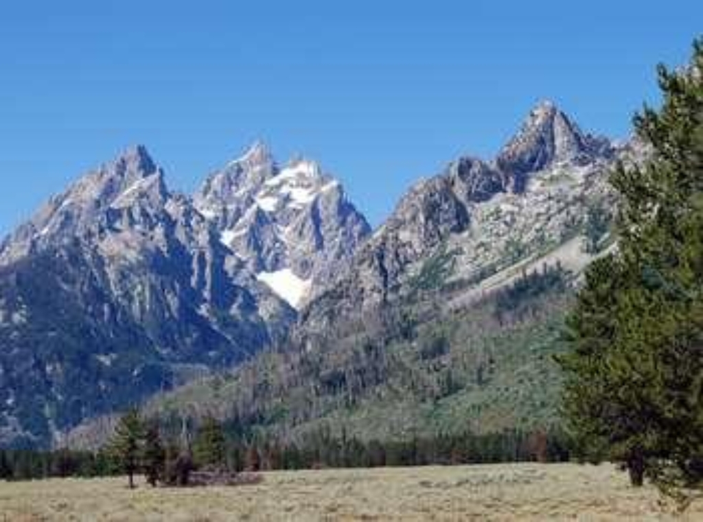
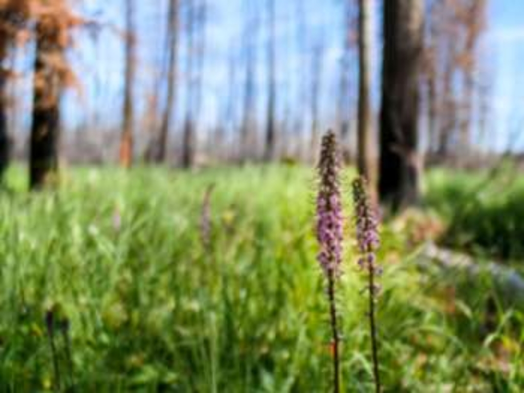
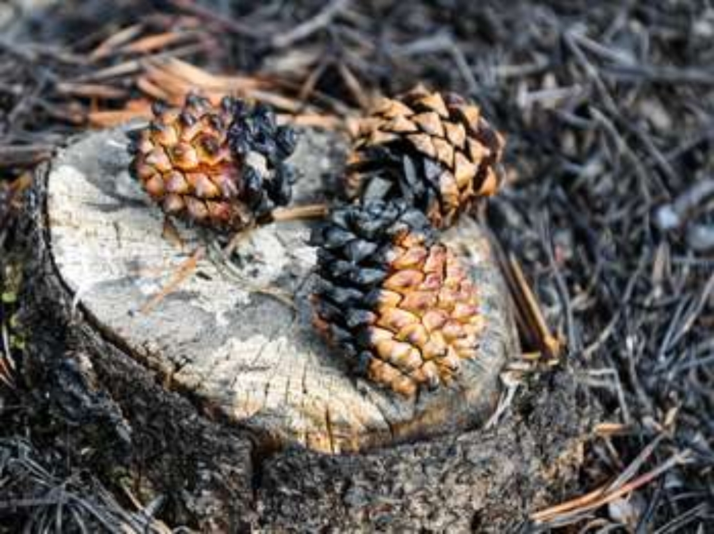
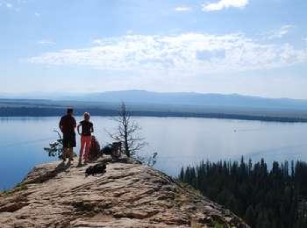
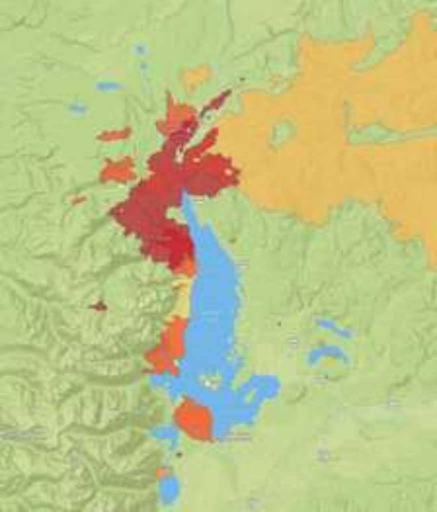
Effects of repeated fires on landscape, importance for forests and wildlife.
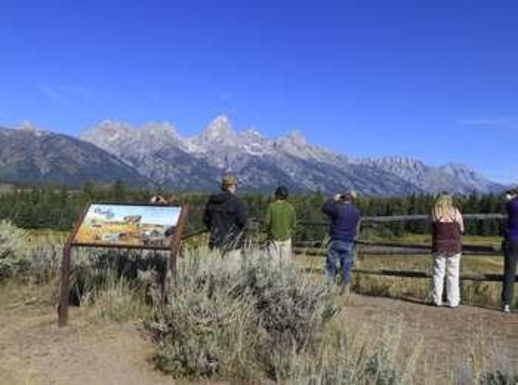
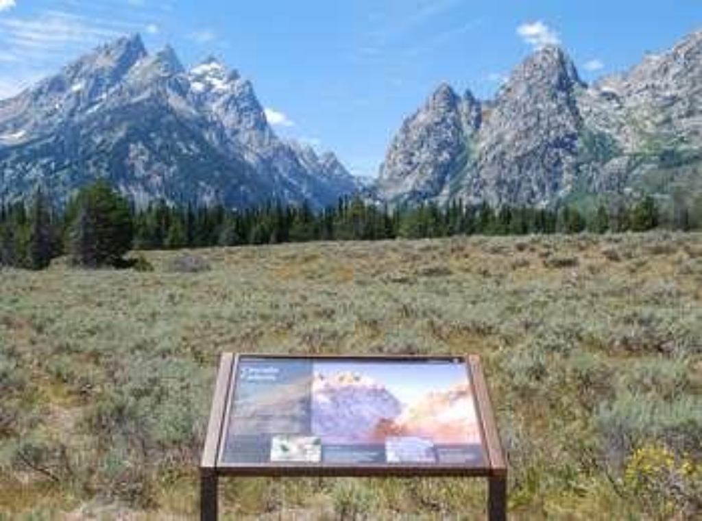
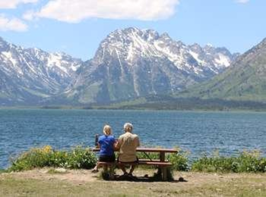
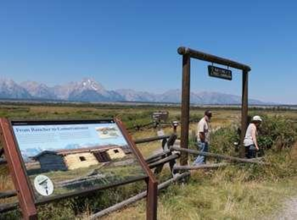
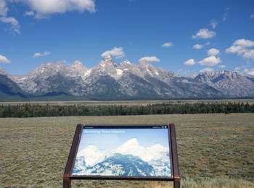
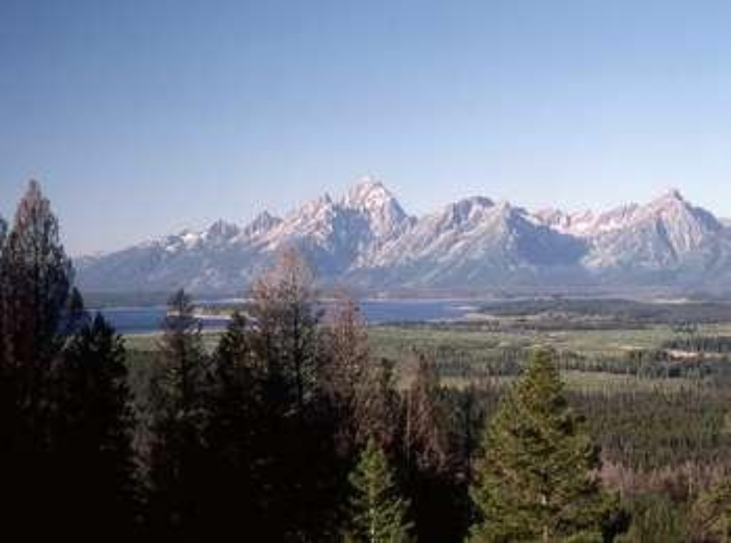
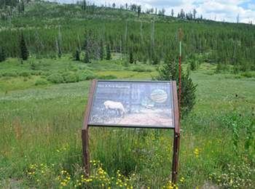
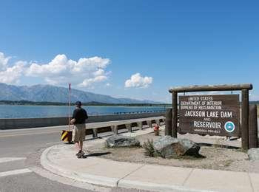
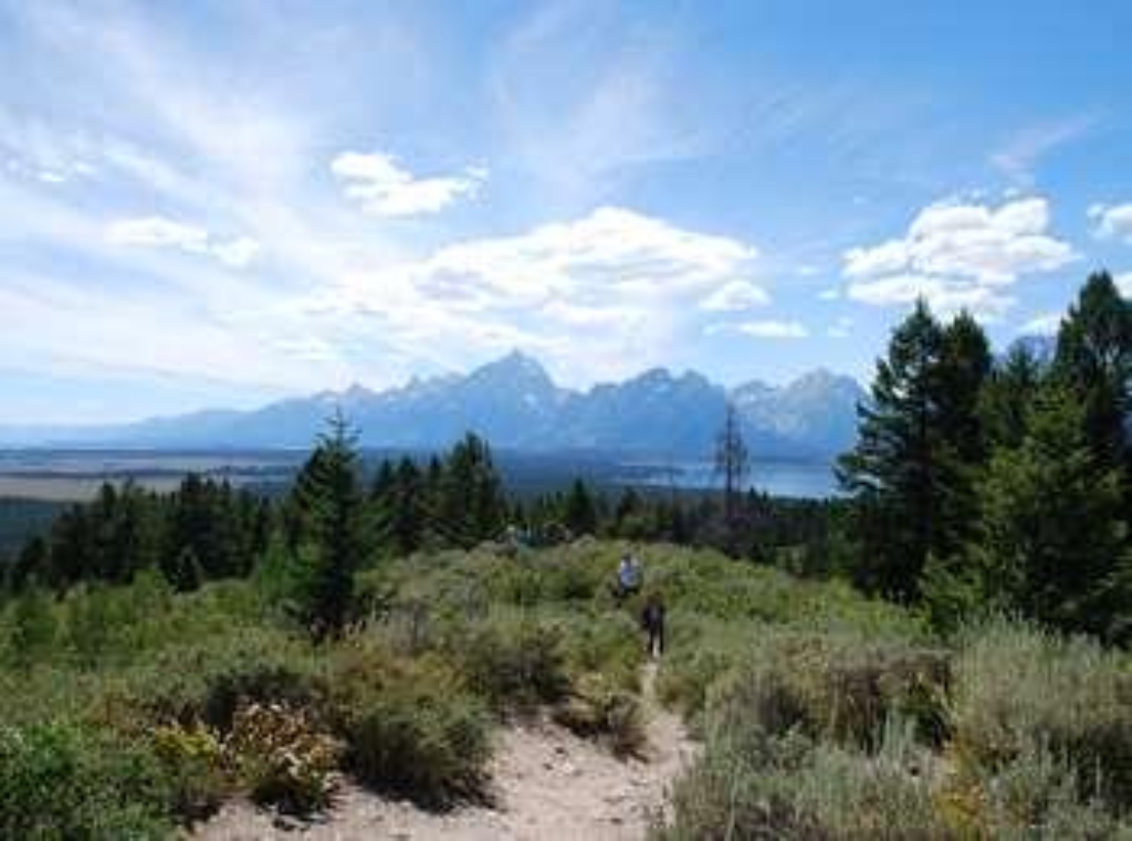
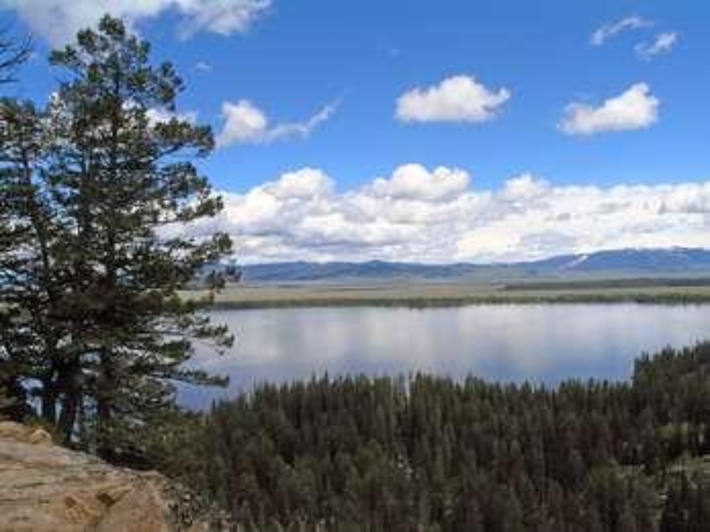
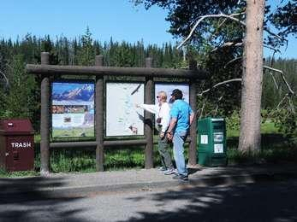
Stop 4 (Jackson Lake Overlook): What effects do repeated fires have on a landscape, and why is that important for forests and wildlife? Explore our Fire History page to see a map of fires in the park over the last several decades, including the ones Diane and Ron discuss.
A Slower Pace of Life
Guests seek nature, views, and solace in Jackson Hole.
Many Bar BC guests of the 1920s and 30s came on vacation to Jackson Hole seeking some of the same things that visitors hope to find today-the peace of being in nature, the splendor of the mountain scenery, and the appreciation of a slower pace of life. Struthers Burt and Horace Carncross selected this site for its beautiful views, its gentle breezes that ruffle the aspen trees, and its solitude, provided by the river valley.
Albright View Turnout
South Teton Range west Jackson Hole. Death Canyon east, Blacktail Butte.
Facing west, the southern Teton Range-dominated by Buck Mountain, Static Peak and Albright Peak-towers over the valley of Jackson Hole. Death Canyon slices deep into the range to the south of these peaks. To the east, Blacktail Butte seems a minor hill but it still over 1,000 feet above the highway. The lack of trees on the south facing slopes of Blacktail Butte suggest past logging by settlers. The lack of trees, however, reflects the well-drained soils and exposure to the s
AMK Ranch
AMK Ranch - original vacation homes in Jackson Hole, historical periods.
The AMK Ranch represents the initial phase of vacation homes in Jackson Hole. Homesteaded by John Sargent in 1890, little remains of his lodge and store that served travelers on the road to Yellowstone. All current buildings date to the W. Lewis Johnson era (1926-1936) and the Alfred Berol era (1936-1976). Both Johnson and Berol built large log vacation homes representing two distinct periods of rustic architecture as well as various other cabins and outbuildings.Berol, presi
Andrew Chambers Barn
Andy Chambers: homestead, trap, dry farm, 1912-1928, Snake River.
Andy Chambers homesteaded on Mormon Row in 1912. By 1916, the homestead consisted of a log house and stable. In addition to homesteading, early settlers trapped to help earn a living. Andy Chambers trapped along the Snake River from 1918 to 1928. The hardships of ranching caused farmers to switch from livestock to farming and back. Chambers homestead lacked water so he dry farmed raising oats and wheat until 1927.
Approaching the Bar BC
Oldest dude ranch in Wyoming, founded in 1912 by pioneers.
The Bar BC was one of the first dude ranches in Jackson Hole, and perhaps the most iconic. Today, it's the oldest one still standing. It was founded in 1912 by Struthers Burt and Harold Carncross, Easterners who emigrated to Wyoming. Burt and his wife, Katharine Newlin Burt, were prolific writers, so their ranch attracted a more artistic and literary set. The clientele tended to be wealthy Easterners who wanted a rustic vacation experience, away from the constraints of high s
Arizona Island Picnic Area
Small picnic area with tables in meadow, surrounded by forests.
Arizona Island picnic area consists of just a few tables in a meadow with mature forests surrounding. Have a snack and enjoy the view when traveling to or from Yellowstone National Park.
Arizona Meadows Turnout
Wet meadow blooms blue with camas, vital Shoshone food source.
This wet meadow turns blue violet in the early summer when blue camas blooms. Shoshone Indians harvested the bulbs once the flowers bloomed so that they did not confuse the plant with death camas that could be a very deadly mistake! The roasted bulbs formed an important part of their diet. Today, the meadow is an oasis surrounded by lodgepole pine forest.
Bar BC Overlook
Historic dude ranch on Snake River; walk through but stay out.
The Bar BC Ranch was the second dude ranch in the valley. Started by Struthers Burt and Horace Carncross in 1912, their ranch attracted Eastern Dudes who wanted to experience life in the Old West. Situated on the west bank of the Snake River, the ranch had a swimming hole from water diverted from the river. Today, the park has stabilized many of the cabins. Visitors may wander through the ranch and enjoy a glimpse of early tourist life, but for your safety please do not enter
Blacktail Butte Trailhead
Access trailhead from highway, one mile north of Moose Junction.
Access the Blacktail Butte Trailhead from US 26/89/191. The parking lot is one mile north of Moose Junction on the east side of the highway. There are no facilities at this trailhead-remember to bring water and use a restroom before you arrive. Bears may be active any place and at any time-travel in groups, make noise and carry bear spray. Hikers cannot access backcountry camping from this trailhead.
Blacktail Ponds Overlook
Park's natural communities stretch out with walking time along trails.
From this vantage point, the park's natural communities stretch out before you. The ponds and wet meadows along the Snake River are home to the wetland community. Terraces step up from the Snake River to the sagebrush community covering much of the valley floor. Islands of lodgepole pines take root on glacial moraines that ring glacial lakes. The lower slopes of the mountains support aspen and conifer forest communities.
Cascade Canyon Turnout
Challenging to reach alpine community, view from Cascade Canyon turnout.
Most visitors find it challenging to reach the alpine community in the park, but the view from Cascade Canyon turnout provides a glimpse. The canyon climbs through the forest community where many conifers thrive-lodgepole pine, Engelmann spruce, Douglas fir and subalpine fir. Cascade Creek flows near the trail providing islands of wetland community. In the upper part of the canyon, the alpine community thrives-a harsh environment buried in snow most of the year.
Cathedral Group Turnout
Cathedral Group peaks, Teton fault, earthquakes, landscape changed permanently.
The Cathedral Group refers to three peaks: Teewinot Mountain, the Grand Teton and Mount Owen. These spires tower above Cascade Canyon casting long shadows during a summer sunset. Looking west, the Teton fault breaks the lower slope on Rockchuck Peak recording the last several large earthquakes on the fault. This turnout captures both the beauty of the Teton Range and the power of earthquakes to change the landscape.
Catholic Bay Picnic Area
Picnic area above lake with trail, fire grates, and chapel.
Catholic Bay picnic area sits above Jackson Lake with a trail that leads down to the shore. This is one of the few picnic areas with fire grates. There is also a vault toilet, trash and recycling available. A great place to stop for a snack along Jackson Lake! Adjacent to the picnic area is the Chapel of the Sacred Heart a historic chapel run by the Catholic Church. Mass is held on Sunday evenings during the summer.
Cattlemans Bridge
Access Cattlemans Bridge from US 89/191/287. No facilities, carry boat.
<b>Location:</b> Access the road to Cattlemans Bridge from US 89/191/287 a half-mile west of Oxbow Bend Turnout or a half-mile east of Jackson Lake Junction. The road to the river continues south for about one mile providing access to the Oxbow Bend or the main channel of the Snake River.<br /><br /> <b>Notes:</b> There are no facilities at this river access-remember to bring water and use the restroom before you arrive. There is no boat ramp at this location. Boats must be carried to the water.
Chapel of the Sacred Heart
Chapel on Catholic Bay, built in 1937, offers Sunday services.
The Chapel of the Sacred Heart is on Catholic Bay of Jackson Lake. The beautiful chapel was built in 1937 and is recognized by the Teton County Historic Preservation Board as being more than 50 years old. The Catholic Church owns the chapel and usually offers Sunday services during the summer. A picnic area is next to the chapel and offers views of Jackson Lake. "http://olmcatholic.org/about-the-parish/location/" Visit the Chapel of the Sacred Heart website to learn more.
Chapel of the Transfiguration
Chapel next to historic district, walking distance, Sunday services available.
The Chapel of the Transfiguration is next to the Menors Ferry Historic District. Maud Noble donated the land to St. John's Episcopal Church in 1925. The chapel served employees and guests from the nearby dude ranches. Today, one of the park's classic views is through the altar window framing the Grand Teton beyond. The chapel usually offers Sunday services during the summer. Visit "http://stjohnsjackson.diowy.org/Worship/chapel-of-the-transfiguration.html" to learn more.
Christian Pond Trailhead
Christian Pond trail from Jackson Lake Lodge: limited facilities, parking. Bears active; travel in groups, make noise.
<b>Location</b> : Access the Christian Pond trail from the east edge of the parking lot next to the corrals at the Jackson Lake Lodge. <br /><br /> <b>Notes</b> : There are minimal facilities and limited parking at this trailhead-remember to bring water and use a restroom before you arrive. Bears may be active any place and at any time-travel in groups, make noise and carry bear spray. Hikers cannot access backcountry camping from this trailhead.
Clark & Veda Moulton Homestead
Mormon settlers built communal homesteads on Mormon Row for farming.
In the early 1900s, Mormon settlers established the community of Grovont along today's Mormon Row. These settlers built homesteads close together to assist with communal efforts. Clark Moulton was TA Moulton's son. He dry-land farmed on Mormon Row until the 1970s when he sold his property. Dry-land farming was unusually by this time. Most farmers used irrigation to support their crops.
Climbers Ranch
Affordable lodging for climbers, communal setting, opened in 1970.
The Climbers Ranch offers affordable and accessible lodging for climbers visiting the Grand Teton National Park. The accommodations are primitive co-ed dormitory-style lodging in a communal setting. Guests are housed in open, one-room cabins with other guests, sleeping on wooden bunks. Minimal facilities include bunkhouses, restrooms with showers and a covered cook shelter. The ranch opened in 1970 re-occupying the Double Diamond Dude Ranch that opened in 1924.
Colter Bay Amphitheater
Ranger programs at Colter Bay Amphitheater, check visitor center for schedule.
Enjoy a variety of ranger programs offered at the Colter Bay Amphitheater. This open-air facility provides a fantastic setting for ranger-led evening programs during the summer. Special programs also occur throughout the season. Check at a visitor center for a current schedule of events.
Colter Bay Cabins
Rustic lodging near Jackson Lake with historic cabins, short distance.
The Colter Bay Cabins and Tent Cabins provide rustic accommodations in Colter Bay Village. Enjoy Jackson Lake, the marina, restaurants, corrals, grocery store and the visitor center all within a short distance. Many of the cabins were part of the Sheffield lodging operation once located below the Jackson Lake Dam. The park service and the Teton Lodge Company moved these cabins to Colter Bay in 1955.
Colter Bay Convenience Store
Convenience store and gas station at US 89/191/287 intersection.
At the corner of US 89/191/287 and the road into Colter Bay Village, is a large convenience store and gasoline station. Whether you visit the Village or continue on your way, the store and gas station offer a break along the way.
Colter Bay Corral
Horseback rides at Grand Teton Lodge Co. website for details.
Enjoy a one or two hour horseback ride along the trails south of Colter Bay. The corrals also offer breakfast and dinner horseback or wagon rides. See and feel the park from a different perspective in truly western style! "http://www.gtlc.com/activities/horseback-riding" Visit the Grand Teton Lodge Co. website for more information.
Colter Bay General Store & Launderette
Travel convenience store, activities desk, laundry, showers. Visit website.
The one stop place for many of your traveling needs! Buy groceries, gifts or sporting goods in the main store. Schedule an activity such as rafting, horseback riding or taking a cruise through the Grand Teton Lodge Company's activities desk. Clean your clothes for the remainder of your trip or take a hot shower if you have been camping for days. "http://www.gtlc.com/dining/the-general-store-colter-bay-village" Visit the Grand Teton Lodge Co. website for more information
Colter Bay Lakeshore Trail
Access trail, visitor services available. Bears active, practice safety precautions, permits required.
Access the paved Colter Bay Lakeshore trail northwest of the visitor center. Visitor services include a visitor center, restrooms, water, stores, restaurants, laundromat, showers, cabins, corrals, campground and an RV park. Bears may be active any place and at any time-travel in groups, make noise and carry bear spray. Backcountry camping requires a permit-pick one up at a backcountry permits office.
Colter Bay Marina & Boat Launch
Colter Bay Village: Visitor services, marina with full amenities.
<b>Location: </b> Colter Bay Village is located west of US 89/191/287 about 10 miles north of Moran Junction. The Village offers a complete complement of visitor services including a visitor center, lodging, restaurants, camping, RV park, groceries, laundry, showers, and more. The marina is full service with boat launch, store, fuel and boat rentals.<br /><br /> <b>Notes: </b> The ramp is paved and accesses a sheltered bay. During low water summers, the boat ramp may become inoperable since Colter Bay is an artificial body of water.<br /> <a href="http://www.gtlc.com/activities"><br />Visit the Grand Teton Lodge Co. website for more information.</a> <br />
Colter Bay Picnic Area & Swim Beach
Visit Colter Bay with walking time. Largest picnic area along Jackson Lake.
Colter Bay picnic area and swim beach is a wonderful place to relax along the shores of Jackson Lake. The largest picnic area in the park has facilities for nearly everyone. There are even tables on the lakeshore hidden back in the trees! Buoys mark off the swimming area to remind boats to remain out of the area. Lodgepole pines shade many of the tables, but some enjoy the sunshine and lake breeze.
Colter Bay Visitor Center
Colter Bay Visitor Center with lake view, exhibits Indian artifacts. Wander near lakeshore for swimming, picnicking.
One of the surviving Mission 66 visitor centers, the Colter Bay Visitor Center sits above the shores of Jackson Lake. Enjoy a view of the lake and Teton Range from the back deck. Wander down to the lakeshore for a swim or picnic lunch, or hike to Swan Lake or Heron Pond from the Hermitage Point Trailhead.The visitor center exhibits 35 artifacts from the David T. Vernon Indian Arts Collection never before displayed .
Cottonwood Creek Overlook
Iconic fall photo spot. Historic Jimmy Manges cabin, aspens, Grand Teton.
A popular fall photograph captures the Jimmy Manges cabin, the park stock used by the summer trial crew, the aspens turning golden and the Grand Teton towering above. A corral is a classic buck and rail fence used by the early homesteaders. Enjoy the view of the horses and mules, but please do not feed them or touch them. Manges' cabin is thought to be the first two story cabin in the valley. The turnout also includes the Cottonwood Creek Picnic area and a vault toilet.
Cottonwood Creek Picnic Area
Cottonwood Creek picnic area with five tables near trees.
Cottonwood Creek picnic area is the first picnic area north of the Moose Entrance Gate. Five tables cluster near cottonwood trees above the creek. Across the Teton Park Road is a fenced meadow where the park houses its pack animals during the summer when they are not in the backcountry. Behind the meadow is the James "Jimmy" Manges cabin thought to be the first two-story cabin in the valley. During fall the aspens that grow on the moraine above the cabin.
Cunningham Cabin
Cunningham established historic ranch; walking time for "dogtrot" style cabin.
J. Pierce Cunningham established the Bar Flying U Ranch in the 1880s. Today, his "dogtrot" style cabin is one of the few remaining homestead cabins in Jackson Hole. This style cabin was common in eastern states, consisting of two small cabins joined with an open, covered breezeway. Cunningham chose this land because silt sediments deposited from an ancient glacial formed soil that retained moisture and provided better nutrients for raising lush grasses and forbs.
Deadmans Bar
Access from US highway, walk half-mile north. Steep road, boat ramp, park. Snake River float, wildlife, Teton views. Remember water.
Location: Access from US 26/98/191 a half-mile north of the Snake River Overlook. The road, partially paved, continues northwest for about one mile to the boat ramp and parking. One section of the road is very steep. Notes: The classic Snake River float through the park launches at Deadmans Bar. The river is home to moose, bald eagles, osprey and many other species. Enjoy sweeping views of the Teton Range as you float down the river to Moose. Remember to bring water with y
Death Canyon Trailhead
Access Death Canyon trailhead from Moose-Wilson Road. Walk 1 mile.
Location: Access the Death Canyon trailhead from the Moose-Wilson Road. Travel three miles south from Moose and turn north on a spur road. The last mile leading to the trailhead is a narrow, rough dirt road recommended for high-clearance vehicles. Notes: Facilities include a small dirt parking lot, a vault toilet and a seasonally-occupied patrol cabin. Remember to bring water with you. Bears may be active any place and at any time-travel in groups, make noise and carry bear
Ditch Creek Pathway Access
Moose Junction to Antelope Flats Road loop for bicyclists.
The pathway section from Moose Junction to the Antelope Flats Road is the most recent addition to the multi-use pathway system. This section allows bicyclists to complete a loop on the secondary roads from Antelope Flats to Kelly and return to Gros Ventre Junction without riding on the main highway. There is parking available at the small lot on the north end Blacktail Butte just south of Antelope Flats Road. ADA compliant.
Dornans
Dornans complex offers various services to park visitors in summer.
The Dornans complex has a long history of providing services to park visitors. This family owned business is actually a park inholding dating back to the 1920s. During summer, visitors may enjoy two restaurants, a wine shoppe, grocery and deli, gasoline, ATM, coffee stand, ice cream cart, gifts, lodging, and adventure sports equipment rental and sales.
Dornans Pathway Access
Accessible pathway connects Dornans to multi-use trail system, walk or ride.
Leave from Dornans in Moose to access the multi-use pathway. A short spur connects to the main pathway allowing non-motorized users access to the paved trail system that extends from Jackson to Moose and on to Jenny Lake. Hop on your bike or pull on your shoes to enjoy the park at a slower pace. ADA compliant.
East Boundary Turnout
Access GTNP from Togwotee: walk along Buffalo Fork River. Orient with map.
Approaching Grand Teton National Park from Togwotee Pass and Dubois brings visitors along the Buffalo Fork River to the East Gate. On a clear day, the length of the Teton Range stretches to the south. Study the orientation map and learn a bit about your options to explore the park.
Elk Ranch Flats Turnout
Elk Ranch flats, historical cattle ranch, now part of park.
Elk Ranch flats is the park's last operating irrigated cattle and hay ranch. In the early 1900s, David (Si) Ferrin consolidated several homesteads to establish one of the valley's largest cattle ranches. After an agricultural depression in the 1920s, Ferrin sold his land to the Snake River Land Company. These lands became part of the park in 1950. Today, livestock, bison, elk and pronghorn graze in the fields and a few cabins remain.
Exum Mountain Guides
Exum and Petzoldt pioneered mountaineering education, training clients in summits.
Glen Exum first climbed the Grand Teton with Paul Petzoldt in 1929. Together they established the Petzoldt-Exum School of American Mountaineering. They believed that clients should learn the skills necessary to participate actively while climbing to the summits of the high Teton peaks. Today, skilled guides train clients of all ages to experience the mountains. "http://exumguides.com/">Visit the Exum website for more information.
Fire Exclusion
European fire management history, near Colter Bay Visitor Center.
Stop 2 (north of Colter Bay Visitor Center): Learn about how Europeans managed fire when they arrived in this area, and how the government shaped fire management in the early 1900s.
Fire Just Is
Reflect on fire management progress in Grand Teton National Park.
Stop 8 (Flagg Canyon Picnic Area): "Fire isn't good or bad-it just is." Fire managers from Grand Teton National Park and Bridger-Teton National Forest reflect on the progress of the last 50 years, and what we need to think about for the future.
Fires and Forest Ecology
Learn about fire's role in forests at Colter Bay Visitor Center.
Stop 1 (Colter Bay Visitor Center): Learn about the role fire plays in our forests and its importance to this ecosystem.
Flagg Canyon Launch
Access from US road, steep dirt road to boat ramp. Carry boat when river is low. Picnic area with toilet. Trail along canyon.
<b>Location:</b> Access from US 89/191/287 just south of the Yellowstone South Gate. A steep dirt road leads from the picnic area down to the boat ramp. The ramp is a log slide that provides access to the river bottom. Except during high water, visitors will need to carry their boat to the water.<br /><br /> <b>Notes:</b> There is a small picnic area above the launch with a vault toilet. The Flagg Canyon trail continues south from the boat launch along the rim of the canyon.
Flagg Canyon Picnic Area
Flagg Canyon picnic area with access to trail and boat launch.
Flagg Canyon picnic area is the first picnic area south of Yellowstone National Park. This location has only a few tables and a vault toilet, but it also provides access to the Flagg Canyon trail and a boat launch for the Snake River. Lodgepole pine trees provide shade, and even though the main highway is nearby the site feels secluded.
Flagg Canyon Trailhead
Flagg Canyon trail: Walk from picnic area, boat launch, visitor services.
<b>Location</b> : Access the Flagg Canyon trail from the picnic area just south of the Yellowstone Entrance. Walk down a steep road from the picnic area to the boat launch and continue south.<br /><br /> <b>Notes</b> : Visitor services include a small picnic area, vault toilet, boat launch and limited parking-remember to bring water. Bears may be active any place and at any time-travel in groups, make noise and carry bear spray. Hikers cannot access backcountry camping from this trailhead.
Flagg Ranch Information Station
Flagg Ranch Info Station between Grand Teton and Yellowstone parks. Hiking.
The Flagg Ranch Information Station is in the John D. Rockefeller, Jr. Memorial Parkway located between Grand Teton and Yellowstone national parks. For visitors traveling south from Yellowstone, Flagg Ranch is the first stop for trip planning information. <br /><br />From the parking area, strike out to hike the Pole Creek loop or explore the Snake River Canyon. Visitors with high-clearance vehicles may enjoy the drive west along the Grassy Lake Road toward Ashton Idaho.
Flagg Ranch Launch
Access from highway, gravel road, minimal facilities, bring water.
<b>Location:</b> Access from US 89/191/287 south of Flagg Ranch where the highway crosses the Snake River. The launch area is a gravel road, parking lot and ramp.<br /><br /> <b>Notes:</b> There are minimal facilities at this boat launch-remember to bring water with you.
Flagg Ranch Trailhead
Trail at Flagg Ranch, essential visitor services, bear safety tips.
Location: Access the Flagg Ranch trail from the Flagg Ranch Information Station. Head west from the information station cabin, through the parking lot, and look for a break in the trees. Notes: Visitor services include an information center, restrooms, water, stores, restaurants, showers, lodge, cabins, corrals, campground and RV park. Bears may be active any place and at any time-travel in groups, make noise and carry bear spray. Backcountry camping requires a permit-pick
Glacier View Turnout
Teton Range. Glaciers. Retreat due to climate change, changing landscape.
Across the valley, the Teton Range rises abruptly from the valley with no foothills to obscure your view. Glaciers lie sheltered on the northeastern flanks of the highest peaks including the Middle Teton and Teton glaciers. Climate change is causing these glaciers to retreat. Smaller glaciers are retreating more rapidly than larger glaciers. Along the valley floor, conifer and cottonwood trees line the Snake River as it cuts through the sagebrush flats.
Glade Creek Trailhead
Access trailhead from Grassy Lake Road. No facilities; bring supplies. Be bear-aware.
Location: Access the Glade Creek Trailhead from the Grassy Lake Road 4.5 miles west of Flagg Ranch about 3/4 of a mile after you enter the area burned during the 1988 Greater Yellowstone fires. Notes: There are no facilities at this trailhead-remember to bring water and use a restroom before you arrive. Bears may be active any place and at any time-travel in groups, make noise and carry bear spray. Backcountry camping requires a permit.
Grand Teton
Grand Teton 13,770', Jackson Hole, Grand Teton National Park, walking time.
The iconic Grand Teton at 13,770' towers over Jackson Hole and Grand Teton National Park. The jagged summit-formed of 2.7 billion year-old gneiss and 2.5 billion year-old granite-towers over the rest of the range. The Teton fault began lifting the range skyward less than ten million years ago making this one of the youngest mountain ranges in the world. Ice age glaciers sculpted arêtes, ridges and canyons to complete the picture.
Grand Teton Medical Clinic
Clinic near lodge offers urgent care, x-ray, pharmacy, lab services.
The medical clinic near the Jackson Lake Lodge offers emergency and urgent care for visitors and residents. They provide x-ray, pharmacy and lab services offered by board-certified providers. The clinic is open during the summer season. No appointment necessary.
Grand Teton North Boundary Turnout
Boundary between parks, notable sign. Learn exploring the park wayside.
The top of Huckleberry Hill marks the boundary between Grand Teton National Park and the John D. Rockefeller, Jr. Memorial Parkway. The US Forest Service transferred the parkway land to the National Park Service in 1972 in honor of Rockefeller's many contributions. Today Grand Teton National Park manages the 24,000 acres that connects Grand Teton to Yellowstone.Take a picture at the classic wooden sign marking this boundary. Learn about the exploring the park from the wayside
Grandview Point Trailhead
Trailhead: Access from highway, walk 1 mile to end. Safety tips: travel in groups, make noise, carry bear spray.
Location: Access the Grandview Point Trailhead from the main highway. Travel two miles north from Jackson Lake Junction, turn east on an unmarked dirt road and continue one mile to the end. Notes: These trails are lightly traveled and pass through prime bear habitat. There are no facilities at this trailhead-remember to bring water and use a restroom before you arrive. Bears may be active any place and at any time-travel in groups, make noise and carry bear spray.
Granite Canyon Entrance Station
1.5 miles north of Teton Village, wildlife habitat, designated pullouts.
Travel 1.5 miles north of Teton Village on the Moose-Wilson Road to access the southern part of Grand Teton National Park. The road crosses through critical wildlife habitat as it winds through sagebrush, forest and wetland communities. Only stop in designated pullouts and maintain a safe distance from all animals. This road becomes congested during peak season.Special restrictions and considerations apply. The park prohibits RVs over 23.3 feet long and trailers. From Novem
Granite Canyon Trailhead
Access Granite Canyon Trailhead 1 mile north of Granite Entrance. Arrive early.
Location: Access the Granite Canyon Trailhead one mile north of the Granite Entrance Station on the Moose-Wilson Road. The road is not accessible to vehicles over 23.3 feet long or trailers. The dirt parking lot is small so arrive early in the day to secure your space. Notes: There are no facilities at this trailhead-remember to bring water and use the restroom before you arrive. Bears may be active any place and at any time-travel in groups, make noise and carry bear spra
Grassy Lake Road Campsites
Grassy Lake Road connects Flagg Ranch to Ashton, ID. Walk time N/A.
Location: The Grassy Lake Road connects Flagg Ranch to Ashton, ID. Follow the road from the John D. Rockefeller, Jr. Memorial Parkway into adjoining US Forest Service land. Please use caution on this dirt road. High clearance vehicles are recommended, and the road is closed for grizzly bear migration until June 1. Sections of the road may open later depending on conditions. Along the road are eight camp areas including 20 campsites. These campsites may not open Summer 2020.
Gros Ventre Amphitheater
Ranger-led evening programs at Gros Ventre Amphitheater, visitor center schedule.
Enjoy an program at the Gros Ventre Amphitheater. This open-air facility provides a fantastic setting for ranger-led evening programs during the summer. Special programs also occur throughout the season. Check at a visitor center for a current schedule of events.
Gros Ventre Pathway Access
Gros Ventre Junction pathway offers 20-mile loop, limited parking.
Access the pathway at Gros Ventre Junction to complete a twenty-mile loop in the southeastern part of the park while avoiding the main highway. Along the loop, traverse sagebrush flats home to bison and pronghorn, or continue west at Moose Junction to enter the central part of the park. Parking is very limited at Gros Ventre Junction. ADA compliant.
Headwaters Lodge
Lodge in national park; cabins, dining, shopping, campground, activities available.
The Headwaters Lodge is located in the John D. Rockefeller, Jr. Memorial Parkway that connects Grand Teton and Yellowstone national parks. Enjoy comfortable cabins or rustic camper cabins. The main building also houses a dining room, a gift shop and a convenience store. Other services include a campground, gas station, horseback rides and a nearby visitor information station.<br /><br /> <a href="http://www.gtlc.com/lodges/headwaters-lodge-at-flagg-ranch">For more information visit the Headwaters Lodge website.</a>
Hermitage Point Trailhead
Access Hermitage Point Trailhead from Colter Bay Village. 10 miles.
Location: Access the Hermitage Point Trailhead from Colter Bay Village. Continue ten miles northwest on the main highway from Moran Junction, and turn southwest at the Colter Bay Junction. The trailhead is at the southeast end of the parking lot next to the marina, and provides access to trails along the eastern edge of Jackson Lake. Destinations: Gently rolling trails lead out to Hermitage Point. Conifers shade the first part of the trail and give way to sagebrush meadow
Hidden Falls
Hidden Falls sensory experience showcases nature's power and tranquility.
Hidden Falls engages all your senses - the 230 foot (70 m) cascade fills your view, the thundering water drowns out speech, the spray chills your skin, and the air smells crisp and clean. As the name suggests, these falls are truly hidden. You will not seem them until you are less than 100 yards from the viewpoint! During peak run-off, the water ricochets off the outcrops, but even late in the summer, the water is still forceful.
Huck Fire Turnout
Natural wildfires regenerate ecosystems by clearing underbrush, promoting tree diversity.
Fire is part of natural western landscapes. Fire helps regenerate the ecosystem by clearing dense underbrush and opening up the forest to sunlight. The Huck Fire was one of many fires during the summer of 1988 that burned across Yellowstone and the John D. Rockefeller, Jr. Memorial Parkway. Today, notice younger, smaller lodgepole pines and subalpine fir interspersed with older, taller trees.
Inspiration Point
Inspiration Point offers panoramic view of Jenny Lake and Tetons.
The view from Inspiration Point draws thousands of visitors each year. Jenny Lake lies below to the east and the Teton Range towers to the west. On a clear day, you can see the Yellowstone Plateau to the north, the Absaroka and Gros Ventre ranges to the east, and the Snake River Range to the south. You feel as though you are high in the mountains, yet you are only 420 feet above the lake below. You are standing at the mouth of Cascade Canyon.
Irrigation Ditch
Homesteaders on Mormon Row relied on snowmelt for farming.
The first homesteaders who settled on Mormon Row were dry-land farmers. They relied on snowmelt soaking into the soil and rainfall during the growing season to support their crops. The catastrophic flood of 1927 damaged many of the irrigation works from the Gros Ventre River. Around the same time, the Kelly Warm Springs began to produce more water. Homesteaders cut a ditch from the springs west to irrigate their dry lands.
Jackson Hole Airport
Only commercial airport in national park, awe-inspiring introduction, busiest in Wyoming.
The Jackson Hole Airport is the only commercial airport within a national park in the country. As such, flying into the airport is an awe-inspiring introduction to the valley and park. Establishing the airport took many years and numerous locations were considered prior to settling on today's location. The airport began commercial operation in 1946 prior to park expansion and is now the busiest airport in Wyoming.
Jackson Hole Mountain Resort Aerial Tram Trailhead
Access trailhead from aerial tram. Services available in Teton Village. Use bear spray. Backcountry camping permit required. More info available.
Location: Access the trailhead from the top of the aerial tram. Teton Village is about one mile south of Grand Teton National Park on the Moose-Wilson Road (WY 390). Notes: Visitor services are extensive in Teton Village including motels, restaurants, shops and activities. Bears may be active any place and at any time-travel in groups, make noise and carry bear spray. Backcountry camping requires a permit-pick one up at a backcountry permits office. For more information ab
Jackson Lake Dam Launch
Location: Snake River below Jackson Lake Dam. Walking time required. Easy float to Pacific Creek with moderate flows. Vault toilet available near picnic area. No water or facilities.
Location: Access the Snake River below the Jackson Lake Dam near the north end of the Teton Park Road. Just north of the dam, turn south on a paved road that leads to a small gravel parking lot. Notes: The easiest section of the Snake River through the park is the float from the Dam to Pacific Creek. Other than early season, the flows are moderate as the volume of water released from the dam is reduced. There is a vault toilet near the picnic area, but no water or other fac
Jackson Lake Dam Overlook
Jackson Lake: original dam failed, new concrete dam raised pool.
Jackson Lake is a 400 foot-deep natural lake with a dam added on top. The original log-crib dam constructed in 1906-07, failed in 1910. In 1916, the Bureau of Reclamation completed a concrete dam raising the pool level by 39 feet. The increased water level flooded the surrounding forest, drowning many trees. Young men from the Civilian Conservation Corps helped to clear the shores of Jackson Lake and burn the slash piles during the Great Depression.
Jackson Lake Dam Picnic Area
Picnic area below Jackson Lake Dam with recreational activities nearby.
Jackson Lake Dam picnic area is below the dam on the north side of the Snake River. Large cottonwood trees shade several picnic tables. Minimal facilities include a vault toilet and trash receptacles. A short walk leads to the outwash from the dam. Many visitors launch non-motorized boats to float the river down toward Pacific Creek and a number of visitors fish in the turbulent outflow.
Jackson Lake Lodge
Historic lodge with concrete walls, opening in 1955, offers relaxation.
The historic Jackson Lake Lodge is one of two National Historic Landmarks in the park. With its concrete textured walls, this building was the first modern lodge built in a national park. Opening in 1955, the Rockefeller Lodge, as it was once known, inspires visitors with a wall of windows over-looking Willow Flats, Jackson Lake and the Teton Range beyond.Today, the great room is a place to relax and enjoy the view or escape from a rainy day.
Jackson Lake Lodge Backdeck
Jackson Lake Lodge: National Historic Landmark, modern design, scenic views.
The Jackson Lake Lodge gained recognition as a National Historic Landmark in 2003. The building broke with the National Park Service tradition of rustic log construction. Instead, designers constructed a "modern" lodge of concrete and steel that blended into the landscape. The great room with its wall of windows offers sweeping views across the valley toward the northern Teton Range. Step outside to the back deck and engage all your senses.
Jackson Lake Lodge Corral
Horseback ride near lodge, 1-2 hours, park perspective. Visit website.
Enjoy a one or two hour horseback ride along the trails east of Jackson Lake Lodge. See and feel the park from a different perspective in truly western style! "http://www.gtlc.com/activities/horseback-riding" For more information visit the horseback activity page for the Grand Teton Lodge Co.
Jackson Lake Overlook
US 89/191/287 follows Jackson Lake, burnt forest, protected fire management, changing landscape, geologic forces.
The north section of US 89/191/287 hugs the eastern shore of Jackson Lake. Across the lake, notice the patchwork of burned forest. The 1974 Waterfalls Canyon fire was one of the first naturally ignited wildland fires allowed to burn. Today, wildland fire management is a critical part of park policy attempting to preserve all aspects of the park's ecosystem. The landscape we enjoy seems to change only with the seasons, but powerful geologic forces continue to shape the earth.
Jackson Point Overlook
Signal Mountain: views of mountain ranges, glacial history, kettles, walking.
Signal Mountain rises almost 1,000 feet above the valley making it the highest point visitors can drive to in the park. On a clear day you may see several mountain ranges: Teton, Gros Ventre, Absaroka and Yellowstone Plateau. The valley floor records the passage of Pleistocene Ice Age glaciers that scoured the valley and carved lakes. The dimples in the landscape below you are potholes also known as kettles.
Jenny Lake Boat Dock
Early visitors flocked to Jenny Lake. Shuttle services for hikers.
Visitors began to flock to the shores of Jenny Lake even before the establishment of Grand Teton National Park. Early entrepreneurs started a boating business to shuttle hikers across the lake to the mouth of Cascade Canyon. Today, Jenny Lake Boating offers shuttle services to sightseers and hikers, and scenic cruises to those who wish to enjoy a quiet trip on the lake.
Jenny Lake Launch
Jenny Lake boat launch at Lupine Meadows Road, bring water.
<b>Location: </b> The Jenny Lake boat launch is not located at South Jenny Lake. On the Teton Park Road turn west less than one mile south of South Jenny Lake onto the Lupine Meadows Road. Follow signs to the small gravel parking area and boat launch.<br /> <b>Notes:</b> There are no facilities at the boat launch-please bring your own water and use a restroom before you arrive. Jenny Lake is open to non-motorized boats and those with a 10 horsepower maximum motor.<br />
Jenny Lake Lodge
Jenny Lake Lodge: rustic elegance, horseback riding, hidden lake view.
The Jenny Lake Lodge was once known as the Danny Ranch. Today, the lodge exemplifies rustic elegance. Individual and duplex cabins are set back in the trees behind a small lodge. Guest amenities include breakfast, dinner, horseback riding and bicycling. Meals are available to all visitors. Although the lodge is near Jenny Lake, the lake itself is hidden from view. <br /> <a href="http://www.gtlc.com/lodges/jenny-lake-lodge">For more information visit the Jenny Lake Lodge website.</a>
Jenny Lake Overlook
Popular Jenny Lake: stunning view, U-shaped canyon, history walking time.
Jenny Lake is the most popular destination in the park. The view across the lake toward Cascade Canyon is stunning. Pleistocene glaciers carved the U-shaped canyon and the basin filled by the lake today. Many people have visited in the past-American Indians, fur trappers, survey expeditions, dude ranchers, car campers and adventurers. The lake is named for a Shoshone Indian woman named Jenny who married a British fur trapper named Richard "Beaver Dick" Leigh.
Jenny Lake Pathway Access
South Jenny Lake connects to Moose, Jackson via multi-use pathway. Short walk to Visitor Center, store, dock. Towering Teewinot views.
South Jenny Lake is the northern end of the multi-use pathway that extends south to Moose and on to Jackson. A short walk will take you to the Jenny Lake Visitor Center, Ranger Station, store or boat dock. With views of Teewinot towering above Jenny Lake the scenery is spectacular. ADA compliant.
Jenny Lake Ranger Station
Jenny Lake Ranger Station opened in 1930s; moved twice.
In the 1930s, the Jenny Lake Ranger Station and Museum opened for business as the park's first visitor facility. Over the years, the cabin has moved twice. Lee Manges homesteaded in this cabin near Windy Point in 1925. Park staff moved the cabin to the shores of Jenny Lake in 1929, and to its present location in the mid-1990s.The furnishings have changed over the years, but the ranger station's mission has changed little.
Jenny Lake Store
Snacks, firewood, souvenirs available at Jenny Lake Store. Convenient location.
Need a snack, firewood or a souvenir, then stop by the Jenny Lake Store to make your purchase! The store is conveniently located in the South Jenny Lake area.
Jenny Lake Trailhead
Location: South Jenny Lake – eight miles north Moose Junction. Walking time: N/A Access to Teton backcountry. Visitor services and campground available.
Location: South Jenny Lake is eight miles north on the Teton Park Road from Moose Junction. The trailhead is located next to the east boat dock and provides access to the core of the Teton backcountry. Notes: Visitor services include a visitor center, restrooms, water, store, ranger station, shuttle boat, boat rentals and campground. The parking lot is often full from 10 am-4 pm. Arrive early to secure your space. Bears may be active any place and at any time-travel in gro
Jenny Lake Visitor Center
Crandall cabin, moved to Jenny Lake. Visitor center, outdoor plaza.
Harrison Crandall built this cabin in 1921 near the Cathedral Group Turnout to house his studio. He moved the cabin to the shores of Jenny Lake in 1929. Today, the rustic Jenny Lake Visitor Center hosts over 250,000 visitors annually. A new outdoor plaza provides interpretive and directional information. A fully accessible trail system leads visitors to the lakeshore and boat dock. Access the majestic Grand Teton backcountry from several nearby trailheads.
John & Bertha Moulton Barn
Iconic barn at sunrise with Teton Range, character with fences.
The John Moulton barn is an iconic structure in Jackson Hole. The sunrise view with the barn in the foreground and the Teton Range as the backdrop is one of the most photographed structures in the valley. The remaining fences and corrals add character to the view. John Moulton and his brother Thomas Alva (T.A.) homesteaded on Mormon Row in 1908. John dry farmed grain until the state built irrigation ditches to the Mormon Row area in the late 1920s.
John & Bertha Moulton Residence
"Pink House" on Mormon Row; John and Bertha Moulton homesteaded.
The "Pink House" as it is locally known was once the residence of John and Bertha Moulton. For the first 17 years of their marriage, the couple lived in a small log cabin. Around 1934, they built the pink stucco house. John and his brother T.A. homesteaded on Mormon Row around 1908. Their iconic homesteads provide a glimpse into communal life in Grovont in the early 1900s.
John D. Rockefeller, Jr. Memorial Parkway North Turnout
North boundary near Yellowstone, headwaters of Snake River eastward. Lodgepole pines.
The north boundary of the John D. Rockefeller, Jr. Memorial Parkway abuts Yellowstone National Park. The headwaters of the adjacent Snake River are east along the Yellowstone, Teton Wilderness Boundary. Lodgepole pines regenerated after the 1988 Yellowstone fires cover the landscape. The parkway is the northern-most parcel of land managed by Grand Teton National Park. Stop at the wayside to learn about activities in the park, the Rockefeller Legacy and a map.

Is there something we missed for this itinerary?

Let us know!

Itineraries across USA