Utah
1 - 5 days
3 day
itinerary in
Bryce Canyon
A Forest Reborn wayside
Lightning started Bridge Fire in 2009, led to forest regeneration.
On June 14, 2009, a lightning strike started the Bridge Fire that burned 3,947 acres in Bryce Canyon National Park and Dixie National Forest. Years of fire suppression had created a crowded, diseased, and less diverse forest. As the fire, a natural agent in the ecosystem, moved through this area, the forest was reborn. After the fire, nutrients were recycled back into the soil, sunlight reached the ground, and a variety of species returned.
A Lasting Legacy wayside
Roosevelt created CCC during Great Depression; improved Bryce Canyon Park.
In 1933, during the Great Depression, President Franklin D. Roosevelt established the Civilian Conservation Corps (CCC) providing employment for young, unmarried men. From 1934–41, at Bryce Canyon National Park the CCC planted trees and shrubs, built and improved roads and trails, developed campgrounds, paved parking lots, and provided insect control. At Rainbow Point, they built the overlook structure and the Under-the-Rim Trail.
Additional Parking Lot
Southwest parking lot near Visitor Center, all-day & oversize parking.
This additional parking lot is located just southeast of the Visitor Center and provides all-day and oversize vehicle parking.
Agua Canyon
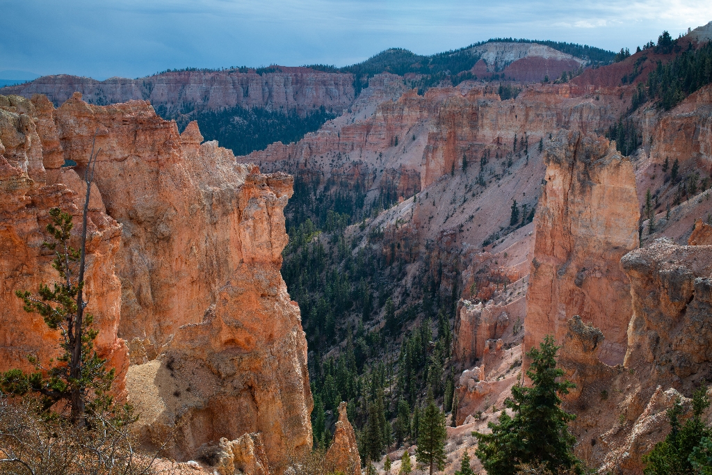
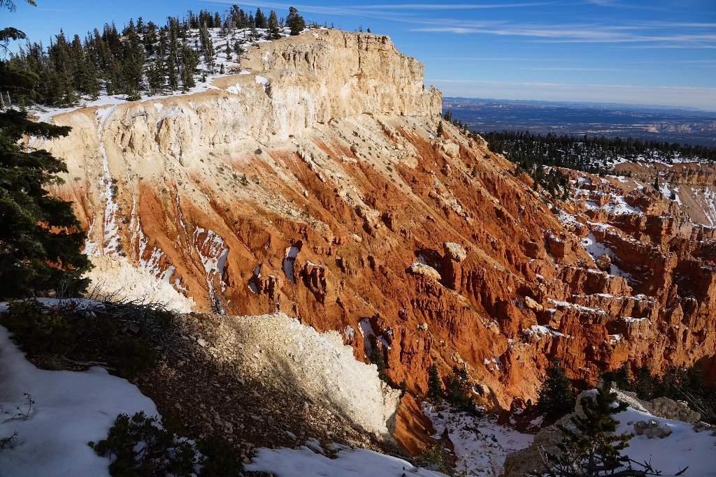
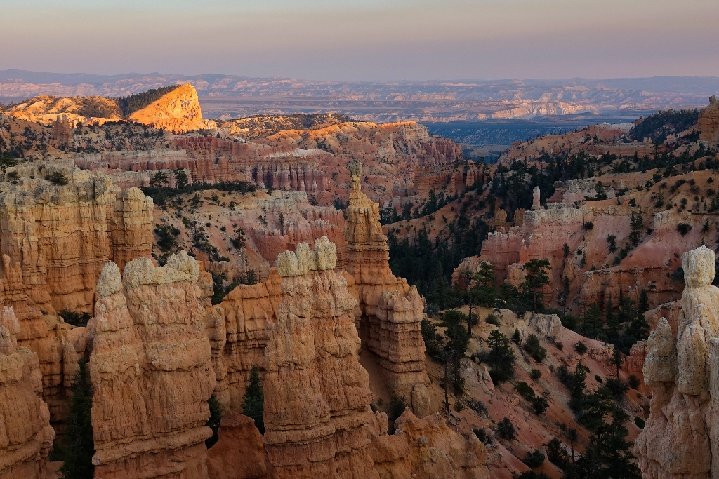
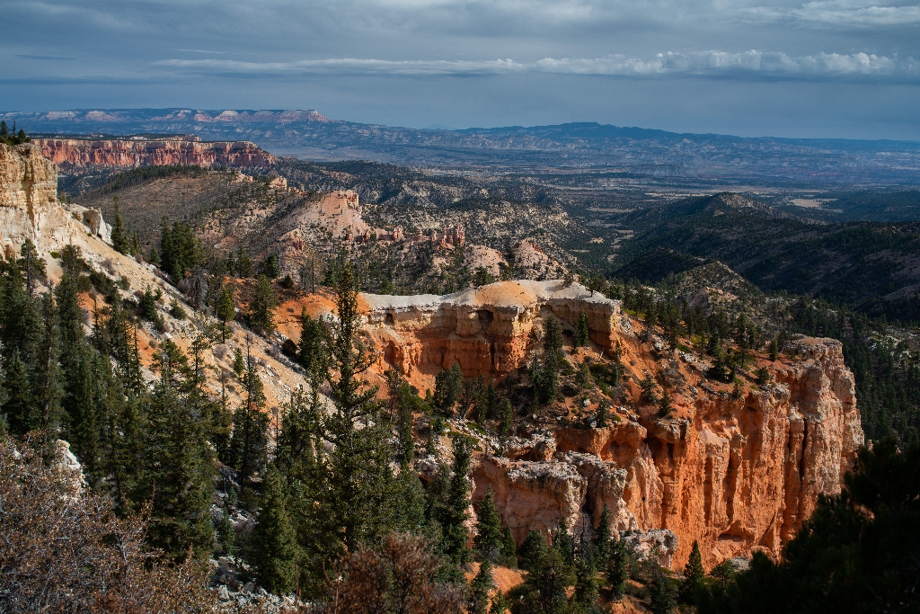
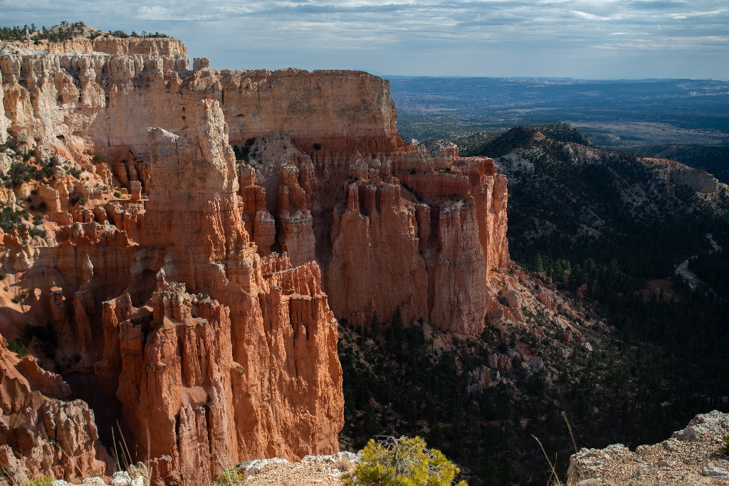
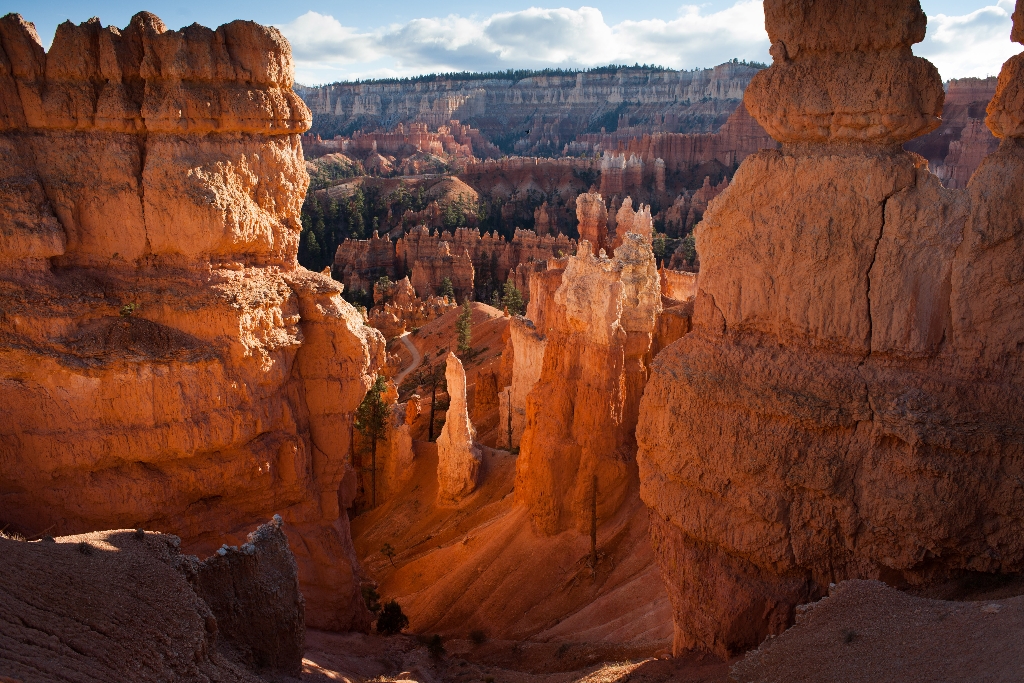
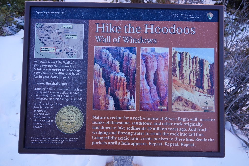
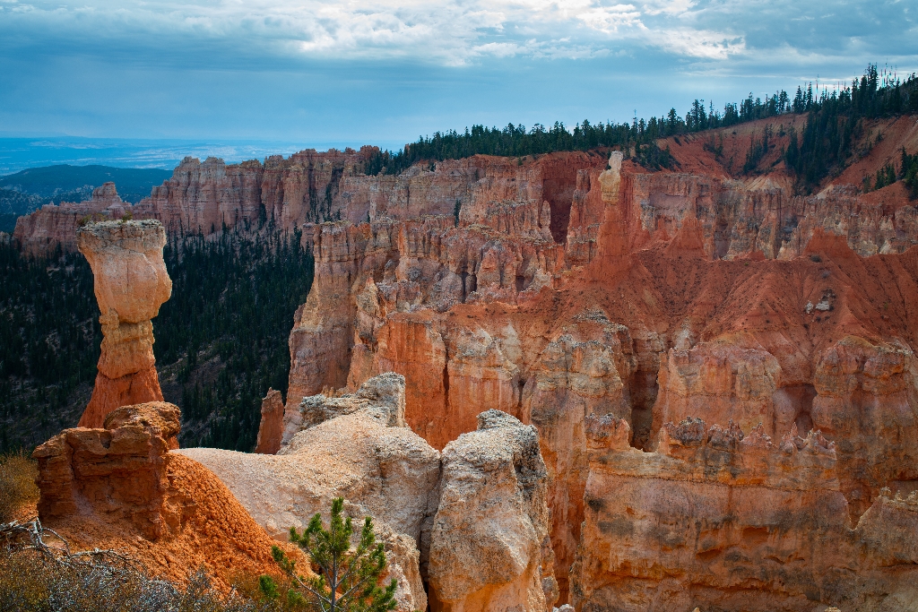
Agua Canyon has prominent hoodoos - "The Hunter" and "Rabbit."
At Agua Canyon two prominent hoodoos command attention. On the left, is the taller of the two towers, "The Hunter." To the right is a hoodoo commonly referred to as the "Rabbit" or alternatively the "Backpacker."
Agua Canyon Connecting Trail Trailhead at Ponderosa Canyon
Trail Closed. Descends 1.6 miles. Junction below.
Trail Closed due to Rockslide This trail descends 1.6 miles (4.0 km) to its junction with the Under the Rim Trail approximately 1,000 feet (305 m) below.
Agua Canyon Trail wayside
Agua Canyon trail connects to 22.9-mile Under-the-Rim trail. Day hike.
Here, the Agua Canyon Connecting Trail descends to the rugged 22.9-mile (36.9 km) Under-the-Rim backcountry trail, which travels north to Bryce Point and south to Rainbow Point. Day hikers can enjoy an out-and-back hike with views of Agua Canyon and the Paria Valley beyond.
Air Quality wayside
Bryce Canyon, stunning views of distant mountains, good air quality.
Bryce Canyon is known for its stunning views and vistas. On a clear day from this point you can see Navajo Mountain, 80 miles (129 km) away, and the San Francisco Peaks, 150 miles (241 km) south. Good air quality, one of the park’s most precious resources, makes these views possible. It is also essential for visitor and employee health and the well-being of the natural environment.
An Ever-changing Landscape wayside
Iron and manganese create colorful canyon layers, influenced by nature.
Colorful Layers Pure limestone is white, but here, iron deposits have oxidized, or rusted, producing the yellows, oranges, reds, and browns. Oxidized manganese creates the pale blue and purple hues. Changing weather and light also affect the canyon’s colors. Bryce Canyon is ever-changing. About 50 million years ago (mya), a large freshwater lake began filling the low basin of southern Utah. Over millions of years, rivers and streams gradually filled this lake.
Architectural Artistry wayside
Architect Underwood pioneered rustic style structures in western national parks.
Gilbert Stanley Underwood, the master architect hired by Union Pacific Railroad, helped pioneer the National Park Service rustic style. Here at Bryce and at many other western national parks, his artistry, vision, and utilization of local timber and stone created structures that nestled harmoniously into the natural landscape.
Black Birch Canyon
Incorrect park names, Black Birch Canyon misnomer.
The park has its share of misnomers (Mossy Cave isn't a cave, the canyon isn't really a canyon...) and Black Birch Canyon would be another.
Bristlecone Loop Gazebo
Octagon shelter on Bristlecone Loop trail, with Thoreau quotes framed.
A small octagon shaped log shelter built by the park in the 1980s after the Bristlecone Loop was completed. At this point in the trail you might recognize smaller bristlecone pines nearby. Look for densely bunched needles travelling in a bushy arrangement up the branch. Needles will be in bundles of 5. Two quotations by Henry David Thoreau are framed on the interior wall of the shelter. The first: Silence alone is worth being heard, then "I need solitude. I have come forth to
Bristlecone Loop Hike the Hoodoos
Hike Hoodoos, exercise, Bryce Canyon scavenger hunt, special reward.
Hike the Hoodoos Hiking is great exercise and Bryce Canyon's "I Hiked the Hoodoos!" program is not just hiking, it's also a scavenger hunt with a special reward!
Bristlecone Loop Trailhead
Short path through trees to 1.0 mi easy loop.
A short path through fir and pine leads to the easy 1.0 mi/1.6 km Bristlecone Loop, as well as the 8.8 mile (14.2 km) backcountry Riggs Spring Loop and 23 mile (37 km) Under-the-Rim Trail. Though the Bristlecone Loop trail only climbs 200 feet (61 m) and is rated as Easy, be sure to carry water, wear ankle-supporting footwear, and postpone your hike if lightning is expected.The Bristlecone Loop reaches elevations over 9,100 feet (2778 m). Here you will pass by bristlecone pin
Bristlecone Loop Trailhead at Rainbow Point
Short path through fir and pine, walking time not specified.
A short path through fir and pine leads to the easy 1.0 mi/1.6 km Bristlecone Loop, as well as the 8.8 mile (14.2 km) backcountry Riggs Spring Loop and 23 mi/37 km Under-the-Rim Trail.
Bristlecone Loop wayside (107)
Forest trail, variety of trees, old bristlecone pines, wildlife sightings.
This trail takes you through a forest of white fir, Douglas-fir, limber pine, and ponderosa pine. Bristlecone pines—some over 1,000 years old—grow at the trail's southern end where hikers enjoy grand views to the south. Small mammals and a variety of birds, including woodpeckers, nuthatches, and peregrine falcons might be spotted. In winter months, this trail may be impassable due to deep snow.
Bristlecone Loop wayside (108)
Forest trail with various pine trees, bristlecone pines, wildlife; snowy in winter.
This trail takes you through a forest of white fir, Douglas-fir, limber pine, and ponderosa pine. Bristlecone pines—some over 1,000 years old—grow at the trail's southern end where hikers enjoy grand views to the south. Small mammals and a variety of birds, including woodpeckers, nuthatches, and peregrine falcons might be spotted. In winter months, this trail may be impassable due to deep snow.
Bristlecone Loop wayside (109)
Trail through forest with diverse trees, wildlife, and scenic views.
This trail takes you through a forest of white fir, Douglas-fir, limber pine, and ponderosa pine. Bristlecone pines—some over 1,000 years old—grow at the trail's southern end where hikers enjoy grand views to the south. Small mammals and a variety of birds, including woodpeckers, nuthatches, and peregrine falcons might be spotted. In winter months, this trail may be impassable due to deep snow.
Bryce Amphitheater wayside
Bryce Canyon: bowl-shaped amphitheaters carved by erosion, changing constantly.
Bryce Canyon is not truly a canyon, but a series of bowl-shaped amphitheaters. For thousands of years, seasonal erosion created gullies in the edge of the Paunsaugunt Plateau, while rain, ice, and snow carved and sculpted the landscape into this extraordinary maze of hoodoos. The Bryce Amphitheater, before you, is constantly changing, chiseled by drainages that gather into Bryce Creek. The breathtaking views can extend nearly 100 miles (161 km) along the eastern horizon.
Bryce Canyon Association Bookstore
501(c)(3) non-profit supports Bryce Canyon National Park since 1961.
Bryce Canyon Natural History Association (BCNHA) is a 501(c)(3) non-profit organization and the official nonprofit partner of Bryce Canyon National Park and Dixie National Forest, operating retail shops and visitor centers within the park, and surrounding national forest lands. Since 1961, BCNHA has provided over nine million dollars in support.
Bryce Canyon Association wayside
Bryce Canyon Association enhances visitor experience, supports park programs.
Since 1961, the Bryce Canyon Association has worked to enhance the visitor experience at Bryce Canyon National Park. This non-profit organization was created to support educational, interpretive, and scientific programs in the park. As the park’s primary partner, they fund free visitor publications, annual geology and astronomy festivals, youth internships, wildlife research, and much more. Your purchase directly supports the park.
Bryce Canyon General Store
Store near Sunrise Point offers food, drinks, camping supplies, souvenirs. Closed Jan-Mar.
The General Store is located near Sunrise Point and North Campground. It serves "grab-and-go" hot and cold foods such as pizza, soup, ice cream, and sandwiches. Beverages such as soda, water, beer, and coffee are also available. Visitors can also find restrooms, showers, camping supplies including firewood, and souveniers. The General Store is typically closed between January and March.
Bryce Canyon Lodge
Iconic historic lodge near Bryce Amphitheater. 114 rooms, including cabins.
The Lodge at Bryce Canyon is one of the park's most iconic historic structures. The Lodge and its surrounding motel structures are located a short walk from the park's iconic Bryce Amphitheater, and offer 114 rooms including lodge suites, motel rooms, and cabins.
Bryce Canyon Mather Plaque
Plaque near Visitor Center flagpole honors conservationist Stephen Tyng Mather.
Embedded in a boulder beside the Visitor Center flagpole is a bronze plaque dedicated to Stephen Tyng Mather, known both as a successful businessman and avid conservationist whose vigorous efforts to build public and political support for the parks helped persuade Congress to create the National Park Service (NPS) in 1916.
Bryce Canyon Park Entrance Sign
Stone monument marks park boundary.
This stone monument marks the beginning of the park boundary.
Bryce Canyon Shared Use Path
Bryce Canyon city to Inspiration Point through Dixie National Forest.
This path provides passage from Bryce Canyon city through Dixie National Forest into Bryce Canyon National Park. Hike, bike, walk or wheel all 5 miles to Inspiration Point, or stop at the shuttle stops and other amenities along the way.
Bryce Canyon Shuttle Station
Shuttle station hub for free shuttle, purchase park admission nearby.
The shuttle station is the hub for the free Bryce Amphitheater shuttle. You can purchase your park admission at a window near the bus boarding area.
Bryce Canyon? Wayside
Bryce Canyon: bowl-shaped amphitheaters formed by erosion, not rivers.
Canyons are formed by rivers, but the colorful scene before you wasn't created by one. Bryce "Canyon" is, instead, a series of bowl-shaped drainages called "amphitheaters" that only contain water when rain or snow fall into them. As this water drains east joining the Paria River, the plateau rim erodes away with it. This process causes the park's many amphitheaters to enlarge at a rate of one to four feet every century.
Bryce Life Zones wayside
Bryce elevation range 6,600-9,100 feet. Various climates, walking time unspecified.
Here at Bryce, the elevation ranges from 9,100 feet (2,778 m) at Rainbow Point to 6,600 feet (2,012 m) at the canyon bottoms. The accompanying wide range of temperatures and precipitation creates three distinctive climatic or life zones—Mixed Conifer (highest elevation), Ponderosa Pine (mid-elevation), and Pinyon/Juniper (lowest elevation).
Bryce Point
Bryce Point offers stunning views of park, 10-minute walk.
Perhaps the most iconic of all the Bryce Amphitheater's four major viewpoints, Bryce Point provides a soaring view of the park's most popular area. The view and the park share the same namesake, Ebenezer Bryce, who settled in the Paria Valley in 1870. Bryce was a shipbuilder who journeyed west with Brigham Young and the Mormon pioneers to assist in the construction of buildings essential to community life throughout the new land. Bryce lived here for only five years, but in t
Building Bryce wayside
Union Pacific and Utah Parks Company developed western national parks with lodging services.
Starting in the 1920s, the Union Pacific Railroad and their subsidiary, the Utah Parks Company, played a key role in the development and popularization of Bryce Canyon and many other western national parks. They provided first-class train and bus transportation, lodging, and tours. Between 1923 and 1929 they built the Bryce Canyon Lodge, along with 15 deluxe and 67 standard cabins in the National Park Service rustic style.
Buy a Digital Pass
No reservations needed to enter. Park entrance fees apply. Support essential improvement projects with digital passes.
No reservations are required to enter Bryce Canyon, but whether you arrive by car, shuttle bus, bicycle, or on foot, park entrance fees will apply. These park entrance fees help support improvement projects and staff to improve your visitor experience. Digital Passes provide a flexible way to pay your entrance fee, support Bryce Canyon, and get you into the park faster.
Camp Center wayside
Park General Store designed by Gilbert Stanley Underwood, built in 1932.
The park's General Store, designed by Gilbert Stanley Underwood, was the Utah Parks Company's last major improvement in the National Park Service rustic style. Built in 1932, it was known as Bryce Inn and served as the nucleus of more than 25 concessions buildings and cabins known as Camp Center.
CCC Picnic Area
Picnic tables available at Mile 5 forest pull-out.
Picnic tables are available for use at this forested pull-out at Mile 5 of the main park road.
Deciphering Nature's Palette wayside
Claron Formation: formed 50-60 million years ago in Utah lakes.
The colorful Claron Formation was formed 50 to 60 million years ago in a system of lakes that stretched across central Utah. Separated into an upper white member and lower pink member, both are composed primarily of limestone mixed with varying amounts of silt and clay. Intermittent layers of mudstone and sandstone were deposited as the lake levels rose or fell and rivers flowed across the basin.
Fairyland Loop Trailhead
The Rim Trail is 5.5 miles, Fairyland Loop 8 miles, strenuous.
The Rim Trail This is the northern end of the 5.5 mile (8.9 km) Rim Trail that begins in the south at Bryce Point. Fairyland Loop The Fairyland Loop is a strenuous 8 mile (12.9 km) loop.
Fairyland Orientation wayside
Trail leads to rock formations with various named features. Embrace beauty.
Follow this trail and discover nature’s fairyland of rock castles, cliffs, and spires. It begins with spectacular views from the rim, then continues down into the amphitheater, past fragile, towering hoodoos and cathedral walls. Changes in light create a mesmerizing, colorful palette at every turn. Look for the spur trail to Tower Bridge. Some of the named features along this loop are Boat Mesa, Sinking Ship, and Chinese Wall.
Fairyland Point
Shuttle does not go to Fairyland Point. Hoodoos in Fairyland Canyon.
The shuttle does not provide service to Fairyland Point. Fairyland Point is the northernmost viewpoint along the rim of the Paunsagunt Plateau within the park. The hoodoos (irregularly eroded rock spires) that fill Fairyland Canyon are younger than those further to the south in the main Bryce Amphitheater.
Farview Point
Farview Point has views of Navajo Mountain and Henry Mountains.
Farview Point is appropriately named. Navajo Mountain, 90 miles away on the border of Utah and Arizona, can be seen on all but the worst days. To the east, beyond the Table Cliff plateau, you may be able to see the more pointed peaks of the Henry Mountains, 84 miles away.
Fee Stations
Three entrance stations, one mile walk, staffed at various times.
Three entrance stations staffed at various times by rangers collect fees, sell passes, and provide free publications. These stations are located one mile inside the park, beside the Visitor Center. 
Fighting Fire with Fire wayside
Two fires merged, 2,000 acres burned. Walking time available.
On August 25 and September 6, 2018, lightning strikes ignited two separate fires that merged, creating the Lonely/Riggs Fire. Over 2,000 acres in Bryce Canyon and Dixie National Forest burned. Thanks to a proactive forest management program, the park had dedicated years to thinning and pile-burning overcrowded, diseased, and dead trees in this area. The fuel reduction project allowed wildland fire crews to set a controlled "back-burn" fire along this trail.
Giants of the Sky wayside
California condor, largest land bird in North America, near extinction.
The California condor, with a nearly ten-foot wingspan, is the largest land bird in North America. Its range once stretched across the west, south to Baja California, and north to British Columbia. By 1940, this magnificent bird was on the verge of extinction from poaching, DDT contamination, habitat destruction, and lead poisoning from consuming carrion containing lead bullets. Captive breeding programs have helped stabilize the population.
Healthy Forest wayside
Forest is a community of diverse life; balance is crucial.
Look into the forest. It is more than just trees; it is a woodland community of animals, plants, and insects that thrives when the ecosystem is balanced. Over one hundred years of fire suppression changed the balance, composition, density, and health of the forest, increasing the chance of severe wildfires, disease spread, and insect infestation. Trees in a dark or over-crowded forest are smaller, weaker, and more susceptible to disease and parasites.
High Plateaus Institute
Field institute operated by park in partnership for courses and research.
The High Plateau Institute is a field institute operated by the park in cooperation with its non-profit partner, the Bryce Canyon Association. The institute aims to provide an opportunity for field courses and research for this high plateau region of which the park is but a part. 
Historic Western Cabins
Bryce Canyon Lodge: built 1925-1929 in National Park rustic style.
Between 1925 and 1929, the Bryce Canyon Lodge, 15 deluxe, and 67 standard cabins were built in the National Park Service rustic style. In 1987, the lodge and deluxe cabin area became a historic district and a National Historic Landmark.
Inspiration Point.
"Birds-eye view of rock spires at Inspiration Point."
Along with Bryce Point, Inspiration Point provides a birds-eye view of the world's largest collection of rock spires called "hoodoos" found within the Bryce Amphitheater.
Layers of Time wayside
Bryce Canyon part of Colorado Plateau, uplifted by tectonic forces.
Bryce Canyon is part of a larger region known as the Colorado Plateau--a layer cake of colorful sedimentary rocks. Over the last twenty million years, tectonic forces have slowly uplifted the Colorado Plateau to elevations reaching nearly 13,000 feet (3,960 m) in some areas. As it rose, faults fractured and offset the layers along its edge, creating the High Plateaus of southwestern Utah.
Leave No Trace wayside
Practice Leave No Trace principles in the park.
Leave No Trace Help take care of the park by practicing these seven principles.
Life of Hoodoos wayside
Climate creates hoodoos, global warming affects freeze/thaw cycles.
Currently the climate here provides a perfect balance of freezing and thawing temperatures to create hoodoos. As global temperatures rise, less frequent freeze/thaw cycles may occur, creating more rounded hoodoos shaped more by rain and chemical weathering than ice.
Living off the Land wayside
Native tribes respect land, plants, animals; find plants along path.
The Southern Paiutes and other tribes that live in this area know the land, plants, and animals can provide them with everything they need, so they always treat them with respect. Three of the plants they use are highlighted below. Look for them along this path.
Making a Difference wayside
Volunteer at Bryce Canyon National Park for various roles. Ask for details.
Share your love for Bryce Canyon by volunteering with us! From visitor services to search and rescue, to campground hosts or one-time service projects, volunteers play an essential role in caring for our national parks. Ask a park ranger or visit volunteer.gov for more information.
Mormon Pioneer National Heritage Area
Preserves Mormon settlement heritage through community-led efforts.
The Mormon Pioneer National Heritage Area preserves the natural, historical, and cultural heritage legacies and contributions of Mormon settlement in the West. The heritage area accomplishes this through community-led efforts to connect with the past by telling the Mormon pioneer story.
Mossy Cave
Mossy Cave trail: unique start to end hill direction route.
Mossy Cave trail is one of the lowest elevation hikes in the park as well as one of the only hikes that begins with a climb and ends with a descent (most day hikes in the park begin with a descent and end with a climb). It is also the northernmost hike in the park, located just off of SR 12 as it winds its way through the park boundary.
Mossy Cave Hike the Hoodoos wayside
Hike the Hoodoos, hike, scavenger hunt, special reward, hiking time.
Hike the Hoodoos Hiking is great exercise and Bryce Canyon's "I Hiked the Hoodoos!" program is not just hiking, it's also a scavenger hunt with a special reward!
Mossy Cave Trailhead Wayside
Streamside walk to alcove, spring moss, winter ice. Water diverted 1892, erosion, frozen waterfall.
This streamside walk leads to a spring-formed alcove that fills with summer moss and winter ice. At one time, water only flowed through Water Canyon after summer storms and spring snowmelt. After settlers completed an irrigation canal in 1892, water was diverted from the plateau above, steeply eroding these fragile canyon walls and feeding a waterfall that regularly freezes in winter.
Mossy Cave wayside
Mossy Cave: acidic water dissolves limestone, creating habitat for moss.
At Mossy Cave, slightly acidic groundwater seeps through the harder limestone layer, dissolving and eroding the softer layers underneath. This cool, moist, shaded environment is a perfect habitat for mosses to thrive. As temperatures drop, the dripping water freezes, creating impressive icicles that sometimes last into summer. Please do not enter the cave and help us protect this fragile environment.
Natural Bridge
Natural Bridge misnomer, actually a natural arch, formed by ice.
Like some other features in the park, Natural Bridge is not what its name would suggest. Natural bridges are formed by the movement of a stream or river cutting through rock. The impressive feature seen here is instead a natural arch, or window, formed primarily by the expansion of ice in cracks deep within.
Natural Bridge wayside
Natural arch formed by frost-wedging, weathering, and gravity; may erode.
This "bridge" is technically an arch. Natural bridges are carved by rushing streams, but here, subtler forces of frost-wedging, chemical weathering, and gravity are at work. Today, the arch spans 85 feet (26 m) and appears solid and enduring, but weather is constantly chipping away at the opening. It may last hundreds or thousands of years, or it could collapse tomorrow.
Nature's Symphony wayside
Listen to soundscapes. Monitor impact of human-caused noise.
Close your eyes and listen. What do you hear? Soundscapes, the combined sounds from natural and non-natural sources, are an important resource in national parks. Non-natural sounds, such as those from vehicles, aircraft, and other visitors, can disturb nature's delicate balance and visitor experiences. Soundscape monitoring helps us understand the impact of human-caused noises on the natural world.
Navajo Loop Hike the Hoodoos
Hoodoos hike: exercise and scavenger hunt with special reward.
Hike the Hoodoos Hiking is great exercise and Bryce Canyon's "I Hiked the Hoodoos!" program is not just hiking, it's also a scavenger hunt with a special reward!
Navajo Loop Trailhead
Navajo Loop Trail switches down, ends at Sunset Point. Two sides.
The iconic Navajo Loop Trail begins and ends at Sunset Point, travelling by switchbacks down between narrow walls of colorful limestone with views of towering Douglas-fir trees and the park's most famous hoodoo: Thor's hammer. The loop has two sides, the Two Bridges side and the Wall Street side. The Two Bridges side is open year-round, however the Wall Street side is closed in months when precipitation combines with freezing overnight temperatures. 
Navajo Loop Trailhead wayside
Trail with two side paths, connections to other loops available.
This popular trail has two sides, one descending into the narrow paths of Wall Street and the other to the erosion-resistant Two Bridges and Thor's Hammer. Hikers can also connect to the Peekaboo Loop and Queen's Garden Trail to create larger loops. See the Visitor Guide for information on combination loops.
North Campground Outdoor Theater
Outdoor theater for ranger programming, only in warmer months, check schedule.
The North Campground Outdoor Theater provides a venue for outdoor ranger programming, typically evening programs. Since it is outdoors, programs are only offered here during peak season / warmer months. Check out the park's calendar page for all ranger programming.
North Campground Picnic Area
Picnic tables, grills available at south end of North Campground.
Picnic tables and grills are available for use at the south end of North Campground.
Orientation Panel waysides
Visitor center entrance has orientation panels with photos, maps, information.
At the entrance to the visitor center are five upright orientation panels along a curved stone wall. The panels provide photographs, maps, text and a chart of information on park amenities, exploring Bryce canyon, the hiking trails, the Bryce Amphitheater, and Junior Ranger activities.
Paria View
Paria View overlooks amphitheater, walking time not specified.
A viewpoint for those who want to experience the quieter side of the park, Paria View overlooks a more than 500 ft (152 m) deep amphitheater formed by the headwaters of Yellow Creek, which drains east and south to the Paria River.
Park Sign Scenic Highway 12 Western Boundary
Stone monument, western park boundary start along Highway 12.
This stone monument marks the beginning of the western park boundary along Highway 12.
Peek-A-Boo Loop Hike the Hoodoos
Hiking program with scavenger hunt and special reward at Bryce Canyon.
Hike the Hoodoos Hiking is great exercise and Bryce Canyon's "I Hiked the Hoodoos!" program is not just hiking, it's also a scavenger hunt with a special reward!
Peekaboo and Hat Shop wayside
Steep Peekaboo Loop hike, 1,000 ft descent, clockwise recommended.
The Peekaboo Loop provides a steep adventure to the floor of Bryce Amphitheater. Both sides of this strenuous loop provide many climbs and descents through a forest of hoodoos. Return up to Bryce Point or connect to Queen's Garden, Navajo Loop, or Tropic trails at the northern junction. Clockwise travel is requested due to horse use. The Hat Shop Trail descends 1,000 feet (305 m) along the first 2 miles (3.2 km) of the much longer 23-mile (37 km) Under-the-Rim Trail.
Peekaboo Loop, Hat Shop, and Under-the-Rim Trail Trailhead
Trails descending from Bryce Point: Peekaboo, Hat Shop, Under Rim.
Here the Peekaboo Loop, Hat Shop, and Under the Rim Trails all descend from the Bryce Point area.
People of Bryce wayside
Ancient tribes, settlers, national park, protected for enjoyment worldwide.
People have been here for thousands of years. Many tribes, including Southern Paiutes, Hopi, Ute, and Zuni, call this area home. Over 150 years ago, early settlers from the Church of Jesus Christ of Latter Day Saints came here. They built nearby communities, many of which are still here. Today this place is a national park. It is protected for you and people around the world to enjoy.
Pinyon Juniper Forest wayside
Bryce Canyon's diverse ecosystems support numerous plant and animal species.
Bryce Canyon’s elevation ranges 2,500 feet (762 m) from Rainbow Point to the canyon bottoms, creating a wide range of temperatures and precipitation resulting in three climatic or life zones—Pinyon/Juniper, Ponderosa Pine, Mixed Conifer. More than a thousand plant species inhabit the park, while dozens of animals, including over 100 species of birds, move throughout these zones.
Piracy Point
Two buttes resemble sailing ships; walking time not provided.
With a little imagination two large buttes appear as sailing ships engaged in a naval battle. Another origin for the name might from from the fact that this point overlooks the Sheep Creek drainage system to the north and the Willis Creek drainage system that collects all run-off from Rainbow Point south from here. The northern extent of the Willis Creek drainage is beginning to be diverted toward Sheep Creek in a process called "stream piracy". This is when a river drainage
Ponderosa Canyon
Ponderosa Canyon named after huge Ponderosa Pines, 150 ft. tall.
Ponderosa Canyon is so named because of the huge Ponderosa Pines on the canyon floor. Some of these trees measure more than 5 ft. in diameter and exceed heights of 150 ft.
Queens Garden Hike the Hoodoos
Exercise with scavenger hunt in Bryce Canyon, "I Hiked the Hoodoos!"
Hike the Hoodoos Hiking is great exercise and Bryce Canyon's "I Hiked the Hoodoos!" program is not just hiking, it's also a scavenger hunt with a special reward!
Queens Garden Trailhead
Moderately strenuous hike, 0.9 miles with unique hoodoo.
One of the park's most popular trails, the Queen's Garden trail descends and bends 0.9 miles (1.4 km) along a ridgeline down to a unique hoodoo said to resemble Queen Victoria. Of the six trails that descend into the Bryce Amphitheater, the Queen's Garden Trail is considered the least strenuous; though due to the park's high elevation and steep grades in some areas, it is still categorized as a moderately strenuous hike.
Rainbow Point
Highest park viewpoints, sea-level raised by tectonic uplift, Colorado tributaries.
At 9,115 ft (2,778 m) this and Yovimpa Point are the highest viewpoints in the park. Tectonic uplift has lifted this entire scene from sea-level over the course of the last 20 million years to later be dissected by tributaries of the Colorado River.
Rainbow Point Orientation wayside
Highest overlooks in park, views south and north. Trails available.
At over 9,000 feet (2,743 m), Rainbow and Yovimpa points are the highest overlooks in the park. While Yovimpa Point looks south across the cliffs of the Grand Staircase, at Rainbow Point views are to the north. Here one can look back on the full length of the Paunsaugunt Plateau's eastern edge. Three trails depart from this area: Bristlecone Loop, Under-the-Rim Trail, and Riggs Spring Loop.
Rainbow Point Shelter
Historic museum at Bryce Canyon by CCC, completed in 1940.
This historic museum shelter is part of the legacy of the Civilian Conservation Corps (CCC) at Bryce Canyon. As Bryce Canyon's CCC camp gained experience in rustic construction techniques, more sophisticated projects were attempted. The CCC's outstanding achievement in the park was this combination museum-overlook at Rainbow Point, which was finished in the summer of 1940.After the completion of the museum-overlook at Rainbow Point, no building was erected at Bryce Canyon unt
Ranger Program Meeting Point
Wooden sign on fence for Geology Talks and Rim Walks.
A wooden routed sign hanging from a fence just south of Sunset Point designates the meeting point for both Geology Talks and Rim Walks.
Riggs Spring Loop Trailhead at Yovimpa
Explore Bryce backcountry on 8.8 mile Riggs Spring Loop trail.
Experience the solitude of Bryce's forested backcountry on the Riggs Spring Loop. Descending from the rim, this 8.8 mile (14.2 km) trail meanders through forests and raised promontories, offering stunning views of pink-hued cliffs in the distance.
Rim Trail Bryce Point Trailhead
Southern end of 5.5 mile Rim Trail starting at Bryce Point.
This is the southern end of the 5.5 mile (8.9 km) Rim Trail that begins in the south at Bryce Point and ends in the north at Fairyland Point.
Rim Trail Bryce Point wayside
Rim Trail to Bryce Point, Fairyland Point, and Inspiration Point.
Bryce Point marks the southern end of the Rim Trail, which follows the edge of the Bryce Amphitheater north to Fairyland Point. It is a 1.5 mile (2.4 km) hike to the next viewpoint at Inspiration Point. When the shuttle is running, it can be used to enjoy one-way hikes between viewpoints as far north as Sunrise Point. In winter the section of Rim Trail between Bryce and Inspiration Points is closed.
Rim Trail Inspiration Point Trailhead
5.5 mile Rim Trail connects viewpoints; closed in winter.
The 5.5 mile (8.9 km) Rim Trail begins in the south at Bryce Point and ends in the north at Fairyland Point. The trail connects all viewpoints in the Bryce Amphitheater area and can be accessed at each of them. From here, turn left to travel north to Sunset Point. Turn right to travel south to Bryce Point. Note that the section between here and Bryce Point is closed in winter.
Rim Trail Sunrise Point Trailhead
Hiking Rim Trail, 5.5 miles, connect all viewpoints, options for direction.
The 5.5 mile (8.9 km) Rim Trail begins in the south at Bryce Point and ends in the north at Fairyland Point. The trail connects all viewpoints in the Bryce Amphitheater area and can be accessed at each of them. From here, turn left to travel north to Fairyland Point. Turn right to travel south to Sunset Point.
Rim Trail Sunset Point Trailhead
Rim Trail: 5.5 mile (8.9 km) connects viewpoints.
The 5.5 mile (8.9 km) Rim Trail begins in the south at Bryce Point and ends in the north at Fairyland Point. The trail connects all viewpoints in the Bryce Amphitheater area and can be accessed at each of them.
Rim-Trail Inspiration Point wayside
Hikes to Sunset & Bryce Points, shuttle for one-way adventures.
Hikers can enjoy an easy 0.7-mile (1.2 km) walk north to Sunset Point above the Silent City, or a moderate 1.5-mi (2.4 km) hike south along steep cliffs to Bryce Point. When the shuttle is running, it can be used to enjoy one-way hikes between viewpoints as far north as Sunrise Point.
RV Dump Station
RV Dump Station at South end of North Campground, $5 fee, potable water, seasonal.
This RV Dump Station is typically open spring - fall, closing for the season when overnight temperatures fall below freezing. The dump station is located at the south end of North Campground and can be used by any visitor for a $5 use fee. No use fee applies for those with a campground reservation in the park. Potable water is available.
Service Station wayside
Post-WWII, car sales rose, tourists arrived. Standard Oil station built.
After World War II, automobile sales surged, and thousands of eager tourists arrived to explore the park. To adapt to the change in visitation, the Utah Parks Company, a subsidiary of the Union Pacific Railroad, built this full-service Standard Oil station in 1947. Identical stations were also built nearby at Zion and the North Rim of Grand Canyon. The station's design was notable for being one of the first examples of the emerging Modern Movement architectural style.
Shuttle Stop 10: Sunset Campground Northbound
Shuttle stop northbound side road near Sunset Campground.
Shuttle Stop located on the northbound side of the main road near Sunset Campground.
Shuttle Stop 11: Sunset Point
Shuttle stop near Sunset Point.
Shuttle Stop located near Sunset Point.
Shuttle Stop 14: Visitor Center Northbound
Shuttle stop near Visitor Center, park shuttles mid-April to mid-October.
Shuttle Stop located on the northbound side of the main road across from the Visitor Center. Provides service leaving the park. Park shuttles run mid-April through mid-October.
Shuttle Stop 2: Ruby's Inn (Outbound)
Shuttle stop across from Ruby's Inn entrance, park admission window.
Shuttle stop located across the road from Ruby's Inn main entrance. You can purchase your park admission at a window located beside the front doors.
Shuttle Stop 3: Best Western Plus Grand
Shuttle stop at the Best Western Plus Hotel.
Shuttle stop located at the Best Western Plus Hotel
Shuttle Stop 4: Ruby's Inn (Inbound)
Shuttle stop at main entrance. Buy park admission beside entrance.
Shuttle stop located at Ruby's Inn main entrance. You can purchase your park admission at a window located beside the front doors.
Shuttle Stop 5: Ruby's Inn Campground
Shuttle stop at Ruby's Inn Campground; admission booth nearby.
Shuttle stop located at Ruby's Inn Campground. You can purchase your park admission at a booth located beside the shuttle stop.
Shuttle Stop 6: Visitor Center Southbound
Shuttle stop at visitor center for park shuttle service.
Shuttle Stop located on the southbound side of the main road just beside the Visitor Center flagpole. Provides shuttle service into the park. Park shuttles run mid-April through mid-October.
Shuttle Stop 7: Sunset Campground Southbound
Shuttle Stop on southbound road near Sunset Campground.
Shuttle Stop located on the southbound side of the main road near Sunset Campground.
Shuttle Stop 8: Bryce Point
Shuttle stop at Bryce Point.
Shuttle stop located at Bryce Point.
Shuttle Stop 9: Inspiration Point
Inspiration Point shuttle stop.
Shuttle stop located at Inspiration Point.
Steps Through Time wayside
Dinosaurs, extinctions, Pangea breakup in 2 miles of rocks.
The first dinosaurs, two mass extinctions, the breaking apart of the supercontinent Pangea—these are just a few of the stories contained in the more than 2 miles (3.2 km) of rocks beneath your feet, and the view stretching over 100 miles (160 km) south.
Sunrise Hotel
Two hotels near main lodge, rustic lodging, minutes from rim.
The Sunrise and Sunset Hotels are two-story structures located to the south and north of the main lodge building. These buildings provide accessible, rustic-themed lodging within minutes of the rim of the iconic Bryce Amphitheater. 
Sunrise Point
Sunrise Point overlooks Bryce Amphitheater, spectacular throughout day. Walking time.
Sunrise Point is the northernmost of the four major viewpoints that overlook the iconic Bryce Amphitheater. Though this point along with Sunset Point was named to entice early Lodge visitors to easily accessible points along the rim at both times of day, this view is equally spectacular at daybreak and day's end.
Sunset Hotel
Two-story motels near Bryce Amphitheater; minutes from main lodge.
The Sunset and Sunrise Motels are two-story structures located to the south and north of the main lodge building. These buildings provide accessible, rustic-themed lodging within minutes of the rim of the iconic Bryce Amphitheater. 
Sunset Point
View famous hoodoos at Sunset Point for breathtaking sunset colors.
Sunset Point offers vistas of some of the most famous and breathtaking of Bryce Canyon's hoodoos. Nowhere are the colors of Bryce Canyon's rock better displayed than from Sunset Point.
Sunset Point Orientation wayside
Hoodoos at Bryce Amphitheater, shuttle available, 0.5 mile flat walk.
Never-ending vistas of the world’s largest collection of hoodoos greet you along the rim of Bryce Amphitheater. From south to north, scenic overlooks include Bryce, Inspiration, Sunset, Sunrise, and Fairyland points. The easiest portion, from Sunrise Point to Sunset Point, approximately 0.5 mile (804 m), is flat and paved. From April to October you can use the park shuttle to enjoy one-way hikes between viewpoints. The shuttle does not stop at Fairyland Point.
Survivors wayside
Great Basin bristlecone pines adapt to harsh environment, survive using dormant state.
The twisted, weathered branches of Great Basin bristlecone pines attest to their longevity and the harsh environment—dry soil, cold temperatures, high winds—under which they grow. These trees are survivors. This species adapts to extreme conditions, entering a dormant state that can last for years during drought. The slow growth rate creates a dense wood resistant to parasites and rotting. Sections of a tree may die, but sprawling roots channel water to living limbs.
Swamp Canyon
Transition from hoodoo-filled Bryce Amphitheater to steep cliffs, walking time included.
Swamp Canyon completes the transition from the hoodoo-filled Bryce Amphitheater to the steep cliffs and buttes that characterize the scenic drive and southern end of the park.
Swamp Canyon Connections wayside
Trail descends to backcountry trail. Day hikers enjoy Swamp Canyon Loop (walking time unknown).
Here, the Swamp Canyon Connecting Trail descends to the rugged 22.9-mile (36.9 km) Under-the-Rim backcountry trail, which travels north to Bryce Point and south to Rainbow Point. Day hikers can enjoy the 4-mile (6.4 km) Swamp Canyon Loop Trail.
Swamp Canyon Loop Trailhead
4.0 mi/6.4 km loop, walking 3-4 hours, moderate hike.
The moderately strenuous 4.0 mi/6.4 km Sheep Creek/Swamp Canyon Loop begins here. The trail descends 647 ft/198 m to the canyon floor on a 3 - 4 hour hike. The loop is created by combining the Sheep Creek Connector Trail with 1.1 mi/1.8 km of the Under-the-Rim Trail and the Swamp Canyon Connector Trail.
The Legend People wayside
Panel at overlook tells legend of To-when-an-Ung-wa people.
A panel along the overlook reads: The Legend People. Before there were any Indians, the legend people, To-when-an-Ung-wa, lived in that place… 
Tower Bridge and Fairyland Loop Trailheads
Moderate difficulty trail with excellent views of distant park features.
Similar in difficulty to the Queen's / Navajo Combination loop, but far less travelled, the Tower Bridge trail provides excellent views of Boat Mesa, Sinking Ship, and other distant features within and outside the Bryce Amphitheater area of the park.
Tower Bridge Hike the Hoodoos wayside
Hike Hoodoos, exercise, Bryce Canyon, scavenger hunt, special reward.
Hike the Hoodoos Hiking is great exercise and Bryce Canyon's "I Hiked the Hoodoos!" program is not just hiking, it's also a scavenger hunt with a special reward!
Transportation Challenges wayside
Bryce Canyon visitor numbers tripled, staff addresses challenges creatively.
In 1947 Bryce Canyon welcomed 163,000 visitors, most travelling by personal automobile. In 2018 the number of visitors exceeded 2.6 million. Park staff is continually developing creative solutions to address increasing visitation and protect this unique landscape for future generations, while making it available for all to safely experience and enjoy.
Tropic Ditch wayside
Mormons settled in Paria Valley, built irrigation canal in 1892.
By 1874 members of the Church of Jesus Christ of Latter-Day Saints had begun to settle in the Paria Valley east of Bryce Canyon. Arid conditions gave rise to a plan to divert water 10 miles (16 km) from the East Fork of the Sevier River to the cliffs of Bryce Canyon and down into the valley. Approximately 40 men, digging with hand tools, began work in 1889. On May 23, 1892 their work was completed, and water from the plateau flowed down through Water Canyon.
Tropic Trail Trailhead
Tropic Trail unique access Bryce Amphitheater, lower elevation forest hike.
One of the least-travelled front-country trails in the park, the Tropic Trail provides a unique point of entry into the Bryce Amphitheater area of the park. While all other hikes in this area begin on the rim and descend into the amphitheater, the Tropic Trail begins in lower elevation forest and steadily climbs to its intersection with the Peekaboo Loop, Navajo Loop, and Queen's Garden Trails.
Tropic Trail wayside
Trail below rim, connects to various loops, creek, gradual incline.
One of the few trails in the park that begins below the rim, the Tropic Trail connects to Navajo Loop, Queen’s Garden, Peekaboo Loop, and Rim trails. It follows Bryce Creek, which is dry much of the year. The incline is initially gradual and connects to other popular and more strenuous hikes. Total ascent to the Rim Trail is over 1,000 feet.
Under-the-Rim and Riggs' Spring Trailhead
Under-the-Rim Trail: 22.9 miles. Agua Canyon Connector Trail closed.
The Under-the-Rim Trail is approximately 22.9 miles (36.9 km) from Bryce Point to Rainbow Point. Connecting trails offer access from the park's Scenic Drive and intersect the Under-the-Rim Trail at Swamp Canyon, and Whiteman Bench. Agua Canyon Connector Trail **is closed** until further notice due to storm damage.
Visitor Center
Visitor center offers driving & hiking directions, weather forecasts, Ranger programs.
The Bryce Canyon Visitor Center might be one of your first stops when visiting Bryce Canyon National Park. Here you can obtain driving and hiking directions beyond those available on this website, weather forecasts, a current schedule of Park Ranger guided programs, Junior Ranger booklets, and information on area services including lodging, dining and other attractions.
Wall of Windows Hike the Hoodoos
Hike Hoodoos for exercise and scavenger hunt with rewards.
Hike the Hoodoos Hiking is great exercise and Bryce Canyon's "I Hiked the Hoodoos!" program is not just hiking, it's also a scavenger hunt with a special reward!
Watching for Wildlife Wayside
Protect wildlife in park, do not try to feed or touch.
An illustration of 13 of the most frequently seen mammals and birds found within the park, all circled around a Ponderosa pine tree. Junior Ranger mascot Ranger Ringtail provides an important reminder: Help us protect the animals of Bryce Canyon. Some might beg for food, but remember they are wild. Do not feed or try to touch them.
What's In A Name? wayside
Scottish immigrant Ebenezer Bryce built road to amphitheater canyon.
In 1875, a Scottish immigrant, Ebenezer Bryce, and his family joined other settlers in the valley to the east. To access timber, he built a road that ended in an amphitheater of pink cliffs. Others started calling it “Bryce’s Canyon.” Bryce and his family moved to Arizona in 1880, never anticipating his name would remain over a century later.
Whiteman Bench Picnic Area
Picnic tables available at pull-out surrounded by burned forest.
Picnic tables are available for use at this pull-out surrounded by burned forest.
Whiteman Connecting Trail Trailhead
Escape to Bryce's backcountry on 22.9 mile trail. Stunning views.
Experience the solitude of Bryce's forested backcountry on the Under the Rim Trail. Descending from the rim, this 22.9 mile (37 km) trail meanders through forests and meadows, offering stunning views of pink-hued cliffs in the distance.
Whiteman Trail Connections wayside
Descend Whiteman Connecting Trail to Under-the-Rim trail for scenic hike.
Here, the Whiteman Connecting Trail descends to the rugged 22.9-mile (36.9 km) Under-the-Rim backcountry trail, which travels north to Bryce Point and south to Rainbow Point. Day hikers can enjoy an out-and-back hike with views of the Paria Valley and Swamp Canyon.
Yovimpa Point
Yovimpa Point, highest viewpoint in the park, with Rainbow Point.
Along with Rainbow Point, Yovimpa Point is one of the highest viewpoints in the park. Tectonic uplift has lifted this entire scene from sea-level over the course of the last 20 million years to later be dissected by tributaries of the Colorado River.
Yovimpa Point Air Quality Station
Visitors seek clean air, clear views in Bryce Canyon NP.
Most visitors expect clean air and clear views in parks. Bryce Canyon National Park (NP), Utah, is home to the largest concentration of hoodoos—totem-shaped rock spires resistant to erosion—in the world. The park enjoys relatively good air quality given its remote location on the Colorado Plateau. However, upwind urban and industrial sources, including large power plants and mines, can harm the park’s natural and scenic resources such as vegetation, surface waters, and visibi
Yovimpa Point Connections wayside
Hikers descend Riggs Spring Loop Trail for 8.6 miles.
From here hikers descend on the 8.6-mile (13.8 km) Riggs Spring Loop Trail. Those looking to hike the rugged 22.9-mile (36.9 km) Under-the-Rim Trail, which travels north to Bryce Point, should begin near Rainbow Point. Day hikers might enjoy the nearby Bristlecone Loop or views of distant mesas and steep plateau cliffs along the strenuous Riggs Spring Loop.

Is there something we missed for this itinerary?

Let us know!

Itineraries across USA