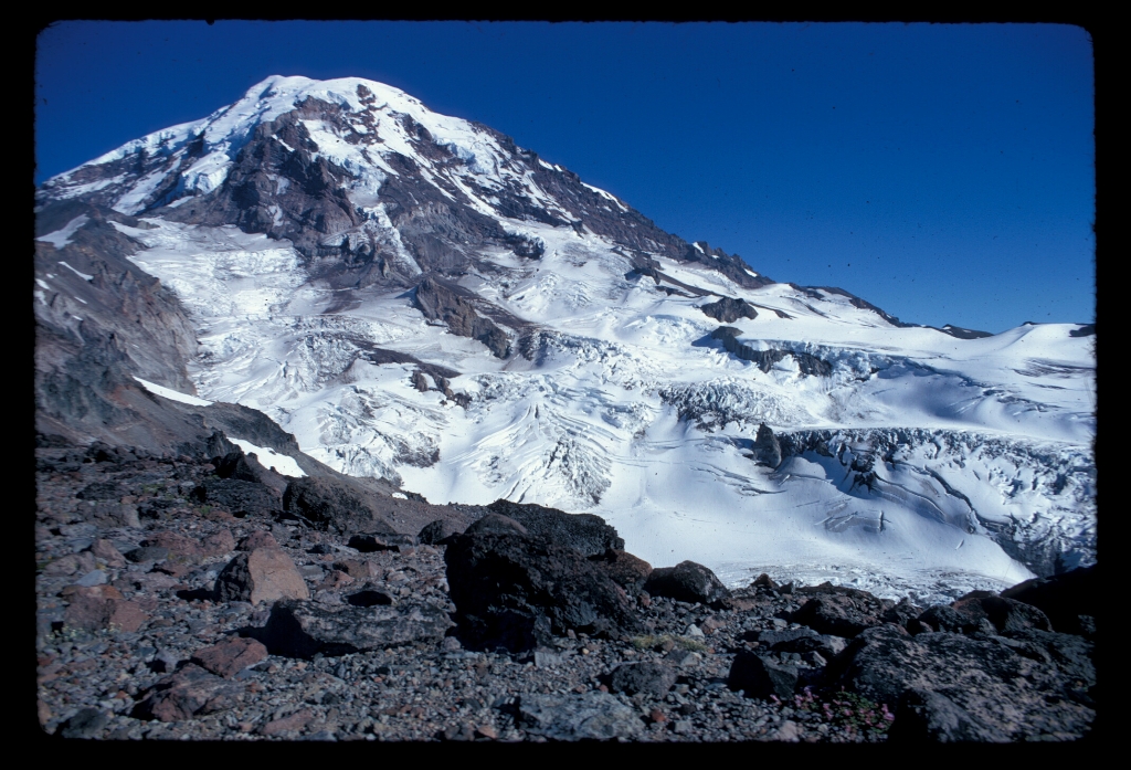
This large glacier on the northwest side of Mount Rainier is separated from the Flett and Russell Glaciers by Ptarmigan Ridge on the northeast and is connected to the Edmonds Glacier to the south. It gives rise to the North Mowich River, a major tributary of the Puyallup River. Mowich is a Chinook jargon term for 'deer' or 'animal.'
The main mass of ice begins at the 10,000 foot (3,050 meter) level and flows down into the North Mowich River Valley. Additional ice joins the main glacier from the south, avalanching down from the Jeannette Heights area. Surveys in 1994 found that the glacier had retreated well over a kilometer up valley compared to its 1898 location reported by geologist I.C. Russell.
Viewing North Mowich Glacier: Located on the northwest slopes of Mount Rainier, the North Mowich Glacier is one of the most visible glaciers from the Seattle-Tacoma area. From Mowich Lake, take the trail connecting to the Wonderland Trail and hike to Spray Park for excellent views of the glacier.
North Mowich Glacier Statistics as of 2021 (Beason et al., 2023):
- Aerial Extent: 1.895 ± 0.102 square miles (4.907 ± 0.264 km2) (Rank: 5 of 29 glaciers on Mount Rainier)
- Highest Elevation (Head): 12,189 feet (3,715 m)
- Lowest Elevation (Terminus): 5,429 feet (1,655 m)
- Elevation Range: 6,760 feet (2,060 m)
- Length: 2.56 miles (4.12 km)
- Average Slope: 25.23°
- Average Flow Direction (direction the glacier flows towards): Northwest (322°)
- Glacier Type: C - Cirque Glacier, or Glacier Head Starts Below Summit
Is there something we missed for this itinerary?
Itineraries across USA


