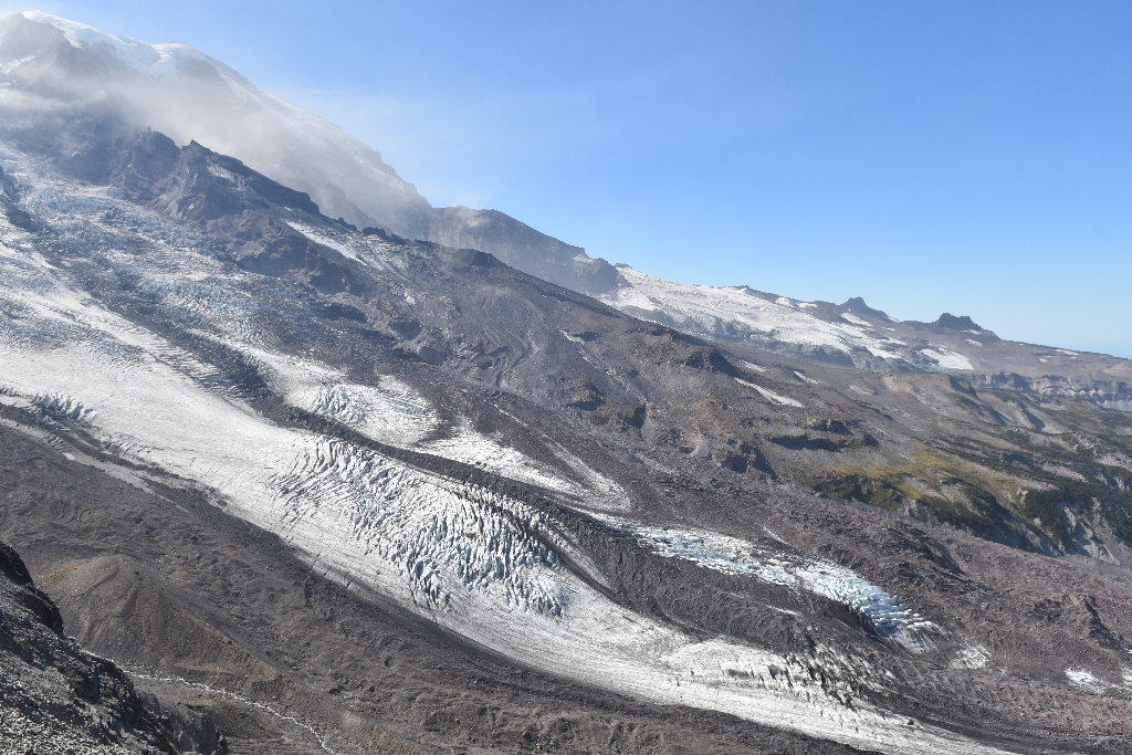
Winthrop Glacier is located on the northeast side of Mount Rainier, just west of Burrough's Mountain. It is the second largest glacier on the mountain, extending from the summit to the 4,700 foot (1,400 m) level of the West Fork of the White River. Its terminus is obscured by a thick coating of rock. Further up the glacier are a series of ice domes formed by ice breaking over bedrock, creating numerous crevasses.
During the Evans Creek glaciation of the Pleistocene epoch (22-15 thousand years ago), Winthrop Glacier extended 14 miles (22 km) north of the summit, where it merged with several small glaciers from tributary valleys north of the mountain. By the late 1800s, the glacier had retreated nearly 3.7 miles (6 km) to its current position.
The Winthrop Glacier was named for Theodore Winthrop who traveled by the mountain in 1853 as the region's first 'tourist.' Winthrop popularized the Pacific Northwest in his book The Canoe and The Saddle.
Viewing Winthrop Glacier: You can see Winthrop Glacier from the Sunrise area of the park. From Sunrise, you can hike to the glacier along the Wonderland Trail. You can also see it from 3rd Burroughs Mountain and Skyscraper Mountain.
Winthrop Glacier Statistics as of 2021 (Beason et al., 2023):
- Aerial Extent: 3.354 ± 0.177 square miles (8.688 ± 0.459 km2) (Rank: 2 of 29 of glaciers on Mount Rainier)
- Highest Elevation (Head): 14,305 feet (4,360 m)
- Lowest Elevation (Terminus): 4,852 feet (1,479 m)
- Elevation Range: 9,454 feet (2,882 m)
- Length: 4.86 miles (7.83 km)
- Average Slope: 24.48°
- Average Flow Direction (direction the glacier flows towards): North northeast (20°)
- Glacier Type: S - Glacier Head Near Summit
Is there something we missed for this itinerary?
Itineraries across USA


