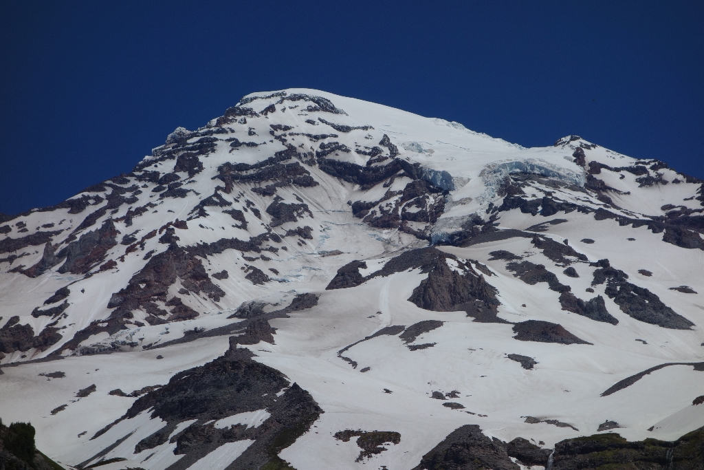
Kautz Glacier is located immediately west of Nisqually Glacier on the mountain's southwestern flank. It is long and fairly narrow as it leads from the top of Mount Rainier to its snout at Mildred Point.
On July 8, 1857, Wapowety of the Nisqually people, led a group of soldiers out of Fort Steilacoom bound for the summit of Mount Rainier. Over the course of eight days the party, consisting of Wapowety, Augustine V. Kautz, Dr. O. R. Craig and four other soldiers, made their way up the Nisqually River Valley to an elevation near 6,000 feet. There they set up camp in preparation for a summit attempt.
The next morning the party set out for the summit. They made their way up the ridge now known as Wapowety Cleaver and then onto the ice of the Kautz Glacier. One by one the party began to falter due to a mix of snow blindness, fatigue, and altitude issues. Finally, at approximately 6:00 pm, the last team members turned around somewhere near 12,000 feet.
In Kautz’s words, “Finally we reached what may be called the top, for although there were points higher yet, the mountain spread out comparatively flat and it was much easier to get along... It was after 6 o’clock and the ice was forming in my canteen and to stay on the mountain at such a temperature was to freeze to death as we brought no blankets with us.”
While that party did not reach the summit first, that honor goes to P.B. Van Trump and Hazard B. Stevens, they climbed fairly high on the volcano and have features on Mount Rainier named after them.
Although the Kautz Glacier is one of the smallest on the mountain, it is a significant player in the recent geologic history of the park. Twice during the last century the Kautz Glacier was the cause of major debris flows. In October 1947, water abruptly drained from underneath the glacier, ripping away a section of glacier over 1 mile (1.2 km) in length and gouging a 320 feet (100 m) deep canyon into the valley once occupied by the ice. Downstream the water mixed with rock, trees, and other debris to form a fast- moving slurry that flowed across the park road almost 6.2 miles (10 km) away. In August 2001, water bursting from Kautz glacier produced a debris flow that flowed over a ridge and into Van Trump Creek.
Viewing Kautz Glacier: The best views of Kautz Glacier can be found at Mildred Point. To reach the point, take the Comet Falls Trail, which starts from the small parking lot along the Nisqually-Paradise Road just west of Christine Falls. Follow the trail past Comet Falls to reach the junction with the trail to Mildred Point.
Kautz Glacier Statistics as of 2021 (Beason et al., 2023):
- Aerial Extent: 0.603 ± 0.034 square miles (1.561 ± 0.088 km2) (Rank: 16 of 29 glaciers on Mount Rainier)
- Highest Elevation (Head): 14,131 feet (4,307 m)
- Lowest Elevation (Terminus): 6,917 feet (2,108 m)
- Elevation Range: 7,213 feet (2,199 m)
- Length: 2.59 miles (4.17 km)
- Average Slope: 29.39°
- Average Flow Direction (direction the glacier flows towards): South southwest (193°)
- Glacier Type: S - Glacier Head Near Summit
Is there something we missed for this itinerary?
Itineraries across USA


