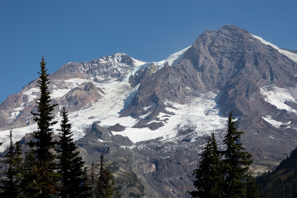
Located on the southwest side of Mount Rainier, South Tahoma and Tahoma Glaciers are separate glaciers that were connected in the recent historical past. Today the two glaciers are separated by Glacier Island. Tahoma Glacier is south of the Puyallup Glacier and is separated from it by the Puyallup Cleaver. The South Tahoma Glacier is south of the Tahoma Glacier and separated from the Pyramid Glacier on the southeast by Success Cleaver.
South Tahoma Glacier flows from a cirque into the Tahoma Creek Valley. Near its terminus the glacier becomes a stagnating mass of ice covered by rock that is nearly indistinguishable from the surrounding moraine. Tahoma Glacier flows from the summit as a single stream of ice before splitting into two lobes that empty into Tahoma Creek and Puyallup River valleys.
Between 25,000 and 15,000 years ago the Tahoma and South Tahoma Glaciers were connected, forming a tributary to the ancient Nisqually Glacier. The two smaller glaciers were again connected during the Little Ice Age about 100 years ago and remained so until nearly the middle of the 1900s.
Like other glaciers on Mount Rainier, South Tahoma produces periodic and sudden catastrophic floods. In August 1967, water stored within the glacier burst from the glacier surface at the 7,000 feet (2,133 m) level. This sudden flood severed the lower glacier into two halves and then mixed with rocks, mud, and trees, forming a debris flow that destroyed the former Tahoma Creek Campground. Since 1967, at least two dozen glacial outburst floods have undercut ice-laden moraine and formed debris flows that rushed down the Tahoma Creek valley, destroying trails, roads, and the former Tahoma Creek Picnic Area.
Viewing South Tahoma and Tahoma Glaciers: One of the best areas for viewing Tahoma Glacier is from the crest of Emerald Ridge along the Wonderland Trail. South Tahoma is best viewed from Indian Henry's Hunting Ground.
South Tahoma Glacier Statistics as of 2021 (Beason et al., 2023):
- Aerial Extent: 0.752 ± 0.042 square miles (1.947 ± 0.109 km2) (Rank: 14 of 29 glaciers on Mount Rainier))
- Highest Elevation (Head): 10,811 feet (3,295 m)
- Lowest Elevation (Terminus): 6,625 feet (2,019 m)
- Elevation Range: 4,186 feet (1,276 m)
- Length: 2.00 miles (3.22 km)
- Average Slope: 23.90°
- Average Flow Direction (direction the glacier flows towards): Southwest (219°)
- Glacier Type: C - Cirque Glacier, or Glacier Head Starts Below Summit
Tahoma Glacier Statistics as of 2021 (Beason et al., 2023):
- Aerial Extent: 2.484 ± 0.132 square miles (6.433 ± 0.343 km2) (Rank: 4 of 29 glaciers on Mount Rainier)
- Highest Elevation (Head): 14,334 feet (4,369 m)
- Lowest Elevation (Terminus): 5,510 feet (1,679 m)
- Elevation Range: 8,824 feet (2,690 m)
- Length: 4.00 miles (6.44 km)
- Average Slope: 24.45°
- Average Flow Direction (direction the glacier flows towards): West southwest (243°)
- Glacier Type: S - Glacier Head Near Summit
Is there something we missed for this itinerary?
Itineraries across USA


