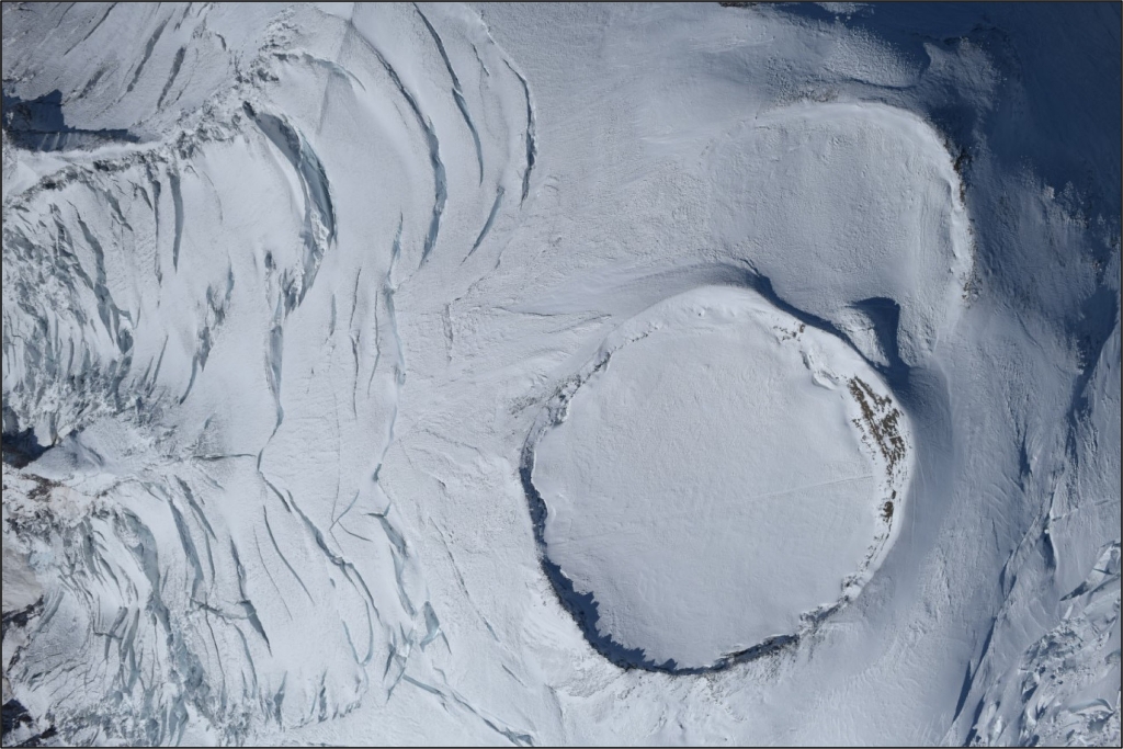
Columbia Crest is the name of the summit of Mount Rainier and the Columbia Crest Glacier occupies the summit crater. This name was suggested by H.E. Holmes of the E.S. Ingraham climbing party of 1891. The party spent two nights on the summit and before leaving jointly chose the name for it. It was believed at the time that the summit was the highest point in the United States. It was called Crater Peak by Hazard Stevens and PB Van Trump, who climbed the mountain in 1870. A report published in the Seattle Telegraph July 28, 1894, notes that Frank W. Hawkins named it Columbia Crest while he was a member of Ingraham's July 18, 1894, climb of the peak.
Though most ice in the summit region flows to large glaciers below, some is confined to the crater at the mountain's summit. Distinct from other glaciers on Mount Rainier, the Columbia Crest Glacier is situated in and between the east and west rims of the volcano, which restricts outward flow.
The crater, produced by volcanic eruptions, is a depression into which snow falls and is converted to ice. Since the crater tilts to the east, some ice and meltwater does flow into the Cowlitz-Ingraham watershed. However, much of the ice loss is caused by high ground temperatures that melt the ice, producing a maze of steam-riddled snow caverns.
Climbers have often taken refuge from storms by descending into the caves from entrances along the crater rim. Geologist Eugene Kiver and Martin Mumma mapped over a mile (1.2 km) of passageways and found a network of tunnels at slopes of 30 to 40 degrees. Geologist Paul Kennard used radar to determine the thickness of the glacier and found it to be about 200 feet (60 m) thick.
Viewing the Columbia Crest Glacier: Because of its location, access to the Columbia Crest Glacier is limited to experienced climbers. Learn more about climbing at Mount Rainier.
Columbia Crest Statistics as of 2021 (Beason et al., 2023):
- Aerial Extent: 0.067 ± 0.005 square miles (0.172 ± 0.012 km2) (Rank: 27 of 29 glaciers on Mount Rainier)
- Highest Elevation (Head): 14,393 feet (4,387 m)
- Lowest Elevation (Terminus): 14,146 feet (4,312 m)
- Elevation Range: 248 feet (76 m)
- Length: 0.43 miles (0.68 km)
- Average Slope: 9.99°
- Average Flow Direction (direction the glacier flows towards): East (96°)
- Glacier Type: S - Glacier Head Near Summit
Is there something we missed for this itinerary?
Itineraries across USA


