Season: Year-Round
NOTE: Visitors to the Carbon River area should be prepared to navigate around road and trail washouts and expect to encounter normal hazards, including downed trees, snow, and changing weather conditions.
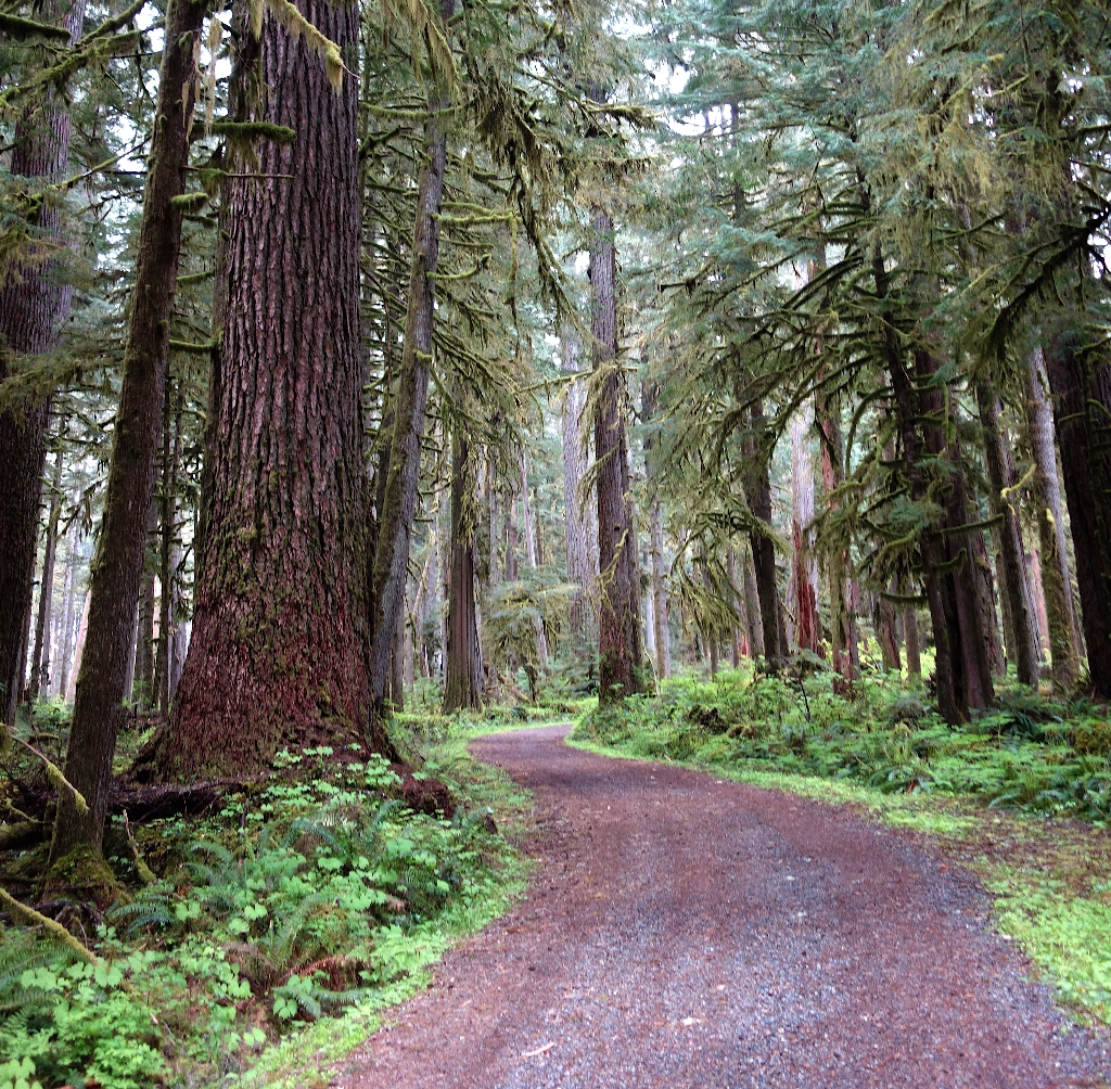
Because of its low elevation of 1,900 feet, the Carbon River area is an excellent place to explore year-round! Nestled in the remote northwest area of the park, the Carbon River area is one of the less visited destinations within the park. Since its construction in the 1920s, the Carbon River Road was repeatedly washed out by flooding. After extensive damage from the 2006 Flood, the Carbon River Road was permantely closed to vehicles starting at the park entrance and converted into a trail.
The Carbon River Ranger Station is located in a remodeled historic farmhouse approximately two miles outside of the Carbon River Entrance and 5.5 miles east of the Mowich Lake (SR165) junction. Its location is strategic-- in an area prone to washouts and floods, the ranger station is far enough away from the river that it is not in danger of destruction. Hours can vary depending on the season. Talk with a ranger, pick up a map, or register for a backcountry permit. There are digital information displays inside the ranger station so visitors can learn more about the history of the area. There are no public facilities at the ranger station, but restrooms and picnic tables can be found at the Carbon River Entrance, just a few miles down the road.
Hiking & Bicycling
There are a variety of recreation opportunities at Carbon River, whether you want to take a short walk to stretch your legs or go for a bike ride. Bicycles are allowed only on the Carbon River Trail (former road) to Ipsut Creek Campground. Several hiking trails begin from along the former road, including the popular day-hiking destinations of Chenuis Falls and Green Lake. Bike racks are available at all trailheads. Backpackers can continue past Ipsut Creek to connect to the Wonderland Trail or to view the Carbon Glacier. Trail bridges often wash out during the fall and winter. Always check conditions before proceeding.
Carbon River does not provide direct driving access to any other area of the park. Mowich Lake is located nearby via State Route 165.
Is there something we missed for this itinerary?
Itineraries across USA


