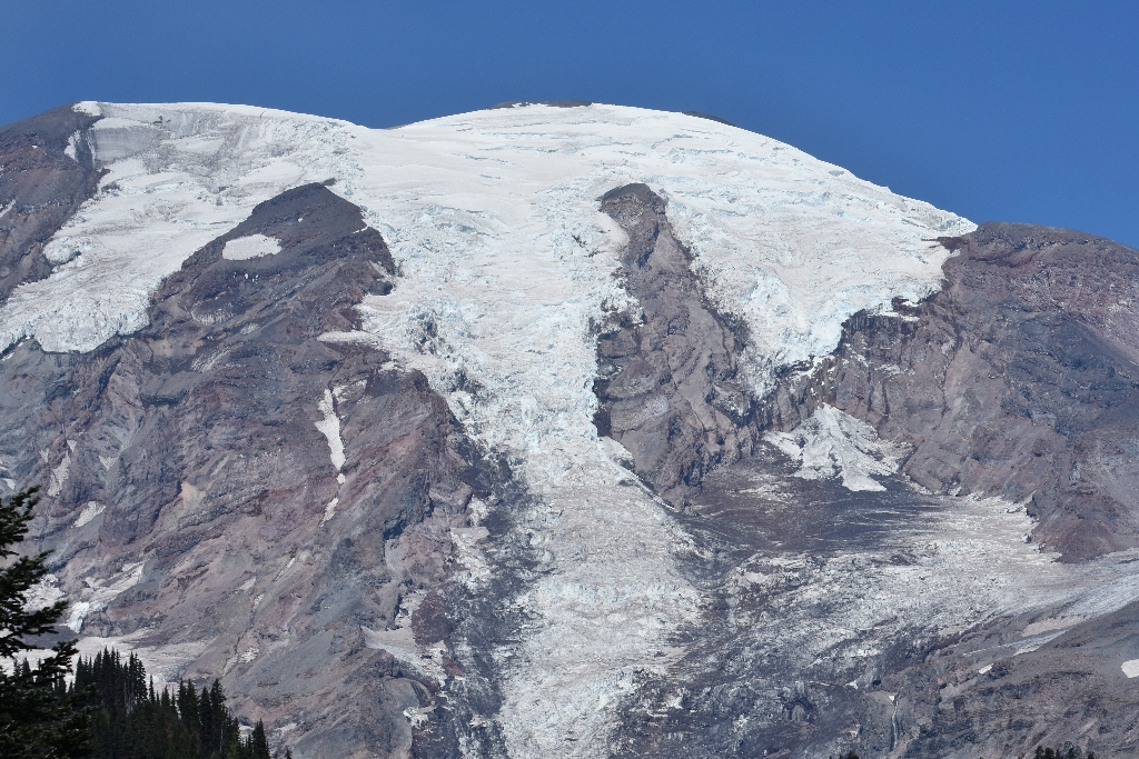
Cowlitz and Ingraham are two glaciers that share a common terminus on the southeast slope of Mount Rainier. Separated by a rocky ridge named Cathedral Rock, the two glaciers merge at the 6,700 foot (2,200 meter) elevation to create a single stream of ice that flows down into the Middle Fork Cowlitz River valley. Below the ridge, a ribbon of rocky debris called a medial moraine produces a dark streak in the middle of the glacier. Further down the glacier are a series of concentric debris-covered ridges called ogives.
More than 35,000 years ago, the ancestral Cowlitz Glacier merged with several other glaciers to become a single stream of ice that flowed nearly 62 miles (100 km) from the mountain's summit. By the end of the Little Ice Age, a little over a 100 years ago, the glacier had retreated to within 5.9 miles (9.5 km) of the summit. By 1994, the longest segment of the glacier was less than 4.4 miles (7 km) long.
Cowlitz is the name of many geographical features in the State of Washington including those within Mount Rainier National Park. The Cowlitz people are one of the associated tribes of Mount Rainier. The name appears in print as early as the Lewis and Clark journals of 1805 where it was written as 'Cowliskee.' The word is said to mean '...capturing the medicine spirit.' Locations named Cowlitz begin on the Cowlitz Glacier on the southeast side of Mount Rainier and continue in the Cowlitz River, which flows south into Cowlitz County.
Ingraham Glacier was named by Professor I.C. Russell in 1896 for Edward Sturgis Ingraham of Seattle, an early mountaineer. He climbed Mount Rainier eleven times often serving as a guide.
Viewing Cowlitz and Ingraham Glaciers: These glaciers can be viewed from the top of Panorama Point or from along the Skyline Trail in the Paradise Area. Alternatively, a pullout at Backbone Ridge along Stevens Canyon Road provides views of the south-facing slopes of Mount Rainier, with the Cowlitz, Ingraham, and Paradise Glaciers visible.
Cowlitz Glacier Statistics as of 2021 (Beason et al., 2023):
- Aerial Extent: 1.423 ± 0.077 square miles (3.685 ± 0.200 km2) (Rank: 7 of 29 of glaciers on Mount Rainier)
- Highest Elevation (Head): 11,137 feet (3,395 m)
- Lowest Elevation (Terminus): 5,232 feet (1,595 m)
- Elevation Range: 5,906 feet (1,800 m)
- Length: 3.48 miles (5.59 km)
- Average Slope: 23.18°
- Average Flow Direction (direction the glacier flows towards): East southeast (121°)
- Glacier Type: C - Cirque Glacier, or Glacier Head Starts Below Summit
Ingraham Glacier Statistics as of 2021 (Beason et al., 2023):
- Aerial Extent: 1.144 ± 0.063 square miles (2.962 ± 0.162 km2) (Rank: 11 of 29)
- Highest Elevation (Head): 14,064 feet (4,287 m)
- Lowest Elevation (Terminus): 6,493 feet (1,979 m)
- Elevation Range: 7,572 feet (2,308 m)
- Length: 3.22 miles (5.18 km)
- Average Slope: 25.17°
- Average Flow Direction (direction the glacier flows towards): East southeast (120°)
- Glacier Type: S - Glacier Head Near Summit
Is there something we missed for this itinerary?
Itineraries across USA


