Season: Summer Only (July-September)
Sunrise Road, which provides access the Sunrise area, is open during the summer only, typically July to September.
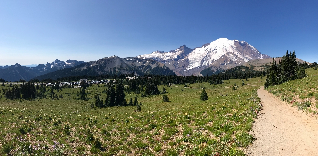
This is the main trailhead from the Sunrise Area, located on the right (north) side of the parking lot looking west towards Mount Rainier and the Sunrise Visitor Center. The trailhead starts as a service road between the restroom facilities and the Sunrise Day Lodge. Keep to the right as you start walking up the road to reach the main trail or follow the road to the left to reach the Sunrise Picnic Area. At a large trail sign, follow the wide gravel trail climbing up the slope towards Sourdough Ridge. The road continues to the left to reach the upper side of the Sunrise Picnic Area and can be followed in a loop back to the parking lot.
Views along the trails include Mount Rainier as well as the White River Valley, Cowlitz Chimneys, Mount Adams, and the Cascade Range. On very clear days, Mount Baker can be glimpsed to the north from Sourdough Ridge. Look for wildlife, including black-tailed deer, mountain goats, marmots, golden-mantled ground squirrels, and birds, in the meadows. The meadows fill with a wide variety of flowers, with peak bloom in mid-to-late July, and can have colorful fall foliage starting in September.
Always check current conditions before heading out and be prepared with the Ten Essentials. Please do not feed any wildlife. Stay on the trail at all times to protect the delicate subalpine vegetation. Pets are not allowed on trails. Download a Sunrise Area Trails Map or pick up a map from a ranger at the Sunrise Visitor Center before starting your hike.
Hiking
The Sourdough Ridge Trailhead is used to access the broader network of trails in the Sunrise Area.
Sunrise Nature Trail – 1.5 miles round-trip, 300 feet elevation gain.
The main trail splits halfway up the slope, with both forks climbing up to Sourdough Ridge Trail. The two forks combined with the ridge trail form a triangle-shaped loop trail known as the the Sunrise Nature Trail. This trail is also a self-guided tour in the NPS app!
Sourdough Ridge east to Dege Peak – 4.2 miles round-trip, 800 feet elevation gain.
From the main trail take the right fork to climb to Sourdough Ridge, then follow the ridge to the right (east) to the Dege Peak spur trail. Dege Peak offers spectacular, 360-degree views of the surrounding area and look for mountain goats along the rocky ridge. For a longer hike, continue along Sourdough Ridge to the east to reach Sunrise Point, an additional 1.1 miles one-way.
Sourdough Ridge west to Frozen Lake – 3 miles round-trip, 500 feet elevation gain.
From the main trail take the left fork to climb to Sourdough Ridge, then follow the ridge to the left (west) to Frozen Lake. This lake is the main water source for the Sunrise Area. Return the same way or take the Wonderland Trail and Old Campground Trail to return to Sunrise, 3 miles round-trip.
Mount Fremount Lookout Trail – 5.6 miles, 900 feet elevation gain.
Follow the Sourdough Ridge Trail to Frozen Lake, then at the junction take the Mount Fremont Trail to the old fire lookout. The lookout is one of four historic lookouts remaining in the park.
Burroughs Mountain Trail - 1st Burroughs Mountain, 4.8 miles. 900 feet elevation gain; 2nd Burroughs Mountain, 6.0 miles, 1200 feet elevation gain.
Follow the Sourdough Ridge Trail to the junction at Frozen Lake, then climb up the Burroughs Mountain Trail. For a loop, return via the Sunrise Rim Trail. Caution: Hazardous travel on icy slopes until late in the season!
Berkeley Park via Northern Loop Trail - 7 miles, 1200 feet elevation gain.
Take the Sourdough Ridge Trail to the junction at Frozen Lake, then follow a section of the Northern Loop Trail down into Berkeley Park. A subalpine parkland, Berkeley Park has lush wildflower meadows.
Is there something we missed for this itinerary?
Itineraries across USA


