Season: Summer Only (June - October)
Owyhigh Lakes Trailhead is located along White River Road, which is open to vehicles during the summer season only, typically June-October.
Drive through the White River Entrance and proceed two miles to a parking area on the right. The trailhead is located across the road. Parking is very limited and can fill early on sunny summer days. Have an alternate destination in mind.
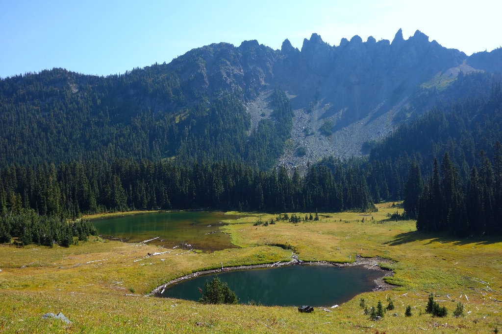
The trail climbs steadily for 3.5 miles through the forest on a series of switchbacks to reach the lakes. According to legend, these lakes were named after Yakama Chief "Owhi," who loaned horses to Theodore Winthrop (after whom the Winthrop Glacier was named), when Winthrop was on a trek across the cascades in the mid-1850s. Although this hike offers no views of Mount Rainier, it does offer an array of secluded mountain lakes and meadows aglow with wildflowers in mid-summer. The jagged cliffs of Governors Ridge rise high above the lakes to the east while Tamanos Mountain lies directly west.
Return back to White River, or the trail continues and descends down into the Ohanapecosh River Valley where it connects to the Eastside Trail at Deer Creek, an additional 4.9 miles. From Deer Creek, a trail (0.4 miles) connects to SR123 where a second vehicle can be parked. If returning to White River, the trail is 7 miles round trip with 1,350 feet of elevation gain.
Tamanos Creek Camp is located among the trees three miles from the trailhead, 0.5 miles short of the lakes. Although the creek is often dry by late summer, Owyhigh Lakes provide a reliable source of water. Treat water before drinking. A wilderness permit is required to camp. Permits and current trail conditions are available park-wide from wilderness information centers, ranger stations, and visitor centers. Fires are prohibited. No pets on trails.
Is there something we missed for this itinerary?
Itineraries across USA


