Roundtrip Distance: 10.5 miles (16.8 km)
Elevation Change: 2,500 feet (762 m)
Average Hiking Time: 6-8 hours
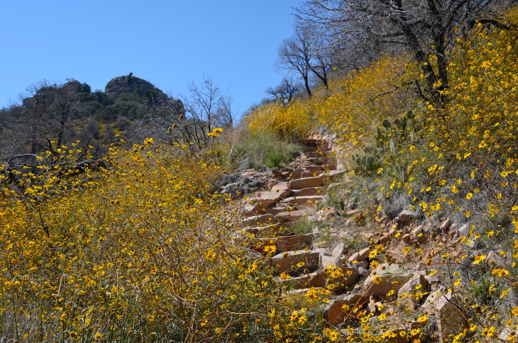
Ascend the forested Pinnacles trail for 3.8 miles (6.1 km) to the Emory Peak trail junction. Then take the 1.4-mile (2.3 km) Emory Peak trail to the peak. The last 0.25 mile climbs steeply, and the final 25 feet require a scramble up an exposed rock face. The 360 degree view from the top of Emory Peak, the highest point in the park, is superb. The antenna and equipment found on the top are part of Big Bend's two-way radio system.
You should not attempt the last mile of this hike when thunderstorms are threatening, especially during the monsoon months of July, August, and September.
Carry 1 liter of water per person per hour that you plan to hike. The importance of carrying enough water in this hot, dry climate cannot be overstated!
Eat
Your body needs food for energy and salts and electrolytes to replace what it's losing from perspiration. The dry climate at Big Bend means that sweat often evaporates almost instantly; your body is likely losing lots of moisture and salts without you even realizing it. Eat plenty of salty snacks to keep your body's salt-to-water ratio in balance.
Sun protection
Carry sunscreen and use it liberally. Hats are also strongly recommended. It may seem strange to wear long-sleeved shirts and pants in hot weather, but many hikers choose lightweight, breathable clothing which covers their arms and legs to protect themselves from the sun.
Don't leave people behind
If you're hiking in a group, make sure the person in the back always has someone to help.
Be aware of wildlife
Keep an eye out for snakes, and remember to maintain a safe distance between yourself and all wildlife. Animals in the park are wild and should never be approached, harassed, or fed.
Don't stack rocks
Cairns are stacks of rocks which are sometimes used to mark trails in areas where they are hard to follow. Randomly stacked rocks can lure hikers off the correct trail.
Elevation Change: 2,500 feet (762 m)
Average Hiking Time: 6-8 hours
Ascend the forested Pinnacles trail for 3.8 miles (6.1 km) to the Emory Peak trail junction. Then take the 1.4-mile (2.3 km) Emory Peak trail to the peak. The last 0.25 mile climbs steeply, and the final 25 feet require a scramble up an exposed rock face. The 360 degree view from the top of Emory Peak, the highest point in the park, is superb. The antenna and equipment found on the top are part of Big Bend's two-way radio system.
Accessibility
The hike to the top of Emory Peak involves a strenuous climb of about 2,500 feet along a dirt and rock trail. The last 25 feet requires a climb up solid rock without rope, rails, or other artificial handholds.You should not attempt the last mile of this hike when thunderstorms are threatening, especially during the monsoon months of July, August, and September.
Hike Smart
Bring plenty of water!Carry 1 liter of water per person per hour that you plan to hike. The importance of carrying enough water in this hot, dry climate cannot be overstated!
Eat
Your body needs food for energy and salts and electrolytes to replace what it's losing from perspiration. The dry climate at Big Bend means that sweat often evaporates almost instantly; your body is likely losing lots of moisture and salts without you even realizing it. Eat plenty of salty snacks to keep your body's salt-to-water ratio in balance.
Sun protection
Carry sunscreen and use it liberally. Hats are also strongly recommended. It may seem strange to wear long-sleeved shirts and pants in hot weather, but many hikers choose lightweight, breathable clothing which covers their arms and legs to protect themselves from the sun.
Don't leave people behind
If you're hiking in a group, make sure the person in the back always has someone to help.
Be aware of wildlife
Keep an eye out for snakes, and remember to maintain a safe distance between yourself and all wildlife. Animals in the park are wild and should never be approached, harassed, or fed.
Don't stack rocks
Cairns are stacks of rocks which are sometimes used to mark trails in areas where they are hard to follow. Randomly stacked rocks can lure hikers off the correct trail.
Is there something we missed for this itinerary?
Itineraries across USA

Acadia

Arches National Park

Badlands

Big Bend

Biscayne

Black Canyon Of The Gunnison

Bryce Canyon

Canyonlands

Capitol Reef

Carlsbad Caverns

Channel Islands

Congaree

Crater Lake

Cuyahoga Valley

Death Valley

Dry Tortugas

Everglades

Gateway Arch

Glacier

Grand Canyon

Grand Teton

Great Basin

Great Smoky Mountains

Guadalupe Mountains

Haleakalā

Hawaiʻi Volcanoes

Hot Springs

Indiana Dunes

Isle Royale

Joshua Tree

Kenai Fjords

Kobuk Valley

Lassen Volcanic

Mammoth Cave

Mesa Verde

Mount Rainier

North Cascades

Olympic

Petrified Forest

Pinnacles

Rocky Mountain

Saguaro

Shenandoah

Theodore Roosevelt

Virgin Islands

Voyageurs

White Sands

Wind Cave

Yellowstone

Yosemite

Zion