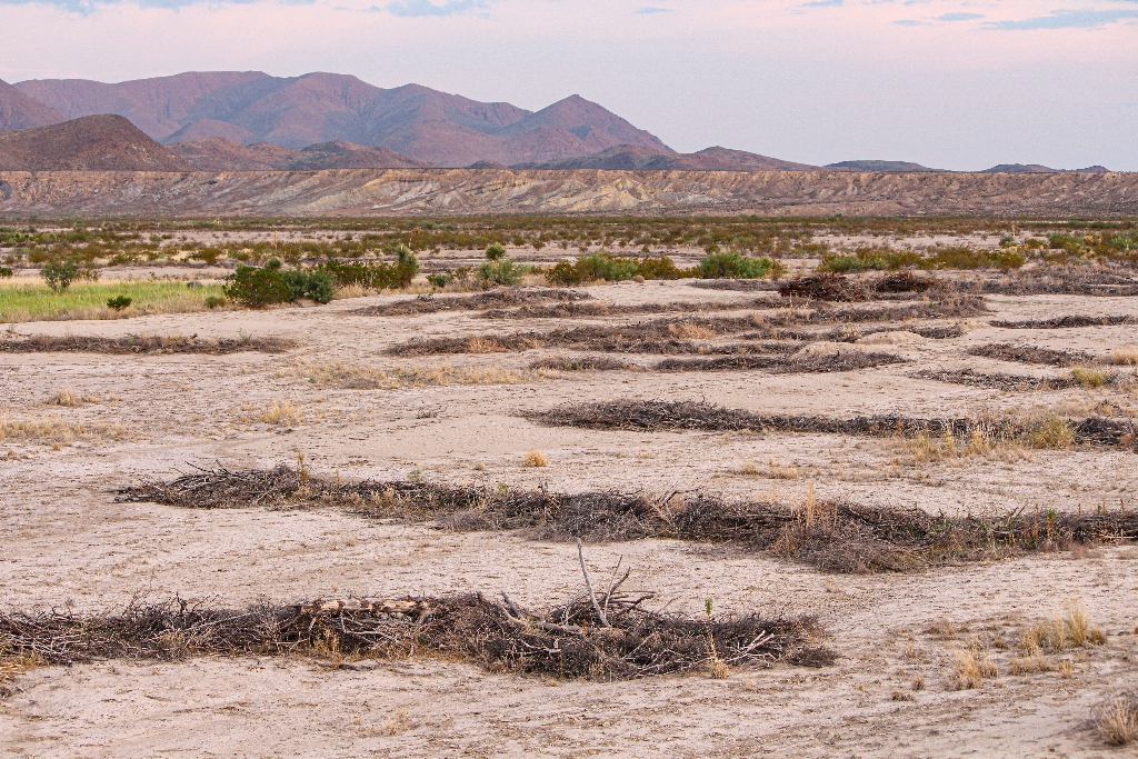
You are approaching an area known as Tornillo Flat, a long plain formed by the erosive action of Tornillo Creek and its tributaries. Prior to 1920, settlers describe Tornillo Flat as a grassland covered by tobosa grass. Pronghorn once ran here over the grassy flats. This grassland provided some of the best range in West Texas, allowing for the birth and growth of successful ranches.
However, decades of overgrazing by livestock began to eliminate the grasses. Drought killed what remained. Once the protective grass cover was removed, erosion stripped the precious topsoil away and the land lost its ability to hold water.
Can damaged lands be restored? The National Park Service has taken on the challenge of restoring native grasses with a long-term project called "Grasslands Not Badlands." Over the years, and through trial and error, park staff have researched and developed different techniques to encourage growth of native grass species. A successful method has evolved to lay lines of dead vegetation perpendicular to the flow of water across the landscape. These strips slow the flow of run off after it rains and let the soil absorb more moisture. This technique is visible on both sides of the road between mile markers 11 and 10.
Is there something we missed for this itinerary?
Itineraries across USA

Acadia

Arches National Park

Badlands

Big Bend

Biscayne

Black Canyon Of The Gunnison

Bryce Canyon

Canyonlands

Capitol Reef

Carlsbad Caverns

Channel Islands

Congaree

Crater Lake

Cuyahoga Valley

Death Valley

Dry Tortugas

Everglades

Gateway Arch

Glacier

Grand Canyon

Grand Teton

Great Basin

Great Smoky Mountains

Guadalupe Mountains

Haleakalā

Hawaiʻi Volcanoes

Hot Springs

Indiana Dunes

Isle Royale

Joshua Tree

Kenai Fjords

Kobuk Valley

Lassen Volcanic

Mammoth Cave

Mesa Verde

Mount Rainier

North Cascades

Olympic

Petrified Forest

Pinnacles

Rocky Mountain

Saguaro

Shenandoah

Theodore Roosevelt

Virgin Islands

Voyageurs

White Sands

Wind Cave

Yellowstone

Yosemite

Zion