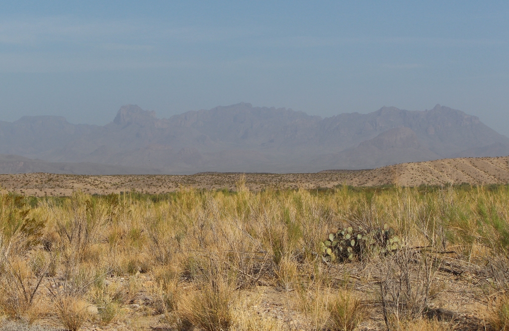
How far can you see? From this mile marker, you should have a great view of the Chisos Mountains, located about 18 miles to the south. But some days the air quality is so poor that those mountains are lost in a haze of pollution.
Over half of Big Bend's visibility impairment is due to sulfates, while organic carbons, nitrates, and wind-blown particles account for the remaining components. Sources of sulfate particles include coal-fired power plants, metal smelters, refineries, and other industrial facilities.
Air quality here varies significantly by season. Prevailing winter winds are from the north and west, while summer winds are usually from the south and east. Air masses arriving from the southeast bring the highest concentrations of sulfates and create the poorest visibility. Research indicates that, during this peak period, pollution originates from sources in the eastern United States, east Texas, and northeast Mexico.
What can be done? The National Park Service works cooperatively with the Environmental Protection Agency, the state of Texas, and Mexico to improve visibility in Big Bend. The use of modern emission-control technology on existing pollution sources, the careful placement and control of new industry, and the involvement of concerned citizens can help to restore visiblity.
Is there something we missed for this itinerary?
Itineraries across USA

Acadia

Arches National Park

Badlands

Big Bend

Biscayne

Black Canyon Of The Gunnison

Bryce Canyon

Canyonlands

Capitol Reef

Carlsbad Caverns

Channel Islands

Congaree

Crater Lake

Cuyahoga Valley

Death Valley

Dry Tortugas

Everglades

Gateway Arch

Glacier

Grand Canyon

Grand Teton

Great Basin

Great Smoky Mountains

Guadalupe Mountains

Haleakalā

Hawaiʻi Volcanoes

Hot Springs

Indiana Dunes

Isle Royale

Joshua Tree

Kenai Fjords

Kobuk Valley

Lassen Volcanic

Mammoth Cave

Mesa Verde

Mount Rainier

North Cascades

Olympic

Petrified Forest

Pinnacles

Rocky Mountain

Saguaro

Shenandoah

Theodore Roosevelt

Virgin Islands

Voyageurs

White Sands

Wind Cave

Yellowstone

Yosemite

Zion