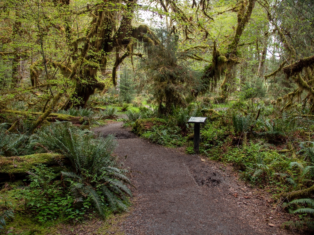
A short rain forest loop, the Spruce Nature Trail packs incredible variety into just 1.2 miles (1.9 km). This is a great place to look for the fascinating phenomenon known as "nurse logs" - fallen trees which provide a place for new seedlings to grow. You can see them at every stage, from the new-fallen log with brand new baby trees sprouting on it to the rows of centuries-old trees whose "nurse log" has long since rotted away, leaving them standing in a perfectly straight line, called a colonnade. The trail also winds past the Hoh River, with its unique pale blue glacial waters flowing down from Mount Olympus to the Pacific.
Full Accessibility Description
Length: 6,645 feet, 1.25 miles; Loop: 6,040 feet, 1.14 miles
Surface Type: Compacted gravel
Typical Trail Width: First 350 feet: 6 feet; 350-720: 3 feet; 720-6,040 feet: 2-3 feet
Typical Running Slope: First 400 feet: under 5%; remainder fluctuating uphill and downhill with numerous steep grades typically less than 50 feet in length ranging from 7-25%, interspersed with gentle stretches
Typical Cross Slope: Less than 2%
Elevation Gain/Loss: Less than 65 feet
Accessible Parking: Van-accessible parking immediately across from park information boards
Description: The Hoh parking area has five van-accessible parking spaces. From the parking area, cross the crosswalk and turn right to reach the trailhead where several boards display information about the area. From the information boards, proceed forward for 310 feet to an intersection. There is a bench on the left at 200 feet. At the intersection, go to the right. At 350 feet cross the 30-foot bridge. The trail narrows from 6 feet to 3 feet after the bridge. From 400 to 455 feet, the trail climbs at 14-17% grade to another intersection. The Hoh River Trail is to the left. Proceed to the right for the Spruce Nature Trail. Continue downhill for 50 feet at 8-11% grade, followed by 30 feet of uphill at 6-8% to reach the start of the loop trail. Turn left and continue uphill at 14-17% grade incline. At 640 feet, there is a staircase with nine stairs. The steps are 4-6 inches high with long treads between, sloping upward at 8-11%. At the top of the staircase, continue uphill at a maximum grade of 10% for 750 feet, completing the longest continuous climb of the trail. After this point, the trail is a series of ups and downs with more level sections in between, before meeting back at the beginning intersection to complete the loop.
Is there something we missed for this itinerary?
Itineraries across USA

Acadia

Arches National Park

Badlands

Big Bend

Biscayne

Black Canyon Of The Gunnison

Bryce Canyon

Canyonlands

Capitol Reef

Carlsbad Caverns

Channel Islands

Congaree

Crater Lake

Cuyahoga Valley

Death Valley

Dry Tortugas

Everglades

Gateway Arch

Glacier

Grand Canyon

Grand Teton

Great Basin

Great Smoky Mountains

Guadalupe Mountains

Haleakalā

Hawaiʻi Volcanoes

Hot Springs

Indiana Dunes

Isle Royale

Joshua Tree

Kenai Fjords

Kobuk Valley

Lassen Volcanic

Mammoth Cave

Mesa Verde

Mount Rainier

North Cascades

Olympic

Petrified Forest

Pinnacles

Rocky Mountain

Saguaro

Shenandoah

Theodore Roosevelt

Virgin Islands

Voyageurs

White Sands

Wind Cave

Yellowstone

Yosemite

Zion