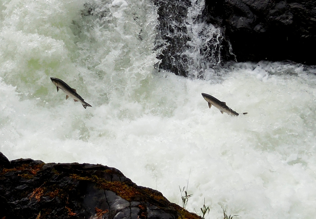
5 miles (8 km) up the Sol Duc road, stop by this viewing platform to witness the iconic leap of determined fish up a waterfall on their way to spawn. The view of the cascades is lovely year-round, but if you hope to see fish, look for Coho salmon in September and October, or steelhead trout from late March through May. These anadromous fish (meaning they live in both fresh and salt water) are born in the Sol Duc River, but spend most of their lives in the Pacific Ocean before returning home to spawn. Fishing is not allowed near Salmon Cascades. If you plan to fish, be sure to check the park fishing regulations for appropriate areas, limits, and equipment limitations. Please also be aware that to protect the fish resources, much of the park is only open to catch and release fishing.
Full Accessibility Description
Length: 190 feet to viewing platformSurface Type: Compacted gravel
Typical Trail Width: 6 feet
Typical Running Slope: Less than 5% with one 12-foot uphill to the viewing platform 7-11%
Typical Cross Slope: Less than 2%
Elevation Gain/Loss: Less than 25 feet
Accessible Parking: Van-accessible parking along parking area.
Description: The primary purpose for this trail is to provide access to a viewing platform that is perched above Salmon Cascades on the Sol Duc River. In late summer/early fall, coho salmon can be seen leaping out of the water as they make their way upriver to spawn. The trailhead is at approximately milepost 7 on the Sol Duc Road. There is a van-accessible parking space immediately in front of the trail, and a picnic table and accessible toilet available to the right down a gravel walkway.
The trail proceeds into the woods at grades under 5%. At 100 feet there is a root in the center of the trail that creates a slight hump, but runs in-line with the trail, and can be easily navigated around. At 140 feet, the trail arrives at an intersection. The viewing platform is 50 feet further to the right from the intersection, including a brief steep climb for 12 feet at 7-11%. Continuing straight from the intersection, the trail narrows to a 2-foot width. The first 35 feet climbs at steep grades up to 15% then levels out, ending at a 2-3 foot drop off near the river.
Is there something we missed for this itinerary?
Itineraries across USA


