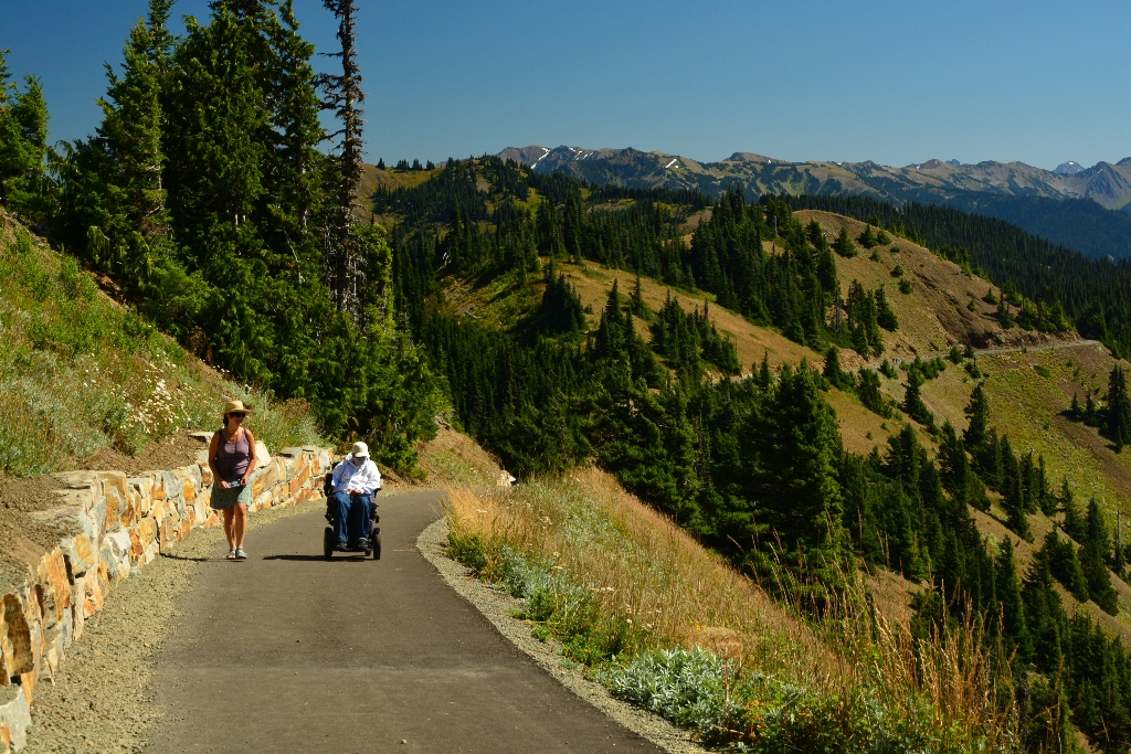
One of the most popular day hikes is the Hurricane Hill trail, about 3 miles (4.8 km) round trip and climbing 700 feet (213 meters) to a high point with 360-degree views in clear weather. The trailhead is at the end of the road, just 1.3 miles (2.1 km) past the Hurricane Ridge Visitor Center. Overflow parking is available at Picnic Area B.
Full Accessibility Description
Length: 8,600 feet, 1.63 milesSurface Type: Asphalt pavement
Typical Trail Width: 8 Feet
Typical Running Slope: First 2,700 feet under 5% with one 150 foot stretch from 7-9%. From 2,700-8,550 feet very steep with many sections 15-20%.
Typical Cross Slope: Less than 1%
Elevation Gain/ Loss: First 2,700 feet: net gain 10 feet, maximum gain/ loss 20 feet. Entire Trail: 645 feet
Accessible Parking: Van-accessible parking immediately across from the trailhead
Description: The Hurricane Hill trailhead is at the end of the Hurricane Hill Road, 2 miles past the Hurricane Ridge Visitor Center. The trail starts at the northwest corner of the parking area and contours to the south side of the hill offering spectacular views of the Olympic Mountains. At the top, there are also views to the north of Griff Peak, Vancouver Island and the Strait of Juan de Fuca.
Initially the trail goes downhill for 400 feet at a gentle grade under 6%. From 400 to 750 feet, the trail proceeds uphill. This stretch is at 7% with a steeper 150-foot stretch in the middle at 8-9%. The trail levels out at the top and is under 2% grade for the next 650 feet. At 1,400 feet, the trail heads downhill around a curve at less than 5% grade for the next 300 feet. The trail is on a steeply-cut bank through this section with exposure to a considerable drop on the outside edge. Those affected by heights may wish to remain on the inside edge of the trail.
The trail continues through gradual ups and downs under 5% until 2,450 feet. From 2,450 to 2,700 feet the trail again goes downhill at about 6%. This is a good location to consider turning back. It is a strenuous hike past this point. From 2,700 to 3,700 feet, the trail is extremely steep with grades ranging from 10 to 18%. The trail continues uphill to its terminus at the top of Hurricane Hill, alternating between moderately steep and extremely steep grades as follows:
From 3,700 to 3,900 feet, grades range from 4-6%
From 3,900 to 4,300 feet, grades range from 8-11%
From 4,300 to 5,700 feet, grades range less than 8%
From 5,700 to 8,200 feet, grades range from 10-18%
Is there something we missed for this itinerary?
Itineraries across USA

Acadia

Arches National Park

Badlands

Big Bend

Biscayne

Black Canyon Of The Gunnison

Bryce Canyon

Canyonlands

Capitol Reef

Carlsbad Caverns

Channel Islands

Congaree

Crater Lake

Cuyahoga Valley

Death Valley

Dry Tortugas

Everglades

Gateway Arch

Glacier

Grand Canyon

Grand Teton

Great Basin

Great Smoky Mountains

Guadalupe Mountains

Haleakalā

Hawaiʻi Volcanoes

Hot Springs

Indiana Dunes

Isle Royale

Joshua Tree

Kenai Fjords

Kobuk Valley

Lassen Volcanic

Mammoth Cave

Mesa Verde

Mount Rainier

North Cascades

Olympic

Petrified Forest

Pinnacles

Rocky Mountain

Saguaro

Shenandoah

Theodore Roosevelt

Virgin Islands

Voyageurs

White Sands

Wind Cave

Yellowstone

Yosemite

Zion