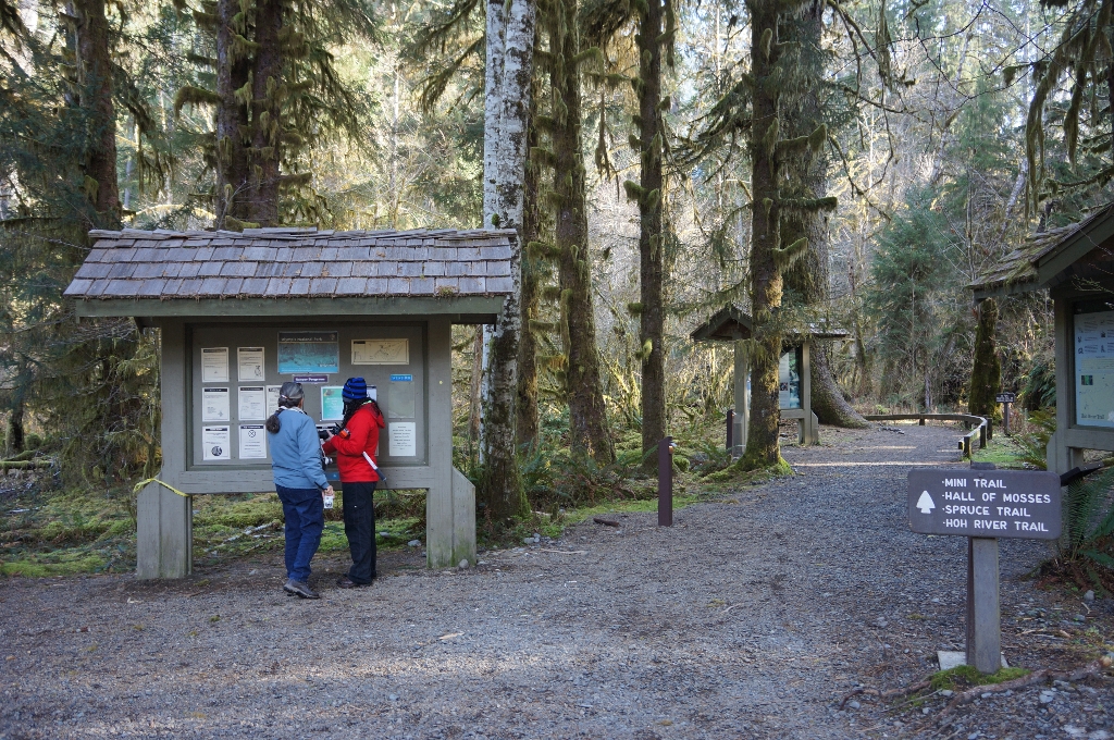
Perhaps the shortest trail in the park!
Surface Type: Compacted gravel
Typical Trail Width: 4-6 feet
Typical Running Slope: Under 5%
Typical Cross Slope: Less than 1%
Elevation Gain/Loss: Less than 15 feet
Accessible Parking: Van-accessible parking immediately across from park information boards
Description: The Hoh parking area has five van-accessible parking spaces. From the parking area, cross the crosswalk and turn right to reach the trailhead where several boards display information about the area. From the park information boards, proceed forward for 310 feet and then follow to the left at the intersection. Trailside benches can be found at 200 feet on the left and at 360 feet on the right. Continue to the next intersection at 450 feet and turn left again. At 475 feet, cross an 8-foot long bridge. Continue forward for 70 feet to a second bridge that is 25-feet long with a 2-inch drop when going off the other end. At 605 feet, there is a tree root across most of the trail, 1-2 inches high. Continue forward to reach the visitor center at 660 feet. To complete the loop, follow the sidewalk around the visitor center towards the parking area.
Full Accessibility Description:
Length: 800 feetSurface Type: Compacted gravel
Typical Trail Width: 4-6 feet
Typical Running Slope: Under 5%
Typical Cross Slope: Less than 1%
Elevation Gain/Loss: Less than 15 feet
Accessible Parking: Van-accessible parking immediately across from park information boards
Description: The Hoh parking area has five van-accessible parking spaces. From the parking area, cross the crosswalk and turn right to reach the trailhead where several boards display information about the area. From the park information boards, proceed forward for 310 feet and then follow to the left at the intersection. Trailside benches can be found at 200 feet on the left and at 360 feet on the right. Continue to the next intersection at 450 feet and turn left again. At 475 feet, cross an 8-foot long bridge. Continue forward for 70 feet to a second bridge that is 25-feet long with a 2-inch drop when going off the other end. At 605 feet, there is a tree root across most of the trail, 1-2 inches high. Continue forward to reach the visitor center at 660 feet. To complete the loop, follow the sidewalk around the visitor center towards the parking area.
Is there something we missed for this itinerary?
Itineraries across USA

Acadia

Arches National Park

Badlands

Big Bend

Biscayne

Black Canyon Of The Gunnison

Bryce Canyon

Canyonlands

Capitol Reef

Carlsbad Caverns

Channel Islands

Congaree

Crater Lake

Cuyahoga Valley

Death Valley

Dry Tortugas

Everglades

Gateway Arch

Glacier

Grand Canyon

Grand Teton

Great Basin

Great Smoky Mountains

Guadalupe Mountains

Haleakalā

Hawaiʻi Volcanoes

Hot Springs

Indiana Dunes

Isle Royale

Joshua Tree

Kenai Fjords

Kobuk Valley

Lassen Volcanic

Mammoth Cave

Mesa Verde

Mount Rainier

North Cascades

Olympic

Petrified Forest

Pinnacles

Rocky Mountain

Saguaro

Shenandoah

Theodore Roosevelt

Virgin Islands

Voyageurs

White Sands

Wind Cave

Yellowstone

Yosemite

Zion