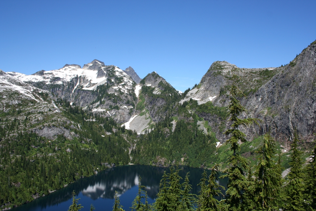
This trail provides views of high mountain lakes and nearby peaks. The trail is level - and often brushy - for the first 2 miles (3.2 km) then gains elevation through cool, old-growth forest. Stop on the ridge above Thornton Lake (4.5 miles/7.2 km) for great views. For a longer, more strenuous day, scramble up Trapper Peak or down to the lake.
- Difficulty: Moderately strenuous.
- Distance and elevation: 10.4 miles (16.7 km) roundtrip with 2,300 ft (700 m) elevation gain.
- Access: From milepost 117 on State Route 20, follow the Thornton Lake Road for 5 miles (8 km) to the trailhead (rough road - not recommended for low-clearance vehicles).
- Leashed dogs allowed up to the national park boundary.
- Backcountry camping is allowed in designated sites only with a backcountry permit.
Is there something we missed for this itinerary?
Itineraries across USA

Acadia

Arches National Park

Badlands

Big Bend

Biscayne

Black Canyon Of The Gunnison

Bryce Canyon

Canyonlands

Capitol Reef

Carlsbad Caverns

Channel Islands

Congaree

Crater Lake

Cuyahoga Valley

Death Valley

Dry Tortugas

Everglades

Gateway Arch

Glacier

Grand Canyon

Grand Teton

Great Basin

Great Smoky Mountains

Guadalupe Mountains

Haleakalā

Hawaiʻi Volcanoes

Hot Springs

Indiana Dunes

Isle Royale

Joshua Tree

Kenai Fjords

Kobuk Valley

Lassen Volcanic

Mammoth Cave

Mesa Verde

Mount Rainier

North Cascades

Olympic

Petrified Forest

Pinnacles

Rocky Mountain

Saguaro

Shenandoah

Theodore Roosevelt

Virgin Islands

Voyageurs

White Sands

Wind Cave

Yellowstone

Yosemite

Zion