Season: Summer (May – November)
SR123 typically opens for the season in May, depending on weather and snow plowing operations. Ohanapecosh on SR 123 is generally open via Hwy 12 from Yakima or Packwood from late May to early November.
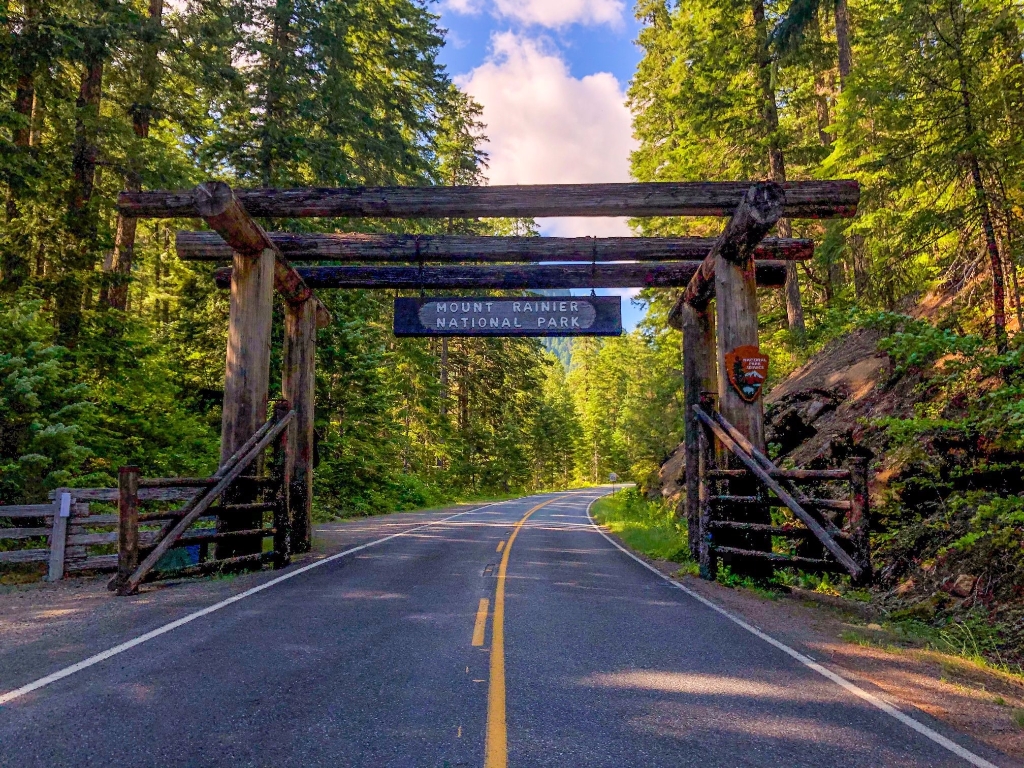
The southeastern entrance to the park is located 10 miles north of Packwood, Washington on SR123. One and a half miles after the arch, the highway reaches Ohanapecosh. Continue another 1.8 miles to reach the junction with Stevens Canyon Road, which leads to Paradise. Continue north on the highway through the eastern side of the park, eventually intersecting with Mather Memorial Parkway (SR410) at Cayuse Pass.
When settlers arrived and began inhabiting the area, a rough private road was built to reach the Ohanapecosh Hot Springs from the town of Lewis (now Packwood). This area was not included in the original boundaries when Mount Rainier National Park was established in 1899. After completing the road to Paradise in 1915, park officials saw a need for increasing vehicle access to the park and sought to construct a road “round-the-mountain". Extending the national park boundaries to include Ohanapecosh in 1931 offered the opportunity for a better route in the southeastern section than previously available. This allowed for officials to proceed with the previously proposed East Side Highway, which would extend from Ohanapecosh to Cayuse Pass, and construction began the same year.
The East Side Highway was completed in 1940 and is now known as State Route 123. The archway for the entrance to the park was not included with the original construction of the road and was added in 1976 to give consistency with the look and feel of the historic Nisqually Entrance. The arch was constructed with peeled cedar logs and is in keeping with the signature rustic style seen throughout the park.
Is there something we missed for this itinerary?
Itineraries across USA


