Title: Shaped by Fire and Ice
Main Text
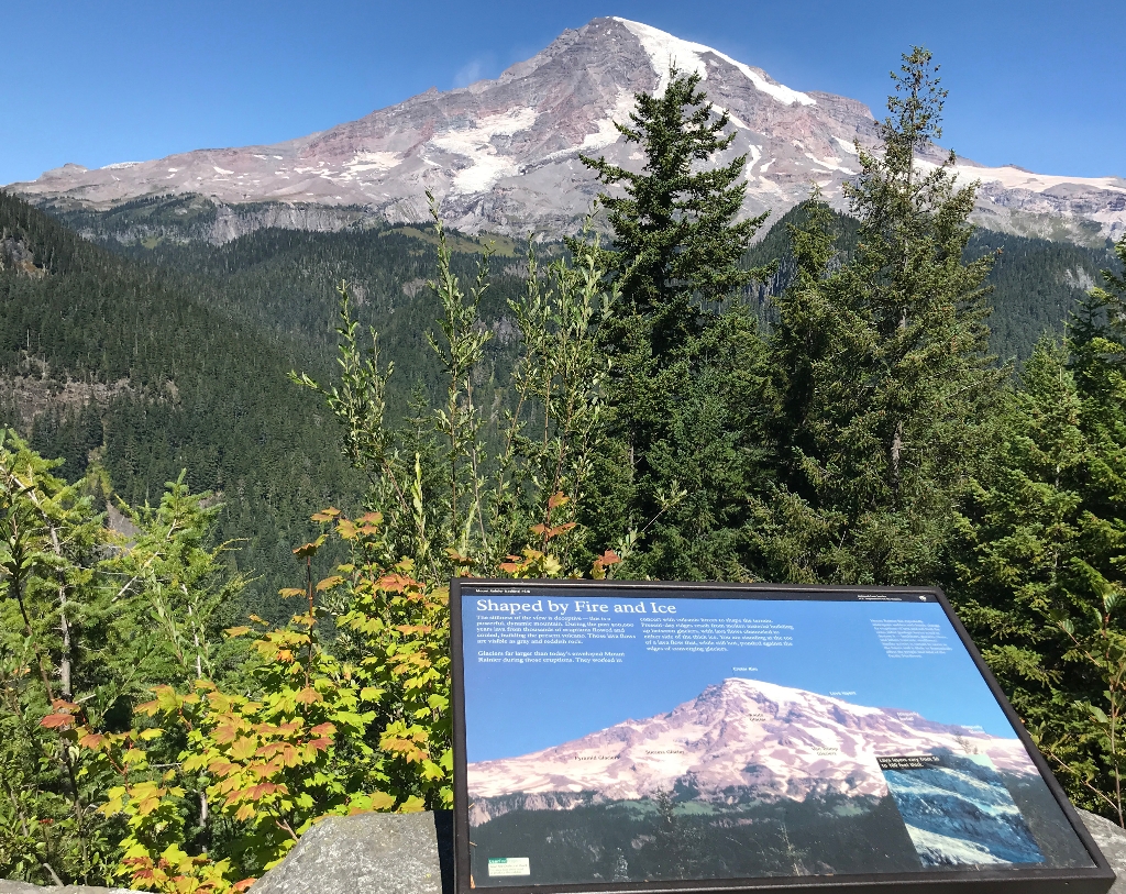
The stillness of the view is deceptive- this is a powerful, dynamic mountain. During the past 500,000 years lava from thousands of eruptions flowed and cooled, building the present volcano. Those lava flows are visible as gray and reddish rock.
Glaciers far larger than today's enveloped Mount Rainier during those eruptions. They worked in concert with volcanic forces to shape the terrain. Present day ridges result from molten material building up between glaciers, with lava flows channeled to either side of the thick ice. You are standing at the toe of a lava flow that, while still hot, ponded against the edges of converging glaciers.
Secondary Text
Mount Rainier has repeatedly undergone sudden and drastic change. As eruptions of lava and ash built the cone, other geologic forces acted to destroy it - landslides, glaciers, rivers, and lahars (volcanic mudflows). Similiar activity is certain to occur in the future and is likely to dramatically affect the people and land of the Pacific Northwest.
Exhibit Panel Description
A single photo of Mount Rainier fills the entire frame of the exhibit panel. The text stretches across the top third of the exhibit panel against a clear blue sky over the summit of the mountain. The view of the mountain in the photo is from the same location and perspective of the view from the exhibit panel location. The mountain peak is labeled "Crater Rim", with rocky ridges descending to either side. Below the summit on the front-face of the mountain, a glacier labeled "Kautz Glacier" descends between broken, rocky ridges. To the left of Kautz Glacier, two more glaciers fills shallow bowls between rocky ridges. "Success Glacier" is labeled in the middle, with "Pyramid Glacier" on the far left. To the right of Kautz Glacier a patchwork of glacial ice is labeled "Van Trump Glaciers". From the Crater Rim, a glacier descends the far right ridge of the mountain, cascading over a rocky promintory labeled "Lava Layers". The ice cascade is labeled "Nisqually Icefall", with the glacier below labeled "Nisqually Glacier". A small inset photo below the Nisqually Glacier is captioned "Lava layers vary from 50 to 100 feet thick" and shows a close-up view of a section of the rocky lava layers on the mountain's slope. A small box in the lower left corner of the exhibit panel reads "User Fee Project. Your Fee Dollars at Work. Entrance fees were used to produce this exhibit".
Visit This Exhibit Panel
Ricksecker Point is located approximately 6.5 miles from Longmire and 5 miles from Paradise along the road to Paradise. A one-way scenic loop drive traces the edge of Ricksecker Point. The second exhibit panel is located in pullout approximately 0.27 miles along the road, overlooking the Nisqually and Paradise River Valleys. Ricksecker Point Road is open to vehicles during the summer, typically from May-October.
Is there something we missed for this itinerary?
Itineraries across USA


