Season: Summer
Paradise is open year-round, but this orientation guide is designed for the summer season when trails are snow-free. In spring and fall, there may be patches of snow covering sections of trail. Please stay on trails, even if it means crossing snow, to avoid trampling delicate meadow plants. Pets are not allowed on trails.
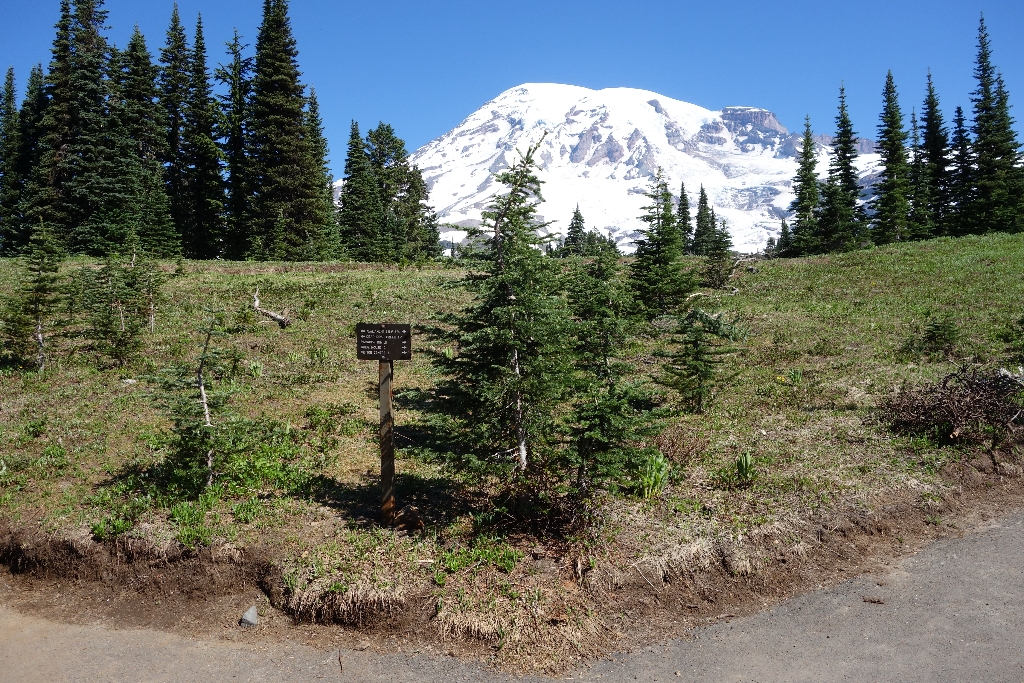
This location is the main junction of Avalanche Lily Trail and Alta Vista Trail. The summit of Mount Rainier is visible to the northwest with the Alta Vista trail heading uphill to the north. A short bypass trail also connects the Avalanche Lily Trail and Alta Vista Trails uphill from this main intersection.
- Avalanche Lily Trail is oriented roughly east-west at this intersection, with the trail to the east connecting to the Jackson Visitor Center and upper parking lot and the trail to the west connecting to the Deadhorse Creek Trail. The bypass trail connects back to the Alta Vista Trail on the right after 150 feet heading west along the Avalanche Lily Trail.
- Alta Vista Trail is oriented roughly north-south at this intersection, with the uphill trail to the north, and the downhill trail heading south towards the lower Paradise parking lot. The bypass trail connects back to the Avalanche Lily Trail on the left after 150 feet heading north along the Alta Vista Trail.
How Far Is It?
- Jackson Visitor Center and Upper Parking Lot: 0.14 miles, average walking time 6 minutes, east on the Avalanche Lily Trail. Restrooms, information, food, and gifts available at the visitor center. Connects to the main Paradise Meadows & Skyline Trailhead at the Muir Steps to access the Skyline Trail and Myrtle Falls.
- Connecting to Nisqually Vista Trail: 0.21 miles, average walking time 9 minutes, by heading west on Avalanche Lily Trail to the Deadhorse Creek and Avalanche Lily Trail Junction then take Deadhorse Creek Trail to connect to Nisqually Vista Trail.
- Connecting to Waterfall Trail: 0.18 miles, average walking time 7 minutes, north on Alta Vista Trail (uphill). While the Waterfall Trail connects to Myrtle Falls, a more direct route is to take the Avalanche Lily trail east to the main Paradise Meadows & Skyline Trailhead near the Jackson Visitor Center.
- Connecting to Skyline Trail: 0.22 miles, average walking time 9 minutes, north on Alta Vista Trail (uphill) and continue straight past the Waterfall Trail junction.
- Lower Parking Lot: 0.16 miles, average walking time 6 minutes, south on Alta Vista Trail (downhill). There are no restrooms in the lower parking lot, but restrooms are available in the Paradise Picnic Area downhill from the parking lot.
For additional information, download the Paradise Area Trails Map.
Is there something we missed for this itinerary?
Itineraries across USA


