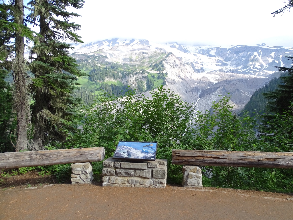
The Nisqually Glacier is one of six glaciers on Mount Rainier that begins at the summit of the mountain. It is also the best surveyed and monitored glaciers on the mountain. Due to easy access and its prominent location near Paradise, the glacier has been studied since the mid-1850s. The product of this research is a record of Nisqually Glacier change spanning nearly 150 years. Although the glacier has had some small advances in that time, these records indicate that the Nisqually Glacier – and most other glaciers on Mount Rainier – has retreated significantly in the last century.
The upper zone of the glacier, where snowfall exceeds melting, is called the accumulation zone. The lower area where melting exceeds snowfall is termed the ablation zone. An equilibrium line, where ice accumulation equals ice loss, separates these zones. A rising equilibrium line indicates a glacial retreat, while a lowering equilibrium line signals that the glacier may advance down-valley. Changes in glacier size (advance and retreat) depend on the climate including air temperature and snowfall.
While the response of each glacier depends on its local conditions, the two main factors driving glacier change are precipitation with low temperatures in winter, and rate of melt due to higher temperatures in summer. The current trend of glacier loss seems to be largely the result of a regional tendency toward warmer weather, resulting in less snowfall and higher melting. During the Ice Ages, the Nisqually Glacier terminated 30 miles down-valley, beyond Ashford and Elbe. Photographs from the early 1900s show park visitors posing at the Nisqually Bridge on the way to Paradise with the glacier clearly visible over their shoulders. Today, the terminus of the glacier is almost 1.5 miles up-valley from the bridge.
To learn more, read the exhibit panel here as the next stop on this tour, and visit our website with internet access here: Glaciers.
Is there something we missed for this itinerary?
Itineraries across USA

Acadia

Arches National Park

Badlands

Big Bend

Biscayne

Black Canyon Of The Gunnison

Bryce Canyon

Canyonlands

Capitol Reef

Carlsbad Caverns

Channel Islands

Congaree

Crater Lake

Cuyahoga Valley

Death Valley

Dry Tortugas

Everglades

Gateway Arch

Glacier

Grand Canyon

Grand Teton

Great Basin

Great Smoky Mountains

Guadalupe Mountains

Haleakalā

Hawaiʻi Volcanoes

Hot Springs

Indiana Dunes

Isle Royale

Joshua Tree

Kenai Fjords

Kobuk Valley

Lassen Volcanic

Mammoth Cave

Mesa Verde

Mount Rainier

North Cascades

Olympic

Petrified Forest

Pinnacles

Rocky Mountain

Saguaro

Shenandoah

Theodore Roosevelt

Virgin Islands

Voyageurs

White Sands

Wind Cave

Yellowstone

Yosemite

Zion