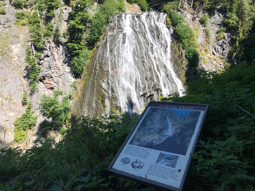
Title: Narada Falls
Main Text
Mount Rainier erupted andesite lava flows which filled and hardened in ancient valleys cut into the older, tougher Tatoosh granodiorite. The Paradise River is eroding into the soft contact zone between these two rock formations as the water plunges over the andesite ledge at Narada Falls.
Snowfields and inactive glaciers melt into the clear water. These sources in Paradise Valley form the Paradise River. Active glaciers grind rocks into fine powder called glacial flour. This material in suspension gives a gray, milky appearance to streams originating from active glaciers.
Exhibit Panel Description
The Narada Falls exhibit panel is vertical in orientation, with the title across the top against a dark brown band. A photo underneath the title shows a waterfall cascading off a rocky cliff into a narrow gorge. A rainbow arches through the mist at the bottom of the waterfall. Underneath the photo, the text forms two columns. On the left, the first paragraph of text has two black line-drawings of rocks underneath. One rock on the left is roughly circular with a fine texture and is labeled "granodiorite". The second rock drawing is a cluster of angular chunks and is labeled "andesite". In the right-side column, a second paragraph of text. Above the text is a small photo showing the terminus of a glacier with a river flowing out of a small cave in the ice. The glacier is covered in rocky debris.
Visit This Exhibit Panel
The Narada Falls exhibit panel is located from the lower falls viewpoint, which is down a steep 0.2 miles trail that starts on the far side of the historic bridge at the Narada Falls pullout along the Paradise Road. The Paradise Road is open year-round, but closes nightly during the winter. During the winter, the trail to the lower viewpoint can be extremely icy and snow-covered.
Is there something we missed for this itinerary?
Itineraries across USA


