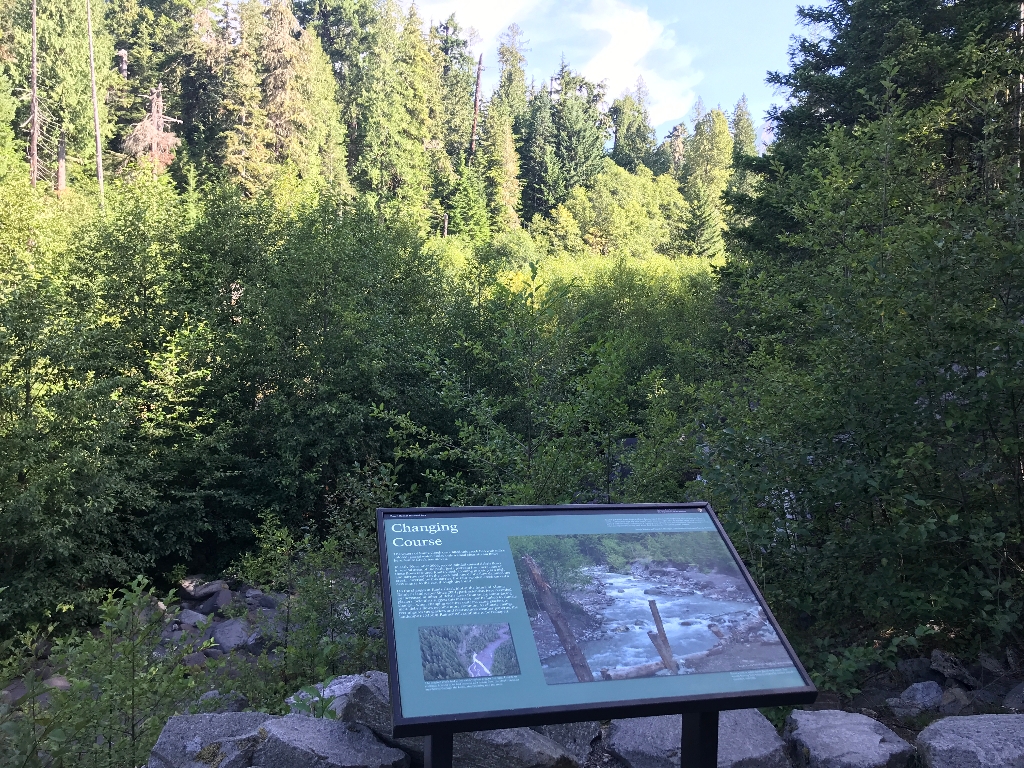
Title: Changing Course
Main Text
The waters of Kautz Creek once filled this creek bed with milky colored, glacier-fed water. Today only a small clear stream flows here. Kautz Creek has moved.
In early November 2006, record rainfall caused debris flows in several areas of the park. Just upstream from here, one of these flows rerouted Kautz Creek. Coming to a stop at a high and narrow point in the creek bed, the debris flow dammed the creek. Diverted by this barrier, the rain-swollen creek carved a new course to the east through the forest.
Do the changes at Kautz Creek hint at the future of Mount Rainier's landscape? Since 2001, park scientists have recorded an increased number of debris flows from small, south-facing glaciers. Scientists suggest this increase may be linked to climate change- when changing weather patterns cause glaciers to melt, debris flows become more common. As climate change reconfigures the glaciers and restructures weather patterns, the landscape of Mount Rainier will continue to be reshaped.
Secondary Text
"Glacier-generated debris flows at Mount Rainier travel downstream at speeds of 10 to 20 miles per hour or more... These flows typically have steep, bouldery snouts-- up to 30 to 60 feet high in the most constricted parts of a stream valley-- followed by a churning mass of mud, rock, and vegetation. Their deafening noise is often accompanied by strong local wind, thick dust clouds, and violent ground shaking."
- Joseph Walder and Carolyn Driedger, United States Geologic Survey (USGS)
Exhibit Panel Description
The exhibit panel has a green background, with the main text in a column on the left third of the panel. Below the main text, a small aerial photo shows a creek flowing into a forest instead of through its original wide, gravel creek bed. A caption below the photo reads: "The original creek bed is the wide, treeless area to the right. Unable to continue flowing in its bed because of a debris flow, the creek rerouted and flowed through the forest, disappearing into the trees." A larger photo fills up the right two-thirds of the exhibit panel, with the secondary text above it. The photo shows a large creek flowing along a rocky bed in a forest. Logs in a fence-like structure shore up one edge of the creek bed. A caption in the lower right corner of the photo reads: "Kautz Creek before the flood and rechanneling." A secondary caption below the photo reads: "Kautz Creek is made up of glacial melt water. The stream flowing here today is created by surface runoff- snowmelt and rain."
Visit This Exhibit Panel
From the Kautz Creek parking lot, cross the road to the Kautz Creek Nature Trail. Kautz Creek, open year-round, is located three miles east of the Nisqually Entrance in the southwest corner of the park along the road to Longmire.
Is there something we missed for this itinerary?
Itineraries across USA


