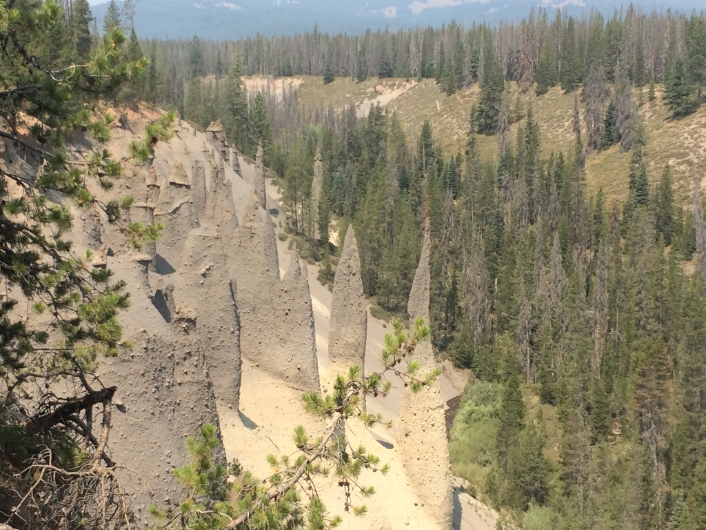
What are they?
The final eruption of Mount Mazama blew volcanic material miles into the air. This was followed by the ejection of gas-charged matter through vents in fractures around the mountain which weakened and ultimately caused the upper mountain to collapse. Rather than rising upwards, the volcanic matter ejected through vents flowed rapidly downhill, filling surrounding valleys to a depth of 300 ft (100 m). Once the flows stopped, trapped gases escaped through fumeroles, and surrounding material hardened. As the streams reclaimed the valley the erosion-resistant spires were exposed.Where can I see them?
The classic view is located in Wheeler Creek Canyon at the end of Pinnacles Road from East Rim Drive. A 0.8 (1.3 km) trail is an easy walk along the rim of the valley where the pinnacles are visible.These can only be seen when East Rim Drive and Pinnacles Road are open. When the roads are closed, look for the pinnacles in the Annie Creek watershed and canyon from several view points along South Hwy 62.
Is there something we missed for this itinerary?
Itineraries across USA

Acadia

Arches National Park

Badlands

Big Bend

Biscayne

Black Canyon Of The Gunnison

Bryce Canyon

Canyonlands

Capitol Reef

Carlsbad Caverns

Channel Islands

Congaree

Crater Lake

Cuyahoga Valley

Death Valley

Dry Tortugas

Everglades

Gateway Arch

Glacier

Grand Canyon

Grand Teton

Great Basin

Great Smoky Mountains

Guadalupe Mountains

Haleakalā

Hawaiʻi Volcanoes

Hot Springs

Indiana Dunes

Isle Royale

Joshua Tree

Kenai Fjords

Kobuk Valley

Lassen Volcanic

Mammoth Cave

Mesa Verde

Mount Rainier

North Cascades

Olympic

Petrified Forest

Pinnacles

Rocky Mountain

Saguaro

Shenandoah

Theodore Roosevelt

Virgin Islands

Voyageurs

White Sands

Wind Cave

Yellowstone

Yosemite

Zion