Geographic Isolation
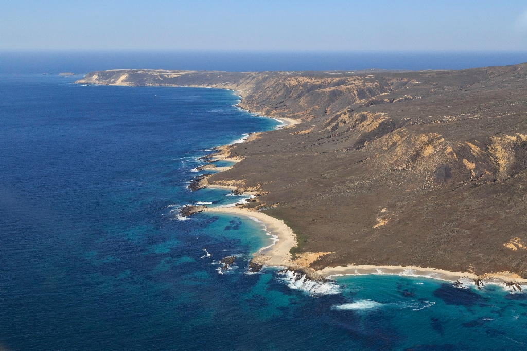
Although it probably feels as if the steep trail up Nidever Canyon will never end, eventually, at about 500 feet in elevation, the terrain will level out to a plateau. This is plateau is a marine terrace-an ancient shoreline carved flat by wave action and exposed through changes in sea level and tectonic uplift of the land. Remnants of this and other marine terraces can be found around much of the island's coastline. A future marine terrace (called a wave-cut platform) is being created by wave erosion at the base of the sea cliffs below you.
The islands' first shoreline was created around five million years ago, when compressional forces, caused by the ramming of Baja California into southern California, resulted in folding and faulting of marine sediments and volcanic rocks (deposited between 15-30 million years ago) and the eventual uplift of the islands. These compressional forces are still ongoing, making this area geologically active today. Earthquakes are quite common and all the islands continue to be uplifted.
Ever since these compressional forces caused the islands to emerge from the sea, they have been separated from the mainland. For decades, scientists assumed that the two were connected by a land bridge, but as bathymetric information (or topography) of the sea floor improved, it revealed that even during periods of lowest sea levels (about 17,000 years ago), the islands still remained isolated by at least four miles of ocean. It is this continuous geographical isolation that has shaped island life.
Santarosae
Although never connected to the mainland by a land bridge, the four northern islands were once part of the Pleistocene 'superisland' known as Santarosae, nearly four times as large as the combined areas of the modern Channel Islands. The dark shaded area on the map depicts ancient coast of Santarosae and California around 20,000 years ago when sea level was 100 meters (approximately 350 feet) lower than it is today. As the ice sheets and glaciers melted and the sea level rose, only the highest parts of Santarosae remained as modern islands.
Caliche Forest
The island's isolation has also helped to preserve one of the island's most interesting features-the caliche forest, calcified casts of ancient vegetation that have been exposed in several areas by the eroding sand. This ancient fossilized vegetation is comprised of roots and trunks of a variety of plants, including possibly pines and cypresses that once grew on the island during periods of colder and wetter climates. The most unusual casting that has been found is a huge caliche log that was 2½ feet in diameter and about 30 feet long. Learn more about the Caliche Forest.
Please note: To visit the caliche forest, you must go with a ranger. You can arrange a hike with available island staff.
Is there something we missed for this itinerary?
Itineraries across USA


