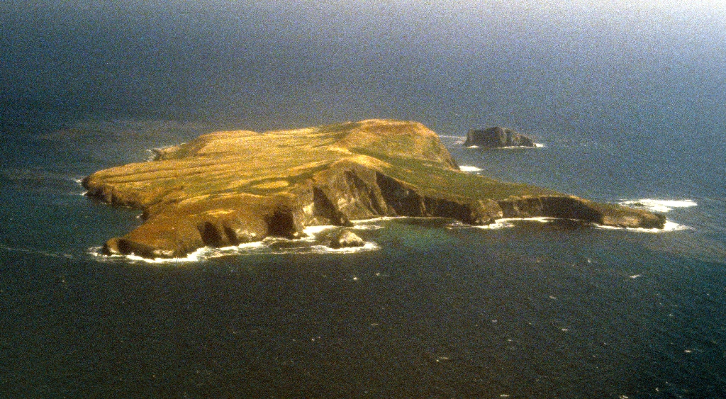
This overlook just west of Arch Point provides coastal view of the northwest coast, including Shag Rock. Shag Rock reaches 145 feet above sea level, and is about an acre in size. Shag is another name for a cormorant, a marine bird which nests at this location.
Stop 5: Arch Point Tour-Geographical Isolation
As you near the ridgeline with the island's two highest points, 635-foot Signal Peak and 562-foot North Peak, take a moment to look across the island. You may notice the broad, elevated coastal plain stretching in front of you, one of six on the island. These plains are remnants of what geologists call "marine terraces"-ancient shorelines carved flat by wave action and exposed through changes in sea level and tectonic uplift of the land. A future marine terrace (called a wave-cut platform) is being created today by wave erosion at the base of the sea cliffs.
The Channel Islands' first shoreline was created around five million years ago, when compressional forces, caused by the ramming of Baja California into southern California, resulted in the folding and faulting of marine sediments and volcanic rocks (deposited between 15-30 million years ago) and the eventual uplift of the islands. These compressional forces are still ongoing, making this area geologically active today-Santa Barbara Island, as well as the other Channel Islands, continues to be uplifted.
Ever since these compressional forces caused the islands to emerge from the sea, the Channel Islands have been separated from the mainland. And unlike the four northern islands, which were once joined as a single, "super island" known as Santarosae, Santa Barbara Island has never been connected to another neighboring island.
For decades, however, scientists assumed that the northern islands (Anacapa, Santa Cruz, Santa Rosa, and San Miguel Islands) were connected to the mainland by a land bridge, but as bathymetric information (or topography) of the sea floor improved, it revealed that even during periods of lowest sea levels (about 17,000 years ago), the islands still remained isolated by at least four miles of ocean. It is this continuous geographical isolation that has shaped island life.
Santarosae
Although never connected to the mainland by a land bridge, the four northern islands were once part of the Pleistocene 'superisland' known as Santarosae, nearly four times as large as the combined areas of the modern Channel Islands. The dark shaded area on the map depicts ancient coast of Santarosae and California around 20,000 years ago when sea level was 100 meters (approximately 350 feet) lower than it is today. As the ice sheets and glaciers melted and the sea level rose, only the highest parts of Santarosae remained as modern islands.
Is there something we missed for this itinerary?
Itineraries across USA


