Due to unexploded ordnance, visitors must be accompanied by a ranger to this location. Entering this area without a ranger is a violation of federal law.
Geographical Isolation
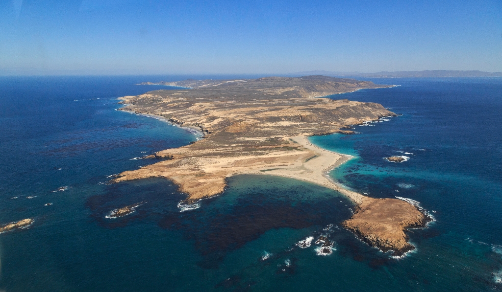
As you reach the island's highest peak, 831-foot San Miguel Hill, take a moment to look across the island. You may notice the broad, elevated coastal plain stretching in front of you. This plain is a remnant of what geologists call a "marine terrace"-an ancient shoreline carved flat by wave action and exposed through changes in sea level and tectonic uplift of the land. A future marine terrace (called a wave-cut platform) is being created today by wave erosion at the base of the sea cliffs.
The islands' first shoreline was created around five million years ago, when compressional forces, caused by the ramming of Baja California into southern California, resulted in folding and faulting of marine sediments and volcanic rocks (deposited between 15-30 million years ago) and the eventual uplift of the islands. These compressional forces are still ongoing, making this area geologically active today. Earthquakes are quite common and all the islands continue to be uplifted.
Ever since these compressional forces caused the islands to emerge from the sea, they have been separated from the mainland. For decades, scientists assumed that the two were connected by a land bridge, but as bathymetric information (or topography) of the sea floor improved, it revealed that even during periods of lowest sea levels (about 17,000 years ago), the islands still remained isolated by at least four miles of ocean. It is this continuous geographical isolation that has shaped island life.
World War II Lookout Site
The Navy erected a Coastal Lookout Station on the summit of San Miguel Hill in 1942. The station consisted of a wooden observation tower and radio communication facilities. A barracks for the staff was built adjacent to the Lester Ranch. Only a small amount of wreckage remains from the tower site, including hardware, broken glass, wire and pieces of wood. A modern remote-controlled weather station operated by the Navy (Point Mugu) stands adjacent to the tower site; concrete foundation pads from an earlier, nuclear powered weather station should not be confused with the World War II lookout. On the trail to the lookout on the east slope of San Miguel Hill are two utility poles likely dating from World War II for telephone communications between the barracks and lookout tower. One has fallen and the other remains standing. The poles have an angle cut off the top where a hole provides evidence of hardware for holding the wire.
Today a weather station sit atop San Miguel Hill.
Is there something we missed for this itinerary?
Itineraries across USA


