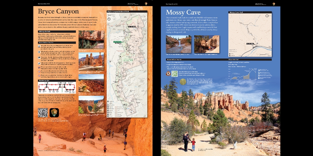
Two upright panels are here near the parking lot; the first is the orientation to Bryce Canyon with full park map. The second provides details about our location here at Mossy Cave.
Bryce Canyon Orientation Wayside
Since no river runs through it, Bryce Canyon is not truly a canyon. Instead, it is a series of natural amphitheaters carved into the edge of the Paunsaugunt Plateau. These bowl-shaped features contain the world's largest collection of varied rock spires known as hoodoos. We welcome you to Bryce Canyon National Park and invite you to discover the sublime beauty and rich history of this land.
Photographs alongside the map highlight four areas of the park:
The first, a view along the trail as it approaches Mossy Cave, a sheltered overhang of rock. Caption reads: Take a streamside walk to a water fall and shady grotto. Then a man with a child in a backpack descends the trail through the Queen's Garden, orange rock spires and formations described as sculptures. Caption reads: Enjoy a moderately difficult descent into the Bryce Amphitheater. Bryce Amphitheater at Sunrise Point.
Next Bryce Amphitheater, the forested edge of the plateau in the distance gives way to a bowl shaped feature below us filled with red and white spires of rock coming up from the bottom like jagged teeth. Caption Reads: Find this iconic area along the first three miles of the park road.
Last, Natural Bridge, a natural arch or window of rock, through which can be seen the trees that grow in the canyon below. Caption reads: Visit one of many beautiful views along the 18-mile scenic drive to Rainbow Point.
Mossy Cave Orientation Wayside
This streamside walk leads to a spring-formed alcove that fills with summer moss and winter ice. At one time, water only flowed through Water Canyon after summer storms and spring snowmelt. After settlers completed an irrigation canal in 1892, water was diverted from the plateau above, steeply eroding these fragile canyon walls and feeding a waterfall that regularly freezes in winter.
Help us protect this delicate area by always staying on designated trails.
Know Before You Go
● Stay on the designated trail.
● Watch for seasonally fast-moving water.
● This is challenging environment for plants. Stay on the trail and leave them for all to enjoy.
Is there something we missed for this itinerary?
Itineraries across USA

Acadia

Arches National Park

Badlands

Big Bend

Biscayne

Black Canyon Of The Gunnison

Bryce Canyon

Canyonlands

Capitol Reef

Carlsbad Caverns

Channel Islands

Congaree

Crater Lake

Cuyahoga Valley

Death Valley

Dry Tortugas

Everglades

Gateway Arch

Glacier

Grand Canyon

Grand Teton

Great Basin

Great Smoky Mountains

Guadalupe Mountains

Haleakalā

Hawaiʻi Volcanoes

Hot Springs

Indiana Dunes

Isle Royale

Joshua Tree

Kenai Fjords

Kobuk Valley

Lassen Volcanic

Mammoth Cave

Mesa Verde

Mount Rainier

North Cascades

Olympic

Petrified Forest

Pinnacles

Rocky Mountain

Saguaro

Shenandoah

Theodore Roosevelt

Virgin Islands

Voyageurs

White Sands

Wind Cave

Yellowstone

Yosemite

Zion