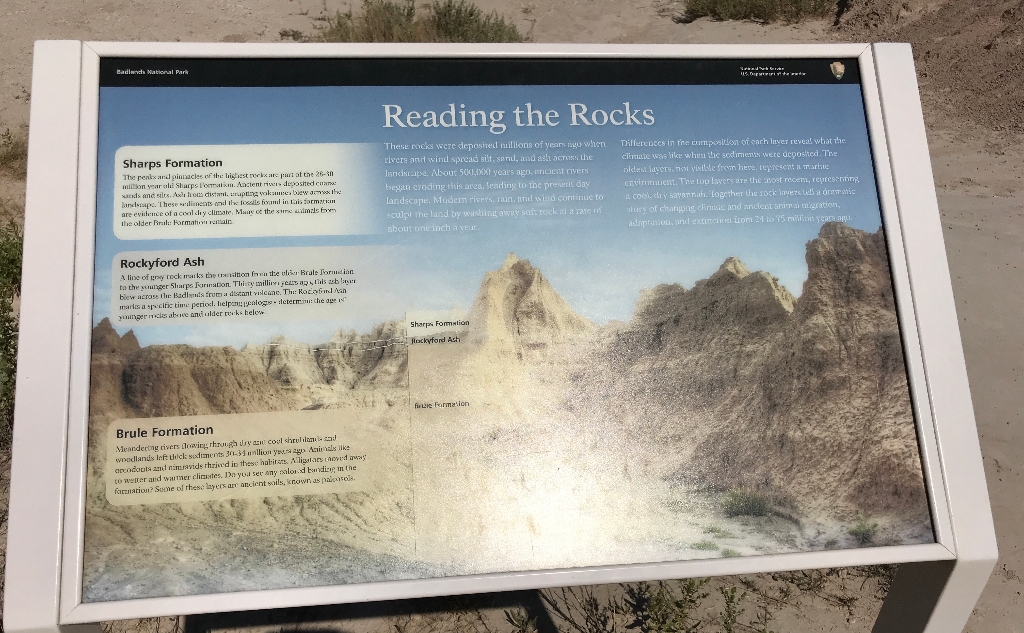
Reading the Rocks:
"These rocks were deposited millions of years ago when rivers and wind spread silt, sand, and ash across the landscape. About 500,000 years ago, ancient rivers began eroding this area, leading to the present day landscape. Modern rivers, rain, and wind continue to sculpt the land by washing away soft rock at a rate of about one inch a year.
Differences in the composition of each layer reveal what the climate was like when the sediments were deposited. The oldest layers, not visible from here, represent a marine environment. The top layers are the most recent, representing a cool, dry savannah. Together the rock layers tell a dramatic story of changing climate and ancient animal migration, adaptation, and extinction from 24 to 75 million years ago."
Sharps Formation:
"The peaks and pinnacles of the highest rocks are part of the 28-30 million year old Sharps Formation. Ancient rivers deposited coarse sands and silts. Ash from distant, erupting volcanoes blew across the landscape. These sediments and the fossils found in this formation are evidence of a cool dry climate. Many of the same animals from the older Brule Formation remain."
Rockyford Ash:
A line of gray rock marks the transition from the older Brule Formation to the younger Sharps Formation. Thirty million years ago, this ash layer blew across the Badlands from a distant volcano. The Rockyford Ash marks a specific time period, helping geologists determine the age of younger rocks above and older rocks below.
Brule Formation:
"Meandering rivers flowing through dry and cool shrublands and woodlands left thick sediments 30-34 million years ago. Animals like oreodonts and rimravids thrived in these habitats. Alligators moved away to wetter and warmer climates. Do you see any colored banding in the formation? Some o these layers are ancient soils, known as paleosols."
Is there something we missed for this itinerary?
Itineraries across USA


